Climbing K2 (8,611 m) means a 6–8 week expedition to the world’s second-highest mountain, almost always by the Abruzzi Spur on its Pakistani side — a serious, technical, high-commitment ascent with a far higher death-to-summit ratio than Everest (historically around 20–25%, per Climbing). It is not a “bucket-list” climb. It is the hardest thing most mountaineers will ever attempt, and it demands real 8000-metre experience, a long weather-and-acclimatisation window, and a team you trust with your life. Here is the honest picture from a Balti outfit that works at the foot of this mountain every season.
Key Takeaways
- Height & rank: 8,611 m (28,251 ft) — second-highest peak on Earth and the highest in the Karakoram.
- Standard route: the Abruzzi Spur (SE Ridge); roughly three-quarters of climbers use it.
- The crux: the Bottleneck, a 50–60° couloir at ~8,200 m under hanging seracs, ~400 m below the summit.
- Season: a short summer window, broadly July, with summits clustering mid-July to early August.
- Commitment: 6–8 weeks total, including the trek in via Askole, the Baltoro Glacier and Concordia.
- Risk: one of the deadliest 8000ers — never to be downplayed. Experience on other 8000ers is effectively mandatory.
Chogori: the mountain the Balti named first
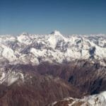
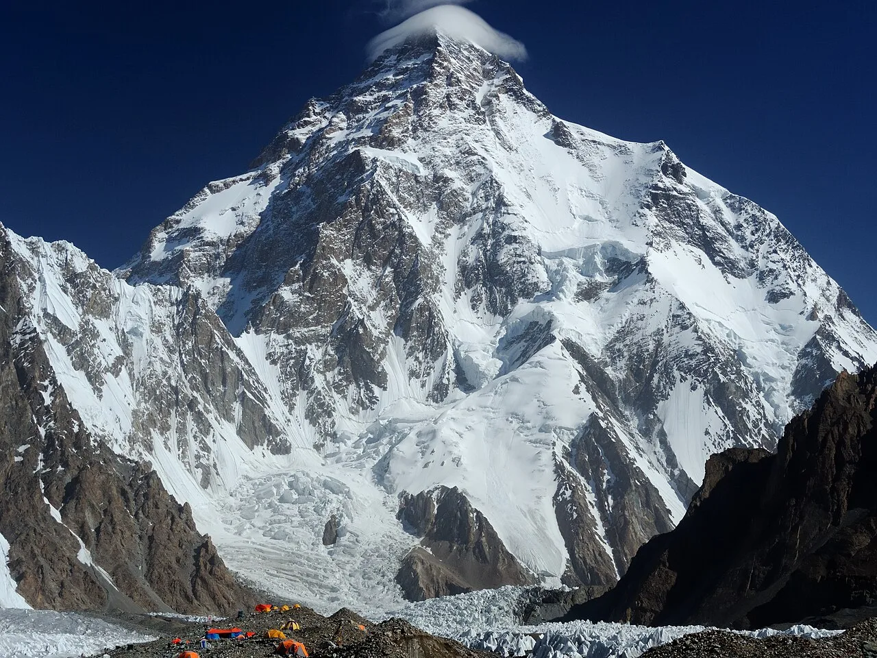
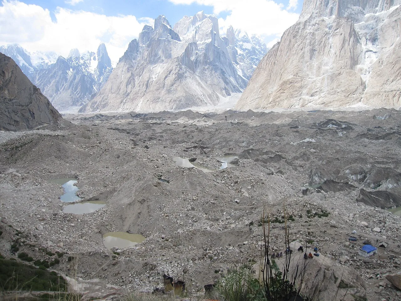
Long before a survey number stuck, the people of these valleys called it Chogori — roughly “the big mountain.” K2 stands at 8,611 metres on the border of Pakistan and China, the high point of the Karakoram and the second-highest mountain in the world after Everest. Yet “second” is misleading. K2 is steeper, colder, more avalanche-prone and far more technical than Everest from bottom to top. There is no easy side. Every route is hard, and the weather in the Karakoram is less forgiving than the Nepal Himalaya.
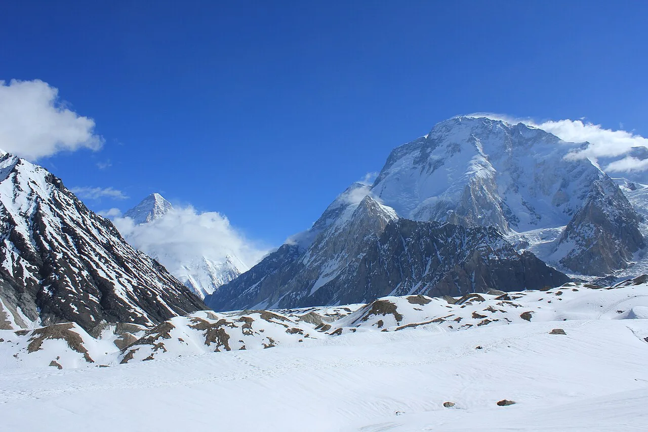
From Pakistan, the mountain is reached up the Baltoro Glacier to Concordia, then up the Godwin-Austen Glacier to Base Camp at roughly 5,150 m. That approach alone — the same one trekkers take on the K2 Base Camp trek — takes the better part of a week on foot from the road-head at Askole.
The standard route: the Abruzzi Spur
About three-quarters of all ascents follow the Abruzzi Spur, the southeast ridge first probed by Prince Luigi Amedeo, Duke of the Abruzzi, in 1909. It is not the safest line — it is the most direct, which on K2 usually wins, because the priority is to minimise time spent in the death zone above 8,000 m.
From Base Camp the route climbs through a series of named obstacles: House’s Chimney, a steep rock cleft around Camp 2; the Black Pyramid, a long mixed rock-and-ice band below Camp 3; and the broad snow Shoulder near 7,900 m where the top camp sits. Above that waits the Bottleneck. The neighbouring Česen route (SSE) is sometimes used to reach the Shoulder more safely, but it too funnels into the Bottleneck for the final push.

The climb, camp by camp (approximate)
Camp altitudes vary by team and season; treat these as a guide, not gospel.
| Camp | Approx. altitude | What it throws at you |
|---|---|---|
| Base Camp | ~5,150 m | Godwin-Austen Glacier; the long acclimatisation home |
| Camp 1 | ~6,050 m | Lower spur, fixed-rope ground begins |
| Camp 2 | ~6,700 m | Above House’s Chimney — steep rock |
| Camp 3 | ~7,350 m | The Black Pyramid; sustained mixed climbing |
| Camp 4 (Shoulder) | ~7,950 m | Edge of the death zone; launch point |
| The Bottleneck | ~8,200 m | 50–60° couloir under seracs — the crux |
| Summit | 8,611 m | The second-highest point on Earth |
The Bottleneck — and why K2 kills
The Bottleneck is a narrow couloir at roughly 8,200 m, around 400 m below the summit, overhung by an ice cliff that can release without warning. Climbers must traverse about 100 m directly beneath those seracs. On 1 August 2008, eleven climbers died here when a serac collapse swept away the fixed ropes during the descent — the worst single accident in the mountain’s history (Wikipedia). K2 carries one of the highest death-to-summit ratios of any 8000er. We will not soften that. If a route description ever makes K2 sound routine, walk away from whoever wrote it.
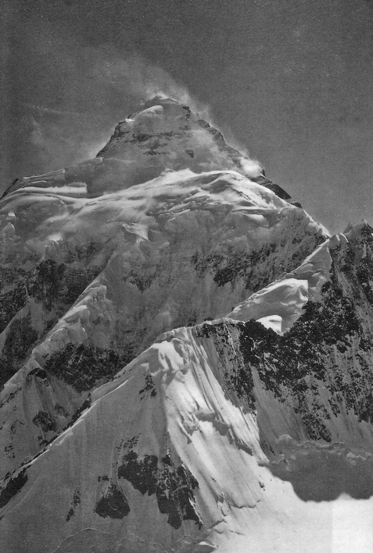
A short, honest history
The Duke of the Abruzzi scouted the spur that bears his name in 1909, reaching about 6,250 m before retreating. Decades of attempts followed. The summit finally fell on 31 July 1954, when Achille Compagnoni and Lino Lacedelli, on an Italian expedition led by geologist Ardito Desio, stood on top.
That victory rode on local shoulders — a fact too often left out. Around 500 Balti porters carried more than 12 tonnes of gear up the Baltoro, and ten Hunza high-altitude porters worked the upper mountain. One of them, Amir Mahdi, climbed into the night near 8,100 m to ferry oxygen for the summit pair, then survived an unplanned open bivouac in the death zone with Walter Bonatti. Mahdi later lost most of his fingers and toes to frostbite. The names on the certificate were European; the climb was built on Balti and Hunza hands. We do not forget that, because we are those hands.
The modern eras are written in both triumph and loss: the 2008 disaster; the February 2021 deaths of Pakistan’s own Muhammad Ali Sadpara — a Skardu man — alongside John Snorri and Juan Pablo Mohr; and, weeks earlier, the historic first winter ascent on 16 January 2021 by a ten-strong all-Nepali team led by Nirmal Purja and Mingma Gyalje Sherpa, the last of the 14 eight-thousanders to be climbed in winter (BBC). For more on the mountain’s character, the Himalayan Club’s essay “The Savage Mountain” is worth your time.
Season, permits & what it costs
K2 has a short summer window. Teams trek in through June, establish camps and acclimatise, then wait for a settled spell — most summits land between mid-July and early August. There is no spring season here as on Everest; the Karakoram weather and the seracs dictate the calendar. See our overview of the Baltoro climbing season for how K2, Broad Peak and the Gasherbrums share it.
Permits & paperwork
K2 requires a mountaineering permit, not a tourist or trekking permit, plus a Mountaineering & Trekking visa, a registered liaison officer and insured high-altitude porters. Pakistan raised the foreign K2 climbing-permit royalty to US$5,000 for the summer season (Express Tribune); rules currently cap teams at 20 members and allow one peak per permit. We handle the NOCs, permits and LO arrangements — you focus on the mountain.
Total expedition cost depends on service level — full-board with bottled oxygen, Sherpa/Balti high-altitude support and fixed ropes sits at the top end; lighter base-camp service costs less. Because our logistics are local, we price fairly without thinning the things that keep you alive: guides, food, oxygen and rescue cover. For current 2026 dates and a transparent quote, WhatsApp us — we will not bury the price.
How we run a K2 expedition
Three things define how we work, and on this mountain they are not marketing — they are survival.
Local Balti hands. Our guides, cooks and porters are from the Baltoro valleys. This is home ground; we have generations of knowledge of these glaciers, not a brochure. Real, resourced safety. A satellite phone in camp, established helicopter-rescue contacts for the Baltoro region, oxygen and a genuine emergency plan — the line items budget operators quietly cut. Fair price, no corner-cutting. Local infrastructure lets us keep costs honest without compromising the guides, food or safety margin. Local hands, real safety, fair price.
Is K2 the right climb for you?
Be honest with yourself before the mountain is honest with you. K2 is for climbers with prior 8000-metre experience, solid technical skill on steep mixed ground, and the patience to sit out weather for weeks. If you are building toward it, the right path runs through smaller Karakoram giants first — a 7,000 m peak like Spantik, then a more forgiving 8000er like Broad Peak. Not ready to climb but want to stand at its foot? The K2 Base Camp trek — optionally looping out over the Gondogoro La — puts you under the mountain without the death zone. First, get yourself here: see how to reach Skardu.
Frequently asked questions
How tall is K2 and where is it?
K2 is 8,611 m (28,251 ft), the second-highest mountain on Earth and the highest in the Karakoram. It sits on the Pakistan–China border; the standard climb is from the Pakistani (Gilgit-Baltistan) side via the Baltoro and Godwin-Austen glaciers.
How dangerous is climbing K2?
Very. K2 has one of the highest death-to-summit ratios of any 8000er — historically in the region of 20–25%. The Bottleneck, under hanging seracs at ~8,200 m, is the deadliest section. K2 should only be attempted with prior high-altitude experience and a properly resourced team.
What is the best season to climb K2?
Summer — broadly July, with most summits between mid-July and early August. Teams arrive in June to trek in and acclimatise. Winter ascents exist but are extreme; the first was only achieved in January 2021.
How long does a K2 expedition take?
Plan on 6–8 weeks door to door, including the multi-day trek from Askole via Concordia, weeks of acclimatisation rotations, and waiting for a summit weather window.
How much does it cost to climb K2?
It varies widely by service level. The Pakistan foreign climbing-permit royalty alone is US$5,000 for summer, on top of logistics, oxygen, high-altitude support and rescue cover. WhatsApp us for a transparent, itemised 2026 quote.
Thinking about K2 — or the trek to its foot?
Talk to a team that lives under this mountain. WhatsApp us on +92 312 9921574 or email info@karakoramventure.com — you’ll be talking to a local Balti team, not a broker.
Sources: Wikipedia (K2; 1954 Italian expedition to K2; Bottleneck; Abruzzi Spur; 2008 K2 disaster); BBC News; Climbing.com; The Express Tribune; The Himalayan Journal / Himalayan Club. Altitudes and statistics are approximate and vary between sources; camp heights differ by team and season.