Spantik — the “Golden Peak” — is a 7,027 m mountain in the Karakoram and the most realistic first 7,000-metre summit in Pakistan, climbed by a long but technically moderate (Alpine grade AD) southeast ridge. For a fit trekker with some crampon and rope experience, it is the honest next step up from a base-camp trek — but it is still a real high-altitude expedition where people have died, not a guaranteed summit. Here is what the climb actually involves, from the jeep to Arandu to the long summit ridge, written by a team that guides these valleys.
Key takeaways
- Height: 7,027 m (23,054 ft), with ~1,250 m of prominence, in the Spantik-Sosbun subrange of the Karakoram, Shigar District.
- Difficulty: Alpine grade AD via the southeast ridge — non-technical by 7,000 m standards, but long, glaciated and high. Not a trekking peak.
- Time: roughly a 3-week expedition, allowing for acclimatisation and weather; the approach trek is short (~3 days on the Chogo Lungma Glacier).
- Season: June to August is the working window, with July the most settled.
- Honest note: “easiest 7000er” is a relative phrase. Several climbers have died on Spantik. Treat it as a serious expedition.
What — and where — Spantik is
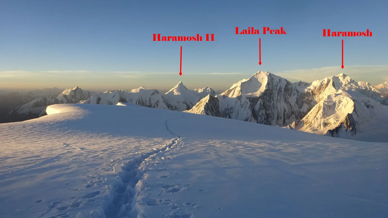
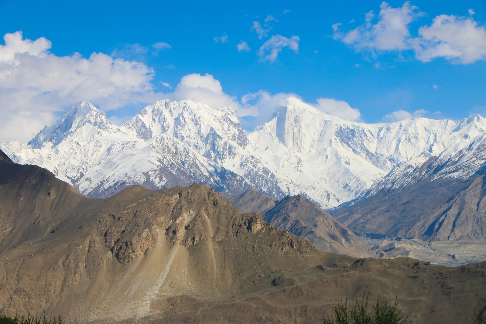
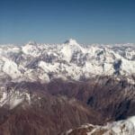
Spantik stands at 7,027 m in the Spantik-Sosbun mountains, a subrange of the western Karakoram in Pakistan’s Gilgit-Baltistan. It sits east of Diran (7,266 m) and northeast of Malubiting (7,458 m), close enough to the Hunza-Nagar skyline that you can pick it out from the Eagle Nest viewpoint above Karimabad on a clear morning.
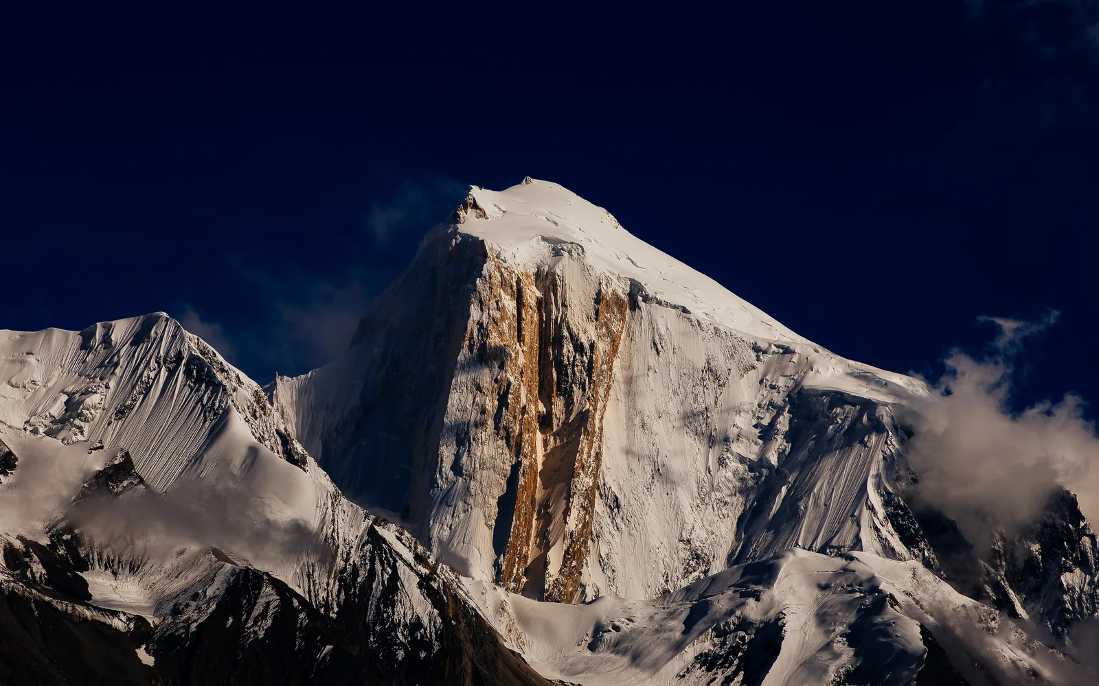
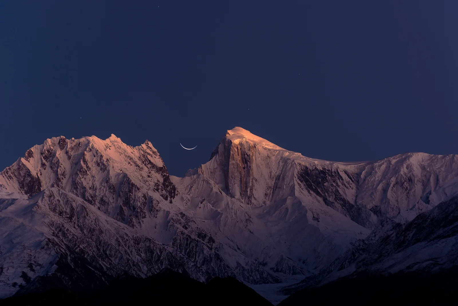
The mountain carries two names, and both are earned. Spantik is the Balti name. Golden Peak — Ganesh Chish in Burushaski — comes from the pillar of creamy, pale-yellow marble on its northwest face that runs up to within about 300 m of the summit and turns molten gold in low sun. That pillar, the “Golden Pillar,” is one of the hardest pieces of rock-and-ice climbing in the range. Almost no commercial client ever touches it. What most climbers come for is the other side of the mountain: the long, walkable southeast ridge.
Why Spantik is called the “first 7000er”
If you have done a base-camp trek — K2 Base Camp, Rakaposhi, Nanga Parbat — and you are wondering what it takes to actually climb something, Spantik is the usual answer. The southeast ridge has no sustained technical climbing. It rises around 2,700 m over roughly 7.6 km, mostly at angles under 30 degrees, with a few sections steepening toward 40. The terrain is glacier, snow and a little scree and rock — ground you move over on crampons with a rope, not ground you have to lead-climb.
That is the appeal, and it is real. But the phrase “easiest 7000er” gets thrown around carelessly. Easiest among 7,000 m peaks still means three weeks at altitude, nights above 6,000 m, crevasse danger, and a summit day that is long, cold and committing. The mountain is moderate; the altitude is not.
The honest safety picture
Spantik has killed experienced climbers. In June 2024, two Japanese alpinists went missing on the mountain; one body was found about 300 m below Camp III, and a third Japanese climber died the same season after falling into a crevasse. A German climber died near Camp II in 2006, and a Japanese climber died of altitude sickness on descent in 2002. None of this means you should not climb Spantik — it means you should respect it, acclimatise properly, rope up on the glacier, and climb with a team that carries a satellite phone and has a real rescue plan. Our acclimatisation guide is worth reading before you commit.
The approach: Skardu to Arandu to base camp
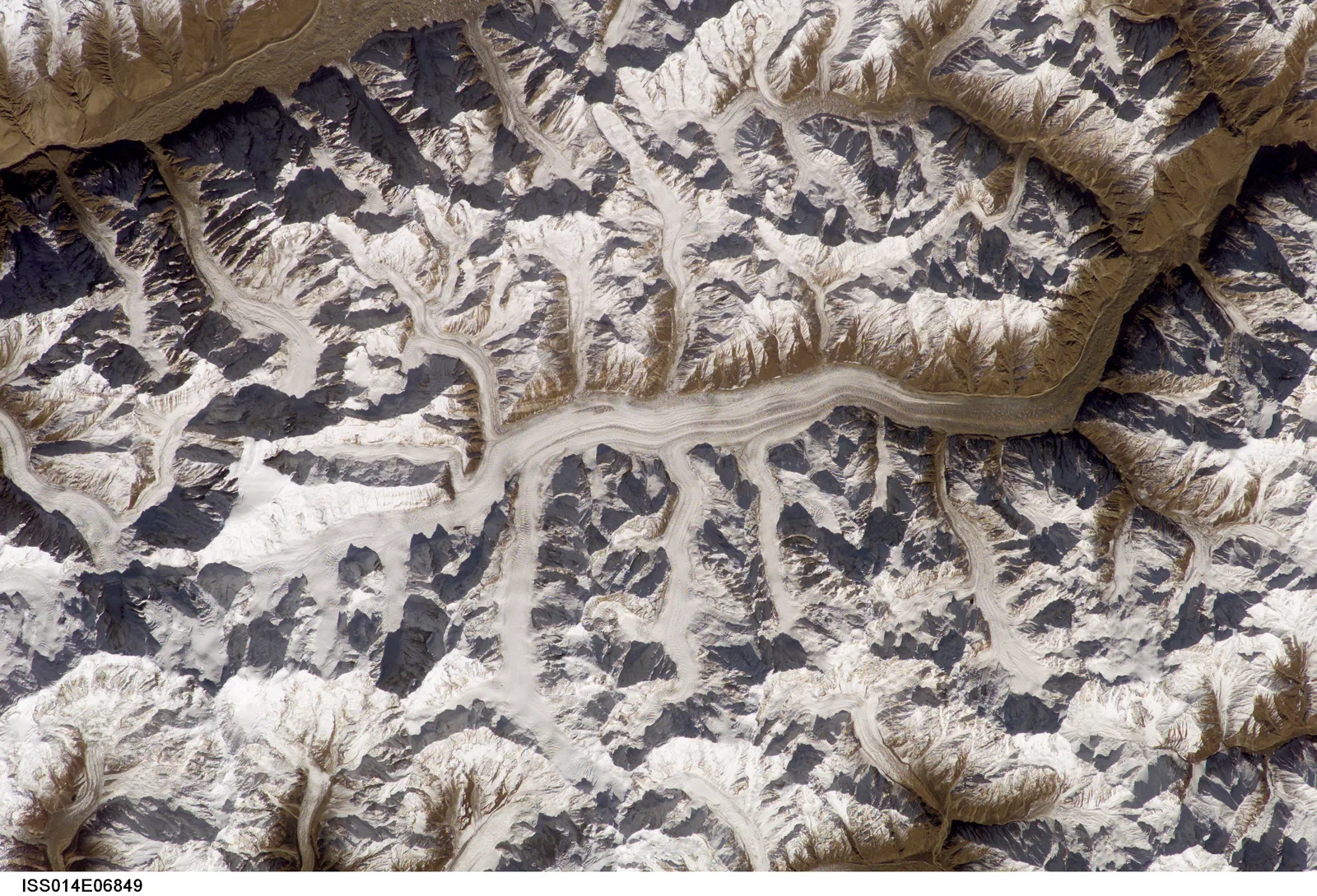
One of Spantik’s quiet advantages is how short the walk-in is. You fly or drive to Skardu (see our guide on getting to Skardu), then take a 4×4 jeep up the Basha Valley to the roadhead village of Arandu (around 2,770 m, approximate) in Shigar District. From Arandu, it is roughly three days on foot up the Chogo Lungma Glacier — one of the longer glaciers in the Karakoram — to base camp at about 4,300 m (sources vary between 4,200 and 4,400 m).
Compared with the week-long slog to Concordia on the classic Baltoro routes, this is a gentle, gradual approach — which is part of why Spantik acclimatises so well. You gain height steadily, your body has time, and you reach base camp with the glacier highway already behind you.
The climb: camps and summit day
Above base camp the route follows the southeast ridge through three high camps. The exact altitudes shift a little between operators and seasons, but the shape is consistent: a steady, rolling climb with one big, long summit day from the top camp.
| Camp | Approx. altitude | What it’s like |
|---|---|---|
| Base Camp | ~4,300 m | Glacier-side camp; rest, training and acclimatisation rotations. |
| Camp 1 | ~5,100 m | Onto the lower ridge; first nights on the mountain. |
| Camp 2 | ~5,600 m | Mid-ridge; the workhorse acclimatisation camp. |
| Camp 3 | ~6,300 m | High camp and launch point for the summit push. |
| Summit | 7,027 m | Long summit day from Camp 3 — commonly 7–10 hours up. |
Camp altitudes are approximate and vary by operator and conditions.
The climbing is done in rotations: you push up, sleep high, drop back to recover, and repeat, letting your body build red cells before the final push. Summit day from Camp 3 is the crux — not because of difficulty, but because of length, cold and altitude. It is a long plod up a broad snow ridge, often starting in the dark, with a sea of Karakoram giants opening up around you as the sun comes.
How hard is it, really?
Be honest with yourself about three things: fitness, skills and altitude tolerance.
Fitness. You need to be genuinely fit — able to carry a pack uphill for long days, back to back, for weeks. This is endurance, not gym strength.
Skills. You do not need to be a technical climber, but you must be comfortable walking in crampons, using an ice axe, clipping into fixed lines, and moving roped on a glacier. If you have never done this, you can learn it — but learn it before, not on summit day.
Altitude. No one is immune. The schedule is built around acclimatisation for a reason. Spantik forgives a slow, patient climber far more than a fast, impatient one.
A good rule: if a hard base-camp trek felt like your ceiling, build toward Spantik over a season or two. If it felt like a comfortable floor and you enjoy snow and ice, you are the right candidate.
Season, permits and the paperwork truth
Permits & visa — read this
Spantik is a 7,000 m peak, so it is a mountaineering objective, not a trek. That means a climbing permit and royalty through the Alpine Club of Pakistan / Gilgit-Baltistan, plus the correct Mountaineering visa (distinct from a tourist visa) and any required NOC. Rules and fees change, so we confirm the current requirements with you directly rather than quoting numbers that may be stale. Our Pakistan visa guide covers the basics; the climbing permit we handle as part of the expedition.
The season runs roughly June to August, with July usually the most settled. Earlier means more snow and colder camps; late August can bring the first autumn instability. As with every Karakoram objective, weather, not fitness, is the most common reason a summit attempt is turned around — build buffer days into your plan and your flights.
How Spantik compares to other Karakoram objectives
If you are weighing Spantik against a trek or a harder climb, here is the honest placement.
| Objective | Type | Max altitude | Technical level |
|---|---|---|---|
| K2 Base Camp trek | Trek | ~5,150 m | Strenuous trek, no climbing |
| Rakaposhi Base Camp trek | Trek | ~3,500 m | Moderate trek |
| Spantik / Golden Peak | Expedition | 7,027 m | Grade AD — moderate climb |
| Broad Peak / Gasherbrums | 8,000 m expedition | 8,000 m+ | Serious, high-risk |
In other words: Spantik is the bridge. It is the step between “I walked to a base camp” and “I want to attempt an 8,000er,” and for many climbers it is a perfectly satisfying summit in its own right.
Who you climb with matters most
On a mountain graded “moderate,” the difference between a good expedition and a dangerous one is almost entirely the team. We run Spantik with local Balti guides and high-altitude porters from the valleys beneath these peaks — not a broker handing you to a stranger. That means a satellite phone in camp, established helicopter-rescue contacts for the region, sensible rotation planning, and guides who will turn you around when the mountain says so. Local hands, real safety, fair price. That is the whole point of climbing with a team that lives here.
Frequently asked questions
Is Spantik really the easiest 7,000 m peak to climb?
It is widely considered one of the most accessible 7,000 m peaks because the southeast ridge is non-technical (Alpine grade AD), the approach is short, and it acclimatises well. But “easiest” is relative — it is still a serious high-altitude expedition where experienced climbers have died. Treat it with respect.
How long does a Spantik expedition take?
Plan for roughly three weeks on the ground, with the approach trek taking about three days and the rest given to acclimatisation rotations, the summit push and weather buffer. Total trip length including travel is usually around 21–30 days.
Do I need prior mountaineering experience?
Yes. You should be comfortable in crampons, with an ice axe, clipping fixed lines and moving roped on a glacier, plus carrying a pack on long days. You do not need technical rock or ice leading skills, but Spantik is not a first-ever climb.
What is the best time to climb Spantik?
June to August, with July generally the most settled. Earlier is colder and snowier; late August can bring early autumn instability.
What permits do I need?
As a 7,000 m peak, Spantik requires a mountaineering permit and royalty plus a Mountaineering visa (different from a tourist visa) and any required NOC. We handle the climbing permit as part of the expedition and confirm current visa requirements with you, since rules and fees change.
Thinking about your first 7,000er?
Spantik is the right place to start, done with the right team. Planning your climb? WhatsApp us on +92 312 9921574 or email info@karakoramventure.com — you’ll be talking to a local Balti team who climb these mountains, not a broker. Tell us your experience and we’ll tell you honestly whether you’re ready, and for which season.
Sources & references: Spantik — Wikipedia; A. V. Saunders, “The Golden Pillar: Spantik,” American Alpine Journal (1988) and Himalayan Journal Vol. 44; American Alpine Club Publications; AP News and Dawn reporting on the 2024 Spantik season. Altitudes and durations are given as approximate where primary sources vary; verify climbing permit, royalty and visa requirements at time of booking. Photographs via Wikimedia Commons under the licences credited beneath each image; NASA imagery is public domain.
[…] is altitude before ambition. Many climbers build up on a 6,000er and then a 7,000er — our Spantik (Golden Peak) expedition is a popular 7,000 m stepping stone — before committing to Broad Peak. For the full picture […]
[…] expedition rather than a trek, our guides to the Broad Peak expedition and the more approachable Spantik (Golden Peak) are good next […]