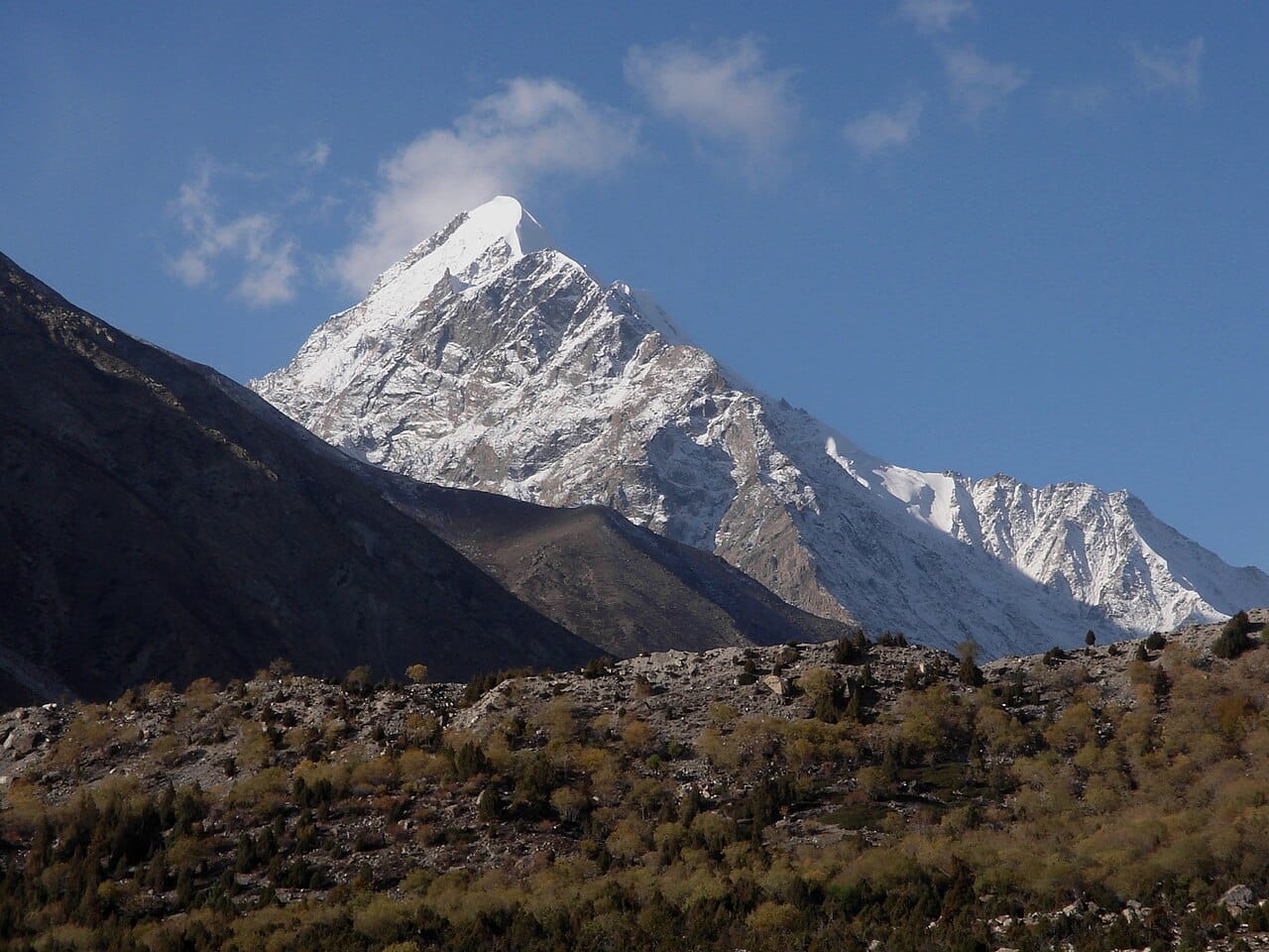
The Nanga Parbat Base Camp trek walks you to the foot of the ninth-highest mountain on earth (8,126 m). The popular route climbs from Raikot Bridge on the Karakoram Highway up to Fairy Meadows (around 3,300 m), then on through Beyal Camp to the Raikot Base Camp viewpoint at roughly 3,900 m — a moderate walk most reasonably fit people can manage. The other side, the Rupal Valley, sits under the highest mountain face on earth, and it is a wilder, more remote affair.
Most people know Nanga Parbat by its harder name: the Killer Mountain. But you do not have to climb it to stand beneath it. From the green shelf of Fairy Meadows you look straight up eight vertical kilometres of rock, ice and snow. Here is the honest version of how to get there, from a Skardu team that runs these valleys.
Key Takeaways
- The mountain: Nanga Parbat, 8,126 m — ninth-highest in the world, the westernmost 8,000er, and the western anchor of the Himalaya.
- Easy side (Raikot / Fairy Meadows): Raikot Bridge → jeep to Tato → 3–4 hr walk to Fairy Meadows (~3,300 m) → Beyal Camp (~3,500 m) → Raikot Base Camp viewpoint (~3,900 m).
- Wild side (Rupal): Astore → Tarashing → Rupal / Herrligkoffer Base Camp (~3,500 m), under the 4,600 m Rupal Face.
- Difficulty: Fairy Meadows side is moderate — no glacier crossings, no ropes. The Rupal side is longer and more remote.
- Best season: roughly April–October; June–September is prime, with green meadows and clear mornings.
- Permits/visa: the Fairy Meadows trek is open to tourists; a full climbing expedition needs permits and a Trekking & Mountaineering visa (not a tourist visa).
Why Nanga Parbat is different
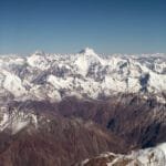
Nanga Parbat stands alone. Where K2 and the Gasherbrums cluster together at the head of the Baltoro, Nanga Parbat rises by itself at the far western end of the Himalaya, west of Skardu and off the Karakoram Highway. The name comes from the Sanskrit for “naked mountain.” The grimmer nickname — the Killer Mountain — was earned in the early expedition decades, when avalanches and weather took many climbers before the summit was finally reached in 1953.
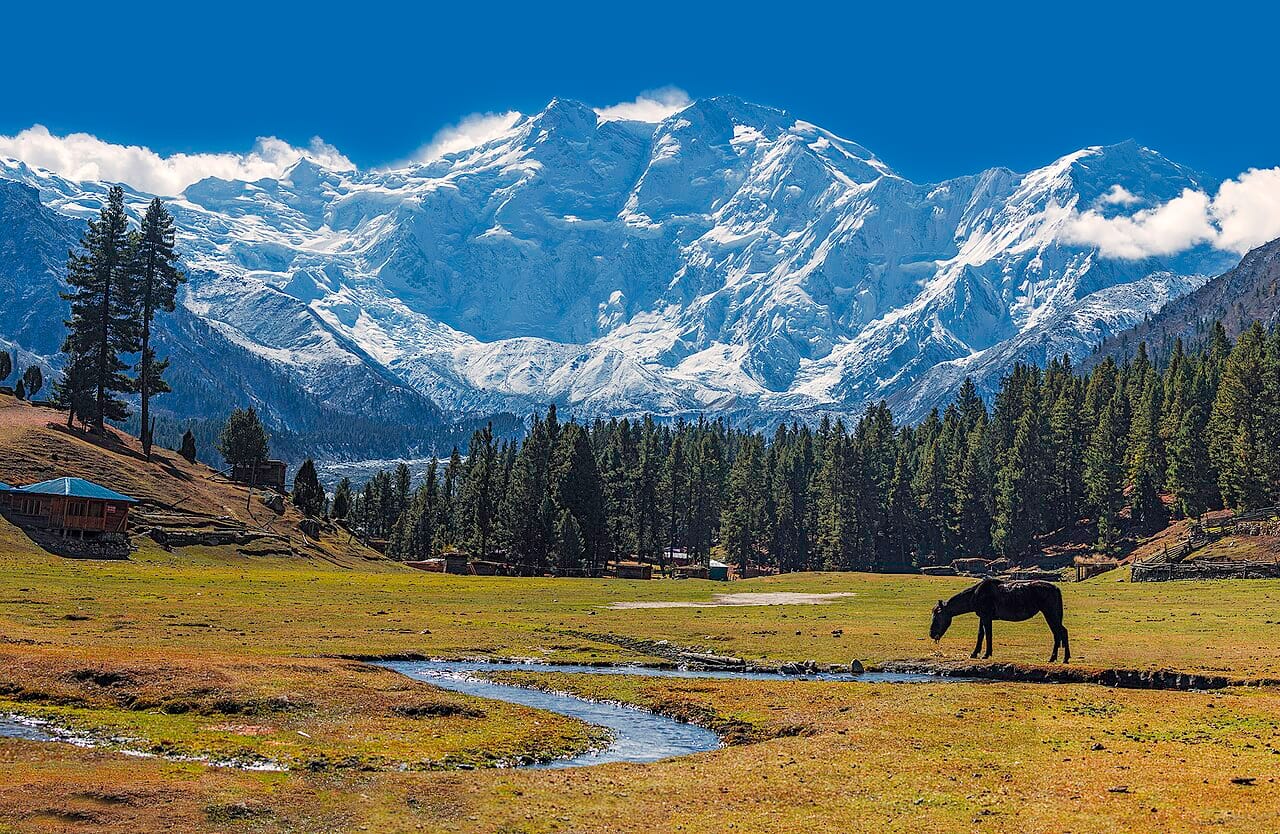
For trekkers, none of that danger applies on the Fairy Meadows side. You are walking to a viewpoint, not onto the mountain. But the scale is real: from the meadow you can see from forest at 3,300 m to a summit at 8,126 m in a single glance.
The trekker’s route: Fairy Meadows to Raikot Base Camp
Getting in: the Tato jeep road
The trek starts at Raikot Bridge on the Karakoram Highway. From there a local jeep grinds up a rough track to Tato village. From Tato it is a 3–4 hour walk on a clear path up to Fairy Meadows.
An honest word on the jeep road. The Raikot–Tato track is narrow, unpaved and exposed in places, and it has a fearsome reputation. It is driven every day in season by experienced local drivers, but it is not for the nervous. We use vetted drivers and vehicles, and we will tell you plainly what to expect before you book — that is part of running real safety rather than selling a fantasy.
Fairy Meadows to Beyal and the viewpoint
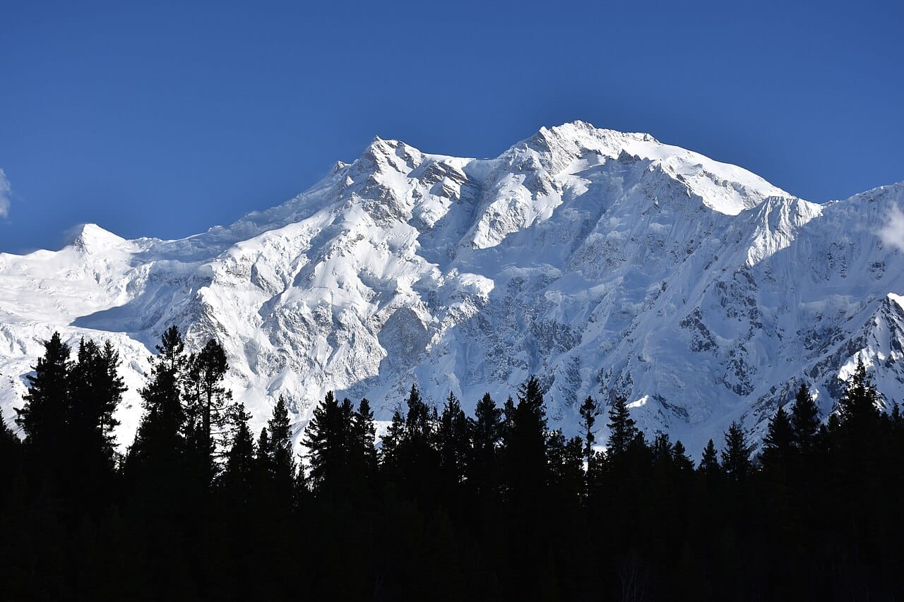
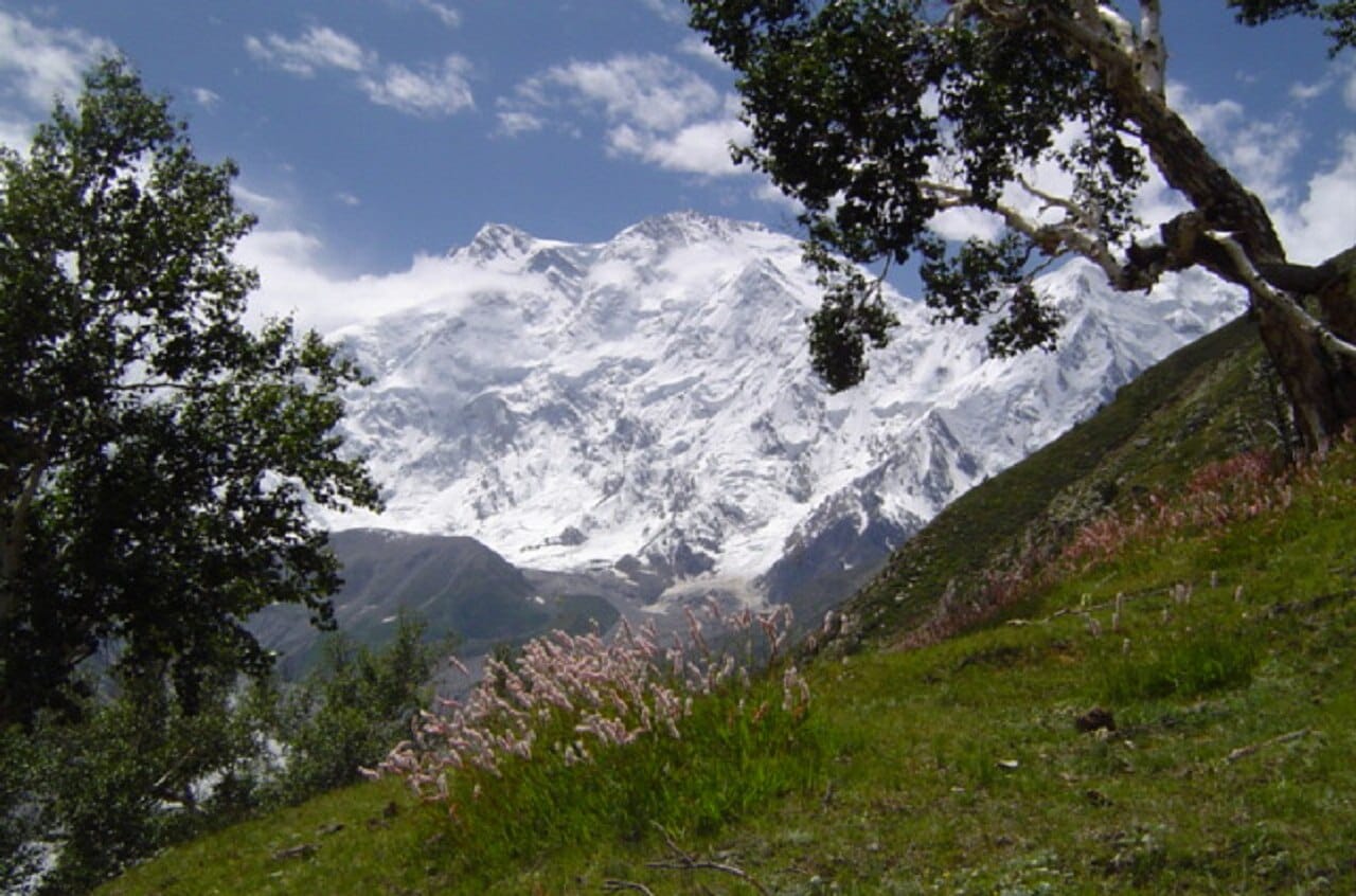
Fairy Meadows itself (around 3,300 m) is the kind of place that earns its name without trying: pine forest opening onto green pasture, wooden huts, and the north (Raikot) face of Nanga Parbat directly ahead. Most people stay a night or two here. From the meadow you can walk on to Beyal Camp (around 3,500 m) and then up toward the Raikot Base Camp viewpoint at roughly 3,900 m, looking across the Raikot Glacier to the wall above.
It is a moderate trek — real ascent and some steep sections, but no glacier travel and no technical climbing. If you have done a hill walk with a full day on your legs, you can do this. Take your time gaining height, and read our acclimatisation guide before you come.
The wild side: the Rupal Face
The other approach is for people who want the serious version. On the south side, reached via the Astore Valley and the village of Tarashing, lies the Rupal Face — a continuous wall that rises about 4,600 m from the valley at 3,500 m to the summit. It is often called the highest mountain face on earth. The trek in to Rupal village and the Herrligkoffer Base Camp area is longer, quieter and more committing than Fairy Meadows, and it is where mountaineering expeditions stage from.
Raikot side vs Rupal side
| Raikot / Fairy Meadows | Rupal Valley | |
|---|---|---|
| Access | Raikot Bridge → jeep to Tato → walk | Astore → Tarashing → walk |
| Highest point | ~3,900 m (base camp viewpoint) | ~3,500 m base camp area |
| Difficulty | Moderate, beginner-friendly | Longer, remote, more committing |
| Best for | First-timers, families, photographers | Strong trekkers, expedition staging |
When to go, and how hard it really is
The season runs roughly April to October. June through September is the sweet spot on the Fairy Meadows side: the meadows are green, mornings are usually clear, and the road is open. Earlier and later, snow and cold come into play, and the jeep road can close. If you are building a wider Gilgit-Baltistan trip, Nanga Parbat pairs naturally with the high plateau of Deosai National Park and a few days in Skardu.
Permits & visa, kept honest. The Fairy Meadows trek is open to tourists on a standard visa. A full climbing expedition on Nanga Parbat is a different matter — it needs a Trekking & Mountaineering visa and the relevant permits, and some areas require an NOC. Rules change, so we confirm the current requirements with you for your exact route rather than guessing. With our local Balti team handling logistics, you are not left untangling paperwork alone.
Frequently asked questions
Do I need to be an experienced trekker for Fairy Meadows?
No. The walk from Tato to Fairy Meadows and on toward the base camp viewpoint is moderate — no glacier and no ropes. Basic fitness and a willingness to walk uphill for a few hours is enough.
How high do I actually get?
Fairy Meadows sits around 3,300 m, Beyal Camp around 3,500 m, and the Raikot Base Camp viewpoint at roughly 3,900 m. Nanga Parbat itself summits at 8,126 m.
Is the jeep road really that dangerous?
It is narrow and exposed, with a big reputation. It is driven daily in season by experienced local drivers. We use vetted drivers and tell you honestly what to expect — if heights unsettle you, you can walk more of it instead.
When is the best time to go?
June to September for the Fairy Meadows side — green meadows, clearer skies and an open road. The broader season runs roughly April to October.
Thinking about Nanga Parbat? Message us on WhatsApp at +92 312 9921574 or email info@karakoramventure.com. You will reach a local Balti team in Skardu who actually run these valleys — not a broker passing you down the line. Tell us your dates and group size and we will plan the right route for you. If K2 is also on your list, see our K2 Base Camp trek guide.
Altitudes and route details compiled from our own guiding experience and public mountaineering references (Wikipedia, Commons). Rupal Face image via Wikimedia Commons (CC BY-SA). Prices and dates change — confirm current details with us before booking.