



Shandur Pass sits at roughly 3,800 metres on the boundary between Chitral and Gilgit-Baltistan. People have called it the Roof of the World since long before it was a line on a tourist map. The road up from Gilgit runs about 212 km through the Ghizer valley, past the turquoise water of Phander Lake. It then climbs onto a wide, treeless plateau where the world’s highest polo ground sits at around 3,700 metres. Every year, teams from Gilgit-Baltistan and Chitral play a freestyle match here with almost no rules and even fewer safety pads. That is the Shandur Polo Festival, usually held 7–9 July. The drive takes a full day from Gilgit, roughly 7–8 hours in a good jeep. Moreover the route is only reliably open from June to September. This is a road trip, not a trek: no technical ground, no mountaineering permit. Just altitude, distance and one of the strangest sporting spectacles in Asia.
We run this route out of Gilgit and Skardu with our own local drivers. They know which switchback turns to loose gravel after rain and which checkpoint wants to see your passport photocopy twice. We’ll be straight with you: Shandur isn’t dramatic the way Concordia or K2 Base Camp is dramatic. It’s open, a little lonely outside festival week. The appeal is the drive itself, and that strange grass field at 3,700 metres where men still ride flat out with no helmets. If that’s your kind of honest travel day, it’s worth it.
Key takeaways
- Shandur Pass: approx. 3,800 m (12,500 ft), on the Chitral–Gilgit-Baltistan boundary, known as “the Roof of the World.”
- Shandur Polo Ground: approx. 3,700 m — the world’s highest polo ground.
- Shandur Polo Festival: held annually, usually 7–9 July, Gilgit-Baltistan vs Chitral, freestyle rules, no boards, few pads.
- Distance: approx. 212 km / 7–8 hours by jeep from Gilgit; Phander village sits around the 184 km mark.
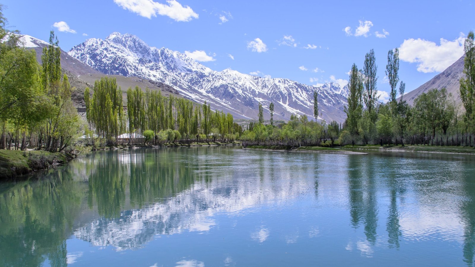
- Phander Lake: the valley’s largest of four lakes, roughly 900 m long and up to 44 m deep, popular trout water.
- Best season: June–September for the pass (May–September for Phander itself); the road is snowbound outside this window.
- Difficulty: easy — a jeep road trip, not a trek. The only climbing is done sitting down.
Where it is, and why the “Roof of the World” name sticks
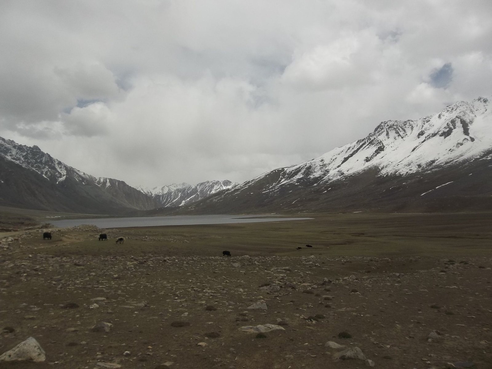
Shandur Pass marks the boundary between Upper Chitral District in Khyber Pakhtunkhwa and the Gupis-Yasin district of Gilgit-Baltistan. The Chitral–Shandur Road connects them. Unlike the jagged granite spires of the Baltoro further east, Shandur is a wide, grass-covered plateau, more high moorland than mountain wall. That is exactly what makes it usable as a polo ground in the first place. At around 3,800 m at the top of the pass, and with the adjoining polo ground sitting just below it at roughly 3,700 m, this is one of the highest pieces of flat, useable ground anywhere on earth. That is why the nickname has stuck for the better part of a century.
The route matters as much as the destination here. It’s the old connection between two very different mountain cultures — Khowar-speaking Chitral on one side, the Shina- and Khowar-mixed valleys of Ghizer on the other. Driving it end to end still feels like crossing a genuine frontier, not just a district line.
The road: Gilgit to Phander to Shandur
Most of our clients do this as a two-day loop out of Gilgit. Some tie it into a longer circuit through Naltar Valley or a wider Gilgit-Baltistan itinerary out of Skardu.
- Day 1 — Gilgit to Phander (approx. 184 km, 5–6 hours): Out along the Gilgit River, through Gupis, into the Ghizer valley proper. The road is paved for long stretches and unpaved for others — slow, not technical. Overnight at a guesthouse on Phander Lake.
- Day 2 — Phander to Shandur Pass and the polo ground (approx. 30 km, 1–1.5 hours each way): A short climb onto the plateau itself. Walk the polo ground, see the pass. Then either return to Phander or Gilgit the same day, or continue over the top into Chitral if that’s your route.
- Optional extension: Continue down the Chitral side to Mastuj and Chitral town for a full cross-border road trip. Alternatively, loop back toward Rakaposhi and Hunza on the return leg.
Phander Valley and its lake — the reason to stop, not just pass through
Phander sits at roughly 2,400–2,900 m in the Gupis-Yasin district. Locals half-jokingly call it “Little Kashmir” for the deep blue-green water against poplar trees and barley fields. There are four lakes in the valley; Phander Lake is the largest, around 900 m long and up to 44 m deep. It is also genuinely good trout water, a legacy of British-era fish stocking in this part of Ghizer. One quirk worth knowing: this is one of the few places where the Gilgit River itself splits into several braided strands as it enters the valley. It then rejoins into a single channel again on the way out. It’s a good, quiet overnight before the plateau — better scenery than Shandur itself, honestly, just without the polo.
The Shandur Polo Festival: freestyle polo at 3,700 metres
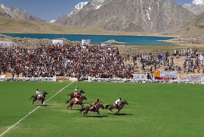
The tournament traces back to the 1930s. Evelyn Hey Cobb, the British political administrator for the area, asked a Chitrali official, Niat Qabool Hayat Kakakhel, to build a proper ground on the plateau. It was completed with local labour and named Mas Junali — “moon polo ground” in Khowar. What grew out of that request is now a fixed annual date on the regional calendar: teams from Gilgit-Baltistan and Chitral play freestyle polo, usually 7–9 July. Preliminary matches in both regions decide who makes the final squads.
The field itself is smaller and rougher than a regulation polo ground. It runs about 200 m by 56 m, lined by 60 cm stone walls instead of boards, with six players a side. Helmets are rare, horses’ legs often go unbandaged, and mallets are used without grips or straps. It’s fast, it’s crowded, and it’s genuinely one of the more startling sporting events you can watch anywhere. Alongside it come folk music, dancing and a full camping village that goes up for the three days. It’s also worth timing against our guide to Gilgit-Baltistan’s trekking and cultural festivals if you’re building a trip around more than one event.
Elevation in context
When to go
| Months | Conditions | Verdict |
|---|---|---|
| May | Phander accessible and green; Shandur Pass often still snow-affected early in the month | Check road status before committing |
| June | Pass opens for the season, valley at its greenest | Good — quiet, before the festival crowds |
| 7–9 July | Shandur Polo Festival — peak crowds, camping village up | Best if you want the festival; book well ahead |
| August | Peak summer, road at its most reliable | Great all-round window |
| September | Cooling, golden light, fewer travellers | Great — our favourite quiet-season pick |
| October onward | Snow risk returns to the pass; road closures possible | Avoid without confirming current road status |
Schematic route profile: Gilgit to Shandur Pass
How hard is it, honestly
This is not a trek and it doesn’t require trekking fitness. It’s a long day of driving on a road that’s paved in places and rough gravel in others. There are real drop-offs on the mountain sections, and single-lane stretches where you wait for oncoming traffic. Some people feel mild effects at 3,700–3,800 m — a headache, a bit of breathlessness walking around the polo ground. However this is nothing like expedition-altitude sickness, and it passes quickly back down at Phander. Bring warm layers regardless of season; nights on the plateau are cold even in July, and the wind across that open ground has nothing to slow it down.
Safety, plainly
The real risk on this route isn’t the altitude — it’s the road and the weather that closes it. Sections above Phander can wash out after heavy rain, and the pass itself can pick up unseasonal snow even in summer. We run this route with a satellite phone in the vehicle, confirmed contacts along the Gilgit–Chitral corridor, and a standing rule. If the pass is reporting fresh snow or the road is compromised, we don’t push through. That’s not caution for its own sake — a stuck vehicle at 3,700 m with no phone signal is a genuinely bad place to be, and we’d rather turn back and reschedule.
Permits, visa & access
This is open-zone travel. Since the 2019 policy change, foreigners no longer need a No-Objection Certificate to travel through Gilgit-Baltistan or Chitral. The exceptions are the areas within about 10 miles of the China border, the Wakhan Corridor, and Siachen, none of which this route touches. A standard tourist visa is enough; you don’t need the Trekking & Mountaineering visa category that applies to expeditions, since there’s no trekking or climbing involved. Bring several photocopies of your passport and visa page — there’s a checkpoint at the top of the pass, and officials along the way routinely ask for a copy to keep. If you’re combining this with an expedition elsewhere in the Karakoram, see our Pakistan visa guide for international trekkers for the difference.
Getting there and cost
Most clients reach Gilgit first, either flying Islamabad–Gilgit direct (fast, weather-dependent, frequently delayed in poor visibility) or driving up the Karakoram Highway. From there it’s a dedicated jeep for the Phander–Shandur leg — not a route served by public transport in any way you’d want to rely on. We keep pricing personal rather than posting a number that goes stale the moment fuel prices move. Tell us your dates and group size on WhatsApp and we will quote it straight, with the vehicle, driver, and guesthouse nights itemised. Fair price, no corners cut. If you’re building a longer trip, our Skardu travel guide and family-friendly northern Pakistan itineraries cover how this route slots into a wider circuit. If you are timing it around bloom season, check our Hunza cherry blossom guide for the spring window instead.
Going for the festival? Our Shandur Polo Festival Journey runs eight days from Gilgit: Phander Lake to acclimatise, three nights in our own camp at the polo ground for the July matches, and back, staying on the Gilgit-Baltistan side. From $980 per person.
Frequently asked questions
How high is Shandur Pass?
Around 3,800 m (12,500 ft) at the top of the pass. The adjoining Shandur Polo Ground, where the festival is played, sits slightly lower at roughly 3,700 m and is recognised as the world’s highest polo ground.
Is Shandur Pass a trek or a drive?
A drive. This is a jeep road trip across a high plateau, not a trekking route — there’s no walking itinerary involved beyond wandering around the polo ground and lakeside at Phander.
When is the Shandur Polo Festival in 2027?
The festival is fixed annually for 7–9 July. As with any government-organised event in the region, it’s worth confirming the exact schedule closer to the date, since logistics can shift year to year.
Do foreigners need a special permit to visit Shandur Pass?
No NOC (No-Objection Certificate) is required since the 2019 policy change — Gilgit-Baltistan and Chitral are open zones for foreign travellers, except the border-proximity areas this route doesn’t go near. A standard tourist visa is sufficient; carry passport and visa photocopies for checkpoints along the way.
Where should I stay on the way to Shandur Pass?
Phander village, on the lake, is the natural overnight stop and by far the more comfortable base — Shandur itself has only festival-week camping infrastructure and no real accommodation the rest of the year.
Plan the road to Shandur with a local team
WhatsApp us at +92 312 9921574 or email info@karakoramventure.com. You’ll be dealing with our own Gilgit-based team directly — not a broker passing your booking down the line.
Sources & attribution: Wikipedia (Shandur Pass, Shandur Polo Festival, Phander (village), Phander Lake). Photos: Phander Lake by FaizanAhmad (CC BY-SA 4.0); Shandur Polo Ground by Razia bano (CC BY-SA 4.0); Shandur National Park by Sbuttar (CC BY-SA 4.0) — all via Wikimedia Commons.

