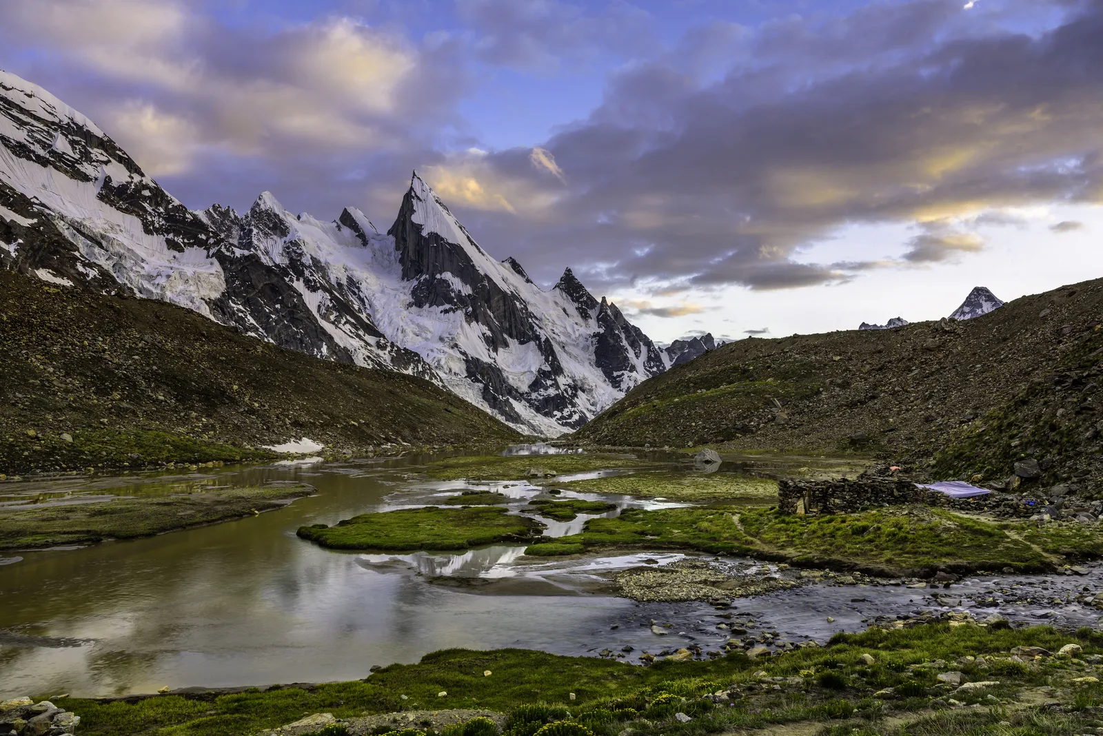
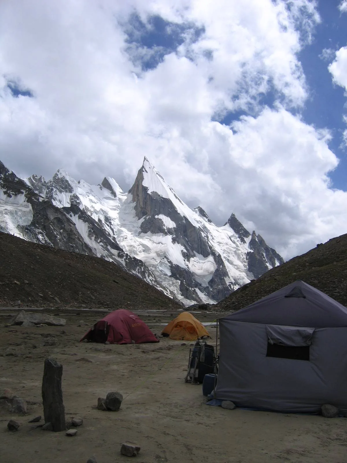
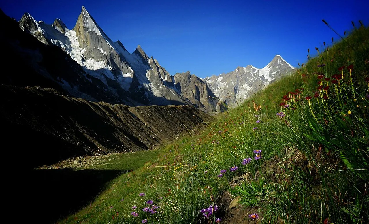
Laila Peak is a roughly 6,096-metre spire in the Hushe Valley of Gilgit-Baltistan, often called the most beautiful mountain in the Karakoram for its impossibly thin, spear-shaped summit and the 1,500-metre, 45-degree ice face that runs down its northwest side. For most travellers it is not a climb but a destination to walk to: a three-to-four-day trek up the Hushe Valley from Skardu brings you to a base camp at about 4,535 m, beneath one of the cleanest mountain shapes on earth. The climb itself is a serious, technical objective that has killed experienced alpinists. This guide separates the two honestly, from a team that guides these valleys.
Key Takeaways
- Height: approximately 6,096 m (20,000 ft). Sources vary; the 6,096 m figure comes from a 2003 Japanese survey map and is the most widely cited.
- Where: Hushe Valley, near the Gondogoro Glacier, about 140 km east of Skardu, opposite Khaplu across the Shyok River.
- The trek: reachable on foot in roughly 3–4 walking days from Hushe village (3,050 m) to Laila Peak Base Camp (about 4,535 m). Moderate to demanding, not technical.
- The climb: a genuine, dangerous alpine route. Restricted zone, permit, guide and insurance required. Fatalities in 2016 and 2025.
- Season: June to September. Peak conditions July–August.
Why Laila Peak gets called the most beautiful mountain in the Karakoram
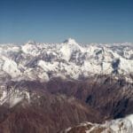
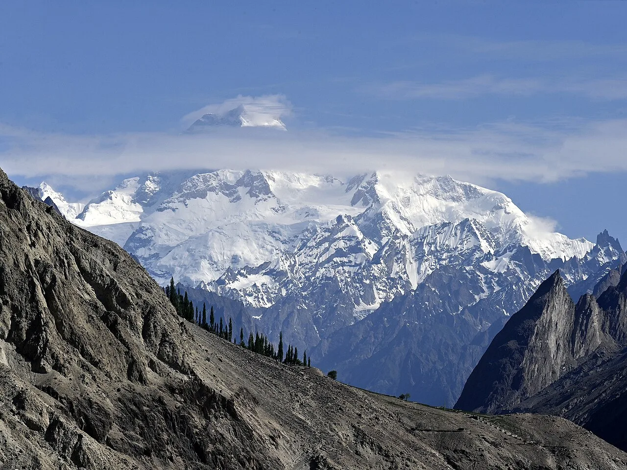
Plenty of peaks here are bigger. K2 is 8,611 m. Masherbrum, at the head of this same valley, is 7,821 m. Laila is smaller than both, and that is exactly the point. What it has instead is shape. The summit tapers to a needle, and the northwest face falls away in a single unbroken sweep of ice, roughly 1,500 vertical metres at around 45 degrees. From the right angle it looks less like a mountain and more like a scythe leaning against the sky.
The Swedish skier Fredrik Ericsson, who made an early ski attempt here, described it as “one of the most amazing mountains they have ever seen, like a needle it points straight up in the sky.” That reputation is why a peak under the magic 6,500 m mark draws climbers, photographers and skiers from across the world. It is not a number on a list. It is a thing you stand under and go quiet.
Where Laila Peak actually is: the Hushe Valley
Laila stands above the Hushe Valley, the easternmost inhabited valley of Baltistan, near the snout of the Gondogoro Glacier. Hushe village sits at about 3,050 m and is the last settlement on the road, roughly 140 km east of Skardu. You reach it by jeep from Skardu, passing through Khaplu, the old palace town across the Shyok River. For the drive itself, see our guide on how to get to Skardu.
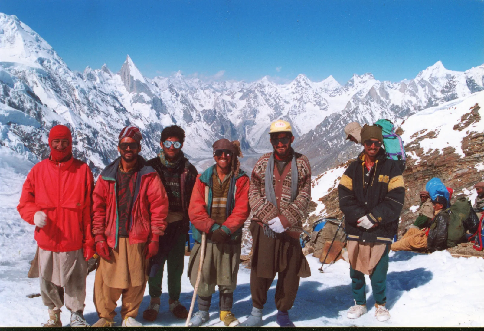
Hushe is one of the great trailheads in the Karakoram. From this single valley you can walk to the base camps of Masherbrum (K1, 7,821 m), K6 (7,281 m), K7 (6,934 m) and Link Sar (7,041 m), cross Gondogoro La to reach Concordia and K2, or simply walk up to Laila. The people here are Balti, and many of the strongest high-altitude porters on K2 and Broad Peak come from Hushe and the villages around it.
The trek to Laila Peak Base Camp
This is the part most travellers come for, and the good news is that you do not need to be a climber. The walk from Hushe to Laila Peak Base Camp is a moderate-to-demanding trek on glacier and moraine, not a technical route. A typical schedule runs three to four walking days each way, built into a longer trip from Skardu with buffer days for the flight and acclimatisation.
Schematic elevation profile (approximate)
Approximate altitudes; intermediate camp heights vary by operator and route conditions.
The stages, day by day
Hushe (3,050 m) to Saitcho (~3,350 m). An easy first day of four to five hours through pasture and apricot ground along the Hushe River. Saitcho is a green camp reached after crossing the Charakusa River on a wooden cantilever bridge, with the granite walls of the valley closing in.
Saitcho to Dalsampa (~3,900 m). Steeper, four to six hours, climbing onto the edge of the Gondogoro Glacier. The views of Masherbrum and the surrounding spires open up here.
Dalsampa to Laila Peak Base Camp (~4,535 m). Five to six hours up the Gondogoro Glacier and its moraine to the camp directly beneath the peak. This is glacier walking; rope, crampons and a guide who knows the crevasses matter.
Permit note. Laila Peak sits in a restricted zone. Non-Pakistani visitors need a permit, a registered guide and accident insurance covering the whole party, even just to trek to base camp. Expeditions and treks here run on a Trekking & Mountaineering visa, which is different from a tourist visa, and some areas need an NOC. We sort the paperwork; you should not try to wing it at the trailhead.
Trek vs climb: know which one you are signing up for
The single most important thing to understand about Laila Peak is that walking to its base camp and climbing its summit are two completely different undertakings. One is a beautiful, achievable trek. The other is a technical alpine climb that has killed strong mountaineers. Here is the honest comparison.
| Trek to Base Camp | Climb to Summit | |
|---|---|---|
| Max altitude | ~4,535 m | ~6,096 m |
| Skill needed | Fit hiker; basic glacier travel | Experienced alpinist; steep ice to 45–50° |
| Time on mountain | 3–4 walking days each way | Multi-day expedition with fixed camps |
| Main hazard | Altitude, crevasses, weather | Rockfall, avalanche, steep falls |
| Who it suits | Most trekkers with decent fitness | Climbers with prior 6,000 m+ experience |
A real safety warning, not a sales line. The climb is dangerous and we will not pretend otherwise. The Italian climber Leonardo Comelli died here in 2016, falling roughly 400 m during a ski descent. In July 2025 the German double Olympic biathlon champion Laura Dahlmeier, an experienced and careful alpinist, was killed by rockfall at around 5,700 m while descending the peak. These were not careless tourists. Laila Peak demands real alpine skill, a strong team, and the humility to turn around. If you want the mountain without the death exposure, the trek to base camp gives you the view and brings you home.
A short, contested climbing history
Even Laila’s history is hard to pin down. Local people in Hushe say the summit has been reached only a couple of times, by a handful of climbers in total. British alpinists including Simon Yates made an early ascent of the peak, and an Italian team is credited with a documented summit in the 1990s; the records are patchy and the sources disagree on exact dates. The first winter ascent came in February 2013, by the Spanish climbers Alex Txikon and José Fernández. The mountain’s long-coveted first complete ski descent was finally made by the French trio of Carole Chambaret, Tiphaine Duperier and Boris Langenstein, who skied the full northwest face. That a face this steep and beautiful has so few ascents tells you everything about how serious it is.
Pairing Laila with the rest of the Hushe and Baltoro
Most people do not fly all the way to Skardu for a single short trek, and the geography rewards combining. Because Laila Peak Base Camp sits on the Gondogoro Glacier, strong trekkers can link it with a crossing of Gondogoro La (5,585 m) to come out at Concordia, under K2 and Broad Peak. Others pair the Hushe Valley with the K6 and K7 base camps in the neighbouring Charakusa Valley, or build a wider Karakoram itinerary; see our roundup of the best treks in Pakistan. If you are weighing an actual expedition rather than a trek, our guides to the Broad Peak expedition and the more approachable Spantik (Golden Peak) are good next reads.
When to go
The Hushe Valley follows the same rhythm as the rest of the high Karakoram. The window runs roughly June to September, with July and August the most stable for the glacier and the high camps. June can still hold heavy snow up at base camp; by late September nights turn hard and the season closes. Flights between Islamabad and Skardu are quick but weather-dependent, so a sensible itinerary keeps a buffer day or two at each end.
Frequently asked questions
How tall is Laila Peak, really?
Most commonly cited at about 6,096 m (20,000 ft), from a 2003 Japanese survey map. Other sources have given figures from roughly 6,069 m up to 6,200 m and even 6,614 m. Treat any single number as approximate.
Do I need climbing experience to visit Laila Peak?
No, not to trek to base camp. That is a moderate-to-demanding walk on trail and glacier, suitable for fit hikers with a guide. Climbing the summit is a serious technical alpine route and is only for experienced mountaineers.
How long is the trek to Laila Peak Base Camp?
Roughly three to four walking days each way from Hushe village, reaching base camp at about 4,535 m. Allow a longer total trip from Skardu to cover the drive, flights and acclimatisation.
Do I need a permit for Laila Peak?
Yes. It lies in a restricted zone, so foreign visitors need a permit, a registered guide and accident insurance for the whole party, on a Trekking & Mountaineering visa. We arrange the paperwork.
What is the best time to trek the Hushe Valley?
June to September, with July and August the most reliable. Earlier in June can still be snowy at base camp; after late September it gets cold and the season ends.
Walk to Laila with a local Balti team
We grew up under these mountains, carry a satellite phone on every trip, and keep a real rescue plan for the Hushe and Baltoro region, not a line in a brochure. Local hands, real safety, fair price. Planning your trip? WhatsApp us on +92 312 9921574 or email info@karakoramventure.com — you’ll be talking to a local Balti team, not a broker.
Sources: Wikipedia (Laila Peak, Hushe Valley; Hushe; Masherbrum); SummitPost; PlanetMountain; American Alpine Club publications; Al Jazeera, Explorersweb and Dawn (reporting on the July 2025 Laila Peak accident). Altitudes and distances are approximate and cross-checked against these references; intermediate camp heights vary by route and conditions. Images via Wikimedia Commons under the CC BY / CC BY-SA licences credited beneath each photo.