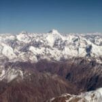
The Gondogoro La (5,585 m / 18,323 ft) is a high glacier pass in the Karakoram that turns the out-and-back K2 Base Camp walk into a complete circuit: you go in from Askole up the Baltoro to Concordia, then cross the pass and drop south into the Hushe Valley — and from its summit, on a clear dawn, you stand in front of four of the world’s fourteen 8,000-metre peaks at once: K2, Broad Peak, Gasherbrum I and Gasherbrum II. It is not a walking pass. It is a crampons-and-fixed-rope crossing on a roughly 16–20 day expedition, and it demands real acclimatisation, an alpine start in the dark, and a team that knows the snow. This guide lays out the route, the altitudes, the season, the honest difficulty, and how to do it safely.
Key Takeaways
- Pass height: 5,585 m at the low point; the climbing crossing tops out slightly higher and to the west, near 5,618 m.
- What it connects: Concordia, on the upper Baltoro, to Hushe village — a route first established in 1986.
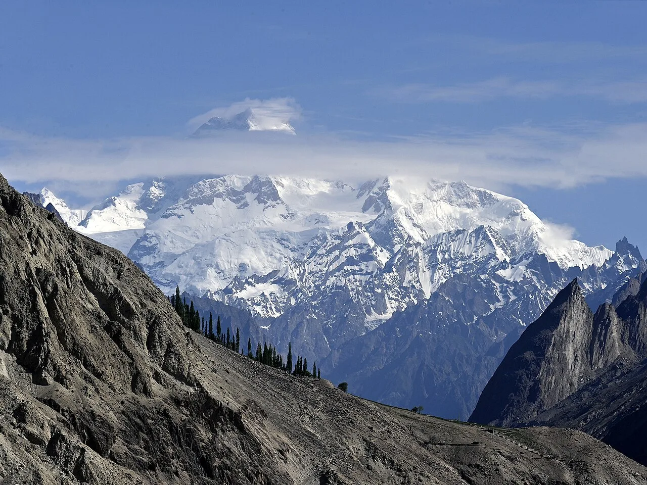
- The view: four 8,000ers from one pass — K2 (8,611 m), Broad Peak (8,051 m), Gasherbrum I (8,080 m), Gasherbrum II (8,035 m).
- Difficulty: Class 4 — crampons, harness, fixed ropes; snow slopes up to 50°. Not a trek for first-timers.
- Season: roughly late June to August; earlier crossings have firmer snow and lower objective risk.
- Length: about 16–20 days; roughly 130 km on foot from Askole to Hushe.
What is the Gondogoro La, and why cross it?
Most people walk to Concordia and turn around the way they came. The Gondogoro La is the alternative ending. Instead of retracing the Baltoro, you climb onto the Vigne Glacier, cross a 5,585-metre pass in the dark, and descend a completely different valley — the Hushe — out the south side of the range. It closes the loop, and it pays you with a panorama you simply cannot get from the valley floor.
The pass sits about 25 km south of K2 and links the Gondogoro Glacier on the southwest with the Vigne Glacier on the northeast. A trekking route over it was opened in 1986, and it has been the connoisseur’s finish to the K2 region ever since. The American photographer and climber Galen Rowell called the bowl of giants you look out over from here the “Throne Room of the Mountain Gods.” Stand on the top at first light and you understand the name.
The route, valley by valley
The first half of the journey is the classic Baltoro approach — the same trail as the standard K2 Base Camp trek. You leave the road at Askole after a long 4×4 jeep day from Skardu (roughly 7–9 hours over the Braldu gorge) and walk up the greatest glacier highway on earth: Jhola, Paju, then onto the ice past the Trango Towers to Urdukas, Goro II and Concordia.
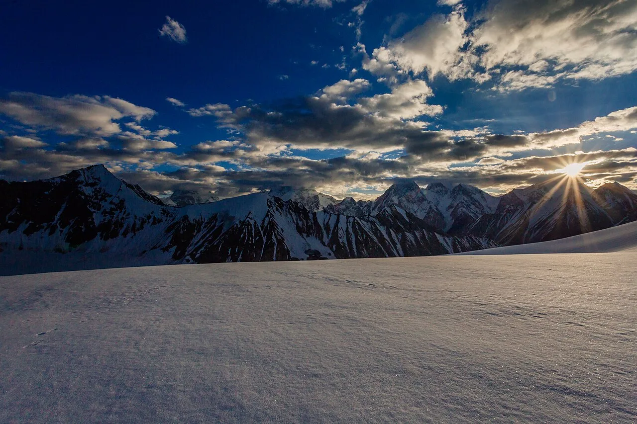
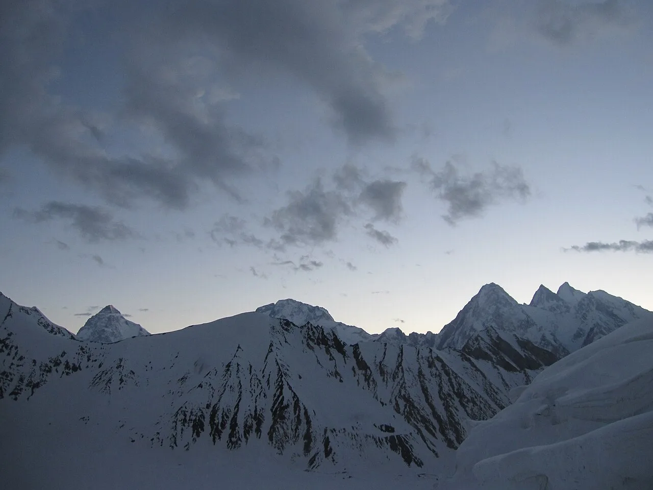
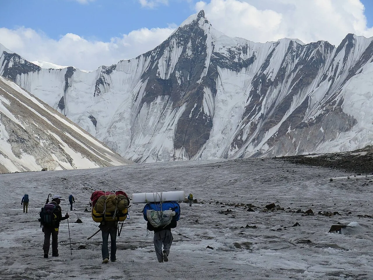
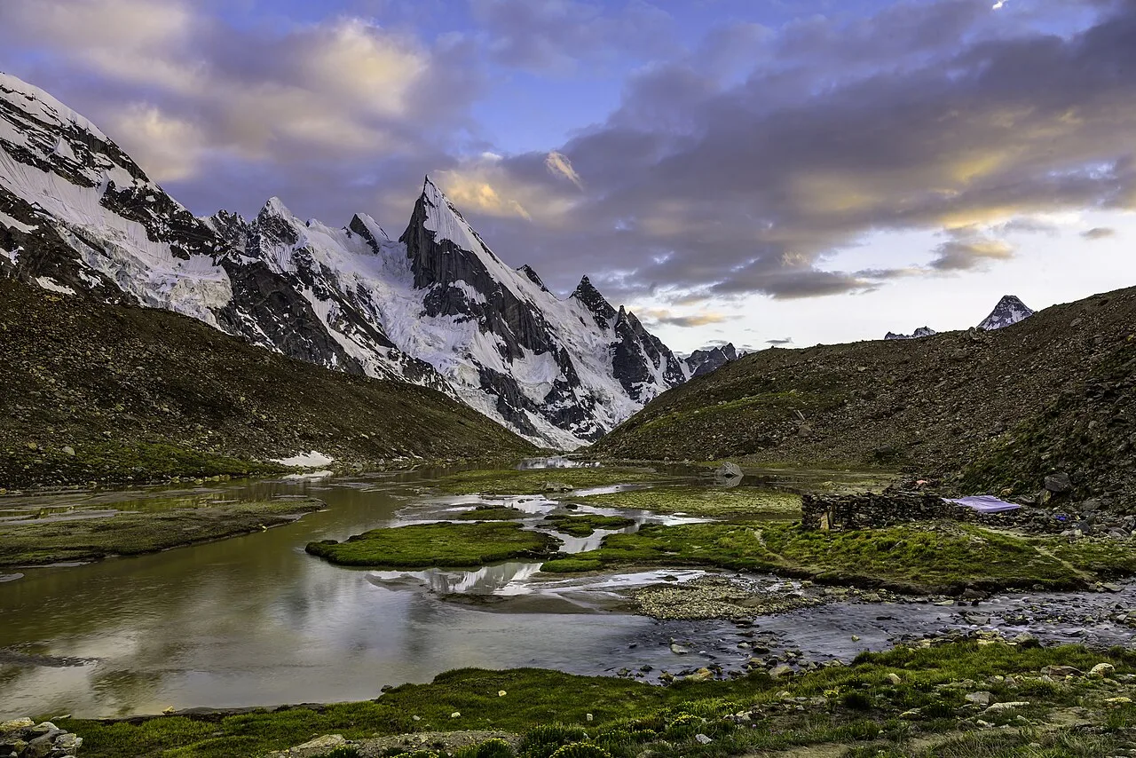
From Concordia you make the side trip to K2 Base Camp (about 5,150 m) and back, then turn south onto the Vigne Glacier to Ali Camp, the high camp tucked below the pass. From Ali Camp you start the crossing itself — usually around midnight — climb to the top of the Gondogoro La for sunrise, then make the long descent down the Gondogoro Glacier to Khuspang, past the ice fin of Laila Peak, and down through Dalsampa and Saicho to Hushe village.
Schematic elevation profile (approximate)
Camps and altitudes
Figures below are drawn from published trek data and GPS records; treat them as approximate, since sources differ by a few dozen metres.
| Stage | Approx. altitude | Notes |
|---|---|---|
| Askole (road head) | ~3,050 m | Last village; jeep from Skardu |
| Jhola | ~3,160 m | First camp on the trail |
| Paju | ~3,400 m | Acclimatisation day; snout of the Baltoro |
| Urdukas | ~4,050 m | Grassy ledge above the glacier |
| Goro II | ~4,300 m | Camp on the ice |
| Concordia | ~4,650 m | The hub; K2 in full view |
| K2 Base Camp | ~5,150 m | Day trip from Concordia |
| Ali Camp | ~5,000 m | High camp; alpine start from here |
| Gondogoro La | 5,585 m | The crossing; fixed ropes both sides |
| Khuspang | ~4,680 m | First camp below the pass, Laila Peak above |
| Saicho | ~3,350 m | Trees and meadows again |
| Hushe | ~3,048 m | Trail head; jeep back to Skardu |
How hard is the Gondogoro La, honestly?
Harder than the standard K2 Base Camp trek, and we say that plainly. The walk-in is long but non-technical; the pass is not. It involves Class 4 climbing on crampons. The northeast side — the way up from Ali Camp — is steep snow with sections reaching about 50°, prone to avalanche, and it is roped. The southwest side, the descent, is a longer continuous slope of similar angle with rockfall and avalanche hazard, and in a heavy snow year can need up to 300 metres of fixed rope.
Safety reality check
This is high-altitude glacier travel with real objective danger — crevasses, avalanche, rockfall, and the effects of 5,500 m on a body that started in the dark. You need prior acclimatisation, basic mountaineering skill with crampons and a harness, genuine fitness, and a team carrying a satellite phone and a rescue plan. People do get turned back here by weather and snow conditions, and that is the right call. Never let anyone sell you the pass as a guaranteed crossing.
The crossing is timed for the dark and the cold for a reason: firm, frozen snow is safer to climb and descend than the soft, melting slush of a warm afternoon. That is why teams leave Ali Camp around midnight and aim to be over the top and off the steep ground before the sun softens it. Experienced local high-altitude porters stay near the top of the pass through the season to fix and maintain the ropes and help trekkers across — one of the quiet reasons this route works at all.
K2 Base Camp trek vs. the Gondogoro La circuit
If you are weighing the standard out-and-back against the full crossing, here is the honest comparison.
| K2 Base Camp (out & back) | K2 BC + Gondogoro La circuit | |
|---|---|---|
| Highest point | K2 BC ~5,150 m | Gondogoro La 5,585 m |
| Technical skill | None — glacier walking | Crampons, harness, fixed ropes |
| Typical length | ~14–18 days | ~16–20 days |
| Shape | Return down the Baltoro | Loop — out via Baltoro, down via Hushe |
| The payoff | K2 from Concordia | Four 8,000ers from the pass at dawn |
| Best for | Fit trekkers, first Karakoram trip | Experienced trekkers wanting a real pass |
Permits & visa note
Trekking in this zone is not the same as a tourist visit. Expeditions and treks in the K2 region generally require a Pakistan Trekking & Mountaineering visa (distinct from a tourist visa) and may need a No Objection Certificate (NOC) and a registered guide. The specifics change, so confirm the current requirements with us before you book flights.
When to go: season and timing
The trekking season in the high Karakoram runs roughly April to October, with the peak from June to September. For the Gondogoro La specifically, timing matters more than on a normal trek. The pass can be attempted as early as the last few days of June — go earlier and you risk being the first party of the season, breaking trail through deep snow. As summer wears on toward August, the snow bridges over crevasses weaken and rockfall and avalanche danger climb as the cover melts. Earlier in the window generally means firmer snow and lower objective risk; later means warmer days but more hazard up high. There is no single perfect date — it depends on the year’s snow, which is exactly why local judgement on the ground counts.
Training and who this trek is for
This is for trekkers who already have multi-day mountain days in their legs and ideally some time at altitude. You do not need to be a technical alpinist, but you must be comfortable walking in crampons, clipping a harness to a fixed line, and managing a very long summit day — the Ali Camp to Khuspang stage alone can run 9–12 hours with a steep ascent and a big descent. Build long back-to-back hiking days with weight, get cardio fit, and if you can, spend nights at altitude before you arrive. Honesty about your own fitness here is a safety tool, not a weakness.
If the crossing sounds beyond where you are now, the straight Concordia and K2 Base Camp trek gives you the same heart of the Karakoram without the technical pass — and it is a magnificent trip in its own right. For a gentler first Karakoram experience entirely, our Deosai jeep safari trades glaciers for high plateau and wildflowers.
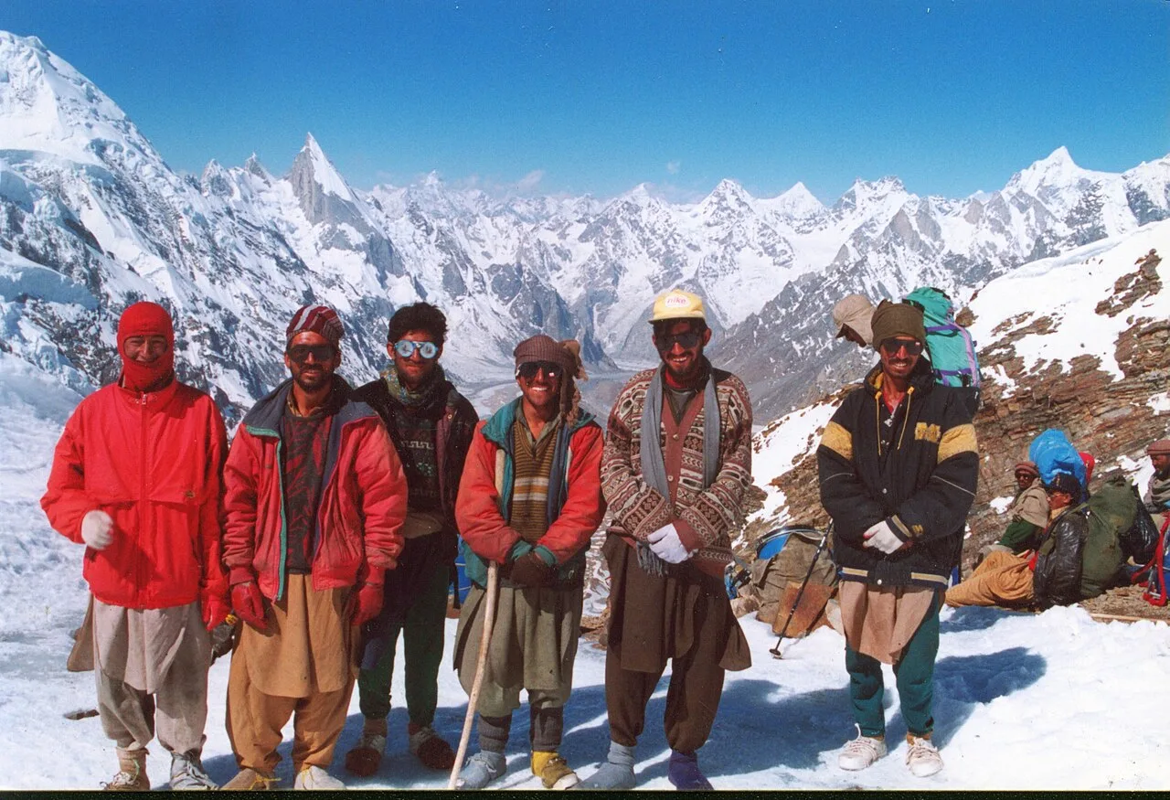
Doing it with a local team
The Gondogoro La is a route where who you walk with is not a detail — it is the whole margin of safety. Our guides and high-altitude porters are Balti, from the very valleys this trek crosses; Hushe, at the southern trail head, is home ground. That means the people fixing the ropes near the top of the pass, reading the snow at midnight, and deciding whether today is a crossing day or a wait day know this ground in a way no outside operator can match. We carry a satellite phone on the mountain, keep established helicopter-rescue contacts for the Baltoro region, and plan evacuations before we need them — because on a Class 4 pass at 5,585 m, the rescue plan has to exist before the moment you need it. Local hands, real safety, a fair price for all of it.
For climbers eyeing a peak from the same valleys, the Hushe side is also the gateway to Laila Peak, and the wider Karakoram holds bigger objectives like Broad Peak and the remote Snow Lake traverse. If a first 7,000er is the goal, Spantik is the classic place to start.
Frequently asked questions
How high is the Gondogoro La pass?
The low point of the pass is 5,585 m (18,323 ft). The actual climbing crossing is slightly higher and to the west, near 5,618 m by GPS. From the top you can see K2, Broad Peak, Gasherbrum I and Gasherbrum II.
How many days is the K2 Base Camp and Gondogoro La trek?
Plan on roughly 16–20 days on the trail, covering about 130 km from Askole to Hushe, plus travel days to and from Skardu. The first 12 or so days follow the standard K2 Base Camp route; the crossing and Hushe descent are the extension.
Do I need climbing experience to cross the Gondogoro La?
You don’t need to be a technical alpinist, but you do need to be fit, acclimatised, and comfortable using crampons, a harness and fixed ropes on snow slopes up to about 50°. It is graded Class 4 and is meaningfully harder than the standard out-and-back to K2 Base Camp.
When is the best time to cross?
Roughly late June through August. Earlier in that window the snow is firmer and objective danger lower; by August melting snow increases crevasse, avalanche and rockfall risk. The right day depends on the season’s snow, which is why local judgement on the ground matters.
Is the Gondogoro La dangerous?
It carries real objective hazard — crevasses, avalanche and rockfall, at altitude. It is done safely every season with proper acclimatisation, an experienced local team, fixed ropes maintained near the top, a midnight start on frozen snow, and a genuine rescue plan. Weather and snow do turn parties back, and that is the correct decision when conditions are wrong.
Ready to put dates to it? See our full K2 Base Camp & Gondogoro La package — fixed departures, all-inclusive, run by our own Balti team.
n
Ready for the real pass?
Planning your trip? WhatsApp us on +92 312 9921574 or email info@karakoramventure.com — you’ll be talking to a local Balti team who guides these valleys, not a broker. Tell us your dates and experience and we’ll tell you straight whether the Gondogoro La is your year.
Sources & references: Gondogoro Pass — Wikipedia; Concordia (Karakoram) — Wikipedia; Baltoro Glacier — Wikipedia; Laila Peak — Wikipedia; K2 — Wikipedia; daily distance and altitude data via Chogori Adventure. Photographs via Wikimedia Commons under CC BY-SA / CC BY / public domain, credited beneath each image. Altitudes are approximate and vary between sources.