



Fairy Meadows sits at 3,300 m in Diamer District, a short but memorable detour off the Karakoram Highway. It lies directly beneath the Raikot Face of Nanga Parbat (8,126 m), the world’s ninth-highest mountain. Getting there takes a jeep ride widely called one of the most dangerous roads on earth. Then comes a 3–4 hour, 5 km walk uphill through pine forest. Most visitors treat it as a 2–3 day trip. You drive in, sleep a night or two at the meadow, then walk further up toward Beyal Camp for the full view. After that you come back down. The tourist season runs April to September. The walk itself is moderate. However it’s the road, not the trail, that does most of the talking.
We run this as an extension to our Karakoram Highway journeys between Islamabad and Skardu — not a Baltistan trek, and we won’t pretend otherwise. Fairy Meadows sits in Diamer, in Shina-speaking Chilasi and Astori country, a different valley system to the Balti communities our core guiding team comes from. What we bring to it is the same thing we bring everywhere. A properly planned itinerary, drivers and local guides we’ve vetted ourselves, and a real safety plan. That plan covers the one part of this trip that actually deserves caution: the road.
Key takeaways
- Fairy Meadows: 3,300 m, in Fairy Meadows National Park (established 1995), Diamer District — locally known as Joot.
- Access: Karakoram Highway to Raikot Bridge, then a 15 km jeep track (locals-only drivers) to Tato village, then a 5 km, 3–4 hour hike to the meadow.
- In 2013 the World Health Organization named the Raikot Bridge–Tato jeep track the second-deadliest road on the planet.
- What you see first isn’t the true summit — it’s Nanga Parbat’s North Peak (7,816 m). The 8,126 m summit stays hidden behind it and the Silver Saddle.
- To see more of the mountain, trekkers extend to Beyal Camp (3,500 m) and a viewpoint at roughly 3,667 m; a further push reaches Nanga Parbat’s Fairy Meadows-side base camp at about 3,967 m.
- Season: six months, April–September, per the park authority; June–September gives the clearest mountain views.
Where it is, and why trekkers come here
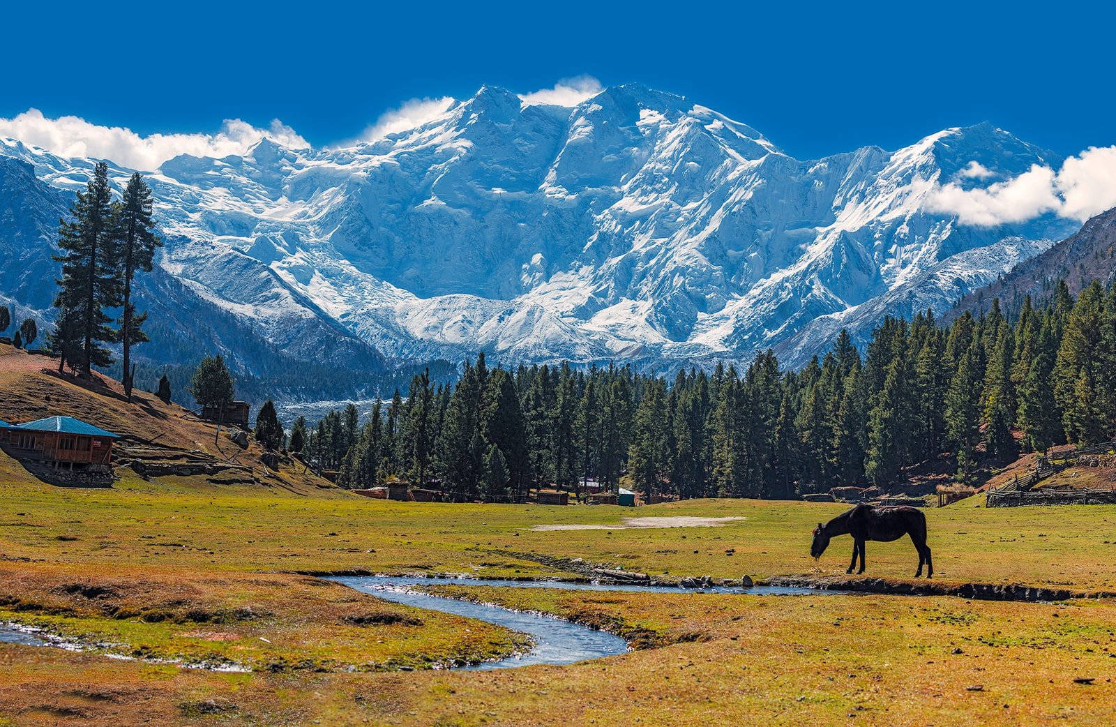
Fairy Meadows is a grassland at 3,300 m in the Rakhiot valley, fed by the Rakhiot Glacier that spills down off Nanga Parbat and eventually reaches the Indus. It was declared a National Park in 1995. Locals have been running campsites here since 1992. The site people now call “Raikot Serai” spreads across roughly 800 hectares of thick alpine forest: pine, spruce, fir, birch and juniper. A small, declining population of brown bears and a few musk deer still use the higher ground.
It matters to mountaineers for a specific reason. This meadow is the traditional launching point for climbers attempting Nanga Parbat by the Rakhiot (Raikot) Face. That was the route used in the mountain’s earliest expeditions. For everyone else, it’s simply the easiest place in Pakistan to stand close to an 8,000 m peak without technical climbing, permits, or weeks on a glacier.
The route, step by step
- Islamabad or Skardu to Raikot Bridge. You reach Raikot Bridge on the Karakoram Highway, on the Indus, whether you’re coming up from Islamabad or coming down as part of a Skardu road trip.
- Raikot Bridge to Tato village (15 km, jeep). A narrow gravel track climbs the mountainside. It’s driven only by local jeep drivers who do this road for a living — in 2013 the WHO called it the world’s second-deadliest road, and that reputation is exactly why we don’t let anyone drive it themselves.
- Tato to Fairy Meadows (5 km, 3–4 hours on foot). A steady climb through pine forest. This is the actual “trek” part, and it’s the easy part — a good boots-and-lungs walk, not a mountaineering day.
- Night at Fairy Meadows. Wooden cottages and campsites at Raikot Serai, with Nanga Parbat’s North Peak filling the skyline.
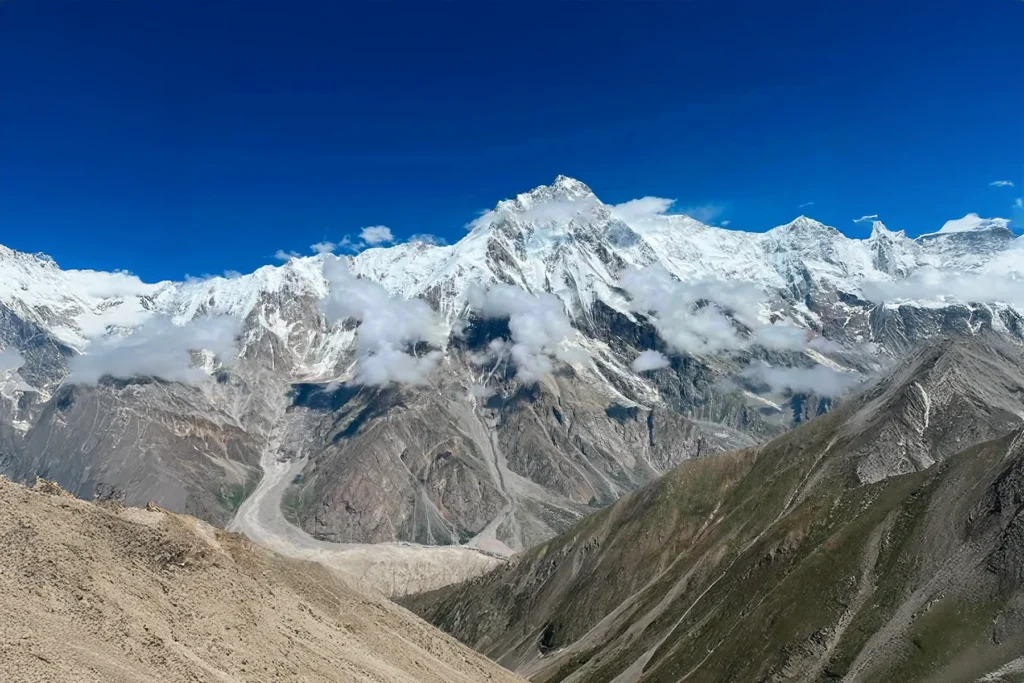
- Optional: Fairy Meadows to Beyal Camp (2–3 hours) and the viewpoint (+30 minutes). This is where the view opens up properly — close to 180 degrees of Nanga Parbat from Beyal Camp (3,500 m), and a close look at the Raikot Glacier from the viewpoint just above it (about 3,667 m).
- Optional: viewpoint to Nanga Parbat’s Fairy Meadows-side base camp (about 3,967 m). A further ridge climb and a walk across rocky glacier terrain — roughly 3 hours one way from the viewpoint, or an 8–10 hour, 14 km round trip if you do it in a single push from Fairy Meadows. This day is rated hard, and it should be treated that way.
- Back down to Tato and out by jeep. Same road, same drivers, same respect for it.
Schematic / approximate — not to horizontal scale, times as commonly reported by local guides.
The mountain behind the meadow
Nanga Parbat is 8,126 m, the world’s ninth-highest mountain and Pakistan’s second-highest after K2. Its nickname, “Killer Mountain,” was earned honestly: between A.F. Mummery’s first attempt in 1895 and the first successful ascent in 1953, 31 people died on its slopes. Many of them died in the catastrophic German expedition disasters of 1934 and 1937. On 3 July 1953, Austrian climber Hermann Buhl reached the summit alone, without supplemental oxygen, after his climbing partners turned back. It remains the only solo first ascent of an 8,000 m peak in mountaineering history. He returned to camp roughly 41 hours after he’d left it.
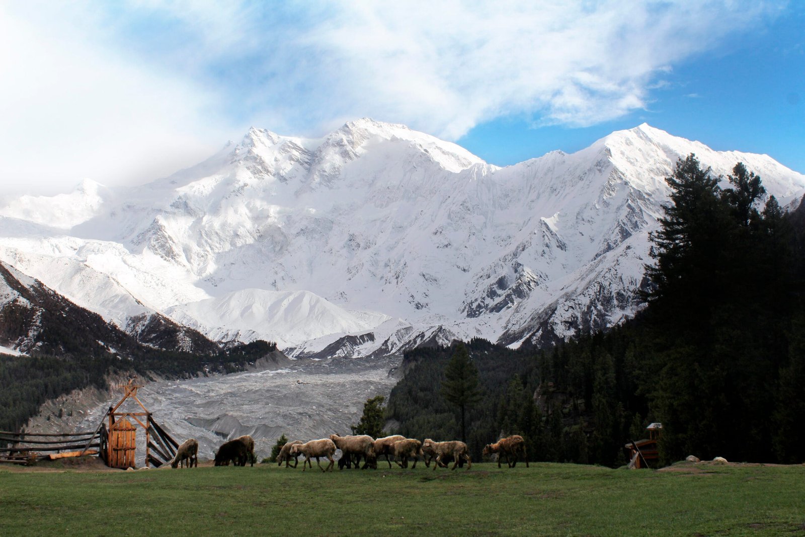
What you actually see from Fairy Meadows on your first evening isn’t that summit. It’s Nanga Parbat’s North Peak, at 7,816 m. That is tall enough to be mistaken for the main event. Meanwhile the true 8,126 m summit stays tucked out of sight behind it and the Silver Saddle. That’s part of why the extension to Beyal Camp and the viewpoint is worth the extra day, if your fitness and schedule allow it.
Schematic / approximate, based on figures reported by local trekking guides — not surveyed elevations.
When to go
| Month | Conditions | Verdict |
|---|---|---|
| April | Road just reopening, meadow still muddy from snowmelt, cold nights | Early / marginal |
| May | Meadow greening up, comfortable days, occasional rain | Good |
| June | Peak season starts, clear skies, warm days | Best |
| July | Warmest, most stable weather of the year | Best |
| August | Some monsoon-influenced cloud and rain possible, still busy | Good — watch the forecast |
| September | Cooling off, clearer air, fewer crowds, good light | Best |
The official tourist season is six months, April through September. Outside that window the road and the meadow itself become far less reliable, and we don’t recommend it.
How hard is it, honestly
The walk from Tato to Fairy Meadows is moderate. It is a steady 3–4 hour uphill hike through forest. That will get your legs and lungs working, especially if you’ve just flown in from sea level. Still, it demands no technical skill. Therefore anyone in reasonably good hiking shape can do it.
The real difficulty is the road, not the trail. The Raikot Bridge to Tato jeep track is narrow, unpaved, and cut into a steep mountainside. The WHO’s “second-deadliest road” label from 2013 isn’t marketing. It is a documented risk. Consequently only local drivers who do this route daily are allowed to take it.
If you go beyond the meadow
If you push on to Beyal Camp, the viewpoint, and the base-camp extension, treat that day seriously. It is 14 km round trip, about 660 m of ascent, and 8–10 hours. You cross rocky glacier terrain near 3,967 m. It’s rated hard for a reason, and mild altitude effects — headache, breathlessness, fatigue — are common even at these modest-by-Karakoram-standards elevations. So build in a rest day at the meadow before attempting it if you can.
Getting there, and what it costs
Most of our clients reach Fairy Meadows as a stop on the Karakoram Highway journey between Islamabad and Skardu — see our guide to getting to Skardu for how that road trip fits together. It also works as a short standalone trip from Islamabad if Fairy Meadows and the Nanga Parbat viewpoint are your only goal.
We keep pricing personal rather than posting a number that goes stale by the time you read it. Jeep availability, group size, and how far up toward the base camp you want to go all change the cost. What doesn’t change is the approach: a local team who knows this road, a real safety plan, and a fair price with nothing cut to get there. Message us and we’ll put together a straight answer for your dates and group.
If Fairy Meadows leaves you wanting the full expedition experience rather than just the view, our Nanga Parbat Base Camp trek covers the longer route across the Raikot Face and around to the Rupal Wall. For a different base-camp trek on the same highway corridor, see our Rakaposhi Base Camp guide. And if you’re weighing Fairy Meadows against the bigger Karakoram treks further along the highway, our roundup of the best treks in Pakistan and our acclimatisation guide are worth reading before you go. Pack using our Karakoram trek packing list, and if Fairy Meadows is your entry point to the wider region, our Skardu travel guide covers what comes after.
Frequently asked questions
How high is Fairy Meadows?
3,300 m. What you see from there first is Nanga Parbat’s North Peak (7,816 m) — the true 8,126 m summit stays hidden behind it and the Silver Saddle.
How do you actually get to Fairy Meadows?
Karakoram Highway to Raikot Bridge, then a 15 km jeep track up to Tato village. Only local drivers take that track. From Tato it is a 5 km, 3–4 hour hike on foot to the meadow.
Is the road really that dangerous?
The World Health Organization named the Raikot Bridge–Tato track the world’s second-deadliest road in 2013. It’s narrow, unpaved, and cut into a steep slope. It’s why only experienced local drivers take it, and why we treat it as the main safety consideration on this trip, not the walk itself.
Can you see Nanga Parbat’s true summit from Fairy Meadows?
Not directly. The 8,126 m summit is hidden behind the North Peak (7,816 m) and the Silver Saddle. For a fuller view, trekkers extend to Beyal Camp (3,500 m) and a viewpoint around 3,667 m, or push on to the base camp near 3,967 m.
When’s the best time to visit?
The official tourist season runs April to September — six months. June through September gives the clearest views of Nanga Parbat.
Local team, not a broker. We coordinate this trip with drivers and guides who know the Raikot road and the Fairy Meadows trail properly, backed by our own safety planning. WhatsApp us at +92 312 9921574 or email info@karakoramventure.com to talk through dates and route options.
Sources & attribution: Wikipedia (Fairy Meadows National Park; Nanga Parbat; 1953 German–Austrian Nanga Parbat expedition). World Health Organization road-safety reporting (2013). Trekking-guide route data from Against the Compass, Bucketlistly, and Traverse Pakistan. Images: “Fairy Meadows and the view of Nanga Parbat” by Imrankhakwani (CC BY-SA 4.0); “Nanga Parbat (Fairy Meadows)” by Zaki Khan89 (CC BY-SA 4.0). Also “Milky way over Fairy Meadows, Gilgit, Pakistan” by M.Ahmad Hussnain (CC BY-SA 4.0) — all via Wikimedia Commons.

