Baintha Brakk, better known as the Ogre, is a 7,285 m (23,901 ft) granite tower in the Panmah Muztagh, the Karakoram sub-range north of the Biafo Glacier in Gilgit-Baltistan. It sits about 75 km north of Skardu and roughly 30 km beyond the roadhead at Askole. Base camp is a three-day trek up the Biafo Glacier at around 4,200 m, reached in the summer window of June to August. Climbing it is another matter entirely: this is one of the hardest mountains on earth, first summited in 1977 and not climbed again for 24 years.
We run treks up this same Biafo Glacier out of Skardu with our own Balti team, and we want to be straight with you about what the Ogre actually is. It is not a trekking peak. It is not a guided commercial climb. It is a wall of compact granite that has turned back some of the strongest alpinists alive, and we will not sell you a “summit package” for it, because no honest operator can. What we can do is get you to Baintha and the base camp safely, on foot, with real logistics behind you — whether you are a trekker who wants to stand under it, or a serious alpine team that needs a local outfit to handle the approach, the porters, and the permit paperwork.
Key takeaways
- Height: 7,285 m (23,901 ft) — Panmah Muztagh, Karakoram, Gilgit-Baltistan.
- First ascent: July 13, 1977, Doug Scott and Chris Bonington, via the southwest spur and west ridge.
- Second ascent: not until July 21, 2001 — a 24-year gap, with more than 20 failed attempts in between.
- Base camp: roughly 4,200 m, a 3-day trek from Askole along the Biafo Glacier.
- Season: approach opens in June; the climbing window is roughly June–August.
- Reality check: the summit is an elite technical objective. Most visitors experience the Ogre from Baintha or from the Biafo–Hispar traverse, not from its top.
Where it is, and why it matters
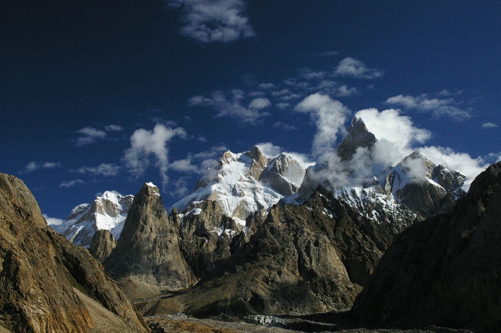
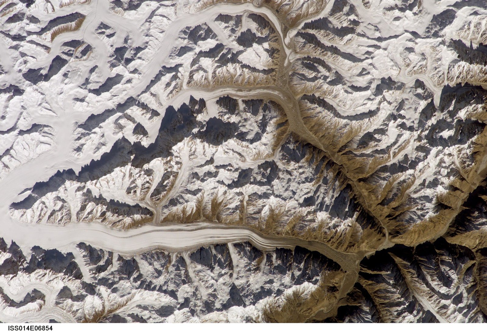
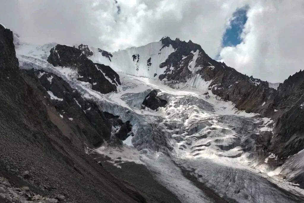
Baintha Brakk rises directly above the north bank of the Biafo Glacier, part of the same glacial system that continues over Hispar La to Hunza — one of the longest non-polar glacier traverses on earth, and a trek we already run in full. The Ogre’s neighbours are the Latok group, cut from the same rock and cast in the same reputation: steep, compact granite, more Yosemite than Himalaya, rising straight out of the ice with almost no easy ground anywhere on the mountain.
What sets the Ogre apart even among Karakoram giants is the combination of altitude and sheer, technical steepness. Its south face rises more than 3,000 m above the Uzun Brakk Glacier in only about 2 km of horizontal distance — a wall, not a slope. That is the reason it took until 2001 for anyone to stand on the summit a second time, and why by 2012 the mountain had seen only a handful of confirmed ascents in total.
The route: getting to Baintha and base camp
Getting to the foot of the Ogre follows the same road and trail system we use for our Snow Lake and Biafo–Hispar trek — this is the same glacier, just a shorter distance up it.
- Day 1 — Skardu to Askole: a full day by 4×4 jeep along the Shigar and Braldu valleys, the same rough, spectacular road that serves every Baltoro-side expedition.
- Day 2 — Askole to Jhola: the trek proper begins here, crossing the Braldu River toward Jhola, the gateway onto the Biafo Glacier.
- Day 3 — Jhola to Namla: onto the glacier itself — moraine, ice, and the crossing of the Biafo’s snout, then down to the Braldu–Domordo confluence and up to Namla camp.
- Day 4 — Namla to Baintha: the final push up-glacier to Baintha meadow and the base camp area at roughly 4,200 m, directly under the Ogre and the Latok group.
- Days 5+ — Base camp: for climbing teams, this is where the real expedition starts — weeks of technical work on the peak’s granite faces. For trekkers, we build in a rest day and a viewpoint excursion toward the Uzun Brakk side before turning back, or continuing on over Hispar La to Hunza if you’re doing the full traverse.
- Return: retrace the route to Askole (roughly 3 days) and jeep back to Skardu, or carry on with the Snow Lake–Hispar La traverse.
The history: why the Ogre has a reputation
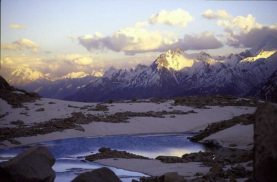
The first ascent, on July 13, 1977, was a British expedition led by Chris Bonington, climbing with Doug Scott, Mo Anthoine, Clive Rowland, Nick Estcourt, and Tut Braithwaite. Estcourt, Anthoine, and Rowland reached the lower west summit at about 7,150 m; Braithwaite was injured early by rockfall. Scott and Bonington pushed on via the southwest spur and west ridge, finishing with genuinely hard rock climbing at over 7,000 m — climbing that pushed the boundaries of what had been attempted at that altitude.
The descent is the part people still talk about. On the very first rappel off the summit, Scott broke both his legs. Bonington broke two ribs and came down with pneumonia during the week-long retreat to base camp, most of it through a major storm. Both survived — a genuine epic of self-rescue on one of the most remote mountains in the world, and a story that still shapes how seriously this peak is taken.
Nobody stood on the summit again for 24 years. More than twenty expeditions tried and failed in between. The second ascent finally came on July 21, 2001, when Urs Stöcker, Iwan Wolf, and Thomas Huber climbed the South Pillar route. A new line up the South Face followed on August 21, 2012, climbed by Americans Kyle Dempster and Hayden Kennedy — their partner Josh Wharton had to turn back around 6,800 m with altitude sickness. That gap and that attrition rate are why alpinists still rank the Ogre among the hardest mountains on earth, expedition-grade savage in a way that has little to do with its “modest” 7,285 m elevation.
The giants nearby: how the Ogre compares
The Ogre isn’t the tallest peak in the neighbourhood, but height only tells part of the story here. This chart lines it up against other Karakoram peaks we cover, all reachable from the same Skardu road system.
The Latok group sits directly across the ice from the Ogre — same rock, same reputation for holding out against strong climbers, and a mountain we cover in its own right in our Latok I guide. If you want the true giants of the region, our K2 expedition guide, Broad Peak guide, and Chogolisa guide cover the 7000ers and 8000ers reached from the Baltoro side of the same road network.
When to go
| Month | Conditions | Verdict |
|---|---|---|
| April–May | Lower Biafo still snow-covered in places, cold nights, glacier crossings trickier | Marginal — early teams only |
| June | Glacier opening up, long daylight, first stable weather windows | Good — season begins |
| July | Warmest, driest rock on the granite faces, most reliable weather of the year | Best for climbing |
| August | Still climbable, but afternoon storms build more often | Good, watch the forecast |
| September | Shortening days, first snow possible high on the peak | Fair — base-camp trekking only |
| October | Cold, unstable, glacier travel harder | Not recommended |
How hard is it, honestly
Separate the trek from the climb, because they are two completely different undertakings. The trek to Baintha and base camp is a long, physical glacier walk — moraine, ice, and altitude up to about 4,200 m, comparable to our other Baltoro-side approaches, with no technical climbing required. Reasonable fitness, sturdy boots, and glacier-trekking experience or a willingness to learn from your guide are what you need.
The mountain itself is a different question altogether. Baintha Brakk demands hard, sustained rock climbing at altitudes above 7,000 m, on rock so compact and steep that even elite alpinists have been turned back repeatedly. The numbers say it plainly: one ascent in 1977, none in the next 24 years despite over twenty attempts, and only a handful of confirmed summits since. We will not oversell this. If a team wants to attempt the Ogre, they need to already be operating at the top of the sport — our job is to get that team, and their gear, safely to and from the mountain, not to put anyone on the summit who isn’t already capable of getting there themselves.
Safety, honestly: this is remote, glaciated, high-altitude terrain with real crevasse and rockfall risk on the approach, and a genuinely dangerous objective above base camp. Every trip we run carries a satellite phone and a real evacuation plan — established helicopter-rescue contacts for the Baltoro/Biafo region, not just a phone number on a brochure. For technical teams we strongly recommend rescue insurance that explicitly covers high-altitude helicopter evacuation from this specific area; see our travel insurance guide before you book anything.
Permits and visa: peaks above 6,500 m anywhere in Gilgit-Baltistan — open zone or restricted — require a climbing permit from the Gilgit-Baltistan Council, along with a government-assigned liaison officer, royalty fees, and expedition/porter insurance arranged through your tour operator. That is separate from the trekking permit needed for the Biafo Glacier approach itself. Everyone, climbers and trekkers alike, needs the Trekking & Mountaineering visa category rather than a standard tourist visa — see our full Pakistan visa guide for how that works.
Getting there and cost
Getting to the start is the easy part: fly or drive to Skardu (see our guide to getting to Skardu), then it’s a day by jeep to Askole. From there, it’s our Balti team, your boots, and the Biafo Glacier.
We keep pricing personal rather than posting a number here that goes stale by the time you read it — expedition logistics, porter numbers, permit costs, and liaison officer fees all vary by team size and season. What doesn’t vary is our approach: local guides, a real safety plan, and a fair price with no corners cut. WhatsApp us your dates and team size and we’ll build you an honest quote.
Before you plan altitude days at Baintha or above, read our acclimatisation guide — base camp itself sits above 4,000 m, and the approach gives you real days to adjust before anything technical begins.
Frequently asked questions
How high is Baintha Brakk (the Ogre)?
7,285 metres (23,901 ft), in the Panmah Muztagh sub-range of the Karakoram, Gilgit-Baltistan, Pakistan.
Why is the Ogre considered one of the hardest mountains in the world?
It was first climbed in 1977, but nobody reached the summit again for 24 years — more than twenty expeditions failed in between. The compact granite rock at high altitude makes it a genuinely elite technical objective, not a matter of altitude alone.
How do you get to Baintha Brakk?
Fly or drive to Skardu, then jeep to Askole (about a day), then trek roughly three days up the Biafo Glacier via Jhola and Namla to Baintha and the base camp area at about 4,200 m.
Can I trek there without attempting to climb it?
Yes. Most of our clients see the Ogre from Baintha or from the wider Biafo–Hispar traverse rather than attempting the peak itself, which is an elite technical climb. The trek to base camp requires fitness and glacier experience but no technical climbing.
What permits do I need?
Climbing teams need a Gilgit-Baltistan Council mountaineering permit, a government liaison officer, and expedition insurance, on top of the standard trekking permit for the Biafo Glacier approach. Everyone needs a Trekking & Mountaineering visa rather than a tourist visa.
Local hands, real safety, fair price. We’re a Balti-run team based in Skardu, not a broker passing you to someone else on the ground. Whether you want to trek to Baintha and stand under the Ogre, or you’re a climbing team that needs serious logistics support for an attempt on the mountain, talk to us directly.
WhatsApp +92 312 9921574 or email info@karakoramventure.com.
Sources & attribution: Wikipedia (Baintha Brakk), American Alpine Club Publications (Baintha Brakk / Ogre expedition reports), and the Gilgit-Baltistan Council mountaineering permit rules as summarised by regional tour operators. Images: Ben Tubby (CC BY 2.0), NASA (Public Domain), and a Wikimedia Commons contributor (CC BY-SA 2.5), all via Wikimedia Commons.
You can walk to it. Our 13-day Ogre Base Camp Trek follows exactly the route above — Skardu to Askole by 4×4, then three days up the Biafo through Jhola and Namla to Baintha and the base camp area at about 4,200m, with a full day under the south face. Balti guides and porters from Askole, permits handled, sat phone in camp, from $1,790 per person. Going further up the same ice? The 22-day Snow Lake and Hispar La Trek continues past Baintha into the Snow Lake basin and over the Hispar La, from $2,800. Climbing teams needing approach and permit logistics only: talk to us directly.