



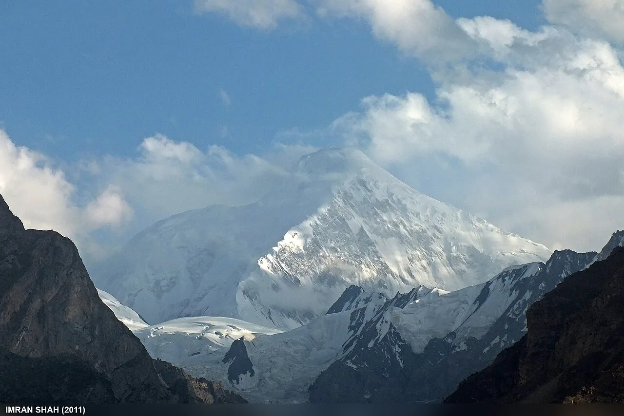
The Diran Peak Base Camp trek climbs to roughly 3,700 m (12,140 ft) beneath a 7,266 m snow pyramid in the Nagar Valley of Gilgit-Baltistan. It is one of the shortest walks to the foot of a Karakoram seven-thousander — about two to three days each way from the village of Minapin, through meadow and along the Minapin Glacier. The trekking season runs June to September, and the walk itself is moderate. The mountain above it, however, is one of the most deceptively dangerous in the range.
We run this trek out of Gilgit-Baltistan with our own Balti team, and we will be straight with you: the walk to Diran Base Camp is achievable for a fit first-timer, but it is still a high, cold, glacier-edge route, and the peak it sits under has killed experienced climbers who underestimated it. Below is the honest, fully-researched guide — altitude, route, season, difficulty, history and the safety realities — with every number checked against primary sources.
Diran Peak Base Camp trek: key takeaways
- The peak: Diran is 7,266 m (23,839 ft), a pyramid-shaped mountain in the Karakoram, ranked the 93rd-highest summit on Earth.
- Where: on the ridge between the Bagrot and Nagar valleys, just east of Rakaposhi (7,788 m). The base-camp trek is walked from Minapin in Nagar.
- Base camp: around 3,700 m, reached by crossing the Minapin Glacier above the Tagaphari meadow.
- Duration: roughly 2–3 days each way, often run as a 4–6 day round trip with acclimatisation and buffer.
- Difficulty: moderate as a trek — short distances but real altitude gain and a glacier crossing.
- Season: June to September, with July and August the warmest and clearest.
Where is Diran Peak, and why does it matter?
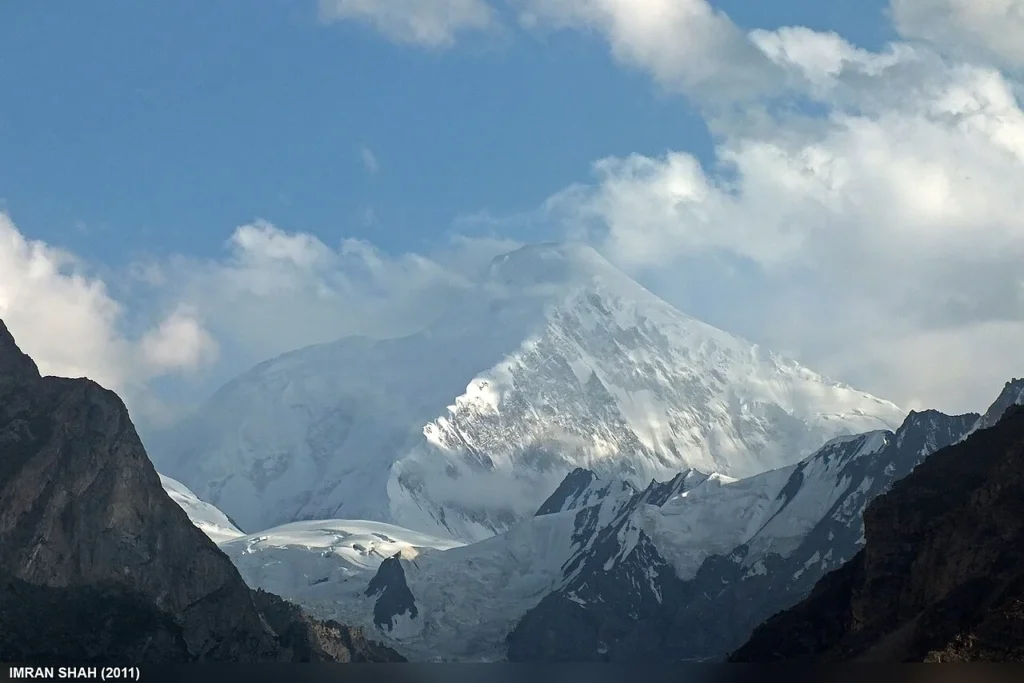
Diran rises on the divide between the Bagrot and Nagar valleys of Gilgit-Baltistan, immediately east of Rakaposhi. The two are part of the same Rakaposhi–Haramosh massif, so from the valley floor you often see them as a pair — Rakaposhi the broad giant, Diran the clean white pyramid beside it. At 7,266 m, Diran is ranked the 93rd-highest mountain in the world, with a prominence of around 1,325 m.
For trekkers, what matters is access. The standard base-camp trek begins at Minapin, a village in the Nagar Valley a short drive off the Karakoram Highway — the same trailhead used for the Rakaposhi Base Camp trek. From here it is a remarkably short walk to stand beneath a 7,000 m peak, which is exactly why Diran is one of the most accessible big-mountain base camps in the Karakoram.
How high is it? Diran among the giants of the massif
Diran is the smallest of the great peaks ringing the Nagar and Bagrot valleys, but “smallest” here still means a seven-thousander. Here is how it sits among its neighbours (summit elevations approximate; sources vary by a few metres):
Diran’s near neighbour Spantik — the Golden Peak — is the one most trekkers think about climbing, because it is among the most achievable 7,000 m summits in the range. If a first big peak is on your mind, read our Spantik (Golden Peak) expedition guide. And for the highest alpine lake in the country, just up the valley, see our Rush Lake trek guide — the same Nagar giants ring its plateau.
The route: Minapin to Diran Base Camp, step by step
The trek shares its first stretch with the Rakaposhi route, then branches up the Minapin Glacier toward Diran. It is short, but it gains height quickly and finishes with a glacier crossing, so it is a real mountain walk rather than a stroll.
A typical itinerary (4–6 days round trip)
- Day 1 — Minapin to Hapakun. A steep forest-and-meadow climb of about three hours from Minapin (~2,000 m) to the grassy shelf of Hapakun (~2,800 m), with first views opening up.
- Day 2 — Hapakun to Tagaphari. A short but stiff climb to the Tagaphari meadow (~3,200–3,300 m), the shepherds’ summer pasture above the glacier and the classic Rakaposhi viewpoint.
- Day 3 — Tagaphari to Diran Base Camp. Walk along and across the Minapin Glacier to reach Diran Base Camp (~3,700 m) at the foot of the peak — a few hours on grass and moraine, then time on the ice.
- Days 4–6 — Return & buffer. Retrace to Minapin, keeping a buffer day for weather, rest, or a second clear morning under the mountain.
Because the height gain is fast, the rhythm matters more than the distance. If you have walked the Rakaposhi Base Camp trek, this will feel like its quieter twin — same valley, same start, a different giant at the end.
Trek elevation profile
Safety reality: the Minapin Glacier is crevassed and moving, and Diran’s slopes above base camp are notorious for avalanches — the early expeditions of 1958, 1959 and 1964 were all driven back by deep snow and avalanche danger before the peak was first climbed in 1968. Even reaching base camp means time on live ice. This is not a route to attempt solo or without a guide who knows the current crossing line. We carry a satellite phone and a real evacuation plan on every high trek — local hands, real safety, fair price.
The mountain’s history: the deceptive pyramid
Diran looks like an easy mountain. Its summit pyramid is a clean snow-and-ice slope, and from a distance it seems gentler than the savage rock around it. That appearance has cost lives. According to the published record, a British expedition in 1958, a German one in 1959 and an Austrian team in 1964 all failed on Diran, beaten back by bad weather, deep snow and avalanches.
The mountain was finally climbed in 1968, in alpine style, by three Austrians — Rainer Goeschl, Rudolph Pischinger and Hanns Schell — after a patient, staged push up the west ridge. Since then Diran has gained a hard reputation: an apparently straightforward snow peak whose avalanche-loaded slopes punish anyone who treats it casually. For trekkers walking only to base camp this is a story to respect from below. For climbers, it is a serious objective, not a beginner’s tick.
When to go: season & weather
The window is June to September. Before June the trail and glacier hold snow and the crossing is riskier. After September, cold and early snow shut the high meadows down. July and August give the warmest days and the clearest views of the peak, though they coincide with the wider Karakoram trekking peak. It is the same broad summer season that opens the best treks in Pakistan, so plan flights and dates early.
| Month | Conditions | Verdict |
|---|---|---|
| Apr–May | Snow on trail and glacier, unstable crossings | Too early |
| June | Melt opening up, green meadows, some lingering snow | Good, with a guide |
| July–Aug | Warmest, clearest views, most stable footing | Best |
| September | Crisp, quiet, cold nights; weather turning | Good, late-season |
| Oct–Mar | Snowbound, meadows and glacier closed | Closed |
How hard is it? Fitness, altitude & the glacier
Honest answer: moderate as treks to a 7,000 m base camp go — which is why it is so popular. The distances are short and the trail is well-trodden as far as Tagaphari. But two things make it more than a walk. First, the altitude gain is fast: you climb from around 2,000 m to roughly 3,700 m in two to three days, and that is enough to bring on altitude sickness if you rush it. Second, the final stretch crosses the live, crevassed Minapin Glacier, where loose footing and a turned ankle become serious far from the road.
If you are new to high trekking, read our acclimatisation guide for the Karakoram before you commit, and pack for genuine cold and strong sun at altitude — our Karakoram trek packing list covers exactly what you need. We build in acclimatisation and watch every client; nobody is pushed onto the glacier who is not ready for it.
Permits & access note: the trek to Diran Base Camp is an open-zone trek and does not require the special mountaineering permit and royalty that climbing the peak itself demands — but rules can change, and climbing Diran is a different matter requiring a permit and a Trekking & Mountaineering visa rather than a tourist visa. Foreign trekkers should check our Pakistan visa guide and confirm any local registration with us before travel.
Getting there & what it costs
Minapin sits on the Hunza–Nagar side of Gilgit-Baltistan, reached overland on the Karakoram Highway from Gilgit, or by flying into the region and driving up. Many travellers tie Diran to a wider northern loop — the Rush Lake plateau up the same valley, or the Baltistan side around Skardu and the Baltoro. If you are combining sides, see how to get to Skardu and our broader Skardu travel guide for the logistics.
Costs vary with group size, days and service level, so we keep pricing personal rather than posting a number that goes stale. What we will promise: a fair price with no corners cut on guides, food or safety gear. WhatsApp us for current 2027 dates and a quote.
Frequently asked questions
How high is Diran Peak?
Diran Peak is 7,266 m (23,839 ft), a pyramid-shaped mountain in the Karakoram ranked the 93rd-highest summit in the world. Its base camp, the goal of the trek, sits at roughly 3,700 m.
How many days is the Diran Base Camp trek?
It is about two to three days each way from Minapin, usually run as a 4–6 day round trip to allow for acclimatisation and a weather buffer. It is one of the shortest treks to a Karakoram seven-thousander’s base camp.
Is the Diran Base Camp trek difficult?
As a trek it is moderate — short distances on a well-trodden trail to Tagaphari. The challenges are the fast altitude gain to around 3,700 m and the crossing of the crevassed Minapin Glacier near base camp, which is why a guide is essential.
When was Diran Peak first climbed?
Diran was first climbed in 1968 by three Austrians — Rainer Goeschl, Rudolph Pischinger and Hanns Schell — after British (1958), German (1959) and Austrian (1964) expeditions had all been turned back by deep snow and avalanches.
What is the best time to trek to Diran Base Camp?
June to September. July and August are warmest with the clearest views of the peak; June and September are quieter and colder, with more chance of lingering or early snow on the glacier.
Plan your Diran Base Camp trek
Want to stand beneath a 7,000 m peak after just a few days’ walk? WhatsApp us on +92 312 9921574 or email info@karakoramventure.com — you’ll be talking to a local Balti team, not a broker. We’ll sort dates, group size, acclimatisation and safety, and walk you to base camp the right way.
Sources & attribution: elevation, geography, first-ascent and expedition history from Wikipedia (Diran, Rakaposhi, Bagrot Valley) and published mountaineering references including the American Alpine Journal. Route, base-camp altitude and itinerary detail from established Gilgit-Baltistan trekking operators. Figures are approximate where sources differ.

