Rush Lake sits at about 4,694 m (15,400 ft) in the Nagar Valley of Gilgit-Baltistan, and it is widely cited as the highest alpine lake in Pakistan and one of the highest in the world. You reach it on a moderate-to-hard 4–6 day trek from Hopar that crosses two glaciers and ends on a high plateau ringed by Rakaposhi, Diran, Spantik and Malubiting. The season runs June to September, and because the route crosses crevassed ice, it should only be done with a local guide.
We run this trek out of Gilgit-Baltistan with our own team, and we will be straight with you: Rush Lake is not a gentle lakeside stroll. It is a high, cold, glacier trek that rewards you with one of the finest mountain panoramas in the Karakoram. Below is the honest, fully-researched guide — altitudes, route, season, difficulty, cost guidance and the safety realities — with the numbers checked against primary sources.
Key Takeaways
- Elevation: ~4,694 m (15,400 ft) — Pakistan’s highest alpine lake, and by one ranking the 27th highest lake on Earth.
- Where: Nagar Valley, Gilgit-Baltistan; reached from Hopar via the Hopar (Bualtar) and Miar glaciers.
- Duration: roughly 4–6 days on the trail; longer days reach 6–8 hours over scree, boulders and glacier ice.
- Difficulty: moderate to hard — fitness, acclimatisation and glacier crossings make a guide essential.
- Season: June to September, when the snow has melted off the plateau and weather is most stable.
- The reward: a 360° amphitheatre of seven-thousanders — Rakaposhi, Diran, Spantik, Malubiting, Phuparash and Ultar Sar.
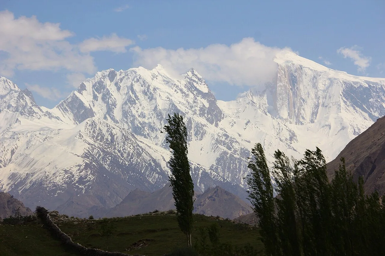
Where is Rush Lake, and why is it famous?
Rush Lake lies above the Hopar (Hoper) Valley in Nagar, the high valley that branches south from the Hunza–Nagar road in Gilgit-Baltistan. According to Wikipedia’s entry on the lake, it rests at 4,694 m and is “one of the highest alpine lakes in the world,” about 15 km north of Miar Peak and Spantik. It is fed and bordered by the Miar Glacier, which spills off Miar and Phuparash peaks.
The fame is simple: altitude plus view. Pakistani press has long called Rush “the highest lake of Pakistan,” and the lake even drew national news in 2018 when a Karachi-based mountaineering team surveyed it (The News International). What sets it apart from Pakistan’s roadside lakes is that you earn it on foot — and from the plateau you stand inside a ring of giants instead of looking up at one.
How high is Rush Lake? The numbers in context
At 4,694 m, Rush sits far above Pakistan’s celebrated roadside and meadow lakes. Here is how it compares with other well-known lakes of Gilgit-Baltistan and the wider north (elevations approximate; sources vary by a few metres):
The lesson in that chart is the one we give every client: most of Pakistan’s famous lakes — like the ones in our Deosai National Park guide — you can drive close to. Rush is a different animal. It belongs in the same conversation as a high-altitude trek, which is why proper acclimatisation matters here as much as on a base-camp route.
The route: Hopar to Rush Lake, step by step
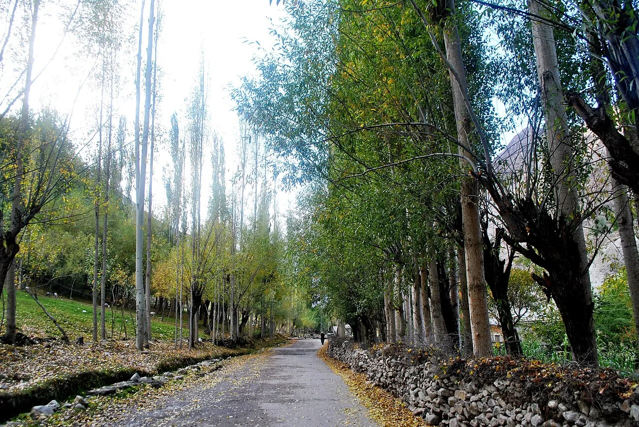
Most teams start the walk from Hopar (Hoper), a cluster of villages reached by jeep from Nagar, itself a short drive from the Karakoram Highway. From there the trek climbs through two distinct worlds: the broken, debris-covered glacier ice, and then the high green-and-grey ablation slopes that lead to the plateau.
A typical itinerary (4–6 days)
- Day 1 — Hopar to first camp. Descend onto and cross the Hopar (Bualtar) Glacier, then climb the far side to a grassy camp such as Barpu Giram or Pheker.
- Day 2 — Up the ablation valley. Follow the edge of the Barpu and Miar glaciers, gaining height steadily toward a high camp near the plateau (~4,000–4,300 m).
- Day 3 — Rush Lake & Rush Peak. A pre-dawn push onto the plateau and the lake (4,694 m); strong, acclimatised parties can continue to Rush Peak (~5,098 m) for the full panorama.
- Days 4–6 — Return. Retrace to Hopar, with a buffer day for weather, rest or a second sunrise at the lake.
It is short on paper, but it gains altitude fast and the glacier sections are real. If you have read our Rakaposhi Base Camp trek guide, the rhythm will feel familiar — both routes share the same Nagar approach and the same giant on the skyline.
Trek elevation profile
Safety reality: the Hopar and Miar glaciers are crevassed and constantly moving. People have been injured here losing the route on the ice in bad visibility. This is not a trek to attempt solo or without a guide who knows the current crossing line. We carry a satellite phone and a real evacuation plan on every high trek — local hands, real safety, fair price.
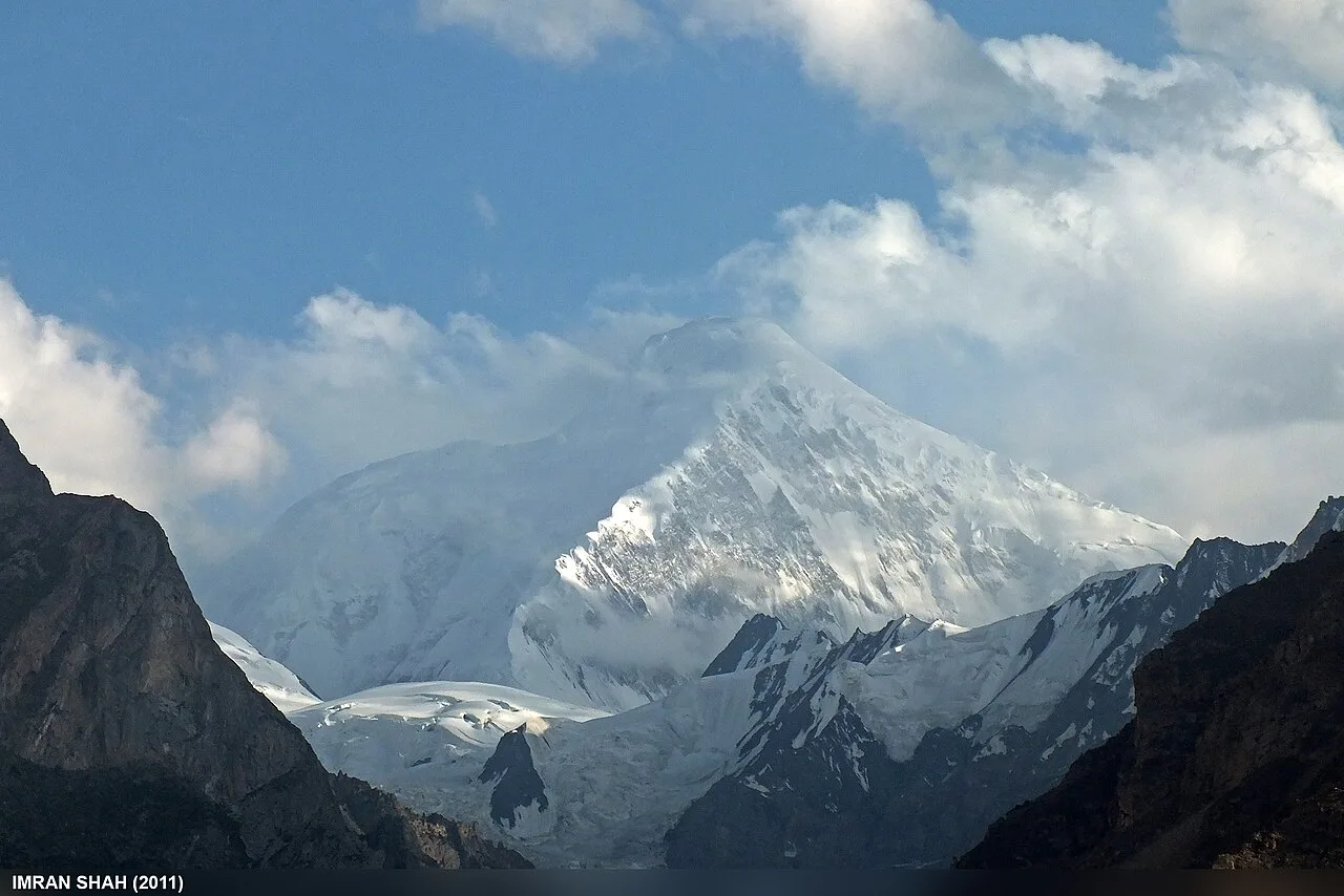
The view: a ring of seven-thousanders
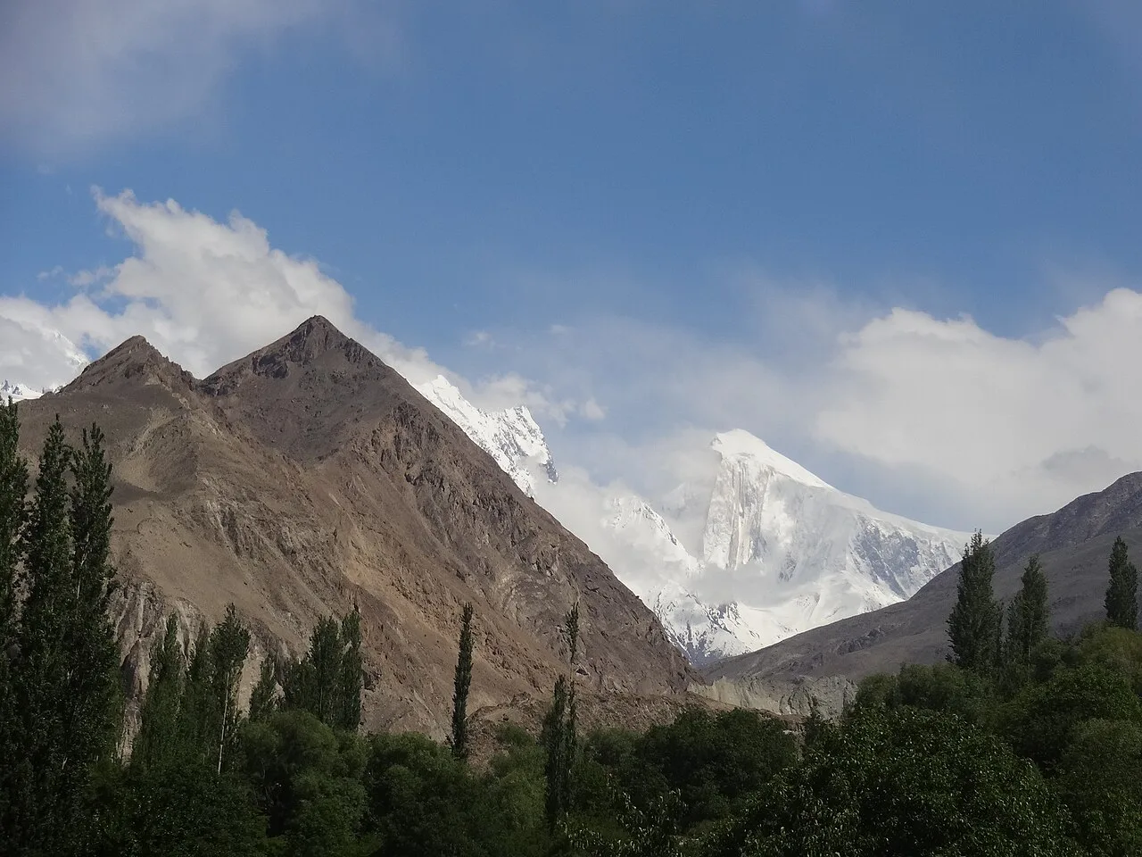
This is why people come. From the plateau, the lake mirrors a wall of giants. The headline peak is Rakaposhi (7,788 m), one of the most dramatic rises on Earth from valley to summit. Beside it stand Diran, Malubiting, Spantik and the spires of Phuparash and Ultar Sar.
Spantik — the Golden Peak — is close enough that many trekkers pair the two in their planning. If a 7,000 m summit is on your mind, read our Spantik (Golden Peak) expedition guide; it is one of the most achievable big peaks in the range and shares this valley.
When to go: season & weather
The window is June to September. Before June the plateau and upper glacier hold snow and the crossings are riskier; after September, cold and early snow shut the high camps down. July and August are the most reliable for clear plateau mornings, though they coincide with the wider Karakoram trekking peak. This is the same broad summer window that opens the best treks in Pakistan, so plan flights and permits early.
| Month | Conditions | Verdict |
|---|---|---|
| Apr–May | Snow on plateau, unstable glacier crossings | Too early |
| June | Melt opening up, fewer crowds, some snow lingering | Good, with a guide |
| July–Aug | Most stable, clearest plateau mornings | Best |
| September | Crisp, quiet, cold nights; weather turning | Good, late-season |
| Oct–Mar | Snowbound, high camps closed | Closed |
How hard is it? Fitness, altitude & the glaciers
Honest answer: moderate to hard. The walking distance is modest, but you gain a lot of height in a few days and finish near 4,700–5,100 m. The two challenges are altitude and ice. Expect 6–8 hours on the longest days over loose scree, boulders and glacier — not technical climbing, but real mountain terrain where a turned ankle is a serious problem far from the road.
Altitude is the bigger risk. Coming straight from low elevation to the plateau invites acute mountain sickness. We build in acclimatisation and watch every client; if you are new to high trekking, read our acclimatisation guide for the Karakoram before you commit. Pack for genuine cold and sun at altitude — our Karakoram trek packing list covers exactly what you need, and it overlaps with what you would carry to Snow Lake or Nanga Parbat Base Camp.
Permits & access note: Rush Lake is an open-zone trek and does not require the special mountaineering permit that 8,000 m peaks need — but you do need the correct Pakistan visa, and rules can change. Foreign trekkers should check our Pakistan visa guide, and confirm any local registration with us before travel.
Getting there & what it costs
Nagar sits on the Hunza side of Gilgit-Baltistan, reached overland on the Karakoram Highway from Gilgit, or by flying into the region and driving up. If you are combining Rush with the Baltistan side — Skardu, Deosai, the Baltoro — see how to get to Skardu and our broader Skardu travel guide for the logistics. Many travellers tie Rush to a wider northern loop that also takes in Hunza’s blossom valleys or the Baltoro glacier giants.
Costs vary with group size, days and service level, so we keep pricing personal rather than posting a number that goes stale. What we will promise: a fair price with no corners cut on guides, food or safety gear. WhatsApp us for current 2026 dates and a quote.
Ready to plan the real thing? See our Rush Lake Trek package for the route, inclusions and how we run it with a local Balti–Nagar team.
Frequently asked questions
How high is Rush Lake?
Rush Lake sits at approximately 4,694 m (15,400 ft). It is widely described as the highest alpine lake in Pakistan and, by one ranking, the 27th highest lake in the world.
How many days is the Rush Lake trek?
Most parties spend 4–6 days on the trail from Hopar, including a buffer day for weather and acclimatisation. Very fit, acclimatised trekkers occasionally do it faster, but that leaves little margin if the weather turns.
Is the Rush Lake trek difficult?
It is moderate to hard. The distances are short but you gain height quickly to nearly 4,700 m and cross moving, crevassed glaciers. Good fitness, proper acclimatisation and a guide who knows the route are essential.
What is the best time to visit Rush Lake?
June to September. July and August are the most stable for clear plateau mornings; June and September are quieter but colder, with more chance of lingering or early snow.
Do I need a permit for Rush Lake?
Rush Lake is in an open trekking zone and does not require the special mountaineering permit needed for 8,000 m peaks. You still need the correct Pakistan visa, and you should confirm any local registration with your operator before travel.
Plan your Rush Lake trek
Thinking about standing on Pakistan’s highest lake? WhatsApp us on +92 312 9921574 or email info@karakoramventure.com — you’ll be talking to a local Balti team, not a broker. We’ll sort dates, group size, acclimatisation and safety, and walk you to the lake the right way.
Sources & attribution: elevation and geography from Wikipedia (Rush Lake, Nagar Valley, Rakaposhi, Miar Glacier) and Pakistani press reporting (The News International). Peak elevations from published mountaineering references. Figures are approximate where sources differ. Photographs via Wikimedia Commons under CC BY-SA licences, credited individually in each caption.