



Khunjerab Pass sits at 4,693 metres (15,397 ft) on the Karakoram Highway. It marks the Hunza-Nagar border with China’s Xinjiang region. Moreover it is the highest paved international border crossing on earth. You don’t trek to it; you drive it. Usually that means a full day out of Karimabad in Hunza. The run is roughly 3.5 to 4 hours each way, through Attabad Lake, Gulmit and Passu. Then the road climbs into Khunjerab National Park and the pass itself. The road is open from around May to October. June to September is the clearest and calmest window. In winter the road closes under heavy snow. No trekking fitness is needed — the “difficulty” here is altitude, cold, and a very long day in a jeep.
We run Hunza and Karakoram Highway trips with our own local team. Our drivers and guides know this road in every season. We are not a broker subcontracting you out to a stranger at the border. We’ll be straight with you. This is one of the easiest big-altitude days in the Karakoram to reach. It is also one of the easiest to underestimate, because you get to 4,693 m without ever putting on boots.
Key takeaways
- Khunjerab Pass: 4,693 m (15,397 ft) — the highest paved international border crossing in the world, and the highest point on the Karakoram Highway.
- Location: Hunza-Nagar district, Gilgit-Baltistan, on the Pakistan–China (Xinjiang) border, roughly 270 km from Gilgit and 870 km from Islamabad.
- Access: a full-day round trip by jeep from Karimabad/Hunza — about 3.5–4 hours each way, no trekking required.
- Season: generally open May–October; best June–September. Closed to all vehicles roughly late December to early April under heavy snow.
- Khunjerab National Park (established 1975) protects the endangered Marco Polo sheep, snow leopard, and Himalayan ibex across 2,269 km².
- No mountaineering permit needed — just your passport and a valid Pakistan visa, checked at Sost — plus a small national park entry fee at the gate.
Where it is, and why it matters
Khunjerab Pass marks the northern tip of Pakistan. There the Karakoram Highway finally tops out, after climbing the length of Hunza. Then it crosses into China’s Xinjiang region. The name comes from Wakhi — khun (“blood”) and jerav (“stream” or “spring”). Meanwhile the valley has carried trade and travellers across the Pamir-Karakoram knot for centuries. That was long before any paved road existed. The current alignment was chosen in 1966 over the neighbouring Mintaka Pass. The highway across it was completed in 1982. It replaced the older unpaved Mintaka and Kilik routes as the main link between Pakistan and China.
It’s also a place of odd, memorable details. The Pakistani side has the world’s highest ATM, installed by the National Bank of Pakistan and linked to China UnionPay. This is also one of the few borders on earth where traffic switches sides. Left-hand in Pakistan becomes right-hand in China the moment you cross. Since 2006 there’s even been a daily bus service running the whole route from Gilgit to Kashgar.
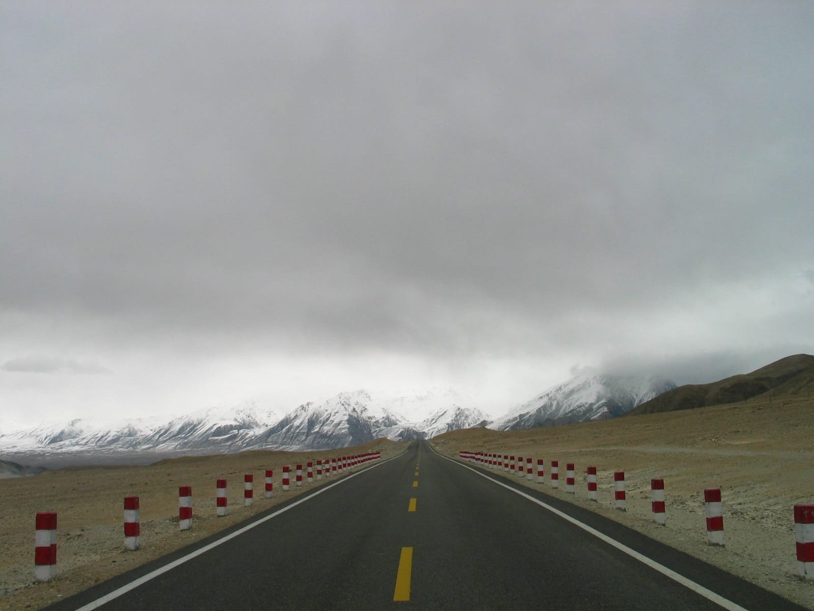
The route, step by step
Almost everyone visits Khunjerab as a long day trip from upper Hunza rather than as a standalone expedition. A typical day with our team runs like this:
- Karimabad (Hunza), early start. We leave before sunrise — it’s a long day and the light on the way up is worth it.
- Attabad Lake and Gulmit. The road skirts the turquoise waters of Attabad, then passes through Gulmit, the old capital of Gojal.
- Passu and the Cones. A stop below the Passu Cones and the Batura Glacier’s snout — one of the great views of the whole highway.
- Sost — immigration check. Sost is Pakistan’s last town before the border and the site of the customs and immigration post; your passport and visa are checked here.
- Dih — national park gate. About 42 km short of the pass, this is the entry checkpoint for Khunjerab National Park, where the entry fee is collected.
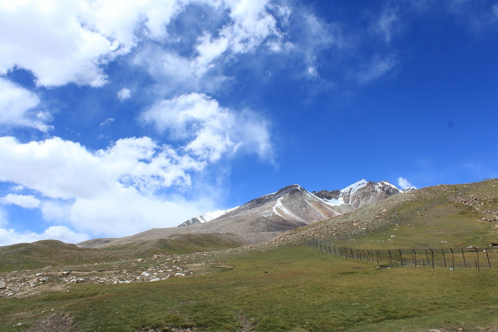
- Khunjerab Pass, 4,693 m. The border itself — fences, monument, flags, and (weather permitting) Marco Polo sheep or ibex on the surrounding slopes.
- Return to Karimabad. Same road back, usually arriving after dark.
Khunjerab National Park and its wildlife
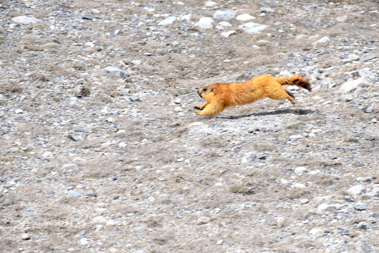
The pass sits inside Khunjerab National Park, Pakistan’s third-largest national park at 2,269 km². It borders the Taxkorgan Nature Reserve on the Chinese side. Its boundaries were mapped in 1974 by American biologist George Schaller. The park was formally established on 29 April 1975 by Prime Minister Zulfikar Ali Bhutto. The whole point of it was — and still is — protecting the Marco Polo sheep, a huge, spiral-horned wild sheep found in Pakistan only here. Numbers have been fragile. Herds were down to under 200 animals by the time the highway was finished. However, counts of 50–75 crossing the pass have been recorded in better years.
The park is also thought to hold one of the highest densities of snow leopards anywhere in the Himalayan-Karakoram ecosystem. It shares that ground with Himalayan ibex, over 2,000 Siberian ibex, brown bear, wolf. Lower down, and easier to actually spot, are long-tailed marmots. More than half the park lies above 4,000 m, so most of what lives here is built for thin air and hard winters. If wildlife and wide-open plateau country is what draws you, it’s worth comparing this to Deosai National Park further south in Baltistan — different range, same kind of high, wild emptiness.
When to go
| Months | Conditions | Verdict |
|---|---|---|
| Nov – Apr | Heavy snow; road officially closed to all vehicles roughly late Dec – early Apr, and to heavy vehicles from late Nov | Avoid — the pass is usually inaccessible |
| May | Road reopening after winter closure; can still be cold and unpredictable | Shoulder season — check conditions first |
| Jun – Sep | Clearest skies, mildest weather, easiest driving | Best window |
| Oct | Early autumn colour, cooling fast; risk of early snow rising through the month | Good, but book with some flexibility |
These dates shift year to year with snowfall, so we always confirm the road status before a Khunjerab day — the schedule above is a guide, not a guarantee.
How hard is it, honestly
This is not a trek and needs no special fitness — you’re in a jeep for almost the whole day. But 4,693 m is real altitude. You get there by road in a matter of hours, rather than walking up over days. Consequently your body never gets the usual acclimatisation head start. Mild headache, light-headedness or breathlessness at the pass itself are common and normally pass quickly once you descend. Still, anyone with a heart or lung condition should talk to a doctor before going. The bigger honest risks are different. One is the length of the day, 12+ hours round trip from Karimabad. Another is the road itself in shoulder season (ice, rockfall, occasional closures), and the remoteness. The nearest proper medical facility is hours away in Gilgit.
Elevation in context
The route to the pass, in profile
Getting there, and cost
Khunjerab is reached by road only, via the Karakoram Highway through Hunza — there’s no flight or shortcut. Most travellers base themselves in Karimabad or Gulmit and do the pass as a single long day. However it can also be tacked onto a wider Hunza-Nagar itinerary, with the Rush Lake trek, the Passu Cones, the Naltar Valley, or even the demanding Shimshal Pass trek. Those options suit anyone with more days to spend. We keep pricing personal rather than posting a number here that goes stale — every trip depends on group size, vehicle, and season. What doesn’t change is the promise: a real local team, proper safety planning, and a fair price with no corners cut. For a wider view of what else is worth doing in the range, see our guide to the best treks in Pakistan.
You don’t trek it, you drive it. Twelve hours round trip from Karimabad to 4,693 m and back, with the immigration check at Sost and no fuel above it. Our 12-day North Pakistan Jeep Safari runs the Karakoram Highway all the way to the Khunjerab gate, then carries on south to Deosai and Astore, from $850 per person. For Hunza and the pass without the southern loop, the 10-day North Pakistan Tour covers Attabad, Passu and Khunjerab from $900. Local drivers who know this road in every season, park fees and paperwork handled, and nobody hands you to a stranger at the border.
The pass is a day; the valley is the week. Our 7-day Hunza Valley Tour Package holds the Khunjerab day flexible inside the week to catch clear weather, with the park fee included — from $860 per person, Islamabad to Islamabad.
Go up with a local team. Our Khunjerab Pass & China Border Day Tour drives you from Hunza to 4,693 m and back, paced for the altitude with oxygen in the vehicle and the national park fee included, from $70 per person.
Frequently asked questions
How high is Khunjerab Pass?
4,693 metres (15,397 ft) above sea level — the highest paved international border crossing in the world, and the highest point on the entire Karakoram Highway.
Do I need a special permit to visit Khunjerab Pass?
No mountaineering or trekking permit is required. You need your passport and a valid Pakistan visa, checked at the Sost immigration post, plus a national park entry fee collected at the Dih gate.
Can I cross into China at Khunjerab Pass?
The pass is a functioning border crossing, but actually crossing into Xinjiang requires a valid Chinese visa arranged in advance. Most visitors go only as far as the Pakistani side of the border and turn back.
What is the best time to visit Khunjerab Pass and National Park?
June to September gives the clearest skies and easiest driving. The road is generally open May to October and closes to all vehicles for roughly three months in deep winter under heavy snow.
Is visiting Khunjerab Pass difficult, or is it a trek?
It’s not a trek — you drive the whole way. The real challenges are the length of the day (12+ hours round trip from Karimabad), the altitude itself, which can cause mild symptoms even without physical exertion, and road conditions in shoulder season.
Plan your Khunjerab day with a local team, not a broker.
WhatsApp +92 312 9921574 or email info@karakoramventure.com — our own Hunza-based team, real safety planning, fair pricing.
Sources: Wikipedia (Khunjerab Pass; Khunjerab National Park); Karakoram Highway record. Photos: SandersPoel (Public Domain), Hunzukutz (CC BY-SA 3.0), Szebkhan (CC BY-SA 4.0), via Wikimedia Commons.

