Latok I is a 7,145 m rock-and-ice giant in the Panmah Muztagh, part of the Karakoram range in Gilgit-Baltistan, reached via a trek up the Panmah and Choktoi Glaciers from Askole, roughly three days’ walk each way. It sits above the Choktoi Glacier on its north side and the Baintha Lukpar Glacier (a tributary of the Biafo) on its south side, with the trailhead village of Askole itself a 7–9 hour jeep ride from Skardu. The trekking season runs April to October, with June to September the most settled window. Getting to base camp is a serious but non-technical trek within reach of a fit, acclimatised hiker; the mountain above it is a different matter entirely — Latok I’s North Ridge is one of the most talked-about unclimbed lines in mountaineering.
We don’t run clients up Latok I — almost nobody does, and we’ll get to why. But we do take trekkers and photographers up the Choktoi Glacier to stand where the world’s best alpinists have stood, camera in hand, looking at a wall that has broken attempt after attempt since 1978. It’s a quieter, harder-to-reach cousin of our Trango Towers and Charakusa treks, with our own Balti crew handling the glacier travel, the camps, and the radio contact the whole way in.
- Latok I stands 7,145 m in the Panmah Muztagh, Karakoram, flanked by the Choktoi Glacier (north) and Baintha Lukpar Glacier (south).
- The Latok group has four main summits: Latok I (7,145 m), Latok II (7,108 m), Latok III (6,949 m) and Latok IV (6,456 m).
- Latok I was first summited in 1979 via the East Ridge; its 2,500 m North Ridge remains uncompleted to this day despite four decades of attempts.
- Access is via Askole (7–9 hrs by jeep from Skardu), then roughly 3 days on foot up the Panmah and Choktoi Glaciers to the Ghafoor Camp / base camp area (~4,700 m).
- Trekking season: April–October, with June–September the most settled window.
- This is a glacier trek for fit, acclimatised trekkers — the peaks above are for elite technical climbers only.
Where it is, and why climbers won’t stop talking about it
The Latok group is a cluster of four dramatic rock-and-ice summits in the Panmah Muztagh, a sub-range of the central Karakoram, just east of the Ogre (Baintha Brakk) and north of the Baltoro Glacier’s better-known giants. Latok I (7,145 m) is the tallest and most storied of the four. Its south side drops to the Baintha Lukpar Glacier, a tributary of the Biafo — the same glacier system our Snow Lake & Biafo-Hispar traverse crosses further south; its north side is walled by the Choktoi Glacier, the approach used by almost every expedition and the route our treks follow.
What sets Latok I apart isn’t just its height — plenty of Karakoram peaks are taller — it’s the North Ridge: a continuous 2,500 m wall of rock and ice that has turned back some of the strongest alpinists of the last fifty years. It is, by wide agreement among climbers, one of the great unfinished problems in high-altitude mountaineering, and that history is what draws trekkers and photographers up the Choktoi as much as the scenery does.
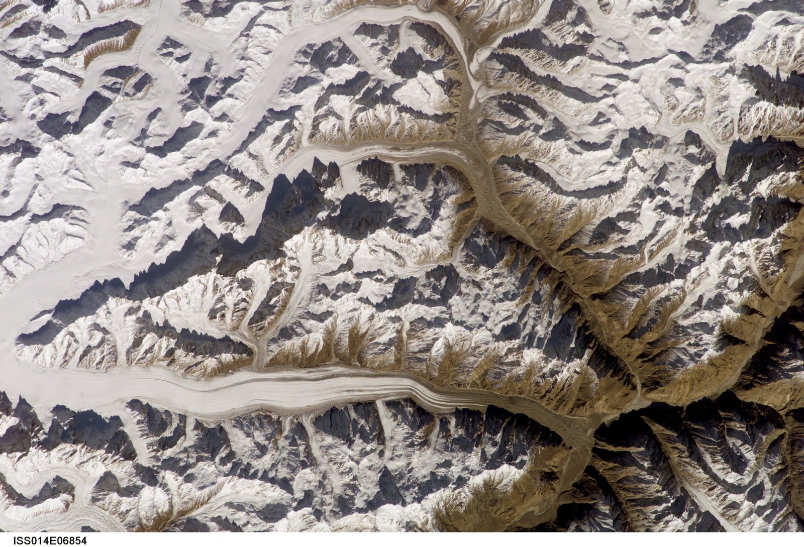
The route: Skardu to the Choktoi Glacier, step by step
The approach shares its first leg with our Trango Towers and Concordia treks — the jeep track and the first days on foot from Askole — before it splits north, away from the main Baltoro highway, and climbs a lonelier glacier system. This is a rough, approximate schedule; real itineraries flex with weather, group fitness, and porter availability, and we always build in a spare day or two, the same as on every glacier trek we run.
- Day 1 — Skardu to Askole. A 7–9 hour 4×4 jeep ride up the Shigar and Braldu valleys to the last village on the road, where the trek begins.
- Day 2 — Askole toward Jula. Trek up the Braldu/Panmah river valley on the same trail used by Baltoro-bound trekkers, before our route forks north up the Panmah River.
- Day 3 — Onto the Panmah Glacier. A full day’s walk up the Panmah Glacier to its junction with the Choktoi.
- Day 4 — Up the Choktoi to Ghafoor Camp. A 5–7 hour day along the Choktoi Glacier to Ghafoor Camp, the base camp area used by Latok and Ogre expeditions, at roughly 4,700 m.
- Day 5 — Base camp day. Rest, acclimatise, and take in the view: the Latok towers to the east, the Ogre massif to the west.
- Days 6–8 — Return to Askole. Retracing the route down the Choktoi and Panmah Glaciers, roughly 3 days, weather allowing.
- Day 9 — Askole to Skardu. Jeep back down to Skardu.
A wall that keeps saying no: the climbing history
Latok I was first climbed in 1979 by a Japanese expedition led by Naoki Takada, whose summit party — Sin’e Matsumi, Tsuneo Shigehiro and Yu Watanabe — started from the Baintha Lukpar Glacier and climbed a buttress to the East Ridge. That’s still the easiest way up, and it’s still hard.
The mountain’s real reputation comes from the North Ridge, first attempted in 1978 by four American climbers — Jim Donini, Jeff Lowe, Michael Kennedy and George Lowe — who fought their way to within a few pitches of the summit before a storm and Lowe’s illness forced a legendary retreat. No one completed the line for forty years. In 2018, two separate teams tried again in the same season. Russian climbers Alexander Gukov and Sergey Glazunov reached the top of the North Ridge itself, but Glazunov fell to his death on the descent and Gukov spent seven days stranded in a bivouac near 6,100 m before a Pakistan Army helicopter reached him. Weeks later, Aleš Česen, Luka Stražar and Tom Livingstone climbed three-quarters of the North Ridge before traversing onto the west side and finishing via the 1979 route, summiting on 9 August 2018 — the second ascent of Latok I ever, and a climb that won that year’s Piolet d’Or. Even so, the full North Ridge, top to bottom, direct to the summit, is still unclimbed.
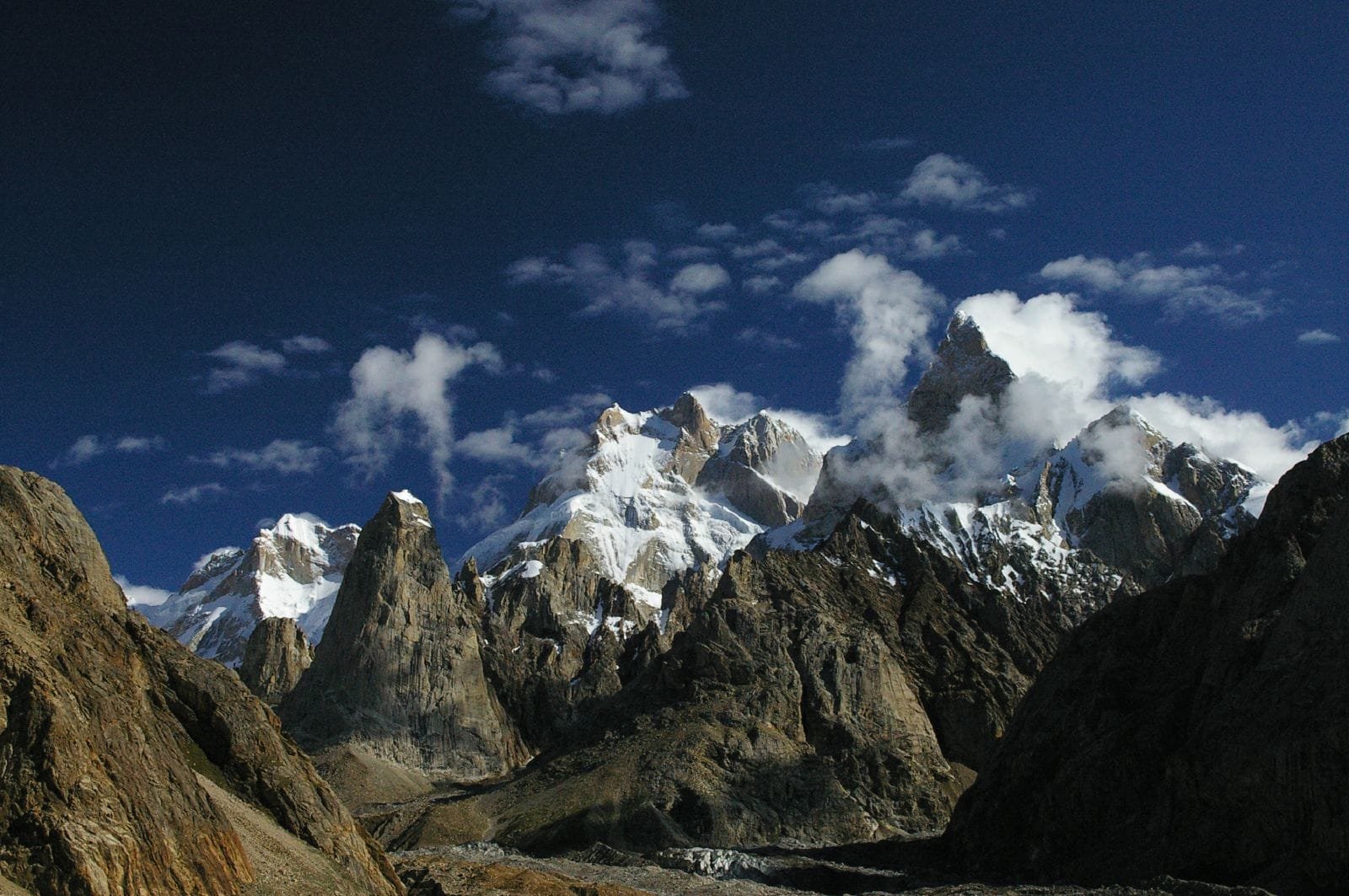
For context, the Latok group sits alongside some of the biggest walls in the Karakoram. Here’s how the four Latok summits compare to their neighbours:
When to go
Like the rest of the Baltoro-area treks, the Choktoi Glacier is only realistically open from April through October, and the glacier travel is friendliest in the middle of that window.
| Months | Conditions | Verdict |
|---|---|---|
| April–May | Cold, snow still low on the glaciers, river crossings lower | Possible for experienced groups; expect cold camps |
| June–July | Warming, glaciers opening up, long daylight | Good — our preferred start of season |
| August–September | Most settled weather of the year, glaciers well open | Best window — this is when the 2018 Latok ascents happened |
| October | Cooling fast, early snow possible on the passes | Marginal — only for flexible, well-equipped groups |
| November–March | Deep winter, road and glacier access effectively closed | We don’t run this trek |
How hard it is — honestly
The trek to Ghafoor Camp is not a technical climb, but don’t mistake that for easy. You’re on glacier terrain from day three onward — roped travel, crevasse awareness, and camps pitched on ice and moraine, at altitudes up to roughly 4,700 m. There’s no teahouse comfort out here; it’s tents, a cook crew, and porters carrying everything in and back out, the same as on our Baltoro-area treks. Good trekking fitness, prior high-altitude experience, and a realistic attitude about cold, wind, and long unbroken days matter more than any technical climbing skill.
Climbing the peaks themselves is an entirely different proposition. Every summit in the Latok group is rated among the hardest technical objectives in the Karakoram — steep mixed rock and ice, sustained altitude, and, on Latok I’s North Ridge specifically, a route that has claimed a life and defeated professional alpinists for over forty years. It’s the same category of objective as the unclimbed Shining Wall of Gasherbrum IV further south on the Baltoro — famous precisely because it keeps saying no. We’re honest with anyone who asks: this is not a guided-client mountain. If you’re a serious climbing team looking at Latok, we can handle the trekking logistics, porters, and base camp support — the climbing itself is between you and the mountain.
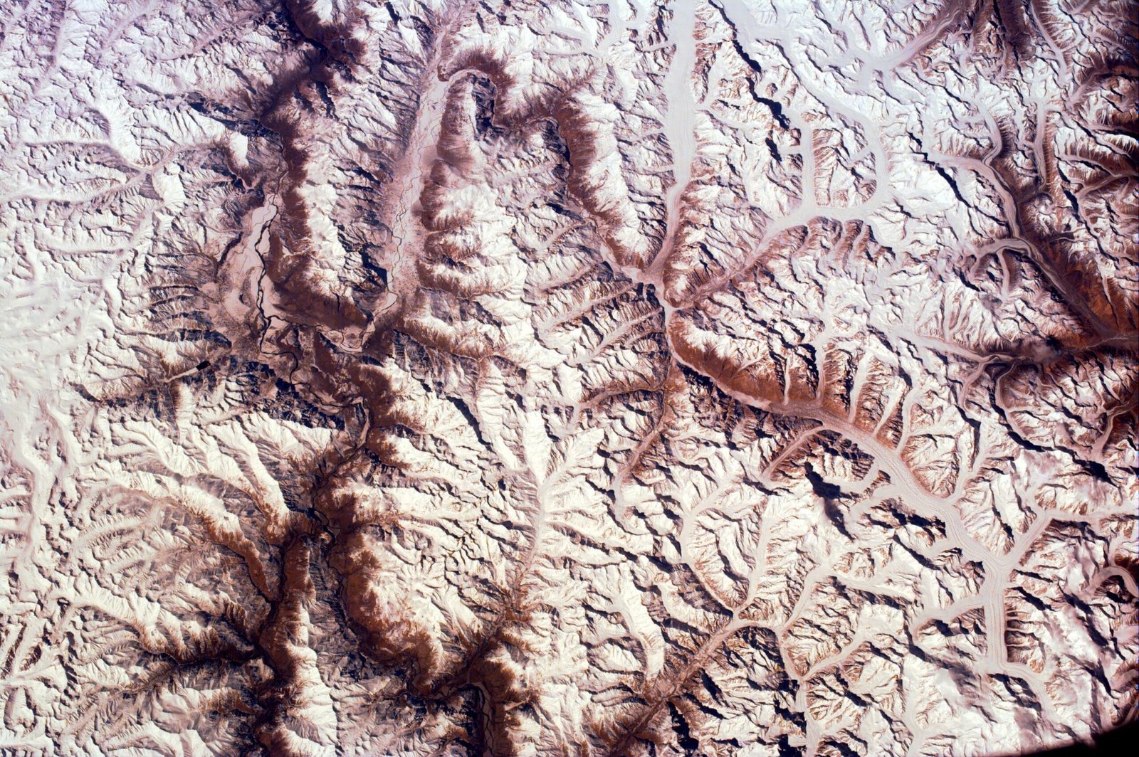
Here’s a schematic look at how the trek climbs from Skardu to base camp:
Getting there & cost
Start in Skardu — see our guide on how to get to Skardu by air or road — then it’s the same jeep track to Askole used for our Trango Towers and Charakusa Valley treks, before your group turns north onto quieter ground. We keep pricing personal rather than posting a number that goes stale the moment porter rates or permit fees shift — message us with your dates and group size and we’ll quote it straight. Local hands, real safety, fair price: no corners cut to hit a number.
Frequently asked questions
How tall is Latok I and where is it?
Latok I stands 7,145 m in the Panmah Muztagh, a sub-range of the Karakoram in Gilgit-Baltistan, Pakistan, just east of the Ogre (Baintha Brakk) group.
Has anyone climbed Latok I’s North Ridge?
Not completely. In August 2018, Aleš Česen, Luka Stražar and Tom Livingstone climbed three-quarters of the North Ridge before traversing onto the west side and finishing via the 1979 route — the second-ever ascent of the peak. The full 2,500 m North Ridge, direct to the summit, remains unclimbed.
Can I trek to Latok I base camp without being a technical climber?
Yes. The trek up the Panmah and Choktoi Glaciers to the Ghafoor Camp / base camp area is a demanding but non-technical glacier trek for fit, acclimatised trekkers — the technical climbing is on the peaks above, and that’s for elite alpinists only.
When is the best time to see the Latok towers?
June through September, with August–September generally offering the most settled weather of the year on this side of the Karakoram.
Do I need a special permit or visa?
Yes. The approach lies in Gilgit-Baltistan’s restricted trekking zone and needs a trekking permit arranged by your operator; technical climbing on the peaks needs a separate mountaineering permit. Visitors need Pakistan’s Trekking & Mountaineering visa, not a standard tourist visa.
We run the Choktoi Glacier trek and Latok/Ogre base camp support ourselves — our own guides, our own logistics, sat phone on every trip.
WhatsApp +92 312 9921574 or email info@karakoramventure.com to talk dates and group size.
Sources & attribution: Wikipedia (Latok group); American Alpine Club Publications (Latok I: The North Ridge; Latok I: The Second Ascent); UKClimbing, Gripped Magazine and Explorersweb reporting on the 2018 Latok I ascents. Images: NASA (Latok-Ogre-Biafo.JPG, Karakoram_ISS.jpg — Public domain) and Ben Tubby (The Ogre I and II and the Ogre’s Thumb — CC BY 2.0), all via Wikimedia Commons.