Haramosh Peak is a 7,409 m mountain in the Rakaposhi-Haramosh range of the Karakoram, about 65 km east of Gilgit and clearly visible from the Gilgit–Skardu road. There is no base-camp trek to its summit — Haramosh has had only four recorded ascents since 1958, and is best known for the 1957 Oxford University expedition that ended in tragedy on its slopes. What you can trek to is Kutwal Lake, a high alpine lake at roughly 3,300 m in the wild, lightly-trekked Haramosh (Kutwal) valley beneath the mountain. It’s a 5–7 day round trip from Gilgit, non-technical but steep and remote, best done June to September.
We don’t run this one as often as K2 Base Camp or Rakaposhi, and we’ll say why upfront: the Kutwal valley isn’t a maintained tourist circuit. It’s a real, lightly-trodden trail into a valley most foreign trekkers have never heard of, beneath a mountain with a harder history than its modest height suggests. That’s exactly the kind of trip we like doing properly — with our own Balti team, a sat phone in the bag, and no attempt to oversell what is genuinely a serious, remote walk.
Key Takeaways
- Haramosh Peak: 7,409 m, Rakaposhi-Haramosh Mountains, Karakoram — about 65 km east of Gilgit, rising above the north bank of the Indus near its confluence with the Gilgit River.
- First ascent: 4 August 1958, by an Austrian team — Heini Roiss, Stefan Pauer and Franz Mandl — via the Haramosh La and the East Ridge. Only three more ascents have been recorded since (1978, 1979, 1988).
- The 1957 tragedy: an Oxford University reconnaissance cost two lives and is told in Ralph Barker’s classic The Last Blue Mountain.
- No base-camp trek to the summit exists. The trekking objective is Kutwal Lake (~3,300 m), reached via Sassi, Dassu and Iskere villages.
- Trip length: commonly 5–7 days round trip from Gilgit; some operators run fuller 7–10 day itineraries.
- Season: June to September. No trekking permit required — the route sits inside Pakistan’s Open Zone.
Where Haramosh Is, and Why It’s Not on Every Trekker’s List
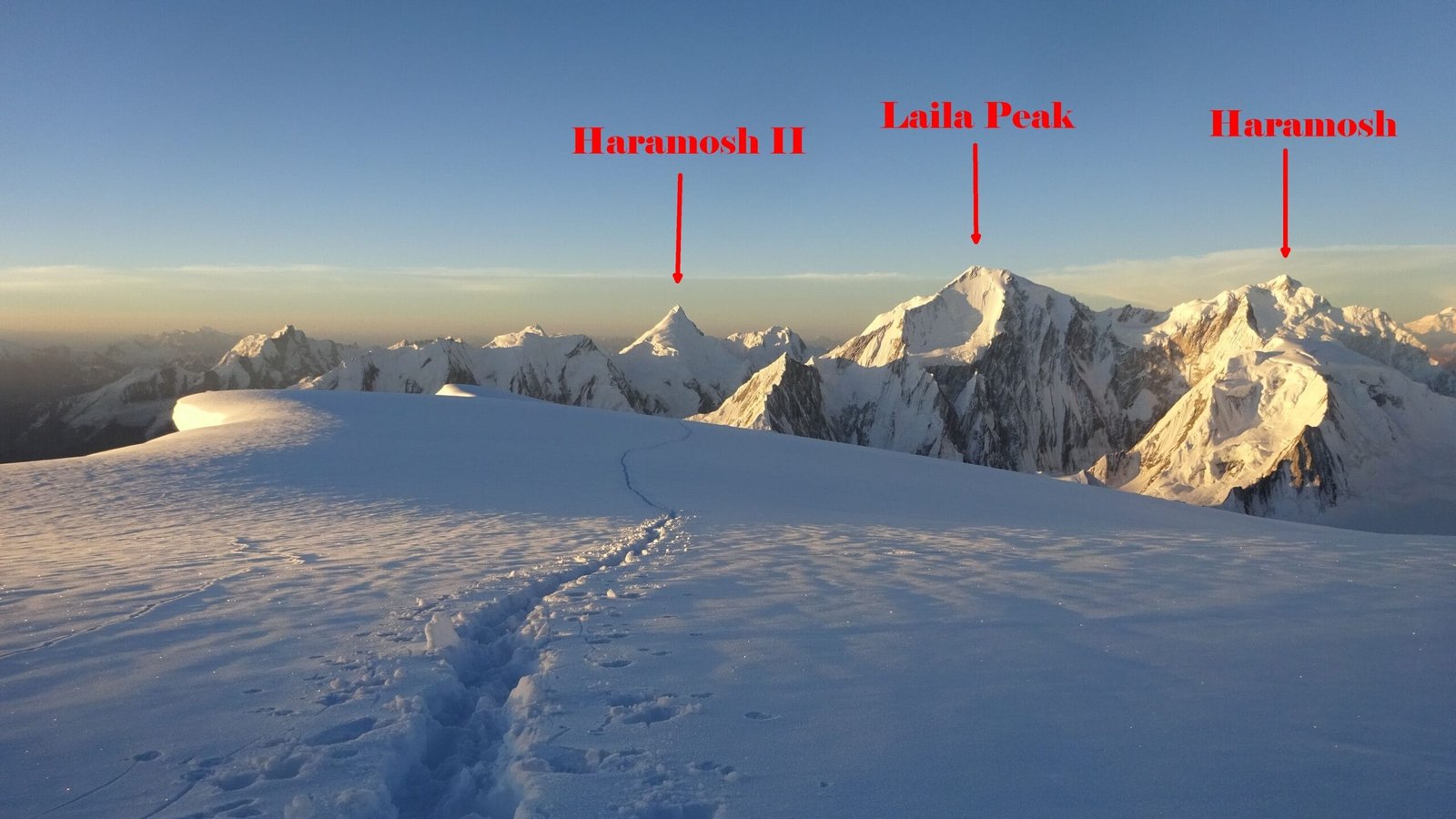
Haramosh Peak stands 7,409 m, part of the Rakaposhi-Haramosh Mountains — a subrange of the Karakoram distinct from the Baltoro giants (K2, the Gasherbrums, Broad Peak) that dominate most of what we write about on this blog. It sits roughly 65 km east of Gilgit, rising steeply above the north bank of the Indus River just upstream of where the Gilgit River joins it. You’ll catch it from the Gilgit–Skardu road, and — as our lead photo shows — even from the summit ridges of neighbouring peaks like Spantik, more than 30 km away.
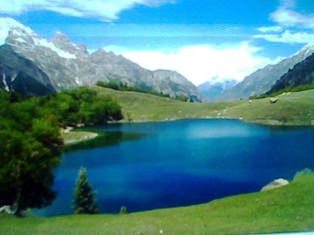
Unlike Rakaposhi or Nanga Parbat, Haramosh has no established base-camp trekking circuit. It has been climbed only four times since its first ascent in 1958 — a remarkably low number for a 7,000 m peak this close to a major road. What draws trekkers into this valley instead is Kutwal Lake, a high alpine lake tucked beneath the mountain’s flank, reached by a trail that sees a fraction of the traffic of our more established routes.
The Route: Sassi to Kutwal Lake, Step by Step
This is not a route with hotels and teahouses at every stop. It runs through working Balti and Shin villages, and the trail past Iskere is genuinely quiet. A typical plan:
- Day 1 — Gilgit to Sassi, then Dassu. Sassi sits on the Gilgit–Skardu road, on the bank of the Indus, about 53 km (roughly an hour’s drive) from Gilgit. From there a rough jeep track — prone to landslides and washouts — climbs about an hour further to Dassu (also written Dache), at around 2,400 m.
- Day 2 — Dassu to Iskere village. Four to five hours on foot, through forest, small hamlets and fruit orchards, gaining height steadily.
- Day 3 — Iskere to Kutwal Lake. Another five to six hours, the trail opening into alpine meadows as Haramosh’s flank fills the head of the valley. Camp at the lake, around 3,300 m.
- Day 4 — At Kutwal Lake. A rest and exploration day around the lake and the meadows above it, weather permitting.
- Days 5–6 (or 7) — Return to Sassi. Retrace the route back through Iskere and Dassu to the road. Some itineraries add a day or build in a side trip, stretching the trip to 7–10 days.
It’s a good pairing with a wider Karakoram Highway trip — see our Karakoram Highway road trip guide if you want to fold Haramosh into a longer overland route through Gilgit-Baltistan.
The Mountain’s Quieter, Harder-Luck History
Haramosh’s reputation among mountaineers has little to do with crowds — it has almost none — and everything to do with one expedition. In 1957, a team from Oxford University — Tony Streather, John Emery, Bernard Jillott and Rae Culbert — set out from a base camp near the Mani Glacier to reconnoitre the mountain’s north and west approaches. What was meant to be a straightforward survey turned into a chain of falls and misfortune: an avalanche swept Jillott and Emery down the mountain, and in the desperate, drawn-out retreat that followed, Jillott and Culbert lost their lives. Streather and Emery survived, but Emery lost all his fingers and toes to frostbite. The story is told in full, and unsparingly, in Ralph Barker’s 1959 book The Last Blue Mountain — still regarded as one of the classics of Karakoram mountaineering literature.
Haramosh was finally climbed on 4 August 1958, by an Austrian team — Heini Roiss, Stefan Pauer and Franz Mandl — following roughly the line of the 1957 attempt, via the Haramosh La and the East Ridge. Since then, records show only three more ascents: a Japanese team via the West Ridge in 1978, an unrecorded party in 1979, and a Polish team via the Southwest Face in 1988. For a 7,000 m peak this visible from a paved road, that is an extraordinarily short climbing history — a reminder that visibility and accessibility are not the same thing as easy.
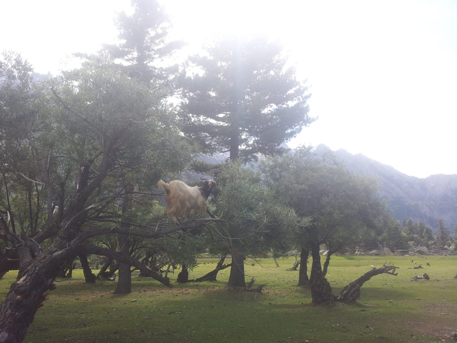
Trekkers heading into the valley today are not anywhere near that technical terrain. But the honest context matters: this is serious ground, and the trail to Kutwal Lake shares the same remote, thinly-supported character that made the 1957 rescue such a desperate undertaking.
The Kutwal Lake trek against the surrounding giants of the Karakoram and Himalaya (schematic / approximate).
When to Go
| Months | Conditions | Verdict |
|---|---|---|
| April–May | Snow lingers on the higher meadows above Iskere; lower trail often runnable but wet | Possible late in the window, confirm with your guide |
| June | Snow clearing, meadows greening, trail quiet | Good |
| July–August | Warmest, most stable weather, best visibility at the lake | Best |
| September | Cooling but generally stable, fewer trekkers | Good |
| October onward | Early snow can close the upper valley with little warning | Risky — window closing |
How Hard Is It, Honestly
The Kutwal Lake trek is non-technical — no rope, no glacier travel — but do not mistake that for easy. You’re gaining close to 1,900 m across three days on foot from Dassu, on a trail that is genuinely lightly used and, in places, not obviously marked. This is not the well-worn K2 Base Camp trail with porters passing every hour; it is a quieter valley where local knowledge of the actual route matters. Altitude at Kutwal Lake (~3,300 m) is moderate by Karakoram standards, but the days are long, the terrain is steep in sections, and rescue infrastructure this far up a side valley is thin. We’d put this in the same fitness bracket as our Rakaposhi Base Camp trek — moderate to challenging, suited to trekkers with some prior high-altitude experience rather than a first trek in Pakistan. If this would be your first, read our acclimatisation guide first, and go with a guide who has actually walked this specific valley before.
The Sassi – Dassu – Iskere – Kutwal Lake round trip (schematic / approximate elevations).
Safety, Plainly
This valley does not see the traffic that K2 Base Camp or Rakaposhi Base Camp do, and that cuts both ways: it’s a genuinely quiet, characterful trek, but rescue infrastructure is thinner and local route knowledge matters more. The mountain overhead has a documented history of avalanche and rockfall — the 1957 tragedy is the starkest reminder of that, even though trekkers stay well clear of the technical ground involved. Every Karakoram Venture trek runs with a satellite phone and a real evacuation plan — an actual chain of contacts, and, where terrain allows, helicopter evacuation contacts for the region — not a phone number we hope works. Our guides are Balti staff, not a driver handed a generic itinerary, and for a lightly-trekked valley like this one, that local knowledge is not optional.
Permits & Visa
The Kutwal Lake trek stays well below 6,000 m and sits inside Pakistan’s designated Open Zone, so no separate trekking permit is required. That’s a different matter from Haramosh’s actual summit: peaks above 6,500 m anywhere in Pakistan require a mountaineering permit from the Gilgit-Baltistan Council, which is not something this trek involves. You will still need the right Pakistan visa to be in the country and trekking — see our Pakistan visa guide for trekkers for current requirements.
Getting There & What It Costs
Most trekkers reach this trailhead via Gilgit — flying Islamabad to Gilgit or Skardu and connecting by road, or driving the Karakoram Highway overland (see our guide to getting to Skardu for the flight-versus-road trade-offs that apply here too). From Gilgit, it’s the short run to Sassi on the Gilgit–Skardu road, then jeep and foot into the valley. Check our season-by-season guide to Gilgit-Baltistan if you’re combining this with other stops on the same trip.
On cost: we keep pricing personal rather than posting a number here that goes stale by the time you read it. Group size, jeep access conditions, and how many days you build in at Kutwal Lake all change the number. WhatsApp us your dates and we’ll quote it straight — local hands, real safety, fair price, no corners cut to hit a number.
Frequently Asked Questions
How high is Haramosh Peak?
7,409 m. It’s part of the Rakaposhi-Haramosh Mountains, a subrange of the Karakoram, about 65 km east of Gilgit.
Is there a Haramosh Base Camp trek?
No established base-camp circuit to the summit exists. Trekkers instead reach Kutwal Lake (~3,300 m) in the Haramosh valley, a wild, lightly-trekked route that gives strong views of the mountain without approaching its technical climbing terrain.
What was the 1957 Haramosh tragedy?
An Oxford University reconnaissance team — Tony Streather, John Emery, Bernard Jillott and Rae Culbert — set out to survey approaches to the mountain. A chain of falls and an avalanche led to the deaths of Jillott and Culbert; Emery survived but lost all his fingers and toes to frostbite. The story is told in Ralph Barker’s book The Last Blue Mountain.
How hard is the Kutwal Lake trek?
Non-technical — no rope or glacier travel — but steep, remote and genuinely lightly trekked, unlike our more established routes. It suits trekkers with some prior high-altitude experience rather than a first trip to Pakistan.
When is the best time to go, and do I need a permit?
June to September, with July–August the most stable. No separate trekking permit is required since the route sits inside Pakistan’s Open Zone below 6,000 m, though a valid Pakistan visa is still required.
Plan the Kutwal Lake Trek With a Local Team
We’re not a broker booking you onto someone else’s trip — Karakoram Venture runs this with our own Balti team, a satellite phone on every trek, and a real evacuation plan. WhatsApp +92 312 9921574 or email info@karakoramventure.com with your dates and group size and we’ll quote it straight.
Sources & attribution: Wikipedia (“Haramosh Peak”, “Kutwal Lake”); American Alpine Journal archives on the 1958 first ascent and subsequent ascents; Ralph Barker, The Last Blue Mountain (1959); operator itineraries for the Kutwal Lake / Haramosh valley trek. Photographs: “Haramosh II Laila Peak” by Transient73, CC BY-SA 4.0; “Haramosh.KUTWAL” and “Haramosh valley of GB” by Nadia Khan Ali Bouq, CC BY-SA 4.0 — all via Wikimedia Commons.