The Karakoram Highway (KKH) runs about 1,300 km from Hassan Abdal near Islamabad to Kashgar in China, with roughly 887 km of it inside Pakistan, climbing from the plains at 500 m to the Khunjerab Pass at around 4,700 m — the highest paved border crossing on earth. Most travelers drive it in 5–7 days one way, stopping in Besham or Chilas, then Karimabad in Hunza, then Sost, before the final push to the pass. It’s open roughly May to October; the Khunjerab border itself closes for winter on 31 December and reopens 1 May. It is not a technical drive, but it is a long, high, and occasionally landslide-interrupted one.
We run trips out of Skardu with our own Gilgit-Baltistan team, and we’ll say this plainly: the KKH is the single best road trip in Pakistan, and also one that rewards patience over speed. People who try to “do” it in three days end up carsick, altitude-headached, and having seen it through a windscreen. People who give it a week come back talking about Nanga Parbat appearing out of nowhere at Chilas, or the turquoise wall of Attabad Lake, for years.
- Total length: ~1,300 km (Hassan Abdal, Pakistan to Kashgar, China); ~887 km lies inside Pakistan.
- Highest point: the Khunjerab Pass area, around 4,693–4,714 m depending on the source — call it 4,700 m.
- Built jointly by Pakistan and China between 1966 and 1979, opened to the public in 1986; roughly 810 Pakistani and 200 Chinese workers died building it.
- Recommended drive time: 5–7 days one way with real stops; two weeks if you want the side valleys too.
- Best season: May–October. The Khunjerab border crossing is open 1 May–31 December only, weather permitting.
- The 2010 Attabad Lake landslide drowned ~19 km of the original road; a 24 km bypass with five tunnels reopened the route in 2015.
Where the Highway Goes, and Why It Matters
The KKH (officially National Highway 35) is also called the China–Pakistan Friendship Highway, and it earns the name. It was carved through the collision zone of the Indian and Eurasian tectonic plates — the same forces that pushed up the Karakoram, the western Himalaya, and the Hindu Kush, all three of which you can see from the road within a single stretch near Jaglot. It traces one of the old branches of the Silk Road, and it is still the only paved route linking Pakistan directly to China.
For us, it’s also simply the road to work. Every expedition and trek we run into the Karakoram — K2, Broad Peak, the Gasherbrums, Rakaposhi, Hunza’s valleys — starts or passes through some stretch of the KKH. If you want to understand Gilgit-Baltistan before you commit to a trek, driving the highway first is the honest way to do it.
The Route, Step by Step
The classic one-way run from Islamabad to the Khunjerab Pass and back is the trip most people mean by “driving the KKH.” Distances below are approximate road distances from Islamabad:
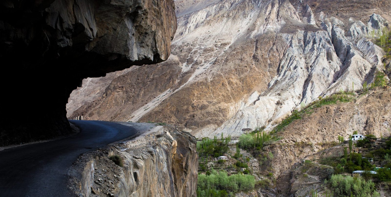
- Islamabad to Besham or Dasu (~220–290 km, one long day). You leave the motorway at Hassan Abdal, pick up the KKH proper, and follow the Indus gorge north. Abbottabad and Mansehra pass early; the road narrows and climbs after that.
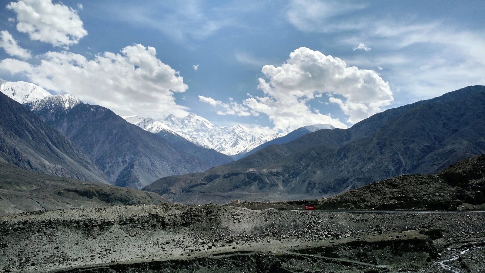
- Besham/Dasu to Chilas (~200 km). This is Karakoram country in earnest — the Indus cuts a huge trench below the road, and Nanga Parbat starts to dominate the skyline as you near Chilas.
- Chilas to Gilgit (~110 km). At Jaglot the Gilgit River joins the Indus, and this is the point where the Karakoram, Himalaya, and Hindu Kush ranges meet — you can see all three from one spot. Gilgit itself is the administrative hub of Gilgit-Baltistan.
- Gilgit to Karimabad, Hunza (~100 km). The road climbs into Hunza and Nagar; this is where most people slow down for two nights, with Rakaposhi (7,788 m) filling the view.
- Karimabad through the Attabad tunnels to Passu and Sost (~100 km). You pass Attabad Lake and the five-tunnel bypass built after the 2010 landslide, then the Passu Cones come into view before the road ends its public-town stretch at Sost, the last settlement and customs post before the border zone.
- Sost to the Khunjerab Pass (~85 km, day trip). This final stretch runs through Khunjerab National Park and climbs hard to the pass itself, the border with China’s Xinjiang region.
Total driving distance from Islamabad to Khunjerab is roughly 800–870 km depending on the exact route taken through the capital area — figures vary a little between sources, so treat any single-kilometre number as approximate. Doing it non-stop is physically possible in two long days; doing it that way is a waste of the trip.
The Giants Along the Way
What makes the KKH different from any other long-distance drive is what’s visible from the tarmac without leaving the car. Nanga Parbat (8,126 m, the ninth-highest mountain on earth) rises directly above the road near Chilas and Raikot Bridge — the Rakhiot Face is close enough to feel oppressive. Further north, Rakaposhi (7,788 m) sits almost on top of the highway near Nagar, one of the few 7,000ers in the world visible from base to summit from a public road. Past Hunza, the Passu Cones (Tupopdan) and Ultar Peak crowd the skyline around Passu and Gulmit.
The road also runs past one of the largest concentrations of ancient rock art anywhere: more than 50,000 petroglyphs and inscriptions, pecked into boulders between Hunza and Shatial by traders, pilgrims, and invaders moving along this same corridor since roughly 5000–1000 BC. Most drivers miss them entirely because they’re not signposted the way a monument would be — ask your driver, they know the stones.
Attabad Lake and the Tunnels
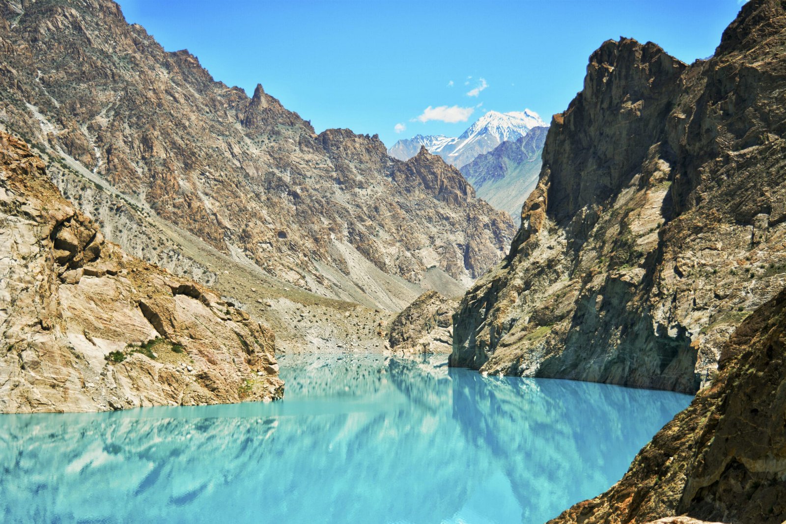
On 4 January 2010, a huge landslide above the village of Attabad blocked the Hunza River. By June the resulting lake had grown to over 20 km long and 100 m deep, drowning roughly 19–25 km of the original highway, submerging parts of several villages, and cutting Pakistan’s only overland link to China for years — goods and people crossed the lake by boat in the meantime. Twenty people died in the landslide itself; thousands more were displaced.
Pakistan and China responded by building a new 24 km stretch of road above the lake, including five tunnels totalling about 7 km, at a cost of roughly $275 million. It opened in September 2015 and is now called the Pakistan-China Friendship Tunnels. Today Attabad Lake itself, with its startling turquoise colour, is one of the most photographed stops on the whole route — a disaster that became, in a strange way, one of the highway’s landmark views.
When to Go
| Months | Conditions | Verdict |
|---|---|---|
| January–March | Cold, snow can close sections; Khunjerab border shut (reopens 1 May) | Avoid for the full route |
| April–May | Snowmelt, orchards blossoming in Hunza; some upper sections still clearing | Beautiful, check road status before Sost |
| June–September | Full route open including Khunjerab; monsoon can trigger landslides in July–August, mainly on the lower Indus stretch | Best overall window |
| October | Clear skies, golden poplars in Hunza, cold nights | Excellent, arguably the best light |
| November–December | Increasing cold and snow risk; Khunjerab closes 31 December | Only with flexibility built in |
How Hard Is It, Honestly
Physically, this is an easy trip — you’re sitting in a vehicle, not walking. The difficulty is entirely about the road and the altitude, not your fitness. Expect long days (5–8 hours of driving between overnight stops), a two-lane road that narrows to one lane in places with sheer drops and no barrier, and occasional delays for landslide clearance or checkpoints. The jump from Sost (~2,800 m) to Khunjerab (~4,700 m) in a single day can give sensitive travelers a mild headache; it passes on its own once you descend back to Sost. We don’t sugarcoat this part: if you have a serious heart or lung condition, talk to a doctor before the Khunjerab day-trip specifically, not the rest of the KKH.
Getting There and What It Costs
Most people start the KKH from Islamabad, which you can reach easily by air from anywhere; from there it’s the road itself, either self-driven, by NATCO or private bus, or with a driver. If you’re combining the highway with Skardu and the Baltoro side of Gilgit-Baltistan, see our guide on how to get to Skardu for the flight-versus-road tradeoffs.
We keep pricing personal rather than posting a number that goes stale the moment fuel prices move or a bridge needs a detour. Tell us your dates, group size, and whether you want the fast 5-day version or the two-week version with Naltar, Rakaposhi base camp, or Passu Glacier built in, and we’ll quote it straight — local hands, real safety, fair price, no corners cut.
Frequently Asked Questions
How many days do I need to drive the Karakoram Highway?
Five to seven days one way with real overnight stops is the practical minimum; two weeks lets you add side valleys like Naltar or a proper two nights in Hunza instead of a rushed one. Doing it non-stop in two days is possible but not worth it.
What is the highest point on the KKH?
The Khunjerab Pass area, at approximately 4,693–4,714 m depending on the source. It’s generally described as the highest paved international border crossing in the world.
Is the Karakoram Highway open all year?
No. The route as a whole can be affected by winter snow, and the Khunjerab border crossing specifically is only open from 1 May to 31 December. May through October is the reliable window for the full route.
Do I need a special permit to drive the KKH?
A standard Pakistan tourist visa covers the road trip itself, including the Khunjerab National Park viewpoint. Actually crossing into China requires a separate Chinese visa arranged beforehand. If your trip extends into trekking or expeditions off the highway, that needs the Trekking & Mountaineering visa category instead.
What happened at Attabad Lake?
A landslide on 4 January 2010 dammed the Hunza River, and the resulting lake drowned roughly 19–25 km of the original highway. A new 24 km bypass with five tunnels opened in September 2015, restoring the road link.
Planning a Karakoram Highway road trip, or want it built into a longer Gilgit-Baltistan itinerary?
WhatsApp us at +92 312 9921574 or email info@karakoramventure.com. We’re a local Gilgit-Baltistan team, not a broker — the same drivers and guides who know this road in every season.
Sources & attribution: Wikipedia (Karakoram Highway, Attabad Lake, Khunjerab Pass); Britannica. Photos: Attabad Lake by Hassanzealous (CC BY-SA 4.0); Nanga Parbat from the Karakoram Highway by Muhammad Usman/Muspal64 (CC BY-SA 4.0); Karakoram Highway road by Shozib ali (CC BY-SA 4.0); all via Wikimedia Commons.