Bublimotin — the Ladyfinger Peak — is a bare rock spire of roughly 6,000 m on the south-west ridge of the Ultar Sar massif, standing directly above Karimabad in the Hunza Valley, in the Batura Muztagh of the Karakoram. It is not a trekking peak. It is a serious 6,000 m rock climb reached by a genuinely alpine approach, first climbed on 22 May 1982 by Patrick Cordier and Jacques Maurin. Most people come to photograph it from the valley or from the Ultar meadow, and only a handful of teams a year come to climb it. The usable window is roughly June to September.
We run this out of Skardu and Hunza with our own Balti and Hunzai team, and we will be straight with you: for ninety-nine people out of a hundred, Bublimotin is a mountain you look at, not one you stand on. That is not us talking you out of anything. It is us telling you what the rock actually demands before you spend money getting here.
Key Takeaways
- Height: approximately 6,000 m (20,000 ft) — the published figure is itself an approximation.
- Where: south-west ridge of the Ultar Sar massif, Batura Muztagh, above Karimabad, Hunza.
- First ascent: 22 May 1982, Patrick Cordier and Jacques Maurin (reported in the American Alpine Journal, 1983).
- Character: a sharp, largely snowless rock spire with little prominence above the saddle it shares with Hunza Peak (6,270 m).
- Season: roughly June to September for the rock; shoulder months are colder and less settled.
- Realistic options: viewpoint photography from Karimabad, a trek to the Ultar meadow, or a full technical rock expedition. Three very different trips.
Where it is, and why it matters
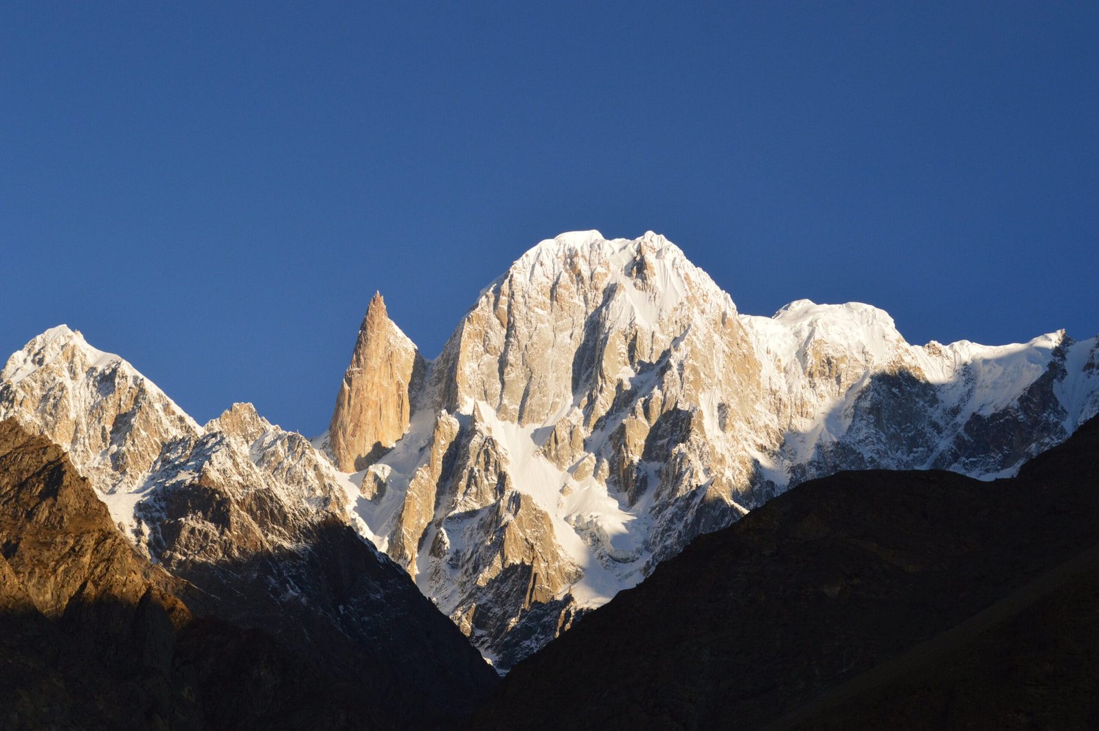
Stand in Karimabad with a cup of tea and look up. The wall above you is the Ultar Sar massif — the most south-easterly of the major groups of the Batura Muztagh, the westernmost sub-range of the Karakoram. The whole thing rises precipitously out of the valley. Off to the left of the high snow, one finger of clean rock stands separate from everything around it. That is Bublimotin.
The name comes from a Hunza folk tale: Bubli mo Ting, Bubli’s peak. The prince Kisar came from Baltistan, married a princess called Bubli, and when word reached him that his first wife had been taken he left Bubli on the mountain with a sack of grain and a hen, telling her to feed the bird one grain a year. When the sack was empty, he would return. They say she is waiting there still. We tell that story on the trail because it is Hunza’s, not ours to improve on.
Geologically and climbing-wise, the spire matters because it is almost pure rock in a range that is mostly snow and ice. Little prominence, enormous presence. It has also been the scene of some notable paragliding.
The approach, step by step
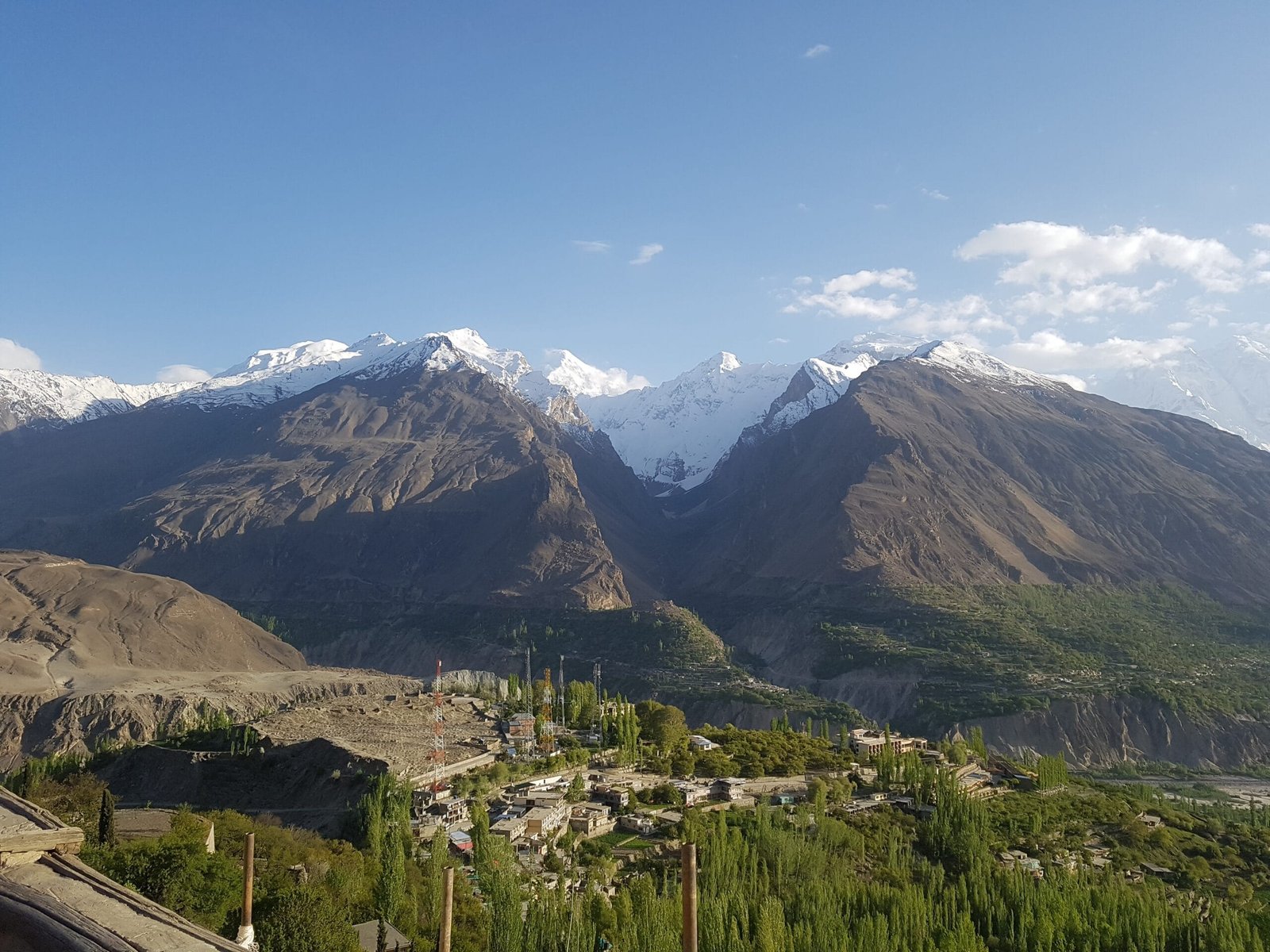
There is no road to the foot of the spire and no easy way in. Everything starts from Karimabad, above Baltit Fort, on the same path used for the Ultar Meadow trek. This is the schedule we run for a photography-and-meadow trip; a climbing expedition uses the same approach and then adds its own load-carrying and weather days on top.
- Day 1 — Gilgit or Hunza arrival. Drive up the Karakoram Highway to Karimabad. Gear check, permits talk, early night.
- Day 2 — Karimabad, acclimatisation walk. Baltit Fort, the irrigation channels, and a short climb toward the gorge to get the legs and lungs working.
- Day 3 — Karimabad to Ultar Meadow. A steep, stony ascent through the gorge above the fort. Short in distance, unkind in gradient.
- Day 4 — Meadow day. Shepherds’ huts, the glacier snout, and the full view of the spire. Most trekkers turn around here, and rightly so.
- Day 5 — Higher camp (climbers only). Onto the moraine and the mixed ground below the ridge. Rope work begins.
- Days 6–9 — Climbing and weather window (climbers only). Technical rock on the spire itself, with fixed days held back for weather. Nobody sensible plans a single-shot summit day here.
- Day 10 — Descend to Karimabad. Down the same gorge, knees complaining, back to apricots and a hot shower.
That is our standard plan, not a published route description. Real climbing itineraries are written around your team’s ability and the season’s conditions.
The climb, and its short history
Bublimotin was first climbed on 22 May 1982 by the French pair Patrick Cordier and Jacques Maurin, who wrote it up the following year in the American Alpine Journal as Bubuli-Mo-Tin, Ultar Group. It is a 6,000 m rock climb with, in the plainest possible language, a very serious alpine approach — the difficulty is not only the pitches, it is getting a team and its gear to the base of them and back down again.
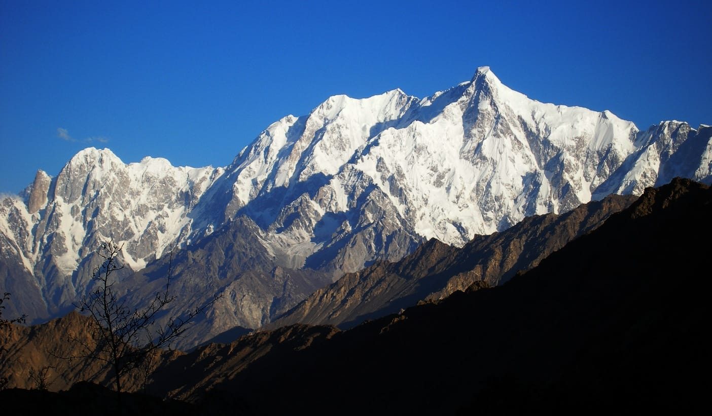
The neighbouring summits give the context. Hunza Peak (6,270 m), which shares the saddle, had two known routes first climbed in 1991, both in alpine style — the first by a Swedish expedition, the second by a British team that included Caradog Jones and Mick Fowler. Ultar Sar itself, the high point of the massif, has a long and difficult history and is far from a beginner’s objective. If you want a Hunza 7,000 m expedition rather than a rock spire, look instead at Shispare Sar or Batura Sar.
When to go
| Months | Conditions | Verdict |
|---|---|---|
| March–May | Blossom in the valley, cold and unsettled high up, snow on the approach | Best for photography and valley travel, not for the rock |
| June–August | Warmest and most settled; longest daylight; busiest in Karimabad | The climbing and meadow season |
| September | Cooling, clearer air, autumn colour beginning | Excellent for trekking and photography; still climbable |
| October–February | Cold, short days, snow low on the approach | Valley visits only; not a climbing season |
For a wider view of the calendar, see our guide to the best time to visit Gilgit-Baltistan.
How hard is it, honestly
Three different answers, because there are three different trips.
Viewing from Karimabad: easy. Anyone who can walk a village lane can see the spire. Altitude around 2,500 m.
Trek to the Ultar meadow: hard for its length. It is a short day on the map and a steep, loose, relentless climb in reality, and it gains altitude quickly. Good fitness required; no technical skill.
Climbing the spire: a technical rock objective at 6,000 m with a committing approach, loose sections, weather exposure and a long way from help. You need real multi-pitch experience, a competent partner, and prior high-altitude days. If you are asking us whether you are ready, the answer is probably no — and we would rather tell you that now than at 5,500 m. Read our acclimatisation guide before you commit to anything above the meadow.
The gorge above Karimabad is steep and stonefall is a genuine hazard, on the approach as much as on the climb. Above the meadow you are on technical ground with no quick way down. We carry a satellite phone on every expedition and every high trek, we hold established helicopter-rescue contacts for the region, and we require proof of insurance that actually covers high-altitude rescue — see our note on travel insurance for high-altitude trekking. Helicopter evacuation in the Karakoram is weather-dependent and never guaranteed. We plan for it anyway.
The Hunza Valley and Karimabad are open-zone: no trekking permit is needed for ordinary valley travel or the meadow walk. Climbing Bublimotin is a mountaineering objective and is treated differently — a climbing permit and the appropriate paperwork are required, and rules change, so we confirm the current position with the authorities for each team rather than quoting a rule that may be out of date. Everyone needs a Pakistan visa, and climbers and trekkers should apply on the Trekking and Mountaineering category rather than the ordinary tourist one: see our Pakistan visa guide for trekkers.
Getting there, and what it costs
Fly Islamabad to Gilgit or Skardu when the weather allows, or drive the Karakoram Highway and give yourself buffer days either way — mountain flights get cancelled and the road takes as long as it takes. From Gilgit it is a short drive up to Karimabad. If you are combining Hunza with the Baltoro side, our Rakaposhi Base Camp trek and the Passu Cones and Batura Glacier sit naturally on the same trip.
On price: we keep pricing personal rather than posting a number that goes stale. Team size, days, whether you need climbing support or just a guide and a jeep — these change the figure a lot. Tell us what you want and we will quote a fair price with no corners cut on guides, food or safety kit. Local infrastructure is why we can do that.
Frequently asked questions
How high is Ladyfinger Peak?
Approximately 6,000 m (20,000 ft). The published elevation is explicitly an approximation, so treat it as a round number rather than a survey figure.
Can a trekker climb Bublimotin?
No. It is a technical rock climb at 6,000 m with a serious alpine approach. Trekkers can walk to the Ultar meadow below it, which is a hard but non-technical day.
Who climbed it first?
Patrick Cordier and Jacques Maurin, on 22 May 1982. Cordier described the ascent in the American Alpine Journal in 1983.
Where is the best place to see Ladyfinger Peak?
From Karimabad in the Hunza Valley, particularly from around Baltit Fort and the Eagle’s Nest side of the village, and from the Nagar side of the valley looking across at the whole Ultar ridge.
Do I need a permit?
Not for valley travel or the meadow trek — Hunza is an open zone. Climbing the peak requires mountaineering paperwork, which we arrange and confirm per team. All visitors need a Pakistan visa; climbers should use the Trekking and Mountaineering category.
Talk to the team that lives here
We are a local Balti team based in Skardu, not a broker who hands you to someone else at the airport. Own guides, own logistics, sat phone in camp, a rescue plan that actually exists, and a fair price.
WhatsApp: +92 312 9921574 · Email: info@karakoramventure.com
Message us Ladyfinger for 2026 dates and a plan built around what you can actually climb.
Sources and attribution: elevation, location and first-ascent details from Wikipedia (Ladyfinger Peak; Hunza Peak) and Patrick Cordier, Bubuli-Mo-Tin, Ultar Group, American Alpine Journal 1983. Photographs: Muhammad Kashif Ali (CC BY-SA 3.0), Eleutherosmartin (CC BY-SA 3.0), Aamir Fawad (CC BY-SA 4.0), all via Wikimedia Commons. Altitudes are approximate.