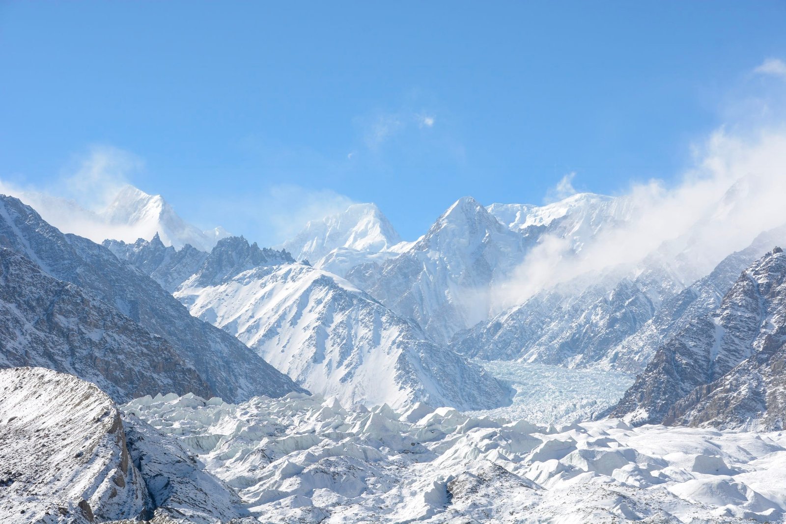
Khunyang Chhish is a 7,852 m mountain in the Hispar Muztagh, in Nagar District of Gilgit-Baltistan, Pakistan. It is the second-highest peak of that range after Distaghil Sar and around the 21st-highest independent mountain on earth. It was first climbed on 26 August 1971 by a Polish team led by Andrzej Zawada, and it has been climbed only a handful of times since. Expeditions run roughly June to August, approach from Hispar village up the Hispar Glacier, and normally need six to eight weeks. This is a serious, technical, high-altitude objective — not a trekking peak, and not a first Karakoram climb.
We run this out of Skardu and Hunza with our own Balti and Burushaski-speaking staff, and we will be straight with you: Khunyang Chhish is one of the least-visited big mountains in Pakistan, and there is a reason for that. It is remote, it is steep, and the summit ridge sits a long way above the last safe camp. If you want a 7,000er to build on, start with Spantik. If you want this one, read on and be honest with yourself about where your climbing is.
Key Takeaways
- Height: 7,852 m — second-highest in the Hispar Muztagh, roughly 21st-highest independent peak in the world, with about 1,765 m of prominence.
- Where: Nagar District, Gilgit-Baltistan, on the northern side of the Hispar Glacier, east of the Hunza Valley.
- Name: from Burushaski, usually translated as the corner peak.
- First ascent: 26 August 1971, south ridge from the Pumari Chhish Glacier — Andrzej Zawada, Andrzej Heinrich, Jan Stryczyński and Ryszard Szafirski. Their team-mate Jan Franczuk had died in a crevasse fall near Camp III at about 6,450 m.
- Modern landmark: the 2,700 m southwest face of Khunyang Chhish East (7,400 m), climbed 14–19 July 2013 by Simon Anthamatten, Hansjörg Auer and Matthias Auer — a Piolets d’Or 2014 finalist.
- Season and length: June to August; plan six to eight weeks door to door.
Where it is, and why so few people go
Draw a line north from the Hispar Glacier and you are in the Hispar Muztagh — a compact block of giants that includes Distaghil Sar at 7,885 m, Kanjut Sar at 7,760 m, and Khunyang Chhish. South of that ice lies the long Biafo–Hispar traverse; west is the Hunza Valley and the Karakoram Highway; north is Shimshal.
The Baltoro gets the traffic because K2 is there and the trail is known. Hispar gets almost none. On the Baltoro in July you will see other teams every day. On the Kunyang side you may see nobody for a month. That is the appeal and it is also the risk: nobody is coming past your camp to help.
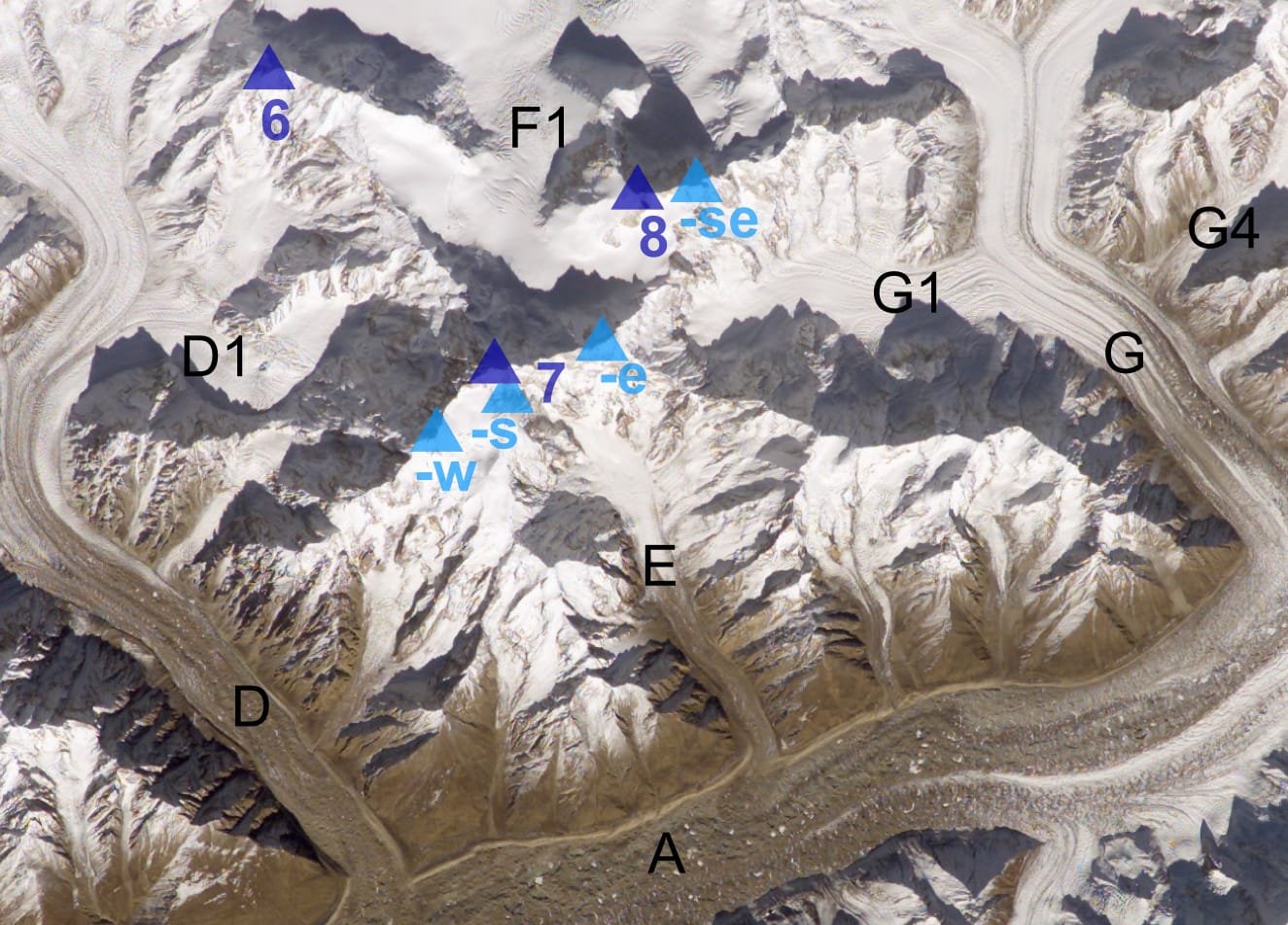
The giants of the Hispar Muztagh
Schematic — bars are scaled from 7,000 m and are approximate.
The route, step by step
There is no fixed commercial itinerary here the way there is on the Baltoro. This is the shape of a normal expedition, and every part of it moves with conditions.
- Islamabad to Gilgit or Hunza. Fly, or drive the Karakoram Highway. Build in buffer days — mountain flights get cancelled.
- Hunza to Nagar and up the Hispar road. A rough jeep road climbs to Hispar village. Times vary with the road; count on most of a day and be ready for it to be longer.
- Hispar village to base camp. Porters carry up the Hispar Glacier and turn north onto the Kunyang Chhish ice. Two to three walking days in normal conditions.
- Base camp and acclimatisation. Rotations on lower slopes, load-carrying, and rest. Read our acclimatisation guide before you come.
- Camps 1 to 3. Three high camps is typical; the 1971 team had Camp III at roughly 6,450 m. Fixed rope on the technical sections, and a lot of waiting for weather.
- Summit push and descent. A long day from the top camp with no easy escape. Descent is where most of the danger lives.
Schematic and approximate — camp positions change every season.
The history: 1971, and the Shining face of 2013
Kunyang Chhish resisted several attempts before 1971. The Polish expedition led by Andrzej Zawada took a long line on the south side from the Pumari Chhish Glacier. On 26 August 1971 Zawada, Heinrich, Stryczyński and Szafirski stood on the summit at 7:45 in the morning and started down at ten. The ascent is remembered in Poland as the point where Polish Himalayan climbing came back to life after the war — and it was paid for. Jan Franczuk, the youngest man on the team, had already died in a hidden crevasse near Camp III at about 6,450 m. They buried him at the site and built a memorial at base camp.
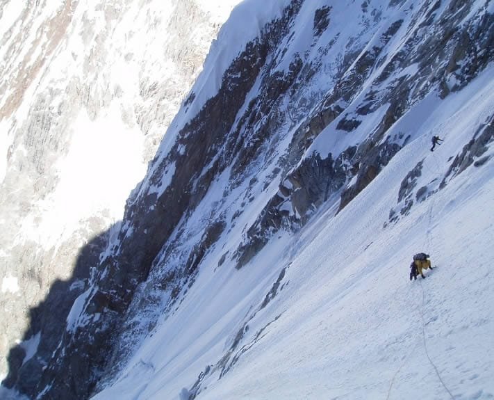
Four decades later the mountain produced one of the finest climbs of the modern Karakoram. In July 2013 Simon Anthamatten, Hansjörg Auer and Matthias Auer climbed the 2,700 m southwest face of Khunyang Chhish East (7,400 m) over six days, alpine style, with mixed climbing high on the wall. It was a Piolets d’Or finalist in 2014. Read those two stories together and you have the character of this mountain: rare, hard-won, and unforgiving of mistakes.
When to go
| Months | Conditions | Verdict |
|---|---|---|
| April–May | Deep snow low down, cold, unsettled; road to Hispar may still be poor | Too early for most teams |
| June | Approach clears, glacier still firm, cold nights | Good for arrival and acclimatisation |
| July | Warmest, longest days, main climbing window — also the most rockfall and serac movement | Peak season |
| August | Settled spells still occur; the 1971 summit was 26 August | Workable, watch the weather turn |
| September–October | Cold, short days, high winds | Too late for a 7,852 m summit |
For the wider picture across the region, see our season-by-season guide to Gilgit-Baltistan.
How hard is it, honestly
Hard. Khunyang Chhish has had very few ascents in more than fifty years, and that number is the most useful figure on this page. You need previous 7,000 m experience, solid mixed and steep-snow climbing, comfort on fixed lines and crevassed glacier, and the patience to sit out weather for weeks. Fitness is necessary and nowhere near sufficient — judgement is what gets people home.
If that is not you yet, that is fine, and we would rather say it now. Spantik is the sensible first 7,000er. Shispare and Baintha Brakk are the harder company Khunyang Chhish keeps. For a walking objective in the same district, Rush Lake is in Nagar too.
The real risks here are crevasses on the approach glacier, avalanche and serac hazard on the face, and being extremely far from help. Kunyang Chhish’s own history opens with a crevasse death at 6,450 m. We carry a satellite phone on every expedition, run daily comms with Hunza and Skardu, hold established helicopter-rescue contacts for the region, and require proof of insurance that covers helicopter evacuation above 6,000 m. Even with all of that, a helicopter needs weather and daylight. Plan to be self-sufficient for days.
Khunyang Chhish is a mountaineering objective, not an open-zone trek, so it requires a climbing permit through the relevant Pakistani authorities and a liaison officer — that process takes months, so start early. You will also need the trekking and mountaineering visa rather than a plain tourist visa; we walk clients through it in our Pakistan visa guide. We handle permit paperwork, royalty payments and the liaison officer as part of the expedition.
Getting there, and what it costs
Islamabad to Gilgit by air, or the Karakoram Highway by road with buffer days; then Hunza, Nagar and the jeep road to Hispar village. From there it is porters and glacier.
On price: we keep pricing personal rather than posting a number that goes stale. A Khunyang Chhish expedition depends on team size, how many high-altitude porters and how much fixed rope you want, the permit and royalty, and how long you are willing to wait for weather. Tell us your team and your dates and we will cost it properly — fair price, no corners cut on guides, food, oxygen policy or safety kit. That is where budget operators save money, and it is the wrong place to save it.
You can walk beneath it. Khunyang Chhish stands over the Hispar Glacier, and two of our treks cross that ice: the Snow Lake & Hispar La Trek (22 days, from ,800) and the Great Karakoram Traverse (32 days, from ,800). Both are guided start to finish by our own Balti team, with permits arranged and a satellite phone in camp. Be straight with yourself about the commitment though: weeks on glacier ice, a tent every night, and no road out once you are past Askole.
Frequently asked questions
How high is Khunyang Chhish?
7,852 m. It is the second-highest peak of the Hispar Muztagh after Distaghil Sar (7,885 m) and roughly the 21st-highest independent mountain in the world, with about 1,765 m of prominence.
Who made the first ascent of Khunyang Chhish?
A Polish expedition led by Andrzej Zawada. Zawada, Andrzej Heinrich, Jan Stryczyński and Ryszard Szafirski reached the summit on 26 August 1971 by the south ridge from the Pumari Chhish Glacier. Team member Jan Franczuk had died earlier in a crevasse fall near Camp III at about 6,450 m.
Where is Khunyang Chhish and how do you get to base camp?
It stands in Nagar District, Gilgit-Baltistan, on the north side of the Hispar Glacier. Access is from the Karakoram Highway through Hunza and Nagar, by jeep road to Hispar village, then two to three days on foot up the Hispar and Kunyang Chhish glaciers.
When is the climbing season?
June to August, with July the main window. The 1971 first ascent was on 26 August. Expect to be in the country six to eight weeks.
Do I need a permit to climb Khunyang Chhish?
Yes. It is a mountaineering peak, so it needs a climbing permit and a liaison officer, plus a trekking and mountaineering visa rather than a tourist visa. Start the paperwork months in advance; we handle it for our teams.
Talk to the team that lives here
If Khunyang Chhish is on your list, message us with your climbing CV, team size and dates and we will tell you honestly whether we think it is the right objective for you — and what we would suggest instead if it is not.
WhatsApp: +92 312 9921574
Email: info@karakoramventure.com
You will be dealing with a local Balti team who run their own logistics in Gilgit-Baltistan — not a broker passing you to someone else. Local hands, real safety, fair price.
Sources & attribution: elevation, prominence and ranking from Wikipedia and standard Karakoram references; 1971 first-ascent details from the Andrzej Zawada archive and Explorersweb; Khunyang Chhish East 2013 details from the American Alpine Journal and Piolets d’Or. Images: Theprotrekker (CC BY-SA 4.0); NASA / ISS, derivative by Rupert Pupkin (public domain); Raphael Slawinski (CC BY-SA 3.0) — all via Wikimedia Commons. Figures marked approximate where sources differ.