



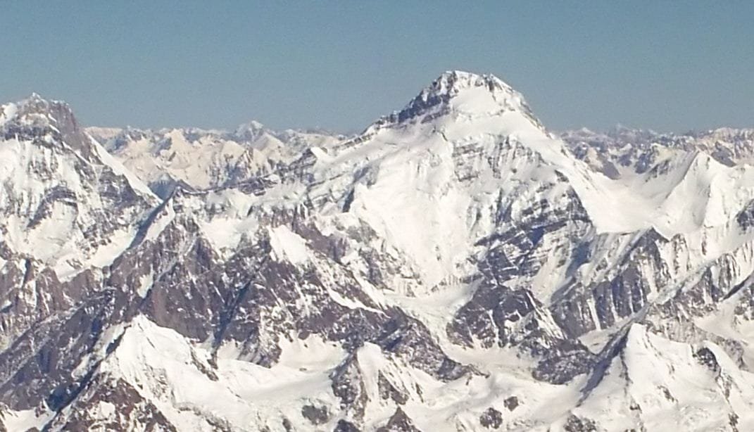
Yukshin Gardan Sar is a 7,530 m peak of the Hispar Muztagh, standing above the Shimshal Valley in Gilgit-Baltistan, roughly 6 km north-west of Kanjut Sar and 16 km north-east of Khunyang Chhish. It was first climbed on 26 June 1984 by an Austrian-Pakistani party via the South Ridge, reached from the Yazghil Glacier on the west side. It has been climbed only three times in total, the last in 1986. A full expedition runs on the standard Karakoram season, roughly June to August, and it is a serious glaciated snow-and-ice climb – not a trekking peak, and not a first 7,000er.
We run this out of Skardu and Shimshal with our own team, and we will be straight with you: this is one of the emptiest big mountains in Pakistan. There is no queue, no fixed rope network, no trail of camps left by somebody else. That is exactly the appeal, and exactly the risk. If you want a 7,000 m peak with company and a broken trail, this is the wrong mountain.
Key takeaways
- Height: 7,530 m (24,700 ft); ranked 55th in the world. Some sources give 7,469 m or 7,641 m – the 7,530 m figure is the one in common use.
- Range: Hispar Muztagh, Karakoram; above the Shimshal Valley, Gilgit-Baltistan.
- Prominence: approximately 1,313 m.
- First ascent: 26 June 1984, South Ridge, by Willi Bauer, Walter Bergmayr, Willi Brandecker and Reinhard Streif, on an Austrian-Pakistani expedition led by Rudolf Wurzer.
- Total ascents: three – 1984 (twice, the second alpine style in July) and 1986 by a Spanish team. No recorded ascents since.
- Access: Karakoram Highway to Passu, then the Shimshal road to Shimshal village, then the Yazghil Glacier.
Where it is, and why almost nobody goes
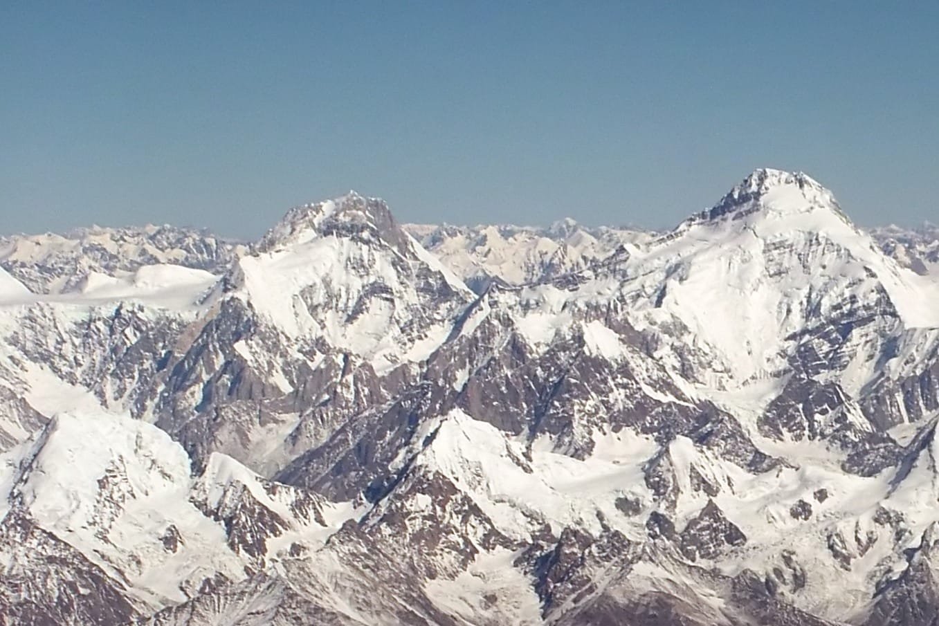
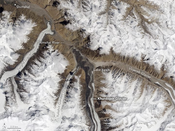
The Hispar Muztagh is the sub-range that holds Distaghil Sar (7,885 m), Khunyang Chhish, Kanjut Sar, Trivor and Pumari Chhish. Yukshin Gardan Sar sits in the middle of that company. It is flanked by the Yazghil Glacier on the north-west and the Yukshin Gardan Glacier on the north-east; both feed the Shimshal River.
One honest complication: in Shimshal itself, many people will tell you that the peak the maps call Yukshin Gardan Sar is actually Kanjut Sar, and the other way round. The local names and the international ones do not agree. We use the map names here so you can match them to permits and reports, but do not be surprised when your Shimshali porters use different ones. They are not wrong – they got there first.
The peaks around it, by height
Getting there: the road, the village, the glacier
There is no shortcut. The approach is long and that length is part of the cost of the trip.
- Islamabad to Gilgit or Hunza. Fly, or drive the Karakoram Highway. Build in buffer days either way – mountain flights are weather-dependent and the highway can close.
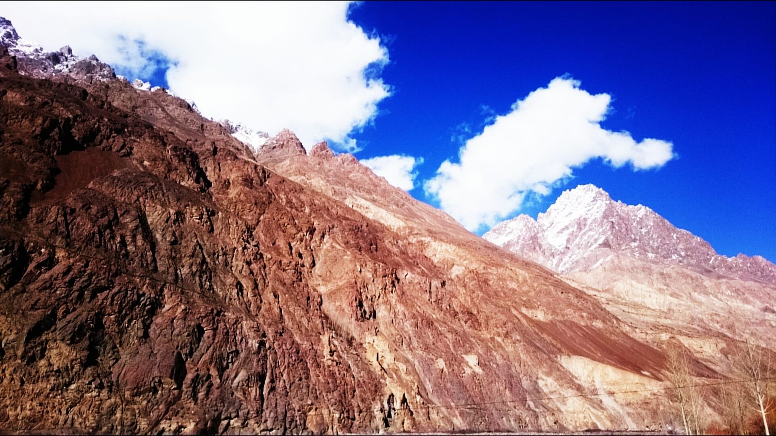
- Passu to Shimshal village. The Shimshal jeep road leaves the KKH near Passu and climbs a gorge to Pakistan’s most famous mountaineering village, at roughly 3,100 m. It is a rough road, and it is the only way in.
- Shimshal to the Yazghil Glacier. The Yazghil comes down to the valley above the village. From here you are on ice and moraine, moving with porters who know the ground.
- Base camp on the west side. Established off the Yazghil, the same side the first-ascent party used.
- Acclimatisation rotations. Load-carrying and sleeping high on the lower glacier and ridge before any summit attempt. Read our acclimatisation guide before you come.
- South Ridge summit push. Steep snow to an ice-coated rock buttress, a narrow gap, then – and this is the part people forget – a 150 m descent down a 60-degree ice couloir before a 45-degree slope leads to the summit ridge. You climb down in the middle of going up, which means you climb back up on the way home, tired.
- Descent and walk out. Back to Shimshal, back to the KKH.
The shape of the climb
Three ascents in forty years
The record is short enough to write out in full. The Austrian-Pakistani expedition led by Rudolf Wurzer put Willi Bauer, Walter Bergmayr, Willi Brandecker and Reinhard Streif on the summit on 26 June 1984, at 4:30 in the afternoon, via the South Ridge from the Yazghil. A Pakistani-Japanese team was on the mountain at the same time, trying the North Ridge; when that would not go, they switched across and made an alpine-style ascent of the same South Ridge on 23 July 1984. Two years later, in 1986, a Spanish team – Alejandro Arranz, Inaki Aldaya, Alfredo Zabalza and Tomas Miguel – repeated the line.
After that, according to the Himalayan Index, nothing. No recorded ascents, no recorded attempts. On a mountain this size, that silence tells you something about both the access and the line.
When to go
| Months | Conditions | Verdict |
|---|---|---|
| April – May | Cold, deep snow low down, Shimshal road often still difficult | Too early for a summit attempt; possible for a long approach and acclimatisation |
| June | The window the first ascent used – 26 June, in excellent weather | Strong. Good snow, long days |
| July – August | Peak Karakoram season; warmest and most settled, but more rockfall and softer snow late in the day | Best overall. Start early, be off the couloir before it heats |
| September | Cooling, shorter days, firmer ground | Workable for a strong, fast team |
| October onward | Cold, high winds, road and logistics unreliable | No |
How hard it is – honestly
Hard. Not fashionably hard, genuinely hard. Three points, plainly:
- Altitude. 7,530 m with no fixed infrastructure and no other teams on the hill. You must arrive already acclimatised from a previous high trip, and then rotate properly.
- Terrain. Glacier travel, steep snow, an ice-coated rock buttress and a 60-degree ice couloir on the summit day. You need to be solid on front points and in crevasse rescue, not learning it here.
- Remoteness. This is the real one. Between you and a hospital lies a glacier, a village, a jeep road and the Karakoram Highway. Self-sufficiency is not a nice extra; it is the plan.
Who this is for: climbers with previous 7,000 m experience and technical alpine ground behind them. If this would be your first 7,000er, climb a more supported peak first and come back. We will tell you that on the phone rather than take your booking.
Getting there and what it costs
Fly Islamabad to Gilgit, or drive the Karakoram Highway, then road to Passu and up to Shimshal. From there it is glacier and porters. If you would rather see the country on foot first, the Shimshal Pass trek uses the same village and is the best acclimatisation this valley offers.
On money: we keep pricing personal rather than posting a number that goes stale. Permit fees, porter loads, liaison officer costs and the length of your rotation schedule all move the figure, and a quoted headline that ignores them is not honest. Tell us your dates, your team size and your climbing history, and we will build the real number – fair price, no corners cut, and nothing shaved off the safety line to make it look cheaper. Pack for it properly: see our Karakoram packing list.
Frequently asked questions
How high is Yukshin Gardan Sar?
7,530 m (24,700 ft), which ranks it 55th in the world. Some sources quote 7,469 m or 7,641 m; 7,530 m is the commonly used figure and the one we work from.
Who first climbed it, and how many times has it been climbed?
First climbed on 26 June 1984 by Willi Bauer, Walter Bergmayr, Willi Brandecker and Reinhard Streif on an Austrian-Pakistani expedition led by Rudolf Wurzer, via the South Ridge from the Yazghil Glacier. It was climbed again in July 1984 alpine style by a Pakistani-Japanese team, and a third time in 1986 by a Spanish team. No ascents are recorded since.
Is it a good first 7,000 m peak?
No. It is remote, technically committing on the summit day, and there is no other team on the hill to help. Climb a more supported 7,000er first and come back with that experience.
What is the best season?
The Karakoram summer, roughly June to August, with late June to early August the strongest window. The first ascent summited on 26 June.
Do I need a permit?
Yes – a mountaineering permit through the Gilgit-Baltistan authorities, with a liaison officer, plus a trekking and mountaineering visa rather than a tourist visa. Allow months of lead time.
Talk to the team that lives here
We are a local Balti team based in Skardu, not a broker who sells your permit on to somebody else. You will speak to the people who will actually be on the glacier with you.
WhatsApp: +92 312 9921574
Email: info@karakoramventure.com
Send us your dates and your climbing history and we will tell you honestly whether Yukshin Gardan Sar is the right mountain for you this season – and which one is, if it is not.
Sources & attribution: elevation, prominence, location and ascent history from Wikipedia (Yukshin Gardan Sar) and the American Alpine Journal reports by Rudolf Wurzer (1985), Akira Suzuki (1985) and Alejandro Arranz (1987); ascent record per the Himalayan Index. Images: “Yukshin Gardan Sar” and “Yukshin Gardan Sar – Yutmaru Sar” by Guilhem Vellut / “*_*”, derivative works by Bulwersator and Rupert Pupkin, CC BY-SA 2.0; “Shimshal Valley” by Omernasimhere, CC BY-SA 4.0; “Glaciers of Shimsal Valley from space” by NASA Earth Observatory (Jesse Allen, Landsat/USGS), public domain – all via Wikimedia Commons.

