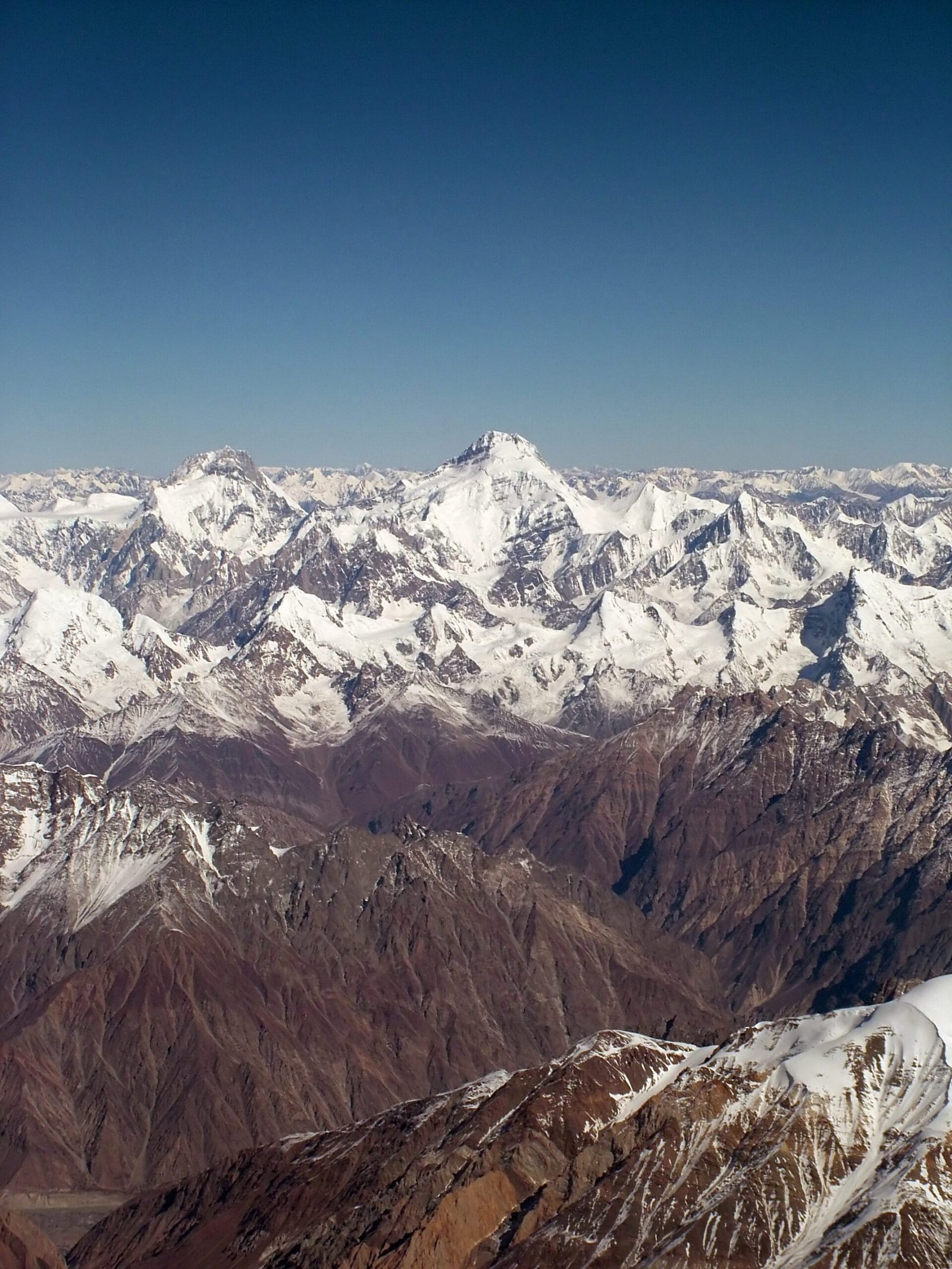
Kanjut Sar (7,760 m) is a mountain in the Hispar Muztagh, the sub-range of the Karakoram that rises between the Hispar and Shimshal valleys in Gilgit-Baltistan, Pakistan. It is one of the thirty highest mountains on earth and one of the least visited of them. It was first climbed on 19 July 1959 by Camillo Pellissier of an Italian expedition led by Guido Monzino. A full expedition runs roughly 40–45 days door to door, with base camp on the Khani Basa Glacier at around 4,650 m, reached on foot up the Hispar Glacier from Hispar village in Nagar. The season is June to August. This is a serious, remote, technical objective — not a first 7,000er.
We run this out of Skardu and Gilgit with our own Balti and Hunza-Nagar staff, and we will be straight with you: Kanjut Sar is not a mountain you book on a whim. It sees a handful of attempts in a decade. There is no fixed-rope highway, no queue, no other team to pull you out. What there is, is a long ice road up the Hispar, a base camp under one of the cleanest snow pyramids in the Karakoram, and a very quiet summit. If you have the record for it, we will build the logistics around you properly.
Key Takeaways
- Height: 7,760 m (Kanjut Sar I) — among the thirty highest peaks on earth.
- Where: Hispar Muztagh, between the Hispar and Shimshal valleys, Nagar District, Gilgit-Baltistan.
- First ascent: 19 July 1959, Camillo Pellissier, Italian expedition led by Guido Monzino.
- Base camp: Khani Basa Glacier, approximately 4,650 m, roughly a week’s walk up the Hispar Glacier.
- Duration: around 40–45 days for a full expedition; June to August is the working window.
- Grade: serious high-altitude mountaineering — glacier travel, crevasse rescue and 7,000 m experience required.
Where Kanjut Sar is, and why it matters
The Karakoram is not one wall. It is a series of muztaghs — ice-mountain groups — and the Hispar Muztagh is the second highest of them after the Baltoro Muztagh that holds K2. Distaghil Sar (7,885 m) is its highest summit. Khunyang Chhish (7,852 m) is its hardest reputation. Kanjut Sar (7,760 m) sits third, a clean snow-and-ice pyramid on the divide between the Hispar valley to the south and Shimshal to the north.
What makes it matter is not the ranking. It is the emptiness. On the Baltoro you share the trail with trekkers and four or five expeditions. On the Hispar you may not see another party for a fortnight. If you want a 7,760 m mountain where the only tracks in the snow are yours, this is one of the last places on earth that reliably delivers it.
The route, step by step
The standard approach follows the old Hispar corridor. From Gilgit you drive into Nagar and up to Hispar village, the last settlement, and from there everything moves on foot and on porter loads.
- Islamabad to Gilgit — by air when the weather allows, or overland on the Karakoram Highway. Build in buffer days.
- Gilgit to Nagar and Hispar village — jeep on rough road; the roadhead is the end of vehicle support.
- Hispar village to the glacier snout — the first walking day, onto the ice.
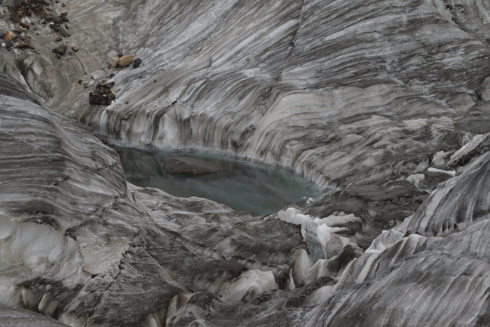
- Up the Hispar Glacier — several days of lateral moraine and ablation-valley camps heading east.
- Turn north into the Khani Basa Glacier — the side glacier that leads under the peak.
- Base camp, approximately 4,650 m — grassy ablation ground with a direct view of the mountain. Roughly a week to ten days from the roadhead.
- Acclimatisation and load carries — camps established progressively up the ridge over two to three weeks.
- Summit window — a single settled spell; then everything reverses back down the Hispar.
Note that the 1959 first ascent was made from a base camp on the Khani Basa Glacier, but the team climbed the south ridge approached via the upper Khurdopin Glacier rather than attacking the south face directly. Modern parties still weigh the same choice, and the answer depends on conditions in the year you go.
The history: one Italian, one summit day
Kanjut Sar was climbed in 1959 by a large, old-style Italian expedition — twelve alpinists, several hundred porters, and tons of material moved up the Hispar. On 19 July, Camillo Pellissier left the top camp with Jean Bich, who was forced back by gastric cramps. Pellissier went on and reached the summit alone.
That is the whole headline. There is no crowded second act, no commercial history, no fixed lines left by last season’s team. The mountain has kept an extremely thin traffic record ever since, which is exactly why serious alpinists keep circling back to it. Read our companion guide to Distaghil Sar for the range’s highest summit, and Baintha Brakk (the Ogre) for its most notorious.
When to go
| Months | Conditions | Verdict |
|---|---|---|
| April – May | Deep snow low down, cold, unstable weather, porters reluctant | Too early for a summit attempt |
| June | Approach opens, glacier still bridged, cold nights | Good for approach and acclimatisation |
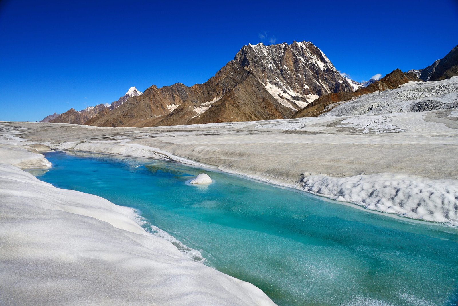
| July – August | Warmest, longest settled windows; heavy meltwater and open crevasses low down | The working season — plan your summit here |
| September | Cooling fast, shorter days, weather turning | Late window; possible but tight |
| October – March | Winter. Roads and high valleys closed | Not operable |
For the wider picture across the range, see our notes on the Karakoram climbing season and the best time to visit Gilgit-Baltistan.
How hard is it, honestly
Hard. Not K2-hard, but hard in a way that a fixed-rope 8,000er is not: you are on your own.
- Altitude. 7,760 m without supplementary oxygen as standard. You need a previous 7,000 m summit, or a very strong 6,000 m and high-altitude record.
- Terrain. Long, heavily crevassed glacier travel on the approach; snow and ice climbing above. Roped movement, crevasse rescue and self-sufficiency are non-negotiable.
- Fitness. Six weeks of load carrying at altitude with no rest days you did not earn. Endurance matters more than technical grade.
- Remoteness. This is the real difficulty. Help is days away on foot. Decisions have to be made conservatively and early.
If you are building toward this, Spantik (Golden Peak) is the sensible first 7,000er, and Diran and Rush Lake sit in the same Nagar valleys for acclimatisation.
Getting there, and what it costs
Fly Islamabad to Gilgit when the weather cooperates, or drive the Karakoram Highway — see our KKH road-trip guide. From Gilgit it is jeep into Nagar and up to Hispar village, then porters and your own legs.
On price: we keep pricing personal rather than posting a number that goes stale. An expedition like this is costed on permit fees, team size, porter stages, duration and the level of high-altitude support you want — those move year to year, and a published figure would mislead you. Tell us your dates, your team and your climbing record and we will build an honest quote. Fair price, no corners cut — and never cut on guides, food or safety kit. Pack from our Karakoram gear list and read the acclimatisation guide before you book flights.
The closest you can get without climbing it. Kanjut Sar rises straight off the Hispar Glacier, and our Snow Lake & Hispar La Trek (22 days, from ,800) crosses it, as does the Great Karakoram Traverse (32 days, from ,800). Our own Balti team throughout, permits arranged, satellite phone in camp. This is a serious undertaking, not a scenic week: long days on the ice, camping the whole way, and a slow walk back if the weather turns.
Frequently asked questions
How high is Kanjut Sar?
Kanjut Sar I is 7,760 m (25,459 ft). It stands in the Hispar Muztagh of the Karakoram, between the Hispar and Shimshal valleys in Gilgit-Baltistan, Pakistan, and ranks among the thirty highest mountains on earth. Sources differ slightly on its exact world ranking.
Who first climbed Kanjut Sar, and when?
Camillo Pellissier reached the summit alone on 19 July 1959, as part of a large Italian expedition led by Guido Monzino. He set out from the top camp with Jean Bich, who was forced to turn back with gastric cramps.
How long does a Kanjut Sar expedition take?
Plan roughly 40–45 days door to door. That covers travel to Gilgit, the jeep and walk-in to base camp on the Khani Basa Glacier at around 4,650 m, three weeks or so of acclimatisation and load carrying, a summit window, and the long walk out down the Hispar Glacier.
Do I need a permit and a special visa?
Yes to both. A peak of 7,760 m requires a formal mountaineering permit from the Pakistani authorities with several months of lead time, and climbers need a Trekking & Mountaineering visa rather than a standard tourist visa. We handle the permit process; you handle the visa with our guidance.
Is Kanjut Sar suitable as a first 7,000 m peak?
No. Its remoteness, long crevassed glacier approach and thin traffic make it a poor choice for a first high-altitude expedition. Spantik (Golden Peak) at 7,027 m is the sensible stepping stone; come back to Kanjut Sar with that on your record.
Talk to the team that lives here
We are a local Balti team based in Skardu, not a broker who sells your booking on. Tell us your dates and your climbing record and we will tell you honestly whether Kanjut Sar is the right mountain for you this year — or which one is.
WhatsApp: +92 312 9921574 · Email: info@karakoramventure.com
Local hands, real safety, fair price.
Sources & attribution: elevation, range and first-ascent details from Wikipedia (Kanjut Sar, Hispar Muztagh, Hispar Glacier) and American Alpine Club publications; base-camp altitude on the Khani Basa Glacier from published expedition reports. World ranking varies between sources. Images: Flickr user “*_*” — CC BY-SA 2.0; Yousaf Feroz Gill — CC BY-SA 4.0; Vasiq Eqbal — CC BY-SA 4.0, all via Wikimedia Commons.