Ultar Meadow sits at about 3,270 m, a steep climb of a few hours straight up the hillside behind Baltit Fort in Karimabad, Hunza — directly beneath Ultar Sar (7,388 m), whose south face rises over 5,300 m above the Hunza River in barely 9 km, one of the steepest walls of rock and ice on earth. Most parties do it as a 3-day round trip from Karimabad: up to the meadow, a push to Hon Pass (roughly 4,200 m) for the view across to Rakaposhi and the Hispar peaks, then back down. It’s non-technical — no rope, no glacier — but it is relentlessly steep, and the June–September window is the one that works.
We run treks out of Hunza and Baltistan with our own Balti and Hunzai team, and we’ll be straight with you: this is not Rakaposhi Base Camp or a lakeside stroll. It’s a short trek with an outsized gradient, done from a town you can walk out of with a daypack. That’s exactly what makes it worth doing — and exactly why people underestimate it.
Key Takeaways
- Ultar Sar: 7,388 m, Batura Muztagh subrange of the Karakoram, about 10 km northeast of Karimabad.
- Ultar Meadow: ~3,270 m, reached by a steep trail starting just above Baltit Fort — no jeep approach needed.
- Hon Pass: approximately 4,200 m (sources vary slightly, treat as approximate), the usual turnaround point with views of Rakaposhi-Haramosh, Hispar, Spantik and Sosbun.
- Trip length: most groups do it in 3 days / 2 nights from Karimabad.
- Season: June to September; July–August is peak, with the clearest, most stable weather.
- Permit: the trek itself is in Pakistan’s Open Zone — no trekking permit required below 6,000 m. Ultar Sar’s actual summit is a different matter entirely.
Where Ultar Sar Is, and Why the Trail Starts in Town
Ultar Sar (also called Ultar II, or Bojohagur Duanasir II in some older records) is the southeasternmost major peak of the Batura Muztagh, a subrange of the Karakoram. It stands about 10 km northeast of Karimabad, the small town on the Karakoram Highway that most travellers know as the heart of Hunza. What makes Ultar unusual isn’t its height — 7,388 m is respectable but not exceptional by Karakoram standards — it’s the rise. The south flank climbs more than 5,300 m above the Hunza River near Karimabad in roughly 9 km of horizontal distance. Few walls anywhere on the planet gain that much vertical in that little ground.
You’ll see it from the rooftop of your guesthouse in Karimabad, from the orchards during cherry blossom season, and from the ramparts of Baltit Fort itself — and that’s the other thing that makes this trek different from almost anything else we run. The trailhead isn’t a jeep track at the end of a valley; it’s a footpath that starts in the town, just above the fort, following an old irrigation channel into the mouth of the Ultar gorge.
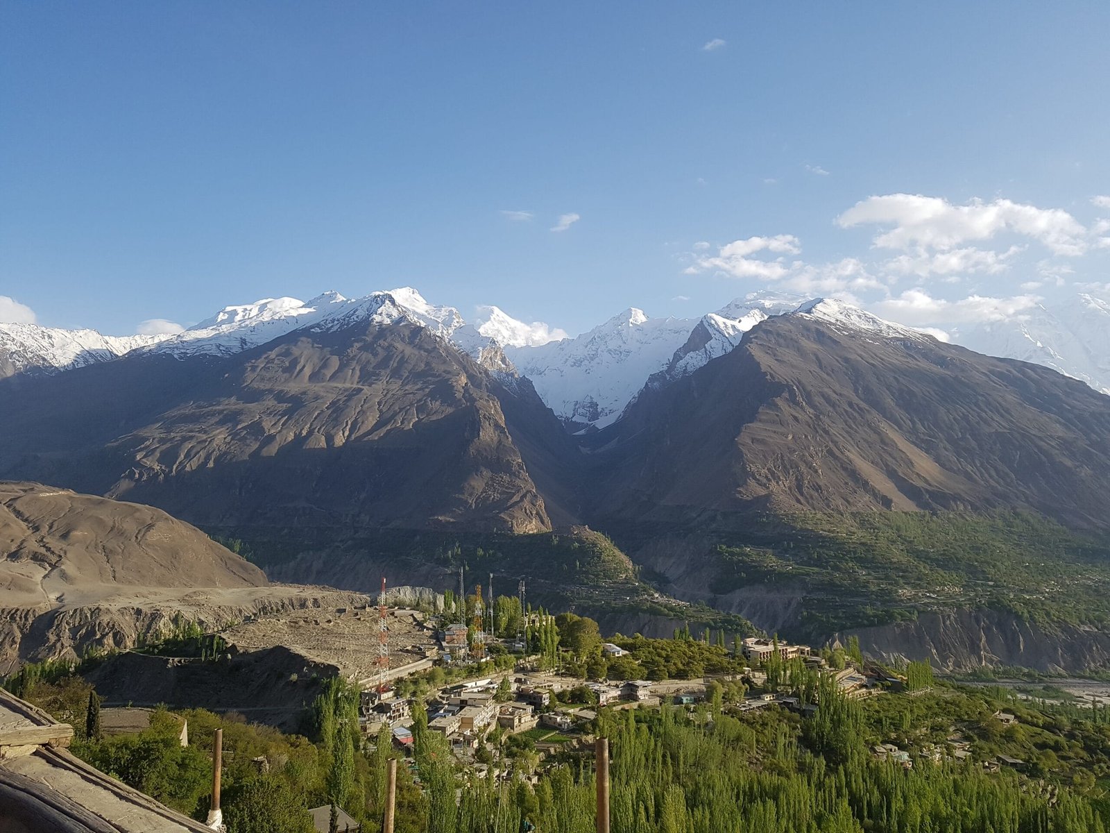
The Route: Baltit Fort to Ultar Meadow and Hon Pass
This is a short trek by Karakoram standards — no multi-day jeep transfer to a roadhead, no glacier crossing — but the gradient does the work of a much longer route. A typical 3-day plan looks like this:
- Day 1 — Karimabad (~2,500 m) to Ultar Meadow (~3,270 m). The trail starts just above Baltit Fort, following the irrigation channel into the canyon, then climbs steeply through rock and scree past shepherds’ huts. Some fast, unladen guides do it in about three hours; most groups carrying camp gear take four to six. Camp at the meadow, a green shelf used by Baltit herders as summer pasture, with the Ultar wall directly overhead.
- Day 2 — Ultar Meadow to Hon Pass (~4,200 m) and back. An early start up the ridge above the meadow to Hon Pass, for the payoff view: the Hunza valley below, and across to the Hispar peaks, Spantik, the Sosbun range and the Rakaposhi-Haramosh wall. Back down to camp at Ultar Meadow for a second night.
- Day 3 — Ultar Meadow back to Karimabad. Retrace the same steep trail down to Baltit Fort and town — easier on the lungs, harder on the knees.
It pairs naturally with other Hunza acclimatisation stops — several of our clients combine it with Naltar Valley or a look at Passu Cones and the Batura Glacier before or after, since you’re already on the Karakoram Highway.
The Giants You’re Walking Beneath
Ultar Sar has a harder history than its short trekking approach suggests. Through the 1980s and into the 1990s, around fifteen expeditions attempted the peak and failed, several with fatalities — enough that Ultar picked up a reputation (inaccurate, as it turned out; Gangkhar Puensum in Bhutan is both higher and unclimbed) as the world’s highest unclimbed independent peak. That mystique pulled in more attempts.
It was finally climbed in 1996, by two separate Japanese expeditions weeks apart. On 11 July, Akito Yamazaki and Kiyoshi Matsuoka, from the Tokai section of the Japanese Alpine Club, summited via the southwest face in alpine style, climbing at night to dodge rockfall. They were caught by storms on the way down and bivouacked for several days without food; Yamazaki died of altitude sickness after they finally reached base camp. A second team — Ken Takahashi, Masayuki Ando, Ryushi Hoshino, Wataru Saito and Nobuo Tsutsumi — summited via the south ridge on 31 July. We tell you this not for drama but because it’s honest context: this is a serious mountain, even if the meadow beneath it is a trek, not a climb. As recently as July 2018, an avalanche near 5,800 m on Ultar Sar killed Austrian climber Christian Huber; his British companions Bruce Normand and Timothy Miller were rescued alive by a Pakistan Army helicopter.
From Hon Pass and the meadow you’re looking at Ultar’s neighbours too: Bojohagur Duanasir (7,329 m) forms the west end of the same short ridge, first climbed in 1984; the huge pyramid of Shispare (7,611 m) stands to the northwest; and along the southwest ridge are Hunza Peak and the striking rock spire of Ladyfinger Peak (Bublimotin), one of the most photographed skylines in the country.
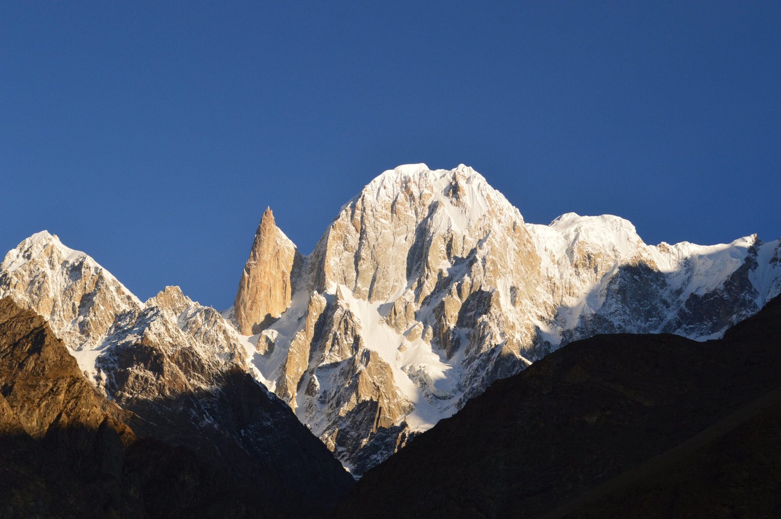
Ultar Meadow and Hon Pass against the surrounding 7,000 m+ giants of the Batura Muztagh (schematic / approximate).
When to Go
| Months | Conditions | Verdict |
|---|---|---|
| April–May | Snow can still linger above the meadow; gorge trail often wet or icy in shaded sections | Possible, but confirm conditions with your guide first |
| June | Snow clearing fast, meadow greening up, trail quiet | Good |
| July–August | Warmest, most stable weather, clearest views from Hon Pass | Best |
| September | Cooling quickly, still generally stable, fewer people on the trail | Good |
| October onward | Early snow can close Hon Pass with little warning | Risky — window closing |
How Hard Is It, Honestly
Don’t let the short distance fool you. From Karimabad to Ultar Meadow is only a few kilometres on the map, but you’re gaining roughly 800 m on a loose, narrow trail with no real switchbacks in places — it’s a stairmaster, not a stroll. The push to Hon Pass adds close to another 900 m over rougher, scrambling ground, at altitude, in a single long day. There’s no glacier travel and no rope work; this is a trek, not a climbing expedition. But it demands honest fitness — sustained steep ascent and descent, comfort on loose rock, and a body that’s had at least a couple of days to settle into Hunza’s altitude before you start climbing. Weather on the pass can turn fast, and there’s no shelter up there. If you’ve done Rakaposhi Base Camp or Diran Peak Base Camp and found the climbing manageable, you’ll be fine here. If this is your first Karakoram trek, read our acclimatisation guide before you book.
The 3-day Karimabad – Ultar Meadow – Hon Pass round trip (schematic / approximate elevations).
Safety, Plainly
The Ultar Meadow and Hon Pass trek does not go anywhere near Ultar Sar’s technical climbing terrain — but you are camping and walking directly beneath a mountain wall with a documented history of rockfall and avalanche (including a fatal avalanche as recently as 2018), and the main trekking risks are the ones that catch people out on any steep, high-altitude trail: a slip on loose ground, altitude sickness from climbing too fast, or a fast-moving storm catching you on the exposed ridge near Hon Pass with no cover. Every Karakoram Venture trek runs with a satellite phone and a real evacuation plan — not a phone number we hope works, an actual chain of contacts and, where the terrain allows, helicopter evacuation contacts for the region. Our guides are Balti and Hunzai staff who know this specific trail, not a generic itinerary handed to a driver.
Permits & Visa
The trek to Ultar Meadow and Hon Pass stays below 6,000 m and sits inside Pakistan’s designated Open Zone — foreigners can trek there without a separate trekking permit. That’s different from Ultar Sar’s actual summit: peaks above 6,500 m anywhere in Pakistan require a mountaineering permit from the Gilgit-Baltistan Council, which is a different undertaking entirely and not what this trek involves. You will still need the right Pakistan visa to be in the country and trekking at all — see our Pakistan visa guide for trekkers for the current requirements.
Getting There & What It Costs
Karimabad sits on the Karakoram Highway, reachable by flying Islamabad to Gilgit and driving up (weather-dependent, and one of the more scenic short flights anywhere), or overland the whole way along the KKH with an overnight stop — see our Karakoram Highway road trip guide if you want to make the drive itself part of the trip. From Karimabad, the trailhead is a walk from your guesthouse, not a jeep transfer.
On cost: we keep pricing personal rather than posting a number here that goes stale by the time you read it. Group size, camping gear, and whether you’re combining this with other Hunza stops all change the number. WhatsApp us your dates and we’ll quote it straight — local hands, real safety, fair price, no corners cut to hit a number.
Frequently Asked Questions
How high is Ultar Sar?
7,388 m. It’s the southeasternmost major peak of the Batura Muztagh, a subrange of the Karakoram, about 10 km northeast of Karimabad in Hunza.
How hard is the Ultar Meadow trek?
Non-technical — no rope or glacier travel — but very steep. You gain roughly 800 m from Karimabad to Ultar Meadow in a few hours, and a further climb of around 900 m to Hon Pass on rougher, scrambling ground. It demands real fitness and prior acclimatisation, even though it isn’t a climbing expedition.
Do I need a permit to trek to Ultar Meadow and Hon Pass?
No separate trekking permit is required — the route is inside Pakistan’s Open Zone, which covers trekking below 6,000 m. A mountaineering permit from the Gilgit-Baltistan Council is only needed for peaks above 6,500 m, which does not apply to this trek. You do still need a valid Pakistan visa.
When is the best time to trek to Ultar Meadow?
June to September. July and August are peak season with the most stable weather; June and September are quieter with similar conditions. Snow can linger into May and return from October, so those months need a case-by-case check.
Has anyone climbed Ultar Sar?
Yes. It was first climbed in 1996 by two separate Japanese expeditions weeks apart, after around fifteen earlier attempts through the 1980s and 1990s failed, several with fatalities. The mountain has continued to see serious incidents since, including a fatal avalanche in 2018 — it remains a serious objective even though the trek to its base is not a technical undertaking.
Plan the Ultar Meadow Trek With a Local Team
We’re not a broker booking you onto someone else’s trip — Karakoram Venture runs this out of Hunza with our own Balti and Hunzai team, a satellite phone on every trek, and a real evacuation plan. WhatsApp +92 312 9921574 or email info@karakoramventure.com with your dates and group size and we’ll quote it straight.
Sources & attribution: Wikipedia (“Ultar”); American Alpine Journal, 1997, “Ultar Sar, First Ascent”; Pakistan Ministry of Tourism trekking zone rules; operator itineraries for Ultar Meadow and Hon Pass. Photographs: “View from the Ultar Glacier trek -Hunza” by Hamzawaqas737, CC BY-SA 4.0; “Lady Finger and Ultar Peak” by Muhammad Kashif Ali, CC BY-SA 3.0; “Hunza Valley from above the Biltit Fort” by Aamir Fawad, CC BY-SA 4.0 — all via Wikimedia Commons.