The Muztagh Tower is a 7,273 m rock and ice peak in the Baltoro Muztagh, standing between the Baltoro and Sarpo Laggo glacier basins on the Pakistan–China frontier north of Skardu. For decades photographs made it look unclimbable; it was finally climbed in July 1956 by two teams within five days of each other. Today it is a serious technical mountaineering objective rather than a trekking peak — expect a season-length commitment, a mountaineering permit, and genuinely steep ground. Trekkers can still see it: the classic view is from the upper Baltoro on the walk to Concordia, best between June and September.
We run the Baltoro out of Skardu with our own Balti team — the same porters, cooks and guides year after year — and we will be straight with you about this one. Most people who search for the Muztagh Tower do not want to climb it. They want to stand on the glacier and look at it, and that is a wonderful trip we can absolutely put together. If you do want to climb it, you are looking at one of the harder 7,000 m propositions in the Karakoram, and we would rather talk you through that honestly than sell you a brochure.
- Height: 7,273 m (some references give 7,284 m — treat the figure as approximate).
- Where: Baltoro Muztagh, Karakoram, between the Baltoro and Sarpo Laggo glaciers, on the Gilgit-Baltistan–Xinjiang border.
- First ascent: 6 July 1956, British team — Hartog, Brown, Patey, McNaught-Davis — by the Northwest Ridge; a French team summited from the east five days later.
- Ascents since: very few. 1984, 1990, and a new Northeast Face route by a Russian team in 2012 that took 17 days of climbing.
- To climb it: technical alpine mountaineering, a formal mountaineering permit and royalty, and a season-length trip.
- To see it: walk the Baltoro toward Urdukas, Goro and Concordia — June to September, roughly 4,000–4,650 m camps.
Where the Muztagh Tower is, and why climbers care
“Muztagh” means icy mountain, and the Baltoro Muztagh is the sub-range that carries K2 itself. The Tower sits north of the main Baltoro trough, its glaciers draining one way toward the Baltoro Glacier and the other way north into the Sarpo Laggo system on the Chinese side. That position matters twice over: it is why the peak is so remote, and it is why the paperwork is more involved than for a peak sitting safely inland.
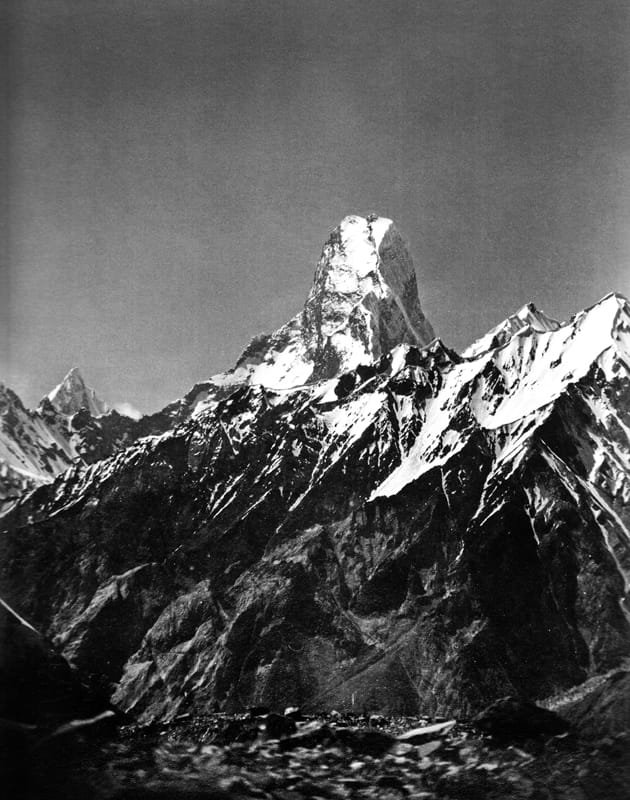
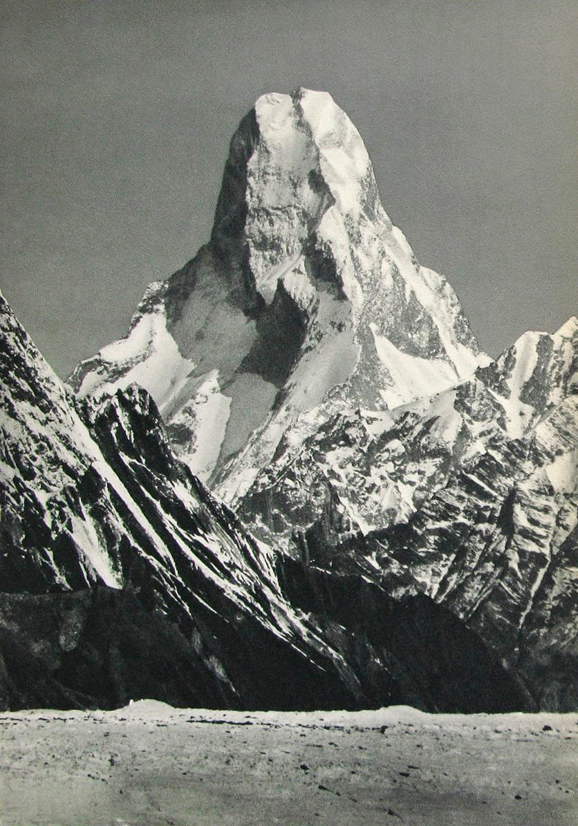
What makes it famous is not its height. At 7,273 m it is well short of the 8,611 m of K2, and it is lower than Gasherbrum IV or Masherbrum. What makes it famous is its shape. From the upper Baltoro, its twin summits stack into one another and the mountain reads as a single sheer tooth of rock — no obvious ridge, no obvious weakness, nothing that looks like a route. Vittorio Sella photographed exactly that in 1909, on the Duke of the Abruzzi’s K2 expedition. When the image was printed in a 1941 mountaineering book, the caption read “The Last Citadel”. That is the reputation the mountain has never quite shaken.
The 1956 race, and the honest punchline
Sella’s photograph did its work slowly. Nearly five decades later, in 1956, two separate expeditions arrived in the Karakoram in the same season, each intending to be first up the Tower.
- The British party — John Hartog, Joe Brown, Tom Patey and Ian McNaught-Davis — came at it from the west, up the Chagaran Glacier, and climbed the Northwest Ridge.
- They reached the summit on 6 July 1956.
- The French party — Guido Magnone, Robert Paragot, André Contamine and Paul Keller — climbed from the east and topped out five days behind them.
- Both teams found the same thing: the mountain was steep, but nowhere near as steep as Sella’s aligned-summit photograph had made it look.
We like that ending, because it is the sort of thing a mountain does to you. The Karakoram is full of peaks that look impossible from one angle and merely very hard from another — the Trango Towers play the same trick in reverse.
Ascents since have been rare, and they tell you what kind of mountain this is. A British team repeated the Northwest Ridge in 1984. Göran Kropp and Rafael Jensen made the fourth ascent in 1990. In 2008 two Slovenian alpinists, Pavle Kozjek and Dejan Miškovič, climbed the Northeast Face in a 17-hour push, turned back short of the summit in high wind, and Kozjek was killed in a fall on the descent. In 2012 three Russians — Sergei Nilov, Dmitry Golovchenko and Alexander Lange — forced a new line up the centre of the Northeast Face over 17 days. That is the full company you would be joining. It is a short list for a reason.
How it stacks up against its neighbours
The approach: how you actually get under it
There is no shortcut. Every team, climbing or trekking, walks the same first week. Fly or drive to Skardu (see how to get to Skardu), then take a 4×4 jeep up the Braldu gorge to Askole, roughly seven to nine hours of road that will make you respect our drivers. From Askole you are on foot with porters.
- Skardu (approx. 2,230 m) — permits finalised, loads weighed, team briefing.
- Skardu → Askole (approx. 3,050 m) — jeep, 7–9 hrs.
- Askole → Jhola — long, hot, dusty day above the Braldu.
- Jhola → Paiju — the last real trees and the first full sight of the Trango group.
- Paiju → Khoburtse / Urdukas (approx. 4,050 m) — onto the Baltoro ice; Urdukas is the grass ledge everyone remembers.
- Urdukas → Goro II (approx. 4,300 m) — the day the Muztagh Tower and Gasherbrum IV start commanding the view.
- Goro II → Concordia (approx. 4,650 m) — the confluence, and the standard turnaround for trekkers.
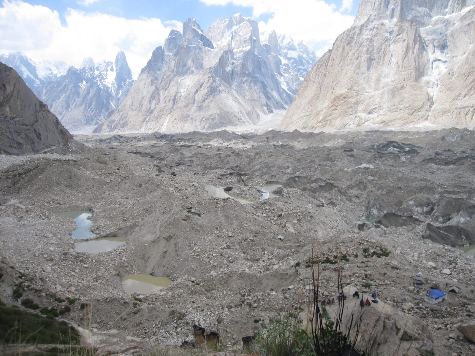
Climbing teams break north off this line toward the Tower’s own glacier basins and then settle into weeks of load-carrying and waiting. Trekkers continue to K2 Base Camp and walk out, or cross the Gondogoro La into Hushe.
When to go
| Months | Conditions | Verdict |
|---|---|---|
| April – May | Cold, deep snow high up, Braldu bridges and jeep track still being repaired. Low porter traffic. | Early season. Fine for strong expedition teams, uncomfortable for trekkers. |
| June | Track open, glacier still well frozen in the mornings, long days. | Strong. Best window for climbing teams settling in. |
| July – August | Warmest and most settled; the main Karakoram climbing season. Busy Baltoro, more meltwater and rockfall in the afternoons. | Peak season. Best odds of a summit window. |
| September | Air clears, colours turn, crowds thin, nights get sharp. | Excellent for trekking and photography. |
| October – March | Snowed in, high passes closed, no porter support. | Not viable. Don’t let anyone tell you otherwise. |
See our wider notes on the climbing season on the Baltoro if you are pinning down dates.
How hard is it, really
Two honest answers, depending on what you are asking.
If you want to climb the Muztagh Tower
This is technical alpine climbing at altitude — steep rock and mixed ground, exposed ridge work, load-carrying between camps, and long stretches of sitting in a tent waiting for weather. You should already have led on serious alpine routes and ideally have been above 7,000 m. It is not a first big mountain, and it is not a stepping stone from a trekking peak. If you are building toward this, Spantik is the sensible rung below it. Plan on a season-length trip; we will build the exact day count with you rather than publishing a number that suits our marketing.
If you want to see it
The Baltoro walk to Urdukas, Goro and Concordia is non-technical but genuinely demanding: consecutive long days, loose moraine and glacier travel, camps to 4,650 m, cold nights and no facilities. Fit hill walkers who train for it do it every summer. Read our acclimatisation guide before you book, and take the altitude schedule seriously.
The real risks here are altitude illness, rockfall and serac collapse on the Baltoro, crevassed glacier travel, and the simple fact that you are days from a road with no mobile signal. On the climbing side, add objective danger on steep mixed ground — people have died on this mountain, most recently on the Northeast Face in 2008. We carry a satellite phone on every expedition, work with established helicopter-rescue contacts for the Baltoro region, and require proof of insurance that covers high-altitude evacuation before departure. We check your cover ourselves — see our notes on insurance for high-altitude trekking in Pakistan. If an operator cannot tell you their evacuation plan in one sentence, they don’t have one.
Trekking the Baltoro to Concordia needs a trekking permit and Central Karakoram National Park fees, and you travel with a registered guide. Climbing the Muztagh Tower is a different category entirely: peaks above 6,500 m require a formal mountaineering permit and royalty arranged through the Pakistani authorities, with a liaison officer assigned to the team. Because the peak sits on the frontier with China, expect extra scrutiny and longer lead times — start the process months ahead, not weeks. Separately, you need a Trekking & Mountaineering visa, not a plain tourist visa; our Pakistan visa guide for trekkers walks through it. We handle the permit paperwork; you handle the visa, and we tell you exactly what to write on it.
Getting there, and what it costs
From Islamabad you either fly to Skardu — fast, spectacular, and genuinely weather-dependent, so build in buffer days — or drive the Karakoram Highway, which is longer and one of the great road journeys anywhere. We usually recommend flying in and keeping a spare day at each end.
On price: we keep pricing personal rather than posting a number that goes stale the moment permit fees, porter rates or fuel move. Tell us your dates, your group size and whether you want the trek or the climb, and we will send you a costed itinerary you can actually compare against other quotes. What we will promise is a fair price with no corners cut — not on guides, not on food, not on the sat phone. Local hands, real safety, fair price.
Frequently asked questions
How high is the Muztagh Tower?
It is generally given as 7,273 m, though some references list 7,284 m. Treat the figure as approximate — surveys of Karakoram peaks vary. Either way it is a 7,000 m peak, not an 8,000er.
Who climbed the Muztagh Tower first?
A British team of John Hartog, Joe Brown, Tom Patey and Ian McNaught-Davis reached the summit by the Northwest Ridge on 6 July 1956, approaching from the Chagaran Glacier to the west. A French team of Guido Magnone, Robert Paragot, André Contamine and Paul Keller summited from the east five days later.
Why was it thought to be unclimbable?
Because of one photograph. Vittorio Sella shot the Tower from the upper Baltoro in 1909 on the Duke of the Abruzzi’s K2 expedition, from an angle where its twin summits align into a single sheer tooth. Printed in 1941 as “The Last Citadel”, it fixed the mountain’s impossible reputation. Both 1956 teams found the ground less steep than the picture suggested.
Can I trek to see the Muztagh Tower without climbing it?
Yes, and most people should. The classic views come from the Baltoro Glacier between Urdukas, Goro II and Concordia, on the standard K2 Base Camp trek out of Askole. It is a hard walk but a non-technical one, best from June to September.
Do I need a special permit and visa?
Yes to both. The Baltoro trek needs a trekking permit and national park fees; climbing any peak above 6,500 m needs a mountaineering permit, royalty and a liaison officer, and this peak’s frontier position means longer lead times. You also need Pakistan’s Trekking & Mountaineering visa rather than a standard tourist visa.
Whether you want to walk the Baltoro and photograph the Tower, or you are seriously planning to climb it, message us and you will be talking to a local Balti team in Skardu — not a broker in another city reselling your trip.
WhatsApp: +92 312 9921574
Email: info@karakoramventure.com
Sources & attribution: elevation, first-ascent and subsequent-ascent details from Wikipedia’s Muztagh Tower article and the American Alpine Journal / Alpine Journal accounts it cites (Hartog 1956–57; Duff 1985; AAC Publications). Images: Vittorio Sella (Public domain) and Shikari7 (CC BY-SA 3.0), via Wikimedia Commons. Altitudes are approximate.