



Khurdopin Pass is a glacier pass of roughly 5,790 m in the Hispar Muztagh, and crossing it links Shimshal in upper Hunza with Snow Lake, the Biafo Glacier and Askole in Baltistan. Done end to end it is a point-to-point traverse of about 20 to 22 days from Islamabad, with roughly 15 of those days on foot and almost all of them on ice. The window is short: late June to early September, and even then the pass does not always give. This is one of the hardest walking routes in Pakistan, not because of technical climbing but because the Khurdopin Glacier is heavily crevassed, actively surging, and there is no road, no village and no easy way out once you commit.
We run our trips out of Skardu with our own Balti team, and we will be straight with you about this one: Khurdopin is not a trek we sell to anybody who asks. The far side of the pass is Shimshali ground, and the Shimshali high-altitude porters who know that glacier are the reason a crossing works at all, so we plan it with them, not around them. If you have never walked a big crevassed glacier roped up, start somewhere else. If you have, this is as deep into the Karakoram as a trekker can get.
Key takeaways
- Pass altitude: approximately 5,790 m (sources vary slightly; treat it as approximate).
- Route: Shimshal (about 3,100 m) → Khurdopin Glacier → Khurdopin Pass → Snow Lake (about 4,877 m) → Biafo Glacier → Askole.
- Length: about 20–22 days total, roughly 15 days walking, point to point.
- Season: late June to early September. Outside that, the glacier and the river crossings shut the route.
- Difficulty: very hard. Roped glacier travel, crevasse rescue skills, full camping self-sufficiency, no bail-out from the middle.
- Permits: an open-zone trek, so no mountaineering permit — but you still need the correct Pakistan visa and a registered local operator.
Where Khurdopin Pass is, and why so few people cross it
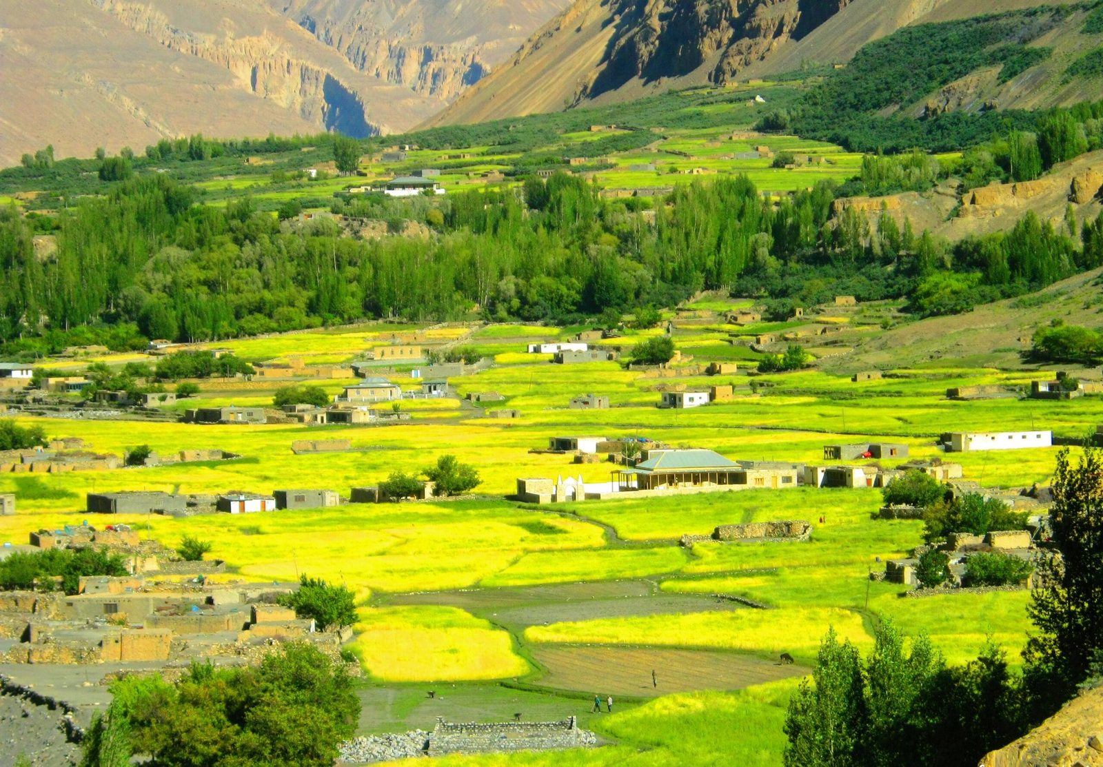
Shimshal sits at about 3,100 m at the end of a jeep road that only reached the village in 2003. Before that it was a three-day walk in. The road runs roughly 56 km up from Passu on the Karakoram Highway, and it is still one of the more committing drives in the country. From Shimshal, the valley system runs south and east into the Hispar Muztagh — the range that holds Distaghil Sar (7,885 m), Khunyang Chhish (7,852 m) and Kanjut Sar (7,760 m).
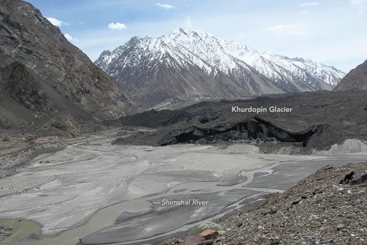
Khurdopin is not a trekking pass in the way Shimshal Pass is. Eric Shipton reached it from the south with Scott Russell in 1939 and turned back rather than descend the far side; by the Himalayan Journal’s account it was decades before two Canadians, with Shimshali porters, made the first full crossing down the Khurdopin Glacier. Successful crossings remain rare, and in some seasons conditions on the glacier stop teams altogether.
The reason is the glacier itself. Khurdopin surges — it periodically accelerates far beyond its normal pace. After years of near-stillness it began advancing in October 2016 and reached roughly 20 metres a day by spring 2017, one of the fastest rates recorded in the region. The snout shoved into the Shimshal River, dammed it, and thickened by as much as 80 m. That is the surface you are asked to walk on: broken, moving, and re-drawn between seasons.
The route, step by step
This is the shape of the traverse as we plan it. Day counts move with conditions — on Khurdopin they move a lot — so treat this as the frame, not a timetable.
- Islamabad to Gilgit or Hunza. Fly or drive up the Karakoram Highway. Build in a buffer day for weather.
- Hunza to Shimshal (about 3,100 m). Jeep from Passu up the Shimshal road. Rest day here to meet the porter team.
- Acclimatisation days above Shimshal. Walk high, sleep low, on the pastures above the village. Do not skip these.
- Into the Khurdopin valley. Follow the Shimshal River east, then turn up onto the glacier system. River crossings are done early morning while the melt is low.
- Up the Khurdopin Glacier. Several days of moraine, then ice. Roped travel begins here. Camps are on the glacier or on lateral moraine benches.
- Khurdopin Pass (about 5,790 m). A pre-dawn start on hard snow, roped, with the crevasse-rescue kit accessible. The crossing is a full day, and it is the day the whole trip is planned around.
- Down to Snow Lake (about 4,877 m). The descent lands you in the great white basin at the head of the Biafo, about 16 km across.
- Snow Lake to Askole down the Biafo. Roughly 63 km of glacier, still roped in the upper section, then moraine, then the Braldu valley and the jeep road at Askole.
- Askole to Skardu. Seven to nine hours by 4×4, and the first hot shower in three weeks.
Schematic and approximate. Intermediate camp altitudes vary year to year with glacier conditions.
The giants you walk beneath
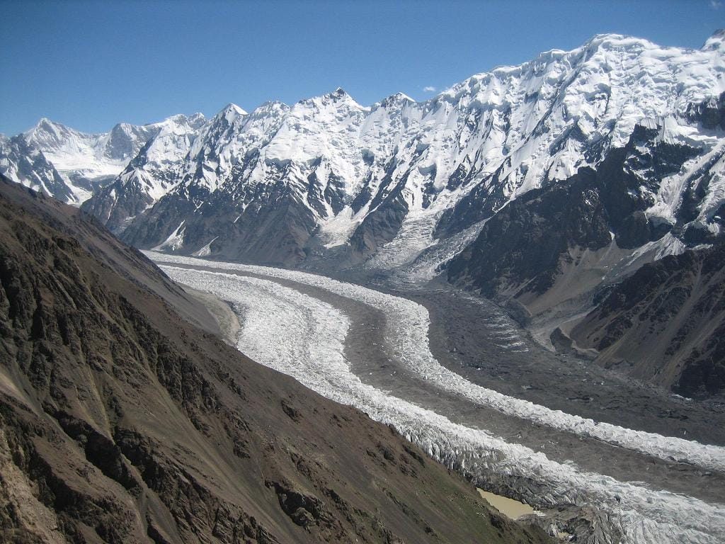
The Hispar Muztagh is the biggest concentration of Karakoram height away from the Baltoro. You spend a fortnight underneath 7,000ers that most trekkers have never heard of, and on the Khurdopin Glacier itself the northeast face of Kanjut Sar stands over the ice.
Schematic. Peak heights from standard references; the pass figure is approximate.
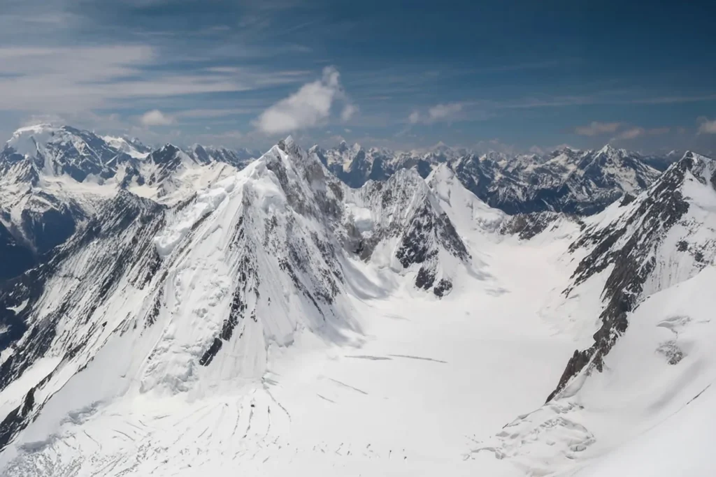
On the far side, Snow Lake is the other reason people come. Lukpe Lawo sits at about 4,877 m and is roughly 16 km wide, the shared catchment of the Biafo and Hispar glaciers — together close to 100 km of continuous ice, among the longest outside the polar regions. If you would rather reach it the standard way, that is the Biafo–Hispar La traverse, which is long and serious but nothing like Khurdopin.
When to go
| Months | Conditions | Verdict |
|---|---|---|
| April–May | Deep snow high up, rivers rising, pass not established | No |
| Late June | Snow bridges still reasonably firm, rivers manageable early morning | Possible — early-season teams sometimes get the best ice |
| July–August | Warmest, longest days; heavy melt, weaker snow bridges, high river flow | The main window — but crevasse risk peaks here |
| Early September | Cooling, lower melt, firmer nights, shorter days | Good if the season has been stable |
| Mid-September onward | Cold, storms, snow closing the pass | No |
More broadly on timing across the region, see our guide to the best time to visit Gilgit-Baltistan.
How hard it is — honestly
Fitness. You need to be able to walk seven to nine hours a day, on uneven ice and moraine, for two weeks, carrying a daypack, and then do the biggest day of the trip at 5,790 m. Not a two-month training project. Come already fit.
Skills. This is the line that rules most people out. You must be comfortable roped up on a glacier, moving in a team, and you and your group should have practised crevasse rescue. Khurdopin is not a place to learn it.
Altitude. The pass is high and the approach is sustained. Proper acclimatisation is built into the plan, and it is not negotiable — read our acclimatisation guide before you book anything.
Commitment. From the middle of the traverse there is no road out in either direction. That single fact should shape how you think about this trek, your fitness, and your insurance.
Gear. Full glacier kit on top of a normal Karakoram load: harness, crampons, axe, prusiks, helmet. Our Karakoram packing list is the baseline; we send a Khurdopin-specific addition on top of it.
Safety: the real risk here is the glacier, not the altitude
Khurdopin is crevassed, it surges, and its surface is rewritten between seasons. Hidden crevasses and unstable seracs are the hazard that has turned teams around and worse. We carry a satellite phone on every departure, we work to established helicopter-rescue contacts for the region, and we plan the pass day around a hard turnaround time that we will use. Helicopter evacuation in Pakistan needs an insurance guarantee in place before a machine flies — check our notes on high-altitude trekking insurance and make sure yours covers 6,000 m and helicopter rescue. If your operator will not tell you their evacuation plan in writing, walk away from them.
Permits and access
Khurdopin is a pass crossing, not a summit, and it lies in open zone — so no mountaineering permit or peak royalty applies. You do need the correct Pakistan visa: trekking parties should apply on the trekking and mountaineering category rather than a plain tourist visa, and you need a registered local operator named on the application. Our Pakistan visa guide for trekkers walks through it. Requirements do change — we confirm the current position for your dates before you apply.
Getting there, and what it costs
Most teams fly Islamabad to Gilgit or Skardu and drive from there, or take the Karakoram Highway the whole way and enjoy it. Our guide to getting to Skardu by air and road covers both, and the flight-weather buffer you should budget for either way. Because Khurdopin is point to point, you start in Hunza and finish in Baltistan, so plan your onward travel from Skardu, not from where you began.
On price: we keep pricing personal rather than posting a number that goes stale. A Khurdopin crossing depends on team size, how many high-altitude porters the glacier conditions demand that year, and how many buffer days you want to carry — and those things move the figure a long way. Tell us your dates and group size and we will send you a full breakdown. What we will promise is a fair price with no corners cut on guides, food, or the safety kit.
Frequently asked questions
How high is Khurdopin Pass?
Approximately 5,790 m. Published figures vary slightly between sources, so treat it as an approximate altitude rather than a surveyed one.
How many days does the Khurdopin Pass trek take?
Plan about 20 to 22 days from Islamabad and back to Skardu, of which roughly 15 are walking days. Weather and glacier conditions regularly add days, so build in buffers.
Do I need mountaineering experience?
You need glacier experience. There is no technical climbing, but you will be roped up for days on a heavily crevassed and actively surging glacier, and your team should have practised crevasse rescue before arriving.
Is a special permit required for Khurdopin Pass?
It is an open-zone trek, so no mountaineering permit or peak fee is needed. You do need the correct Pakistan visa — the trekking and mountaineering category — with a registered local operator named on the application.
Can Khurdopin be combined with Snow Lake and the Biafo?
Yes — the classic line is exactly that. You cross the pass, descend into Snow Lake, then walk out down the Biafo Glacier to Askole, which is why the trek finishes in Baltistan rather than back in Hunza.
Talk to the team that actually walks it
Khurdopin only works with the right people on the rope. We plan it from Skardu with our own Balti staff and the Shimshali high-altitude porters who know that glacier — a local team, not a broker passing you to somebody else. Sat phone in camp, a real evacuation plan, fair price.
WhatsApp: +92 312 9921574 · Email: info@karakoramventure.com — send us your dates and group size and we will tell you honestly whether the crossing is right for you.
Sources & attribution: altitudes and route facts cross-checked against Wikipedia (Shimshal, Snow Lake, Biafo Glacier), the Himalayan Journal, and NASA Earth Observatory reporting on the 2016–17 Khurdopin surge; pass altitude is approximate. Images: Loïc Perrin (CC BY-SA 3.0); Waheed Anwar and NASA Earth Observatory (Public domain); Shimshalee (CC BY-SA 3.0) — all via Wikimedia Commons.

