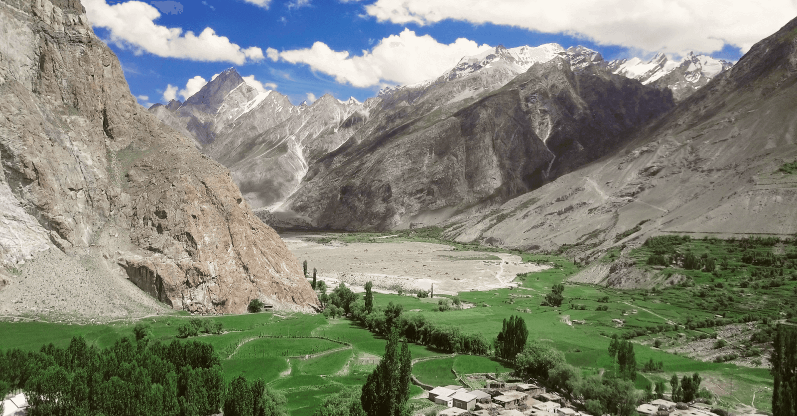
Askole sits at roughly 3,040 m in the Braldu Valley of Shigar District, Gilgit-Baltistan, and it is the last permanent village before the high Karakoram begins. Every trek and expedition on the Baltoro side — K2, Broad Peak, the Gasherbrums, Concordia, Trango, Snow Lake — starts walking from here. Getting to it means a 6–9 hour jeep drive of roughly 85–100 km from Skardu, most of it unpaved. The road is open from about April to October; the trekking season that matters is June to September.
We run our Baltoro trips out of Skardu with our own Balti team, and we’ll be straight with you about Askole: it is not a destination, it is a threshold. There is no hotel, no hospital, no reliable signal. What there is, is a cluster of stone and mud houses, apricot and poplar trees, terraced barley fields, and a few hundred people who have been feeding and carrying for expeditions since the first Europeans came up this valley in the 1890s. Many of our porters and guides are from Askole and the villages just below it. If you book a Baltoro trek with us, you are hiring the people who live at the end of this road.
Key Takeaways
- Altitude: approximately 3,040 m (9,970 ft); some operators quote 3,015–3,050 m, so treat it as approximate.
- Location: right bank of the Braldu River, Braldo union council, Shigar District, Gilgit-Baltistan.
- Getting there: roughly 85–100 km from Skardu, 6–9 hours by 4×4 jeep; around 32 km paved as far as Shigar, unpaved after that.
- Role: trailhead for K2 Base Camp, Concordia, Gondogoro La, Trango Towers, Biafo–Hispar (Snow Lake), Skoro La and the Panmah glaciers.
- Season: jeep road usable roughly April–October; peak trekking June–September.
- Facilities: campground, a couple of basic shops, no hospital, no dependable mobile network. This is your last resupply point.
Where Askole is, and why it matters
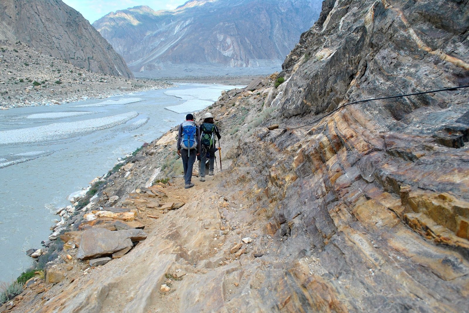
From Skardu the Indus is left behind at Shigar, and the road turns up the Braldu — a grey, silt-heavy river that drains the Baltoro and Biafo glaciers. Follow it far enough and the valley narrows into a gorge with almost nowhere flat. Askole is the last place in that gorge where there is enough soil, water and sun to farm. Above it there are summer grazing settlements and glacier snouts, and then nothing but ice for a hundred kilometres.
That geography is why Askole carries more weight than its size suggests. It is the gateway to four of the world’s fourteen eight-thousanders — K2, Broad Peak, Gasherbrum I and Gasherbrum II — and the staging point for most of the Karakoram’s famous rock objectives. When you read that a K2 expedition “left for base camp,” Askole is where the jeeps stopped and the walking started.
Local tradition holds that the village was founded in the sixteenth century by three brothers who came over from Yarkand, in what is now Xinjiang. We pass that on as the story the village tells, not as documented history. What is documented is the stream of expeditions: Martin Conway’s 1892 Karakoram journey came down the Biafo into the Braldu and on to Askole, and the Duke of the Abruzzi’s 1909 K2 expedition went up the Shigar and Braldu by the same line. More than a century later, trekkers still walk out of the same village on the same path.
The road from Skardu, step by step
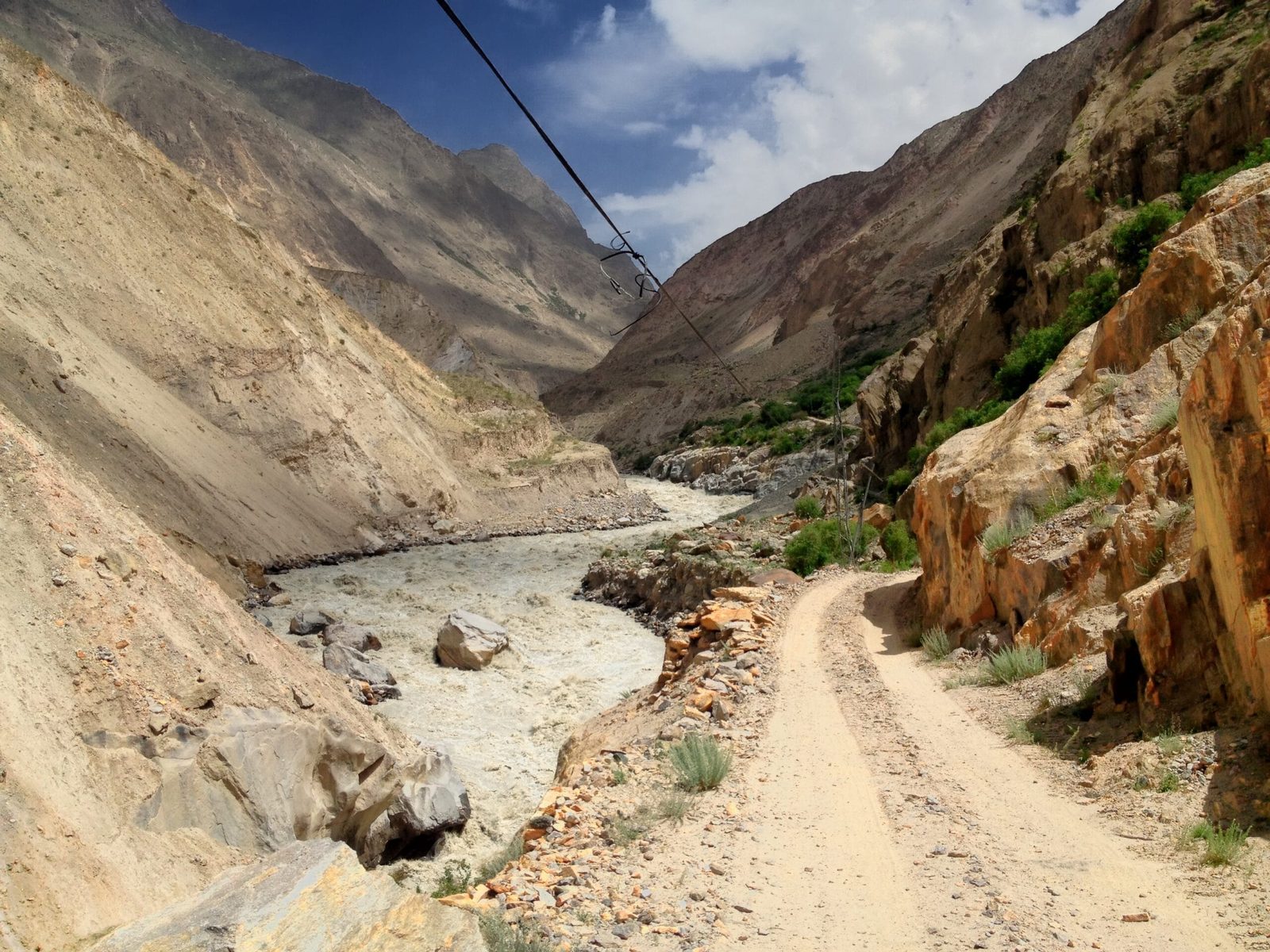
This drive has a reputation, and it earns it. Reckon on 6–9 hours and build a buffer day into any itinerary that depends on it. Distance figures vary between about 85 km and 120 km depending on where you start measuring, which tells you something about how the road is mapped.
- Skardu to Shigar (approx. 32 km, 1–1.5 hrs). Paved, straightforward, over the Shigar bridge and into the valley. Worth a stop at Shigar Fort if you have a spare half-day before the trek.
- Shigar to Dassu (approx. 2 hrs). The tarmac ends and the jeep track begins. The valley closes in and the Braldu drops away below the road.
- Dassu to Apaligon and Chongo. The exposed section. Single-lane cuts in the cliff, overhanging rock, drops straight to the river. Drivers reverse for each other at passing bays. Nobody enjoys this part; everyone remembers it.
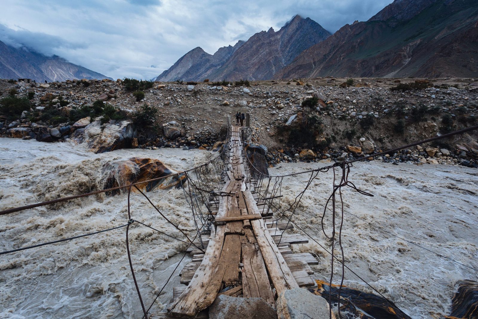
- Chongo to Askole (approx. 2–3 hrs). Side-streams cross the track, and in hot weather or after rain they run high enough to stop a jeep until the flow drops. The last climb opens into Askole’s fields.
- Askole (approx. 3,040 m). Camp, weigh and distribute loads, meet the porter team, final kit check. Most itineraries sleep one night here before walking.
Flights into Skardu from Islamabad are quick but weather-dependent, and the overland alternative is long. We cover both options honestly in our guide to getting to Skardu — read it before you book non-refundable international flights.
What starts in Askole
Askole is the trailhead for more serious Karakoram objectives than anywhere else in Pakistan. Walk east and you are on the Baltoro; walk north and you are on the Biafo.
- Baltoro / Concordia / K2 Base Camp. The classic. Askole → Jhola → Paiju → onto the Baltoro Glacier → Urdukas → Concordia → K2 Base Camp.
- Gondogoro La. The same approach, exiting over a high pass into Hushe instead of walking back out — see our Gondogoro La guide.
- Trango Towers. Three to four days in, for the big-wall basecamp under Nameless Tower.
- Biafo–Hispar and Snow Lake. North from Korophon onto the Biafo for the Snow Lake traverse — remote, committing, and one of the longest glacier crossings outside the poles.
- Skoro La. The old foot route back over the ridge to Shigar, covered in our Skoro La guide.
The first stages out of the village run roughly: Askole (approx. 3,040 m) → Korophon (approx. 3,100 m) → Jhola (approx. 3,200 m) → Paiju (approx. 3,400 m), where most parties take a rest day before stepping onto the glacier. The altitude gain in those first days is gentle; what gets people is the heat, the dust and the distance, not the thin air.
When to go
The Braldu road and the Baltoro have a short, well-defined window. Outside it you are either fighting snow and rockfall or waiting for a bulldozer.
| Months | Conditions | Verdict |
|---|---|---|
| Nov–Mar | Winter. Road frequently blocked, village snowbound, no trekking support in place. | Closed in practice. |
| April–May | Road usually reopens. Cold nights, high rockfall risk, snow still low on the trails. | Possible for the road, early for the Baltoro. |
| June | Season opens. Clear spells, glaciers in good shape, rivers rising with the melt. | Strong — our preferred early window. |
| July–August | Warmest and busiest. Peak expedition traffic, but highest side-stream flows and most washout delays. | Best weather, least solitude. |
| September | Cooling, clearer air, quieter trails, lower rivers. | Our favourite month on the Baltoro. |
| October | Cold, short days, support thinning out, snow arriving on the passes. | Late — only with a short, flexible plan. |
How hard is it to get to Askole?
Reaching the village itself takes no fitness at all — you sit in a jeep. The honest difficulty is tolerance: eight hours on a track with exposed drops and no barrier, dust, heat, and the knowledge that if the jeep has a problem there is nobody to call quickly. People with a serious fear of heights find this drive harder than any day of the trek that follows.
What begins at Askole is a different matter. The Baltoro trek is long days on moraine and glacier ice at 3,000–5,150 m, carrying nothing but a daypack while porters move the loads. There is no technical climbing on the standard K2 Base Camp route, but there is a lot of unstable rock underfoot, real altitude, and no quick way out. Train for consecutive long days rather than for one hard one, and read our acclimatisation guide and Karakoram packing list before you commit.
The real risk, and what we do about it
The Braldu gorge road is the most dangerous part of a Baltoro trip, and we will not pretend otherwise. Rockfall, landslides, washed-out culverts and single-lane exposure are normal, not exceptional. Above Askole the hazards change to altitude illness, crevassed glacier travel and sudden weather. There is no hospital in the valley and no dependable mobile network.
So we carry a satellite phone on every expedition, we keep established helicopter-rescue contacts for the Baltoro region, and we require proof of insurance that covers helicopter evacuation above 5,000 m. We drive these roads in daylight only, with our own vetted drivers, and we will sit out a day rather than push a jeep through a stream that is running too high. Local hands, real safety, fair price — the safety part is the one we spend money on.
Permits and visa
Askole and the standard Baltoro trek to Concordia and K2 Base Camp lie in an open zone, so trekking there does not require a restricted-zone permit — though your party is registered and you pass through checkposts in the valley. Climbing any peak, including crossing into mountaineering territory, needs a separate mountaineering permit and a liaison officer, and some neighbouring areas are restricted.
Separately, you need the right visa. Pakistan issues a Trekking & Mountaineering visa that is distinct from a standard tourist visa, and our visa, permits and NOC guide walks through what to apply for and in what order. Start it early; it is the part of the trip people leave too late.
Getting there with us, and what it costs
In practice there is no public transport to Askole. Cargo jeeps run up the valley irregularly, and hitching one is a lottery you do not want to play with a flight home booked. Every serious party charters 4×4s in Skardu, and the number of jeeps depends on the size of your group and the weight of your expedition load.
We keep pricing personal rather than posting a number that goes stale the moment fuel or porter rates move. Tell us your dates, group size and objective and we will send a full costing: jeeps and drivers, porter wages at the proper rate, permits, food, guide, and the safety kit that budget operators quietly leave out. Fair price, no corners cut — and you will see exactly what each line is for.
Frequently asked questions
How high is Askole?
Approximately 3,040 m (9,970 ft). You will also see 3,015 m and 3,050 m quoted; the spread is small enough that it makes no practical difference to your acclimatisation plan.
How long does the drive from Skardu to Askole take?
Usually 6–9 hours for roughly 85–100 km. Around 32 km is paved as far as Shigar; the rest is jeep track. Delays from single-lane sections, high side-streams or small washouts are common, so build a buffer day into your itinerary.
Can I stay in a hotel in Askole?
No. There is a campground, a couple of basic shops and some very simple rooms, but no hotel, no restaurant and no hospital. Trekking groups camp. Treat Askole as your final resupply and nothing more.
Is there mobile signal or internet in Askole?
Not dependably. Coverage in the upper Braldu valley is patchy at best and there is none on the Baltoro, which is why we carry a satellite phone. Send your last messages from Skardu and give your family a realistic date for the next contact.
Which treks start from Askole?
K2 Base Camp and Concordia via the Baltoro Glacier, the Gondogoro La crossing into Hushe, Trango Towers basecamp, the Biafo–Hispar Snow Lake traverse, Skoro La over to Shigar, and expedition approaches to K2, Broad Peak and the Gasherbrums.
Planning a Baltoro trek or expedition out of Askole?
Local Balti team, not a broker — many of our guides and porters are from this valley. Sat phone in camp, a real evacuation plan, fair pricing.
WhatsApp +92 312 9921574 or email info@karakoramventure.com
Sources & attribution: altitude, location and population figures from Wikipedia’s Askole and Braldu River entries; expedition history from published accounts of the 1892 Conway and 1909 Duke of the Abruzzi Karakoram expeditions; road distances and campsite altitudes cross-checked against multiple operator and Wikivoyage itineraries and treated as approximate. Images: Askole aerial by Arsalan Majid (CC BY-SA 4.0); Braldu River from the Shigar–Askole road by Zacharie Grossen (CC BY-SA 4.0); Braldu side-stream bridge by Muhammadbinmasood (CC BY-SA 4.0); Jhola–Askole trail by Aapkamajid (CC BY-SA 3.0) — all via Wikimedia Commons.