Six peaks above 7,000 m, run from Skardu by our own Balti team. Permits, oxygen, insured high-altitude porters and a turnaround policy that is actually enforced.
Six peaks above 7,000 m, run from Skardu by our own Balti team. Permits, oxygen, insured high-altitude porters and a turnaround policy that is actually enforced.
Nanga Parbat and Fairy Meadows: the Killer Mountain, the Meadow Below It and Both Sides of the Wall
HomeNanga Parbat and Fairy Meadows: the Killer Mountain, the Meadow Below It and Both Sides of the Wall
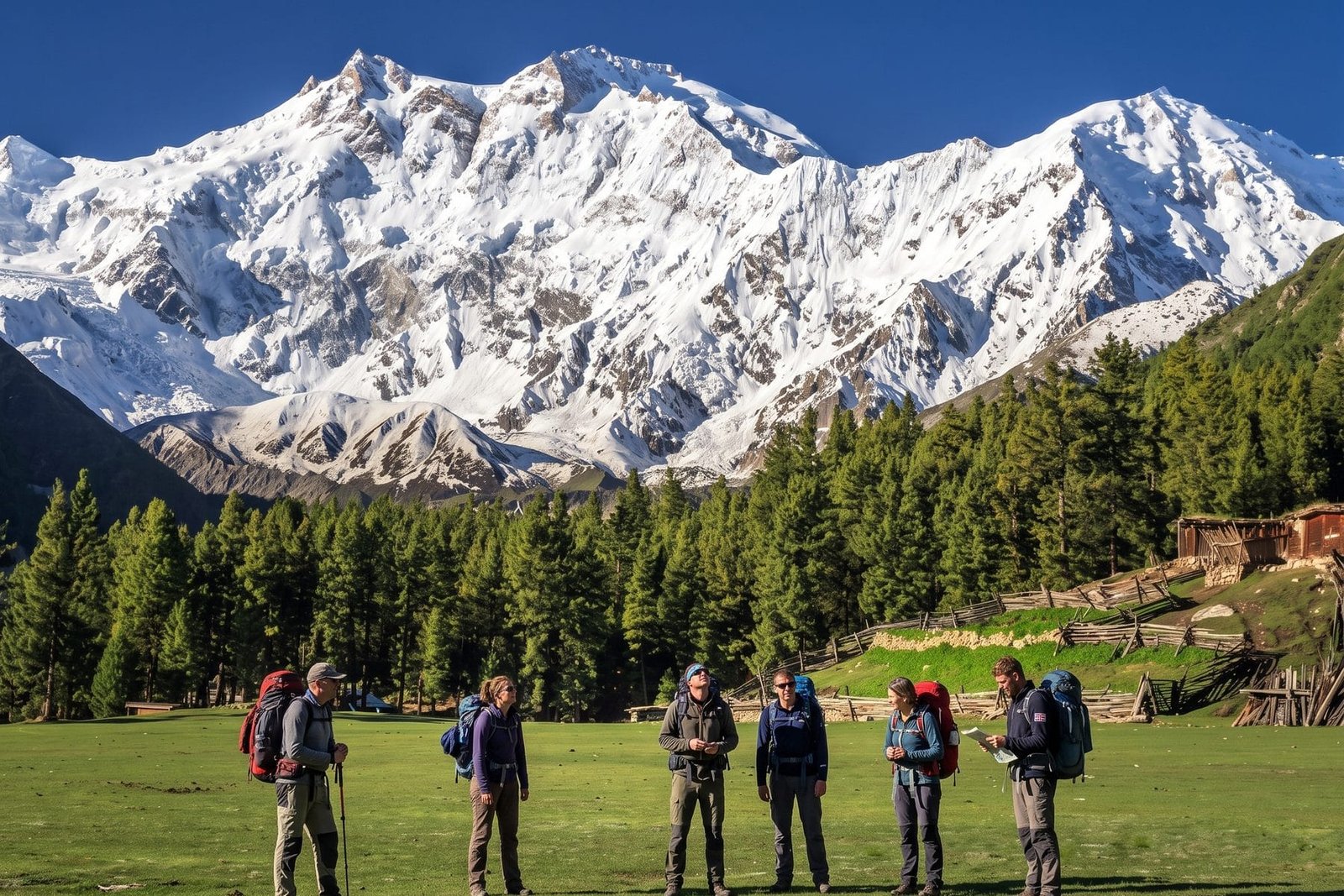
Nanga Parbat is 8,126 metres, the ninth-highest mountain on earth, and it stands completely alone. Where K2 and the Gasherbrums crowd together at the head of the Baltoro, Nanga Parbat rises by itself. It sits at the western end of the Himalaya, west of the Indus and north of Astore. That isolation gives it everything: the weather and the reputation. Moreover, a walker with ordinary fitness can stand under an 8,000-metre wall after one day’s drive and one afternoon’s walk. In short, this page is the map of everything we have written about the mountain. It also covers the meadow below it, and the two very different sides of it.
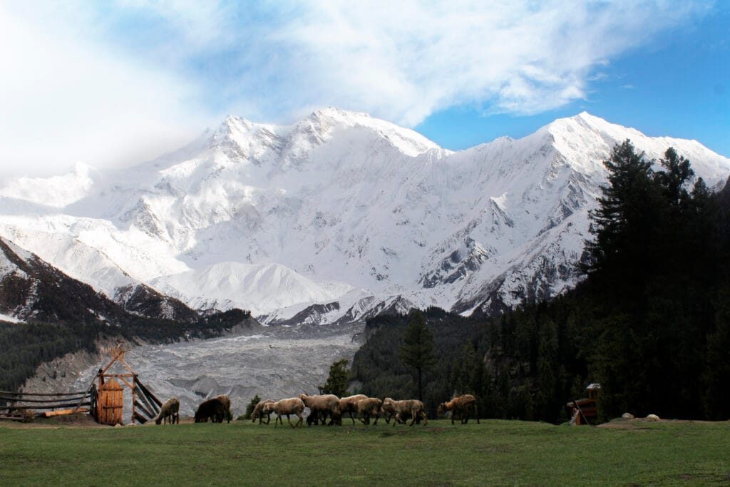
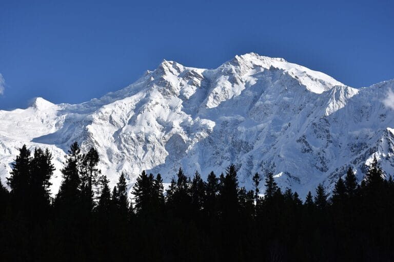
Nanga Parbat from Fairy Meadows. Photo: Zaki Khan89, CC BY-SA 4.0, via Wikimedia Commons.
Nanga Parbat at a glance
The mountain
8,126 m. Ninth-highest in the world, second in Pakistan after K2, the westernmost 8,000er and the western anchor of the Himalaya
Where
Diamer District, Gilgit-Baltistan, west of the Indus and north of the Astore Valley, straight off the Karakoram Highway
The name
Sanskrit for “naked mountain”. The Killer Mountain nickname was earned in the early expedition decades, before the summit was first reached in 1953
Three faces
Raikot or Rakhiot, the north side above Fairy Meadows; Diamir, the west side carrying the normal climbing route; Rupal, the south side and about 4,600 m of continuous wall
Fairy Meadows
3,300 m, known locally as Joot. Declared a national park in 1995 and part of Nanga Parbat National Park since 2021
How close you can walk
Beyal Camp 3,500 m, the viewpoint about 3,667 m, and the Fairy Meadows-side base camp at roughly 3,967 m
First ascent
3 July 1953, Hermann Buhl, alone and without oxygen after his partners turned back, back in camp about 41 hours later. The only solo first ascent of an 8,000-metre peak
Longest ridge anywhere
The Mazeno Ridge runs 13 km from pass to col, the longest ridge on any 8,000er, with eight summits above 6,800 m
Season
May to October for Fairy Meadows; June to September for the Rupal side and the Mazeno Pass; June to August for climbing
Fitness needed
None for the meadow, moderate for base camp, serious for the Mazeno crossing, full expedition experience for the summit
Where Nanga Parbat is, and why it stands alone
The mountain sits at the far western end of the Himalaya, not in the Karakoram. Therefore it looks so different from K2 and its neighbours. Nothing shelters it. The summit rises more than 4,000 metres above the valleys on every side. Moreover, the weather arrives unobstructed. As a result, it is a peak that has always been harder than its height suggests. The expedition guide explains how that geography shapes the climbing. In addition, the Karakoram Range guide sets out where one range stops and the other begins.
Fairy Meadows: the easiest 8,000-metre view in the world
Fairy Meadows is a grass shelf at 3,300 metres in the Rakhiot valley. It is fed by the glacier that spills off the north face. Indeed, it is the easiest place on earth to stand close to an eight-thousander. There is no permit, no glacier and no technical climbing. However, what you see first is not the true top. That is the North Peak at 7,816 metres. Meanwhile, the real 8,126-metre summit hides behind it and the Silver Saddle. Walk on to Beyal Camp at 3,500 metres, and the view opens to nearly 180 degrees. Our Fairy Meadows guide is the long version. Finally, the route from Islamabad covers the drive, the jeep track and the costs.
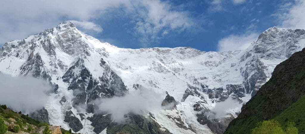
The Rupal Face. Photo: Ahmad Omer, CC BY-SA 4.0, via Wikimedia Commons.
The Rupal Face and the Astore side
Cross to the south and the mountain changes character completely. Above the Rupal Valley, the Rupal Face rises about 4,600 metres in one continuous sweep. You reach it through Astore and the village of Tarashing. Indeed, it is widely described as the highest mountain face on earth. Meanwhile, the same valley holds the gentler Rama Lake and Astore trip. There a jeep track and a short walk put you under the eastern side at about 3,300 metres. Finally, the Deosai Jeep Safari crosses the plateau from Skardu and comes out on exactly this side.
Walking right around the mountain
There is one trek that circles Nanga Parbat, and it is one of the finest walks in Pakistan. The Mazeno Pass trek starts at Tarashing at about 2,900 metres and climbs the Rupal Valley. Then it crosses a saddle of roughly 5,358 metres beneath the Mazeno Ridge. Finally it drops down the Diamir side and finishes at Fairy Meadows. It is 140 to 150 kilometres and about 14 days of walking. Moreover, several nights are above 4,000 metres. Nothing on it is technical. However, it is still committing country, with no road near the middle of the route.
Climbing Nanga Parbat
Almost every commercial attempt now uses the Kinshofer route on the Diamir face, first climbed in 1962. Specifically, teams work through four high camps between a base camp at roughly 4,200 metres and the summit. They move up at about 5,000, 6,200, 6,900 and around 7,400 metres. The history is heavy. For example, Mummery tried in 1895, and roughly thirty people died before 1953. Many of them died in the 1934 German disaster. Moreover, the first winter ascent only came in 2016. This is not a first eight-thousander. Therefore we say so before we quote anyone. Accordingly, our Nanga Parbat Expedition runs 42 days on the Kinshofer line.
Base camp on foot, the trekker’s version
You do not have to climb to get under the wall. The Nanga Parbat Base Camp trek walks from Raikot Bridge up to Fairy Meadows. Then it goes on through Beyal to the viewpoint and base camp at around 3,900 to 4,000 metres. Moreover, it asks for nothing more than reasonable fitness. The nine-day version builds in an acclimatisation day at the meadow.
When to go
May to October for the meadow and the Raikot side. June to September for Rupal, Astore and the Mazeno Pass. That is because Rama Valley lies under snow seven or eight months a year. Meanwhile, June to August is the window for climbing. Finally, the best time to visit Gilgit-Baltistan guide compares the whole region month by month.
Trips to Nanga Parbat and Fairy Meadows
Every trip below is run by our own team, with our own jeeps and drivers on the Raikot track.
8,126 metres. That makes it the ninth-highest mountain in the world, and the second-highest in Pakistan after K2. Moreover, it is the westernmost of the fourteen eight-thousanders.
Where is Nanga Parbat?
In Diamer District, Gilgit-Baltistan, in northern Pakistan. It stands west of the Indus and north of the Astore Valley. Specifically, it sits at the western end of the Himalaya rather than in the Karakoram. Moreover, it is visible from the Karakoram Highway.
Why is Nanga Parbat called the Killer Mountain?
The nickname comes from the early expedition decades. Roughly thirty climbers died on it between Mummery's first attempt in 1895 and the first ascent in 1953. Indeed, many of them died in the 1934 German expedition disaster. Moreover, that was long before K2 earned its own reputation.
Is Nanga Parbat in India or Pakistan?
Pakistan. It lies in Gilgit-Baltistan, which Pakistan administers. Moreover, both the Fairy Meadows and Rupal approaches are reached on ordinary Pakistani roads with a normal tourist visa.
Who climbed Nanga Parbat first?
Hermann Buhl, on 3 July 1953. He reached the summit alone and without supplemental oxygen after his partners turned back. Then he returned to camp about 41 hours after leaving it. Indeed, it remains the only solo first ascent of an eight-thousander.
What is the Rupal Face?
The south side of the mountain: about 4,600 metres of continuous wall from the Rupal Valley to the summit. Indeed, it is widely described as the highest mountain face on earth. Moreover, you can stand under it at Tarashing without climbing anything.
Is the Fairy Meadows trek difficult?
No. It is a 15 km jeep track followed by a 5 km walk of three to four hours up through forest to 3,300 metres. Ordinary fitness is enough, and families do it. The jeep track, not the walk, is the part people remember.
How close can you get to Nanga Parbat without climbing?
About 3,967 metres, at the Fairy Meadows-side base camp, with Beyal Camp at 3,500 metres and a viewpoint near 3,667 metres on the way. All of it is walking, with no glacier travel or ropes.
Is Nanga Parbat harder to climb than K2?
Both are serious. K2 is higher and more technical on its normal route, while Nanga Parbat is more exposed to weather and avalanche because it stands alone, and its first winter ascent came only in 2016. Neither is a first eight-thousander.
See it with the team that drives this road every season
Our own drivers work the Raikot track, and our guides walk the meadow. Moreover, we will tell you honestly which side of the mountain suits you. Local hands, real safety, fair price. 2027 dates are open.
Contains information about the traffic source or campaign that directed user to the website. The cookie is set when the GA.js javascript is loaded and updated when data is sent to the Google Anaytics server
6 months after last activity
__utmv
Contains custom information set by the web developer via the _setCustomVar method in Google Analytics. This cookie is updated every time new data is sent to the Google Analytics server.
2 years after last activity
__utmx
Used to determine whether a user is included in an A / B or Multivariate test.
18 months
_ga
ID used to identify users
2 years
_gali
Used by Google Analytics to determine which links on a page are being clicked
30 seconds
_ga_
ID used to identify users
2 years
_gid
ID used to identify users for 24 hours after last activity
24 hours
_gat
Used to monitor number of Google Analytics server requests when using Google Tag Manager
1 minute
_gac_
Contains information related to marketing campaigns of the user. These are shared with Google AdWords / Google Ads when the Google Ads and Google Analytics accounts are linked together.
90 days
__utma
ID used to identify users and sessions
2 years after last activity
__utmt
Used to monitor number of Google Analytics server requests
10 minutes
__utmb
Used to distinguish new sessions and visits. This cookie is set when the GA.js javascript library is loaded and there is no existing __utmb cookie. The cookie is updated every time data is sent to the Google Analytics server.
30 minutes after last activity
__utmc
Used only with old Urchin versions of Google Analytics and not with GA.js. Was used to distinguish between new sessions and visits at the end of a session.
End of session (browser)
Marketing cookies are used to follow visitors to websites. The intention is to show ads that are relevant and engaging to the individual user.
Facebook Pixel is a web analytics service that tracks and reports website traffic.