Batura Sar is 7,795 m high, the 25th highest mountain on earth and the highest peak of the Batura Muztagh, the westernmost sub-range of the Karakoram. It stands above Passu in Gojal, Upper Hunza. Almost nobody climbs it: it was first summited in 1976 and has seen only a handful of ascents since. For ordinary trekkers the way to meet it is the Batura Glacier trek from Passu — roughly 5 to 7 days on the ice and the summer pastures, topping out near 3,700 m, best between June and September.
We run this out of Skardu and Hunza with our own team, and we will be straight with you: Batura Sar is not a trekking peak and it is not a guided-summit product. It is a serious, storm-battered expedition mountain with a long approach and a thin history of success. What we can put you under is the Batura Wall — and that walk is one of the most underrated in Pakistan.
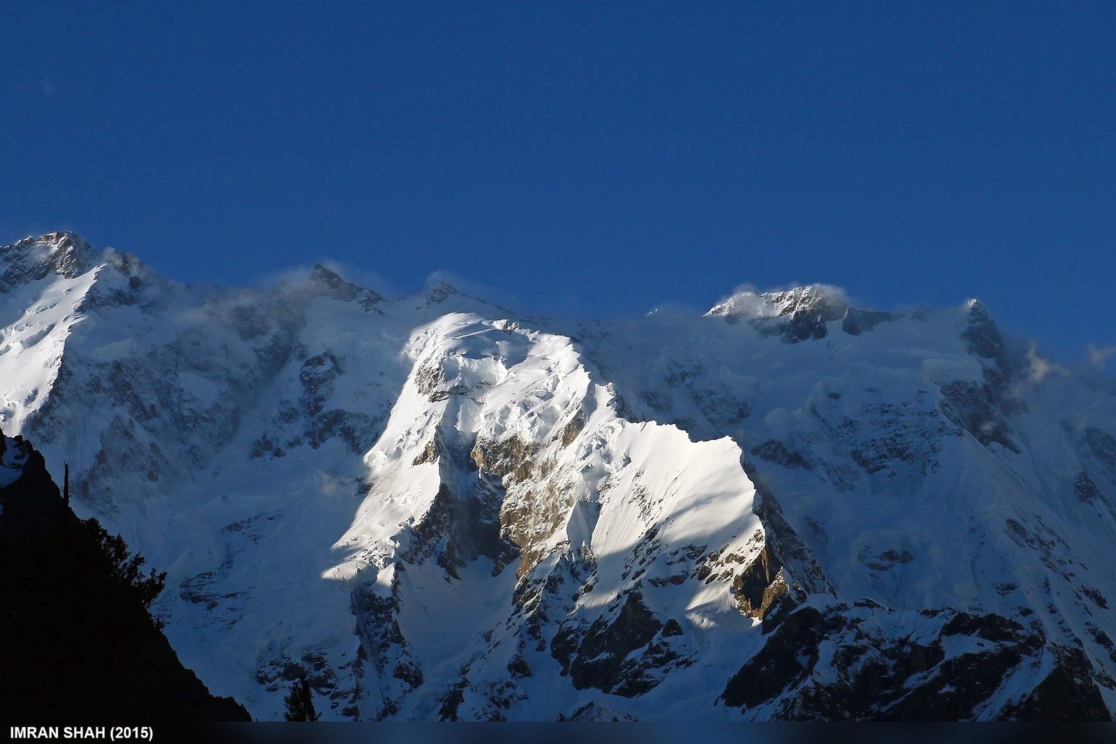
- Altitude: 7,795 m — 25th highest mountain in the world, 10th highest in Pakistan.
- Where: Batura Muztagh, above Passu and the Gojal Valley, Hunza District, Gilgit-Baltistan.
- First ascent: 30 June 1976, Hubert Bleicher and Herbert Oberhofer, Göppingen Karakoram-Himalaya Expedition led by Dr Alexander Schlee.
- The Batura Wall: an unbroken ridge of roughly 11.3 km held above 7,000 m — Batura Sar is its apex.
- The trekker’s version: the Batura Glacier trek from Passu, about 5–7 days, maximum altitude around 3,700 m.
- Season: June to September for the glacier and the pastures; the climbing season is short and weather-ruled.
Where Batura Sar is, and why it matters
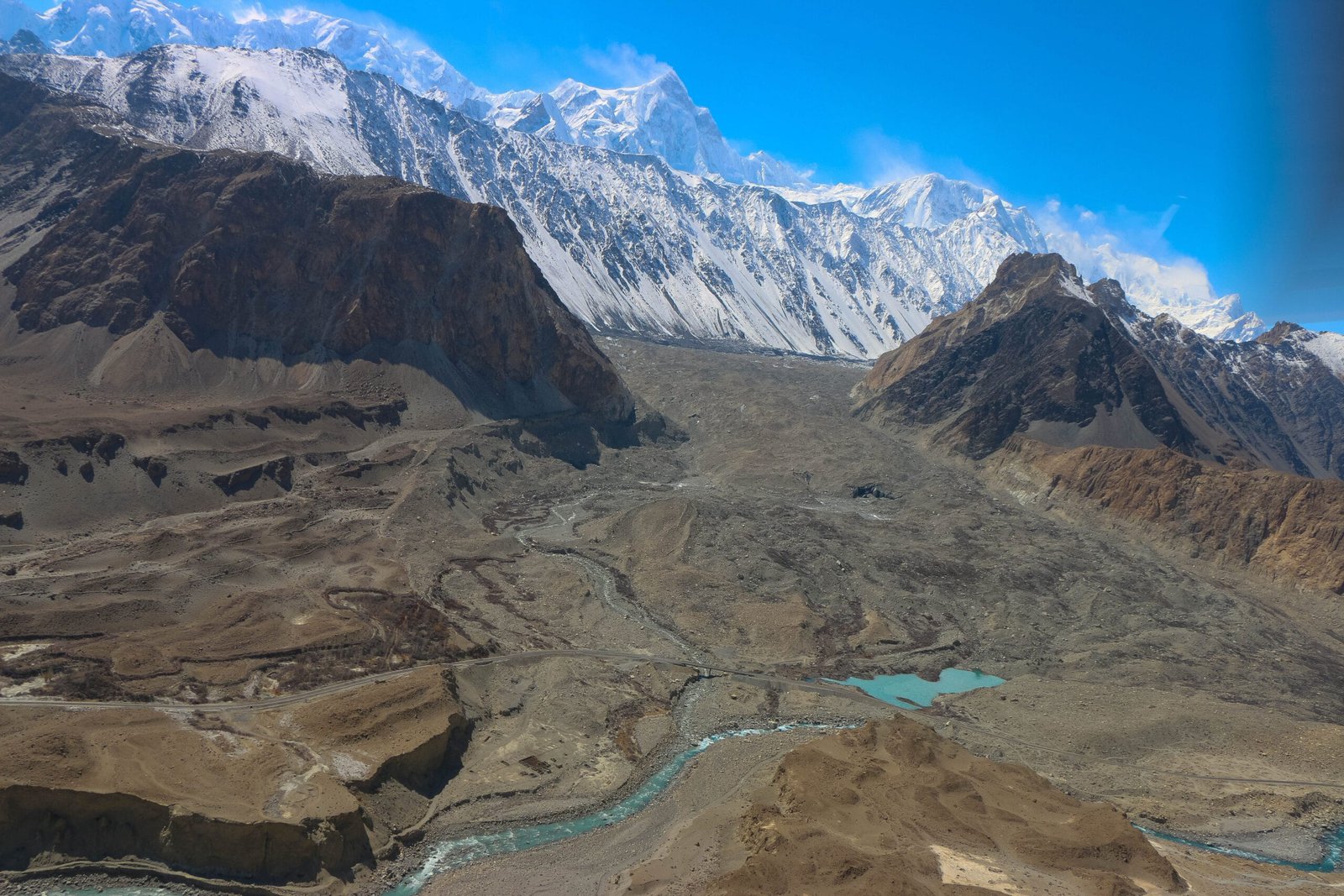
Drive north on the Karakoram Highway past Gulmit and the Passu Cones, and the snout of the Batura Glacier comes down almost to the road. Behind it, out of sight from the tarmac, sits Batura Sar. That is the whole story of this mountain: it is enormous, and it hides.
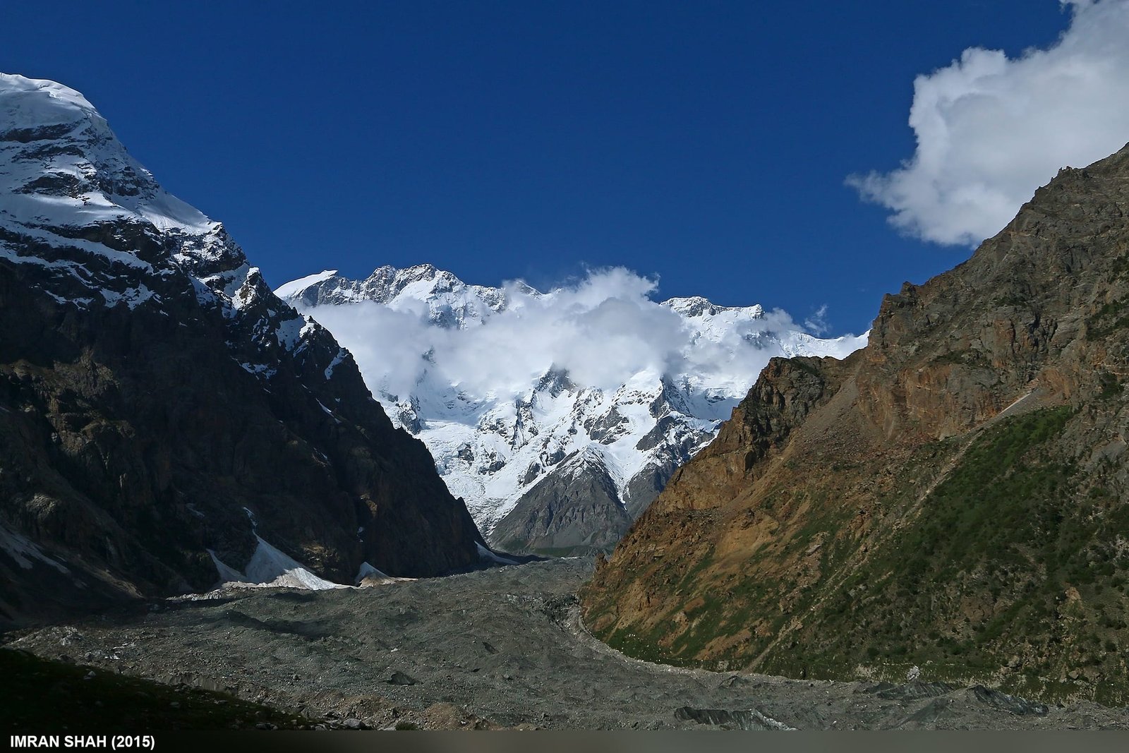
Batura Sar is the second most topographically prominent peak in the Karakoram, with about 3,118 m of prominence. Because it sits at the north-west corner of the range, there is no higher mountain anywhere north or west of it on the planet. It is slightly higher than Rakaposhi — and far less famous, because Rakaposhi rises straight out of the Hunza Valley where every traveller can see it, while Batura Sar is set back behind a wall of ice.
It is also not a spire. Batura Sar is a long, ridge-like summit — the high point of the Batura Wall, a continuously high crest of roughly 11.3 km that never drops below 7,000 m. Standing on the moraine at Yashpirt with that wall filling the horizon is, honestly, a bigger experience than most single-summit views in the range.
How high is it, really? Batura Sar among its neighbours
The trek: Passu to the Batura pastures, step by step
The Batura Glacier is roughly 57 km long — one of the longest non-polar glaciers anywhere. You do not walk its full length. The classic trek climbs the lateral moraine from Passu and links the Wakhi summer pastures on its northern flank. Maximum altitude is around 3,700 m, which makes it one of the friendlier high-glacier walks in Gilgit-Baltistan.
- Day 1 — Passu (about 2,540 m) to Yunzbin. A gentle climb along the moraine through juniper, wild rose and birch to a summer pasture where Wakhi herders keep yaks.
- Day 2 — Yunzbin to Yashpirt. The day the mountain arrives. You cross broken glacier ground and come out onto high meadow with shepherd huts and the Batura icefall in front of you.
- Day 3 — Yashpirt to Kukhil and Guchishm. Ridgelines, glacier-fed streams, grazing yaks, and the full sweep of the Batura massif. This is the high point of the trek in every sense.
- Day 4–5 — return to Passu. Back down the same pastures, usually faster, with an option to add a rest and view day at Yashpirt.
Add a day or two for arrival, acclimatisation and weather. Six or seven days from Passu is a comfortable, unhurried version; five is tight. Itinerary lengths vary between operators — treat the above as the standard shape, not a fixed contract.
The climbing history: 1959, 1976, and a long silence
Climbing came late to the Batura Muztagh, and Batura Sar has been left largely alone. Matthias Rebitsch is recorded in the icefall area in 1954. In 1959 a party of three British and two German climbers attempted the peak and all five died, probably in an avalanche — some may have got close to the top. That is the fact worth sitting with before anyone romanticises this mountain.
The first ascent came on 30 June 1976. The Göppingen Karakoram-Himalaya Expedition, led by Dr Alexander Schlee, placed base camp on the Baltar Glacier below the south face on 21 May. Hubert Bleicher and Herbert Oberhofer reached the summit by climbing over Batokshi Peak to the Batokshi Pass, then diagonally north-east to the East Ridge, using five camps above base camp. They reported ice to about 50 degrees and no extensive fixed rope — and named weather and repeated storms as the real difficulty.
An Austrian team made the second ascent in 1983 by a new line. A Polish-German expedition led by Piotr Młotecki climbed it again in 1988 by the original route. Sources disagree on a possible 1984 ascent. Beyond that: failed attempts, including an Austrian winter try in 1981, and almost no activity at all on the north side since the 1950s.
Its neighbour Muchu Chhish (7,453 m) held the title of the highest unclimbed peak in the world for which a permit could be obtained until a Czech team — Zdeněk Hák, Radoslav Groh and Jaroslav Banský — summited on 5 July 2024. That is the character of this range: even now, it hands out first ascents.
When to go
| Months | Conditions | Verdict |
|---|---|---|
| April–May | Snow still low on the pastures, cold nights, unsettled weather, blossom in lower Hunza | Too early for the high pastures; fine for a Hunza road trip |
| June | Pastures opening, herders moving up, glacier travel improving | Good — early-season, quieter |
| July–August | Warmest and most reliable; also the expedition window on the big peaks | Best overall for the trek |
| September | Clear air, cold nights, autumn colour, herders coming down | Excellent — our quiet favourite |
| October–March | Snow, cold, pastures empty, access unreliable | Not recommended for trekking |
For the wider picture of seasons across the region, see our season-by-season guide to Gilgit-Baltistan.
How hard is it — honestly
The trek: moderate. Nothing technical, but glacier moraine is loose, uneven and tiring, and there are stream crossings that change by the hour with meltwater. You should be comfortable with 5–7 hours of walking a day on rough ground, several days running. Camps are simple. There are no lodges up there and no shops.
The altitude: around 3,700 m maximum. That is real but manageable for most fit people who take it steadily — read our acclimatisation guide and build in the extra day rather than pushing through a headache.
The mountain: a different world. Batura Sar is a full expedition — long approach, weeks of committed climbing, serious avalanche and storm exposure, and a first-ascent line that has been repeated only a handful of times in fifty years. If you are building towards 7,000 m climbing, start somewhere like Spantik, not here.
Getting there, and what it costs
Passu is on the Karakoram Highway, roughly 2–3 hours north of Karimabad in Hunza and a long but spectacular day from Gilgit. Most of our guests fly Islamabad–Gilgit or Islamabad–Skardu and drive up, or come overland along the KKH. Flights are quick and weather-dependent; the road always works but needs buffer days.
On price: we keep pricing personal rather than posting a number that goes stale the moment a jeep rate or a porter wage moves. Tell us your dates, group size and how many days you want on the ice, and we will quote you properly — a fair price, no corners cut on guides, food or safety kit. We are a local Balti and Wakhi team running our own logistics, not a broker reselling someone else’s trek.
Pair it with Ultar Meadow above Karimabad, the Shimshal Pass, or read our Karakoram packing list before you start buying gear.
Want to see the Batura Wall for yourself? We do not run a Batura Glacier trek, and we will not pretend otherwise \u{2014} the glacier is heavily crevassed and very rarely visited. What we do run puts you in front of it: the Hunza Cultural Tour (6 days, from 0) and the North Pakistan Jeep Safari (12 days, from 0) both stop at Passu, where the whole 7,795 m wall fills the skyline. Our own local guides, permits handled, and a satellite phone on every trip. If you are set on the glacier itself, ask us and we will tell you straight what it would take.
Frequently asked questions
How high is Batura Sar?
Batura Sar is 7,795 m (25,574 ft). It is the 25th highest mountain in the world, the 10th highest in Pakistan, and the highest peak of the Batura Muztagh, with a topographic prominence of about 3,118 m.
Can I climb Batura Sar as a client on a commercial expedition?
Realistically, no. Batura Sar has had only a handful of ascents since 1976, has no established commercial infrastructure, and demands weeks of committed high-altitude climbing in storm-prone weather. It suits self-sufficient alpine teams, not guided clients. We support such expeditions logistically; we do not sell it as a guided summit.
What is the trek to see Batura Sar, and how long does it take?
The Batura Glacier trek from Passu, through Yunzbin, Yashpirt and Guchishm. Around 5–7 days depending on how many rest and view days you build in, with a maximum altitude near 3,700 m.
When is the best time to do the Batura Glacier trek?
June to September. July and August are the most reliable; September gives the clearest air and the finest colour, with colder nights. Outside that window the pastures are empty and access is unreliable.
Do I need a permit for the Batura Glacier trek?
The trek itself is in an open zone and does not require a trekking permit, though you should travel with a licensed local guide and register locally. Climbing any peak over 6,500 m, including Batura Sar, requires a full mountaineering permit and a liaison officer. All foreign visitors need a Pakistan visa; expedition members need the trekking and mountaineering category.
Tell us your dates and group size and we will build the trek around them — a local Balti and Wakhi team, our own guides and porters, a sat phone in camp and a rescue plan that actually exists. Not a broker.
WhatsApp: +92 312 9921574
Email: info@karakoramventure.com
Sources & attribution: elevation, prominence, first-ascent and Batura Wall details from Wikipedia (Batura Sar, Batura Muztagh, Batura Glacier), the Alpine Journal 1960 account of the 1959 Batura Muztagh expedition, and the American Alpine Journal. Muchu Chhish first ascent, 5 July 2024, per published reports. Trek stages reflect commonly published itineraries and our own operations; distances and altitudes are approximate. Images: Batura Sar south face and the Batura Wall — Imran Shah, CC BY-SA 2.0, via Wikimedia Commons; Batura Glacier — Akbar Khan Niazi, CC BY-SA 3.0, via Wikimedia Commons.