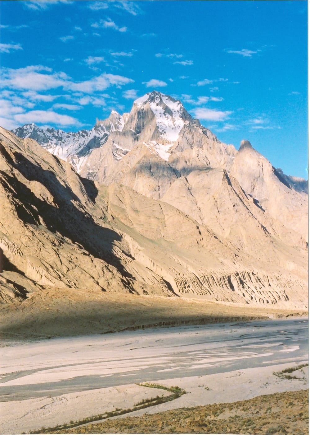
Paiju Peak (also spelled Payu) is a 6,610 m glaciated summit in the Baltoro Muztagh, standing about 3 km northwest of the snout of the Baltoro Glacier and roughly 9 km southwest of the Trango Towers, inside Central Karakoram National Park. Almost nobody climbs it — but nearly everyone walking to K2 sleeps beneath it, at the Paiju campsite (about 3,450 m), reached on day two or three from Askole. Trekkers pass it in June to August; climbers who come for the summit face a serious, rockfall-prone objective that has turned back far more parties than it has let through.
We run this out of Skardu with our own Balti team, and we will be straight with you: for 95% of the people who read this, Paiju is a camp, not a climb. It is where the willow trees end, where your porters kill the last goat, and where the glacier ahead stops being an idea. That is worth understanding properly — and if you really are here for the summit, you should know what the mountain has done to the teams that tried it.
Key takeaways
- Height: 6,610 m (21,686 ft), Baltoro Muztagh, Karakoram, Gilgit-Baltistan.
- Position: ~3 km northwest of the Baltoro Glacier terminus; ~9 km southwest of the Trango Towers.
- Relief: the summit rises about 3,200 m above the Braldu valley in only 3 km of horizontal distance.
- First ascent: 20 July 1976 — Raja Bashir Ahmad, Manzoor Hussain and Nazir Sabir, an Alpine Club of Pakistan expedition, with technical support from Allen Steck.
- Paiju campsite: around 3,450 m, roughly 2–3 walking days from Askole, and the standard rest/acclimatisation stop before stepping onto the glacier.
- Season: June, July and August give the most workable weather; October–November brings the monsoon tail into this range.
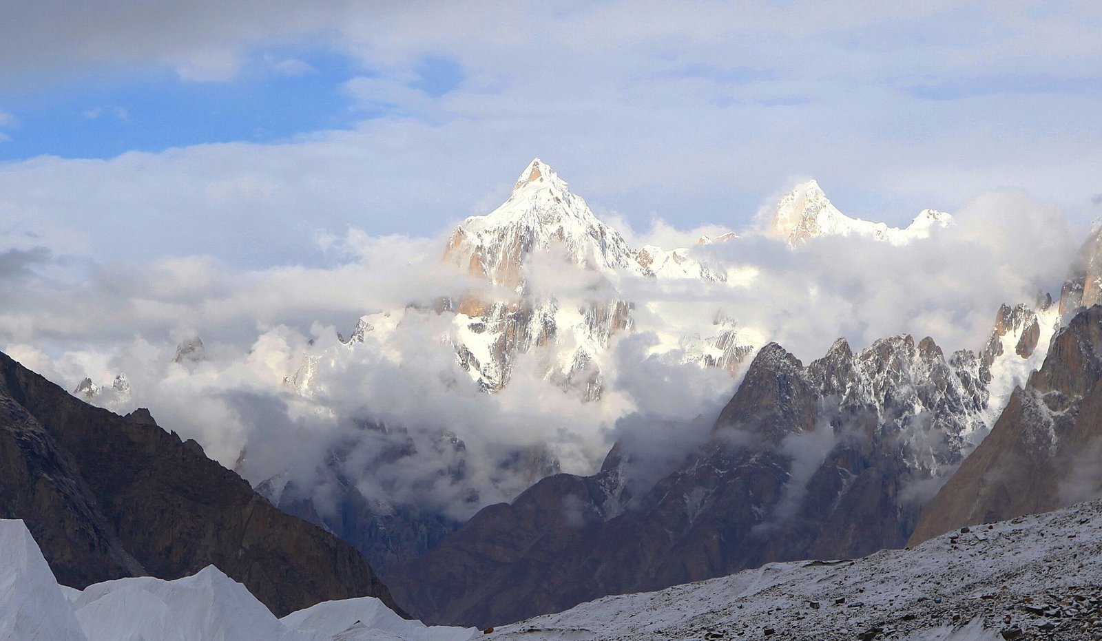
Where Paiju Peak is — and why every Baltoro trekker meets it
Walk out of Askole on the K2 Base Camp trek and for two days you follow the Braldu River through dust, boulder fans and river crossings. The valley is grey. Then a white tooth appears ahead on the left, and it keeps appearing, hour after hour, growing until it fills the sky. That is Paiju.
The mountain sits on the north side of the Braldu, immediately west of where the Baltoro Glacier dumps its meltwater into the river. Its relief is what makes it feel so heavy: about 3,200 m of vertical gain from the valley floor in roughly three horizontal kilometres. You are not looking at a peak in the distance. You are standing under a wall.
Beneath it, in a stand of willows fed by a spring, is Paiju campsite — about 3,450 m, the last green ground before the ice. Most teams spend two nights here: one to arrive, one to rest, sort loads and let bodies adjust before the glacier. Read our acclimatisation guide if you want to understand why that extra night matters more than it looks.
The route: Askole to Paiju, step by step
- Skardu to Askole (by 4×4 jeep, roughly 7–9 hours). The road up the Shigar and Braldu valleys is rough, exposed and slow. It is the real start of the trip.
- Day 1 — Askole (~3,000 m) to Jhula (~3,100 m). Around 3–4 hours along the Braldu. “Jhula” means cable bridge; you will see why.
- Day 2 — Jhula to Paiju (~3,450 m). Another 3–4 hours on riverside trail and moraine, with Paiju Peak in front of you almost the whole way.
- Day 3 — rest day at Paiju. Acclimatisation, load sorting, porter arrangements. Short walk up toward the glacier snout in the afternoon.
- Onward — Paiju to Khoburtse / Urdukas. This is where you step onto the Baltoro itself and the trek changes character entirely: rubble-covered ice, meltwater channels, and the Trango Towers opening up on your left.
- Further — Urdukas to Goro II to Concordia (~4,600 m), then K2 Base Camp (~5,150 m). From Askole it is roughly 90 km to K2 Base Camp and about nine walking days.
Climbers going for the summit of Paiju use the same approach and then base themselves near the mountain’s foot; the peak has been attempted from the south side, including a 2015 Basque ascent of a line on the south pillar reported in the American Alpine Journal.
The giants around it — and the history on its walls
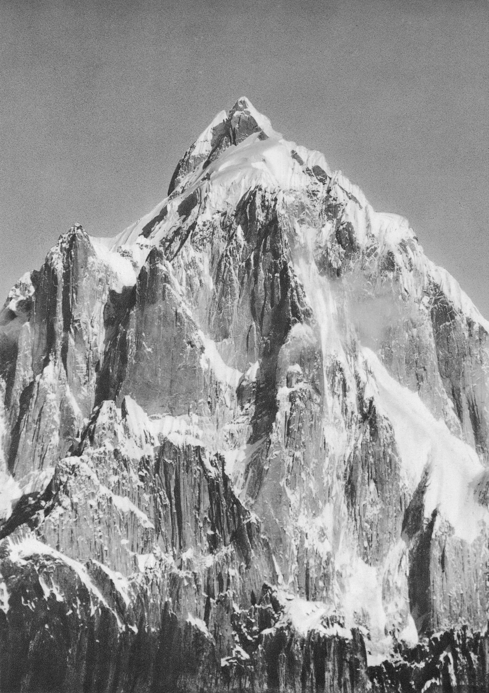
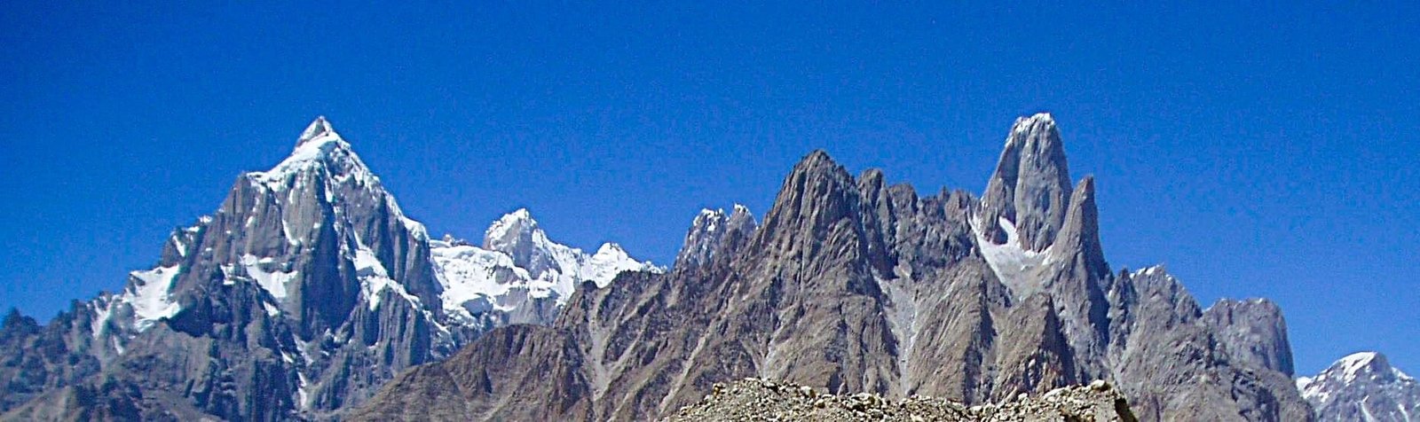
Paiju is a small number on a range full of eight-thousanders, and that is exactly why it gets ignored. It should not be. It is one of the most photographed shapes in the Karakoram, and the Italian photographer Vittorio Sella pointed a plate camera at it more than a century ago on the Baltoro.
The climbing record is short and hard. A joint Pakistani-American attempt in 1974 ended in a fatal accident. A French attempt in 1975 was stopped by an avalanche injury. The summit finally fell on 20 July 1976 to Raja Bashir Ahmad, Manzoor Hussain and Nazir Sabir on an Alpine Club of Pakistan expedition — a Pakistani first ascent, on a Pakistani mountain, which is not something you can say about many Karakoram summits. Allen Steck provided technical support and stopped short of the top to photograph the others.
When to go
The Baltoro has a short working window, and Paiju sits at the low end of it, so it opens a little earlier than the high camps.
| Months | Conditions at Paiju / lower Baltoro | Verdict |
|---|---|---|
| April–May | Cold nights, unstable weather, high and dirty snowmelt in the Braldu, jeep road can be cut | Early. Possible for hardy trekkers, not ideal |
| June | Warming, glacier travel opening up, fewer teams on the trail | Good — the quiet start of the season |
| July–August | Most settled weather of the year; also the busiest, with expedition caravans moving up | Best — this is the window |
| September | Cooling fast, clearer air, thinning crowds, real risk of early snow higher up | Good for trekking, colder camps |
| October–November | Monsoon tail reaches this range; cold, unsettled, short days | Avoid |
For how this lines up with the expedition calendar on the glacier, see our note on climbing season on the Baltoro.
How hard is it, honestly
Walking to Paiju is not technical. There is no ice axe, no rope, no altitude drama at 3,450 m for most people. What it is, is hot, dusty, long and relentless — two days of moraine and riverbank with a heavy sun and no shade. Reasonable hill fitness and the ability to walk 5–7 hours on consecutive days is enough.
Continuing past Paiju is a different job: broken glacier, 4,000 m-plus camps, cold nights, and the real possibility of altitude sickness. That is where fitness stops being optional.
Climbing Paiju Peak is in another category entirely. It is a serious alpine objective with steep mixed ground, objective rockfall and avalanche hazard, and a fatality in its short history. It is not a first 7,000er substitute — if you want a big Karakoram summit as a step up, Spantik is the honest recommendation. We will say plainly when a mountain is out of proportion to a client’s experience, because the alternative gets people hurt.
Safety — said plainly
The real risk on this stretch is not the summit; it is what happens to an ordinary trekker two days from the nearest road. River crossings on the Braldu run high and fast in the afternoon heat. Rockfall comes off the flanks above the trail. Beyond Paiju, altitude and glacier travel add their own problems, and there is no phone signal, no clinic and no quick way out. We carry a satellite phone on every expedition, we hold established helicopter-rescue contacts for the Baltoro region, and we require proper insurance before you walk in. Budget operators skip all three. Ask any operator you talk to — including us — exactly what their evacuation plan is, and expect a specific answer.
Permits and access
Trekking to Paiju campsite on the standard Baltoro route falls under open-zone trekking; climbing Paiju Peak itself is mountaineering and requires a peak permit through the relevant Pakistani authorities, plus a licensed liaison arrangement. The two are not the same paperwork and the timelines are different. Foreign visitors also need the correct Pakistani visa — a trekking and mountaineering visa, not a plain tourist visa — and it is worth starting early. Our Pakistan visa guide for trekkers walks through it. Central Karakoram National Park entry fees also apply.
Getting there, and what it costs
You start in Skardu. Fly Islamabad–Skardu when the weather cooperates, or take the road when it does not — both options and the trade-offs are in our guide on how to get to Skardu. From Skardu it is a long 4×4 day up to Askole, and then you walk.
On price: we keep pricing personal rather than posting a number that goes stale the moment porter rates, park fees or fuel move. Tell us your dates, group size and whether you want Paiju as part of a full Baltoro trip or a shorter lower-glacier trek, and we will quote you honestly — fair price, no corners cut on guides, food or safety kit. What we will not do is undercut ourselves by dropping the sat phone or the rescue arrangement, because that is the part that matters when something goes wrong.
Before you book anything, read our K2 Base Camp packing list — the same kit list applies to this section of the route — and, if you want the full loop rather than an out-and-back, look at the Gondogoro La crossing.
Frequently asked questions
How high is Paiju Peak?
Paiju Peak is 6,610 m (21,686 ft), in the Baltoro Muztagh subrange of the Karakoram, in Gilgit-Baltistan, Pakistan.
How many days does it take to reach Paiju campsite from Askole?
Two walking days for most groups — Askole to Jhula (about 3–4 hours), then Jhula to Paiju (another 3–4 hours). Almost every itinerary then adds a third day as a rest and acclimatisation day at Paiju, around 3,450 m, before stepping onto the Baltoro Glacier.
Do I need mountaineering experience to reach Paiju?
No. Walking to Paiju campsite is non-technical trekking on riverside trail and moraine. You need solid hill fitness and the ability to walk five to seven hours on consecutive days in heat and dust. Climbing Paiju Peak itself is a completely different proposition and requires serious alpine experience.
Who made the first ascent of Paiju Peak?
Raja Bashir Ahmad, Manzoor Hussain and Nazir Sabir reached the summit on 20 July 1976 as part of an Alpine Club of Pakistan expedition, with technical support from the American climber Allen Steck, who stopped below the top to photograph the ascent.
When is the best time to visit?
June through August offers the most workable weather on the lower Baltoro, with July and August the most settled and the busiest. September works for trekking but the camps get cold. Avoid October and November, when the monsoon tail reaches the range.
Walk under Paiju with a local Balti team
We are based in Skardu. Our guides and cooks are Balti, from the valleys below these mountains — not a broker handing you to a third party in Islamabad. Sat phone in camp, a rescue plan that actually exists, and a fair price.
WhatsApp: +92 312 9921574 · Email: info@karakoramventure.com
Message us “Paiju” with your dates and group size and we will come back with a real itinerary and a real number.
Sources & attribution: elevation, location and first-ascent details from Wikipedia (Paiju Peak) and the American Alpine Journal; campsite altitudes and stage timings from published Baltoro trekking itineraries and our own field experience. Images: east aspect — Muhammad Nazir Baltistani, CC BY-SA 4.0; south-west face — Stuart Orford, CC BY-SA 2.0; Paiju with Uli Biaho — Muhammad Ibrahim, public domain; historic Baltoro plate — Vittorio Sella, public domain; all via Wikimedia Commons. Altitudes are approximate where sources differ.