



Mitre Peak is the sharp, mitre-shaped rock tower that stands at Concordia on the Baltoro Glacier in Gilgit-Baltistan, Pakistan, at roughly 6,010 m (about 19,720 ft; some references give 6,013 m or 6,025 m). It marks the junction where the Godwin-Austen branch of the Baltoro arrives from the north-east and the Gasherbrum branch from the south-east, and it sits directly across the ice from Broad Peak. You reach its foot on the K2 Base Camp trek — roughly 6 to 7 walking days from Askole to Concordia, 12 to 16 days for the full round trip, in the June-to-September season. Walking to it is a hard but non-technical glacier trek; climbing it is another matter entirely: Mitre Peak has been summited only once, in 1980.
We run this trek out of Skardu with our own Balti team, and we will be straight with you about Mitre Peak. It is not a summit we sell. Almost nobody climbs it. What we sell is the walk that puts you at its base, on the ice at Concordia, at 4,600 m, in a tent, with that tower catching the last orange light while K2 stands behind your shoulder. That is worth the eight days of glacier moraine it takes to get there. The peak itself is a reminder that in the Karakoram, beauty and climbability are two different things.
Key takeaways
- Height: approximately 6,010 m (19,720 ft). Sources vary between about 6,010 m and 6,025 m — treat the figure as approximate.
- Where: Concordia, Baltoro Glacier, Central Karakoram, Gilgit-Baltistan, Pakistan.
- Why it matters: it marks the confluence of the Baltoro’s Godwin-Austen and Gasherbrum branches, facing Broad Peak (8,051 m).
- Climbing history: one recorded ascent only — Ivano Ghirardini, solo, in the summer of 1980. It has not been repeated.
- To see it: trek Askole → Concordia, about 6–7 walking days one way; approximately 4,600 m at Concordia.
- Season: June to September, with July and August the most reliable window.
Where Mitre Peak is, and why every trekker remembers it
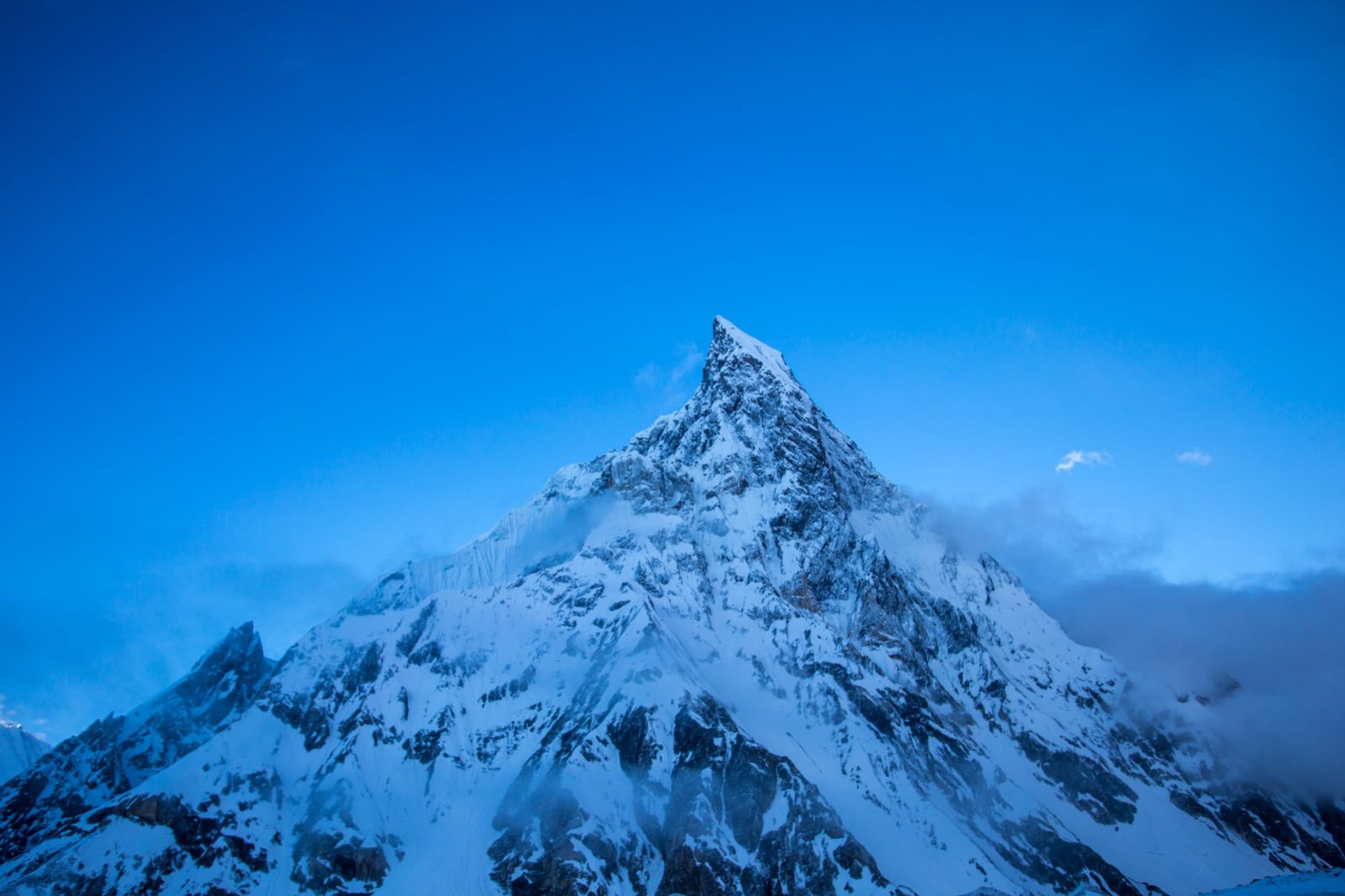
Concordia is the great junction of the Baltoro Glacier — the place where the Godwin-Austen branch comes down from K2 in the north-east and the Gasherbrum branch comes in from the south-east. Stand there and you are surrounded by four eight-thousanders and a wall of granite that goes on for days. Most people arrive looking north, at K2. Then they turn round.
Mitre Peak is what they see. It is not tall by Karakoram standards — barely a third of K2’s mass in prominence terms — but it is the shape that sticks: a leaning bishop’s mitre of rock and ice standing alone above the ice plain, uncluttered by anything behind it. On a clear evening at Concordia it holds the alpenglow longer than anything else in view. It is, along with the Trango Towers and the Muztagh Tower, one of the three rock shapes that define the Baltoro in photographs.
The Italian photographer Vittorio Sella brought the first great images of these peaks back to Europe in the early twentieth century, and Mitre Peak was among them. More than a hundred years on, it is still the frame most trekkers put their tent in front of.
The route: Skardu to Concordia, step by step
There is no separate “Mitre Peak trek.” You reach it on the K2 Base Camp trek, and Concordia is where you meet it. Here is the standard walking sequence from Skardu.
- Skardu → Askole (about 7–9 hours by 4×4 jeep). Rough road up the Braldu gorge. The last village, roughly 3,050 m.
- Askole → Jhula / Korophon. First walking day, following the Braldu. Low, hot, dusty.
- Jhula → Paiju. Long day to the campsite below Paiju Peak, at the snout of the Baltoro. Usually a rest day here.
- Paiju → Khoburtse / Urdukas. You step onto the glacier. Moraine, rubble, ice. The Trango Towers open on your left.
- Urdukas → Goro II. Full day on the ice, roughly 4,300 m. Muztagh Tower ahead.
- Goro II → Concordia (approximately 4,600 m). The day it all opens. K2 to the north, Broad Peak to the east, Mitre Peak at your back.
- Concordia. Rest or push up to K2 Base Camp (around 5,150 m) and return; or cross out via Gondogoro La to Hushe.
Twelve to sixteen days total, depending on rest days, weather and whether you return down the Baltoro or cross the pass.
Climbed once, in 1980 — and not since
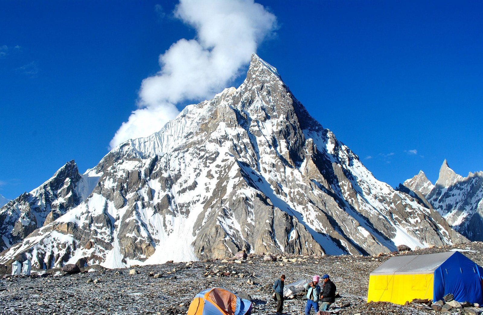
Mitre Peak’s climbing record is one of the strangest in the Karakoram. Despite standing at the single most photographed campsite in the range, it has one recorded ascent: the French-Italian guide Ivano Ghirardini, alone, in the summer of 1980, by a mixed line up the corridor on its right-hand side above the Baltoro. As far as the published record goes, nobody has repeated it.
Why so few? Partly because a 6,010 m rock peak sitting between four eight-thousanders attracts almost no expedition funding — teams come for K2, Broad Peak and the Gasherbrums. Partly because the face is steep, loose in places, and objectively exposed to rockfall as the day warms. Height is not the difficulty here. We would not put a trekking client on it, and we would not pretend it is a straightforward add-on. If you want a first Karakoram summit, there are honest options in the 5,000–6,000 m range in Hushe and Nagar that we will happily discuss instead.
When to go
| Months | Conditions | Verdict |
|---|---|---|
| April – May | Baltoro still heavily snowed; jeep road to Askole often blocked; cold camps | Too early for Concordia |
| June | Route opening; snow on the upper glacier; fewer people; changeable | Possible, for experienced trekkers |
| July – August | Warmest, most stable; expedition season on the Baltoro; busiest camps | Best window |
| September | Clear air, sharp light, cold nights; quieter trail | Excellent for photography |
| October – March | Deep cold, snow, closed access, flight disruption | Closed — do not attempt |
For a fuller breakdown of what the Baltoro does month by month, see our guide to the climbing season on the Baltoro.
How hard is it, honestly
Getting to Mitre Peak’s foot is a serious trek and an easy climb of nothing. There is no technical climbing on the way to Concordia, but that undersells it:
- Altitude. You sleep at roughly 4,600 m at Concordia after a week of gain. Headaches are normal; anything worse is not. Read our acclimatisation guide before you book.
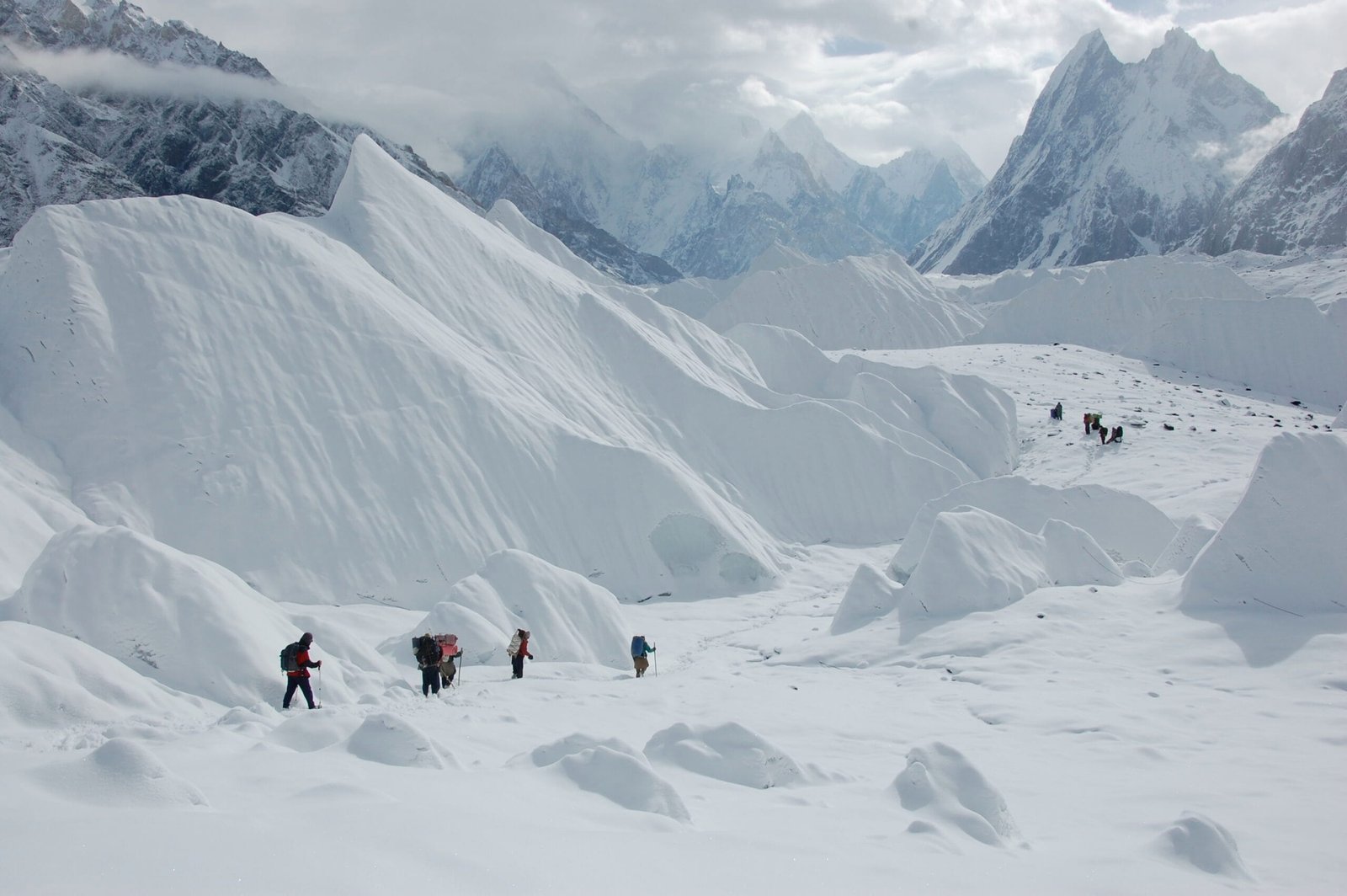
- Terrain. Days 4 onwards are on glacier moraine — loose rock over ice, ankle-turning, slow. It is tiring in a way flat distance figures never show.
- Duration. Six to eight consecutive walking days of 6–8 hours, with no road out. That endurance load is the real filter, not any single day.
- Cold and remoteness. Sub-zero nights at Concordia even in August. Nearest hospital is days away.
If you can walk 7 hours on rough ground, back-to-back, for a week, and you have trained for it, you can do this trek. If you have never carried a day pack for more than three hours, start there first.
Safety: the risk is altitude and evacuation distance, not the mountain
The genuine danger on this route is high-altitude illness — HACE and HAPE — combined with being three to five walking days from the nearest road. Rockfall off the flanks of Mitre Peak and the moraine walls is real and gets worse as the day heats up; we keep camps and rest stops clear of runout zones. Every Karakoram Venture expedition and trek carries a satellite phone, and we hold established helicopter-rescue contacts for the Baltoro region. Helicopter rescue in Pakistan requires a financial guarantee and is weather-dependent — it is not a taxi, and we will tell you exactly how it works before you go. Comprehensive insurance with high-altitude cover is required on our trips, not suggested.
Permits, zones and visas
Trekking to Concordia and K2 Base Camp falls in an open zone and does not require a mountaineering permit, though park fees, registration and a licensed guide apply. Climbing Mitre Peak is a different category and requires a mountaineering permit and royalty through the relevant authorities — that process takes months, not weeks. Separately, foreign trekkers and climbers need the correct Pakistani visa: a Trekking & Mountaineering visa, not a plain tourist visa. See our Pakistan visa guide for trekkers, and let us handle the invitation letter and permit paperwork.
Getting there — and what it costs
Fly Islamabad to Skardu (about an hour, weather-dependent, and it does get cancelled) or drive the Karakoram Highway overland, which takes far longer and needs buffer days built in. From Skardu it is a 4×4 jeep to Askole, roughly 7 to 9 hours on a road that deserves the word loosely. After that, you walk.
On price: we keep pricing personal rather than posting a number that goes stale the moment porter rates, park fees or fuel move. Tell us your dates, group size and whether you want the Gondogoro La crossing on the way out, and we will send you a real, itemised quote. Fair price, no corners cut — and we will show you where the money goes: porters paid properly, food, permits, the sat phone, the guide.
Frequently asked questions
How high is Mitre Peak?
Approximately 6,010 m (19,720 ft). Some references list 6,013 m or 6,025 m, so treat any single figure as approximate. It stands at Concordia on the Baltoro Glacier in Gilgit-Baltistan, Pakistan.
Can I climb Mitre Peak on a trek?
No. Mitre Peak has one recorded ascent — Ivano Ghirardini, solo, in 1980 — and it has not been repeated. It is a technical objective requiring a mountaineering permit, and it is not something we add to a trekking itinerary. Trekkers reach its base at Concordia, not its summit.
How many days to reach Mitre Peak from Skardu?
Roughly 6 to 7 walking days from Askole to Concordia, plus the jeep day from Skardu to Askole. A full round trip is typically 12 to 16 days depending on rest days and whether you exit over Gondogoro La.
What is the best month to see Mitre Peak?
July and August are the most reliable for weather and access. September gives clearer air and sharper light for photography, with colder nights and fewer people. Outside June to September the route is effectively closed.
Do I need a permit to trek to Concordia?
Concordia and K2 Base Camp are in an open zone, so no mountaineering permit is needed for trekking, but park fees, registration and a licensed guide apply. You will also need a Pakistani Trekking & Mountaineering visa rather than a standard tourist visa.
Plan your Baltoro trek with a local Balti team
We are based in Skardu. Our guides and cooks are from the Balti valleys under these mountains — not a broker handing you to a third party. Tell us your dates and we will come back with a real itinerary and an honest quote.
WhatsApp: +92 312 9921574 | Email: info@karakoramventure.com
Local hands, real safety, fair price.
Sources & attribution: elevation, location and first-ascent details from Wikipedia (Mitre Peak, Pakistan), SummitPost and Explorersweb; trek stage altitudes are approximate and vary by operator. Images: Anne Dirkse (CC BY-SA 4.0), Aapkamajid (CC BY-SA 3.0) and Maria Ly (CC BY 2.0), all via Wikimedia Commons.

