



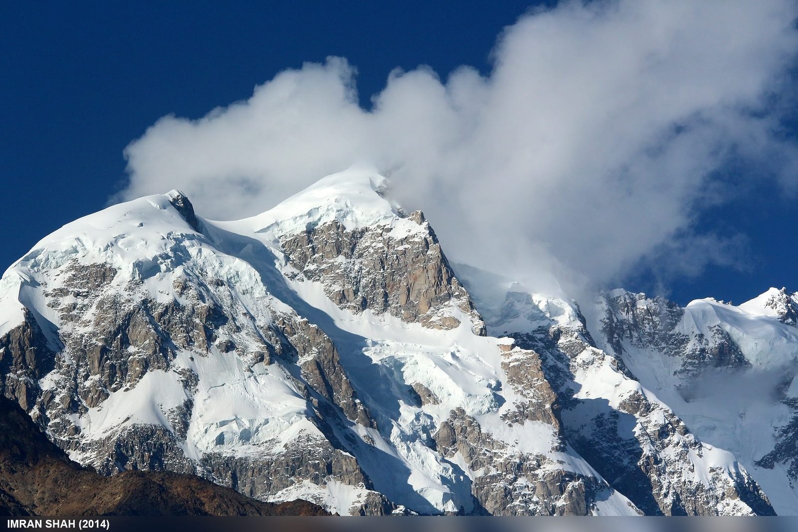
Bojohagur Duanasir I is a 7,329 m peak in the Batura Muztagh of the Karakoram, standing roughly 8–10 km north-east of Karimabad in the Hunza Valley, Gilgit-Baltistan. It is the west summit of a short ridge whose true high point is Ultar Sar (7,388 m). It was first climbed in 1984 by a Japanese expedition via the South-West Ridge from the Hasanabad Glacier, and it has seen very little traffic since. Expeditions run roughly June to September and need about four to six weeks; this is a serious, technical, objectively dangerous mountain, not a trekking peak.
We run this side of the Karakoram out of Skardu and Hunza with our own Balti and Hunzai team, and we will be straight with you: almost nobody who reads this page should climb Bojohagur. Most people should walk up to the Ultar meadow, look at it hard for an afternoon, and go home happy. If you are one of the few teams with the alpine record to attempt it, we will tell you exactly what the approach costs in risk before you spend a rupee getting here.
Key Takeaways
- Height: 7,329 m (24,045 ft), Batura Muztagh, Karakoram, Gilgit-Baltistan.
- Where: roughly 8–10 km north-east of Karimabad, Hunza — visible from the Karakoram Highway.
- Status: the west summit of the Ultar massif; Ultar Sar (7,388 m), sometimes called Bojahagur Duanasir II, is the higher point on the same ridge.
- First ascent: 1984, by E. Kisa, M. Nagoshi and R. Okamoto of a Japanese expedition led by Tsuneo Omae, via the South-West Ridge from the Hasanabad Glacier.
- Season: roughly June to September; the wider Karakoram climbing season runs May to September.
- Difficulty: high. Steep mixed ground, serac and rockfall danger low on the route, and a long committing ridge above. Expedition experience on 7,000 m peaks is the entry ticket.
Where Bojohagur is, and why it matters
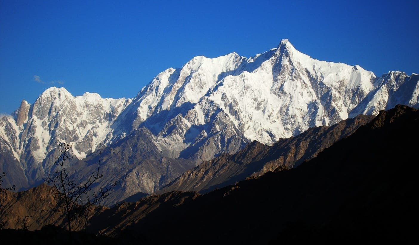
Stand in Karimabad with a cup of tea and look north. The huge, cold, complicated wall above you is the Ultar massif, and its western high point is Bojohagur Duanasir I. Wikipedia and Peakbagger put it at 7,329 m. Ultar Sar, 7,388 m, is the true summit of the same ridge and sits just to the east — which is why the naming is a mess, and why you will see Ultar Sar called “Bojahagur Duanasir II” in older literature even though it is the higher of the two.
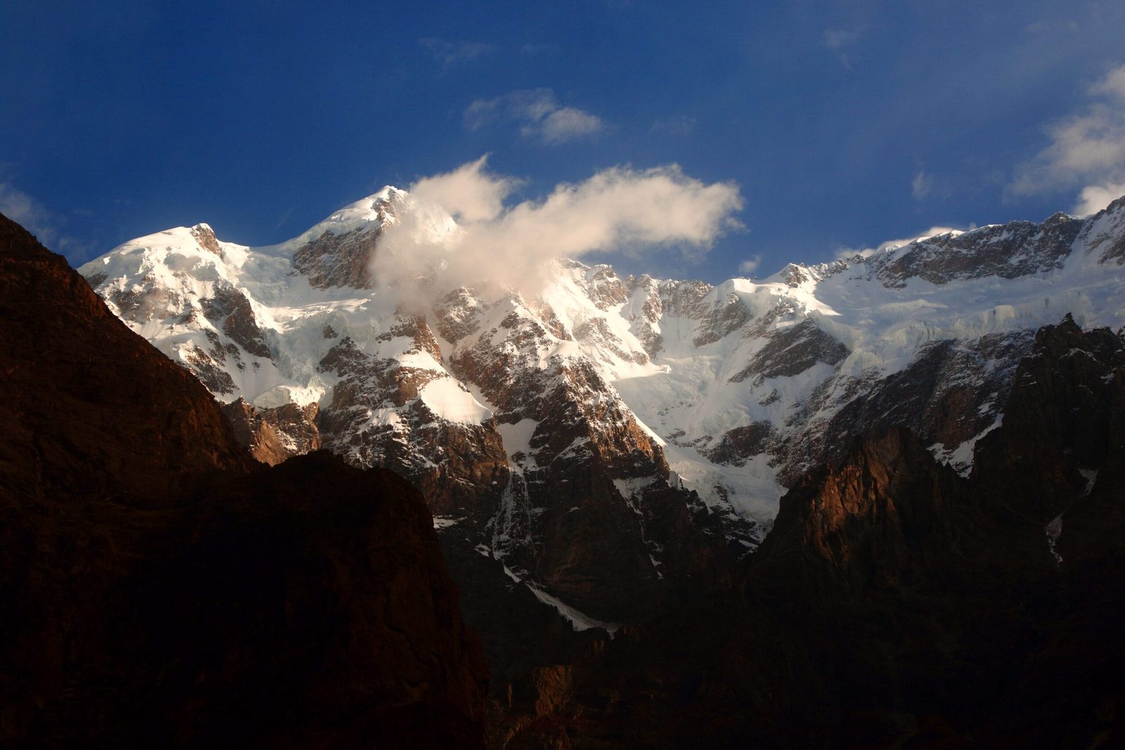
What makes this mountain unusual is not its height. It is the vertical interval. From the Hunza Valley floor at roughly 2,500 m to the summit is about 4,800 m of rise, packed into a very short horizontal distance. That is why the faces look absurd from the road, and why the glaciers below them — the Ultar and Hasanabad in particular — are broken, steep and unforgiving. The massif drains, clockwise from the north, into the Ghulkin, Gulmit, Ahmad Abad, Ultar and Hasanabad glaciers.
Its neighbours are the ones you already know: Shispare (7,611 m) to the north-west, and along the south-west ridge, Hunza Peak (6,270 m) and the rock spire of Bublimotin, the Ladyfinger Peak. If you have walked the Ultar Meadow and Hon Pass trek, you have already stood underneath Bojohagur without necessarily knowing its name.
The route, step by step
The first ascent line — and still the reference route — climbs from the Hasanabad Glacier side to a col, then follows the South-West Ridge. The 1984 British party that attempted the mountain from the Ultar side described the shape of it plainly: a long approach through broken glacier, a face of about 1,000 m to the col, then a serrated ridge with serac barriers that has to be unpicked pitch by pitch. A realistic modern schedule looks like this.
Bojohagur Duanasir: the route in stages
- Days 1–3 — Islamabad to Hunza. Fly or drive north; see our Karakoram Highway guide for road timings and buffer days.
- Days 4–6 — Karimabad, permits, porters. Load-making, liaison officer, final food buying in Gilgit and Karimabad.
- Day 7 — walk to base camp. A short but steep porter stage through the Ultar nala, or the Hasanabad approach. Base sits a little over 3,000 m, which is low; expect to do your altitude gain higher up.
- Days 8–14 — acclimatisation and advance base. Two hours of scrambling above base puts you under the icefalls. Route-finding onto the glacier is the first real problem and the first real danger.
- Days 15–28 — the face to the col. Roughly 1,000 m of snow and ice at around 50 degrees with mixed ground between. Climbed at night, because the sun turns the gullies into a shooting gallery.
- Days 29–40 — the ridge and the summit push. Ice arêtes, serac barriers, granite ribs, and a final face to the summit ridge. Weather windows here are short and rarely generous.
- Days 41–45 — descent and buffer. Abseil descents on a mountain like this are slow and dangerous. Build in the days.
Treat those numbers as a shape, not a promise. Every party that has been on this mountain has had its plan rearranged by weather.
The history: two 1984 expeditions and a broken back
In 1984 Bojohagur was described in the mountaineering press as one of the highest unclimbed peaks in the world. Two teams went for it that summer.
The Japanese expedition led by Tsuneo Omae climbed it. E. Kisa, M. Nagoshi and R. Okamoto reached the summit via the South-West Ridge from the Hasanabad Glacier, the ascent recorded in the American Alpine Journal in 1985.
The other team was a group of British working climbers from the North London Mountaineering Club — Anthony Saunders, Mick Fowler, Chris Watts, Mike Morrison, John English and Phil Butler — who went with a small budget and an honest ambition: to prove a serious Karakoram peak could be attempted on an extended annual holiday. Their account in the Himalayan Journal is one of the great honest expedition reports. A crampon point snapped and dropped John English twenty feet onto boulders; he walked out and was told five weeks later in England that his back was broken. A bivouac ledge the size of a single bed sent Chris Watts swinging into the dark on one rope, minus a boot. Saunders and Butler reached a snow cave at around 22,500 ft (roughly 6,860 m) before storms and food ran out. Butler got frostbite. Nobody summited.
Ultar Sar held out longer
The higher summit next door, Ultar Sar, held out even longer: more than fifteen expeditions tried between 1985 and 1996, and when Japanese climbers finally succeeded in July 1996, expedition leader Akito Yamazaki died at base camp after the ascent. This is the character of the massif. It is small on a map and very large in practice.
When to go
| Months | Conditions | Verdict |
|---|---|---|
| March–April | Cold, unsettled, heavy snow on the faces; blossom in the valley | Good for photography from Karimabad, not for climbing |
| May | Season opening; base camps establishing across the Karakoram | Possible for approach and acclimatisation, still cold high up |
| June–July | The main window; longest days, most settled spells | Best for a summit attempt |
| August | Warm low down, more rockfall and serac activity in the sun | Workable, but night climbing on the lower route is essential |
| September | Colder, clearer, shorter days; autumn colour in Hunza | A narrowing window; fine for trekking beneath the peak |
| October–February | Winter conditions, closed high ground | Not an expedition season |
For the wider picture across Gilgit-Baltistan, see our season-by-season guide.
How hard is it, honestly
Hard. Not “hard for a trek” — hard for a mountain. The three things that turn teams around here are not fitness:
- Objective danger low on the route. Hanging glacier snouts, ravines that fire boulders with the meltwater, and sun-loosened rock. The 1984 British party climbed the dangerous sections at night for exactly this reason.
- Sustained technical ground high up. Ice at around 50 degrees, serac barriers, and rock pitches at Scottish IV standard at nearly 7,000 m, carrying expedition loads.
- Altitude gained fast. Base camp is low and the mountain is steep, so acclimatisation has to be planned deliberately. Read our acclimatisation guide before you build a schedule.
If you have not led technical mixed ground on a 7,000 m peak, this is not the mountain to learn on. Rakaposhi or a Baltoro objective is a better next step, and we will say so rather than sell you a permit.
Safety: the real risk on this mountain
The documented accidents on the Ultar massif are stonefall, serac collapse and equipment failure on steep ice — not summit-day heroics. A broken back on the approach glacier is the kind of thing that actually happens here. Every Karakoram Venture expedition carries a satellite phone in camp, works to established helicopter-rescue contacts for Gilgit-Baltistan, and requires you to hold high-altitude evacuation cover. We plan the night-climbing schedule around the danger sections rather than hoping. See our insurance guide.
Permits and access
Bojohagur is above 6,500 m, so this is a mountaineering objective and needs a climbing permit through the relevant Gilgit-Baltistan authorities, with a liaison officer — not the open-zone trekking arrangement that covers the Ultar meadow walk. You also need the correct visa: a Trekking and Mountaineering visa, not a plain tourist visa. Start early; see our Pakistan visa guide for trekkers. We handle the permit paperwork, liaison officer and porters.
Getting there, and what it costs
Islamabad to Gilgit by air, then roughly two hours by road to Karimabad; or the full Karakoram Highway drive north, which is slower, more beautiful and needs weather buffer days. Base camp is a short walk from the road — unusually short for a Karakoram 7,000er, which is precisely what attracted the 1984 teams.
On cost: we keep pricing personal rather than posting a number that goes stale, because permit fees, porter rates and group size move it more than anything we could publish. Tell us your team size, your dates and your objective and we will build the real figure. Fair price, no corners cut — and the safety line is the one thing we will not discount.
Frequently asked questions
How high is Bojohagur Duanasir I?
7,329 m (24,045 ft). It is the west summit of the Ultar massif in the Batura Muztagh, Karakoram. The higher summit on the same ridge is Ultar Sar at 7,388 m.
Who made the first ascent of Bojohagur Duanasir?
A Japanese expedition led by Tsuneo Omae in 1984. E. Kisa, M. Nagoshi and R. Okamoto reached the summit via the South-West Ridge from the Hasanabad Glacier, as recorded in the American Alpine Journal.
Can I trek to Bojohagur base camp without climbing?
You can walk into the Ultar nala and the Ultar meadow beneath the massif, which is an open-zone trek and a genuinely good short trip from Karimabad. The climbing base camps and the glacier above them are a different proposition and are not a trekking objective.
What season should I climb Bojohagur in?
Roughly June to September, with June and July the most reliable summit window. The wider Karakoram climbing season runs May to September.
Do I need a mountaineering permit for Bojohagur?
Yes. Above 6,500 m you need a climbing permit and a liaison officer through the Gilgit-Baltistan authorities, plus a Trekking and Mountaineering visa for Pakistan rather than a standard tourist visa.
Talk to the team that lives here
We are a local Balti team based in Skardu, not a broker passing you to somebody else. Same guides, same cook, same logistics, from the permit to the last abseil.
WhatsApp: +92 312 9921574 | Email: info@karakoramventure.com
Local hands, real safety, fair price.
Sources & attribution: elevation and first-ascent details from Wikipedia and the American Alpine Journal (1985); the 1984 British attempt from Anthony Saunders, “Bojohagur, 1984”, Himalayan Journal 42. Photographs: Imran Shah (CC BY-SA 2.0), Rohaan Ali Bhatti (CC BY-SA 4.0) and Eleutherosmartin (CC BY-SA 3.0), all via Wikimedia Commons. Schematics are approximate and for orientation only.

