



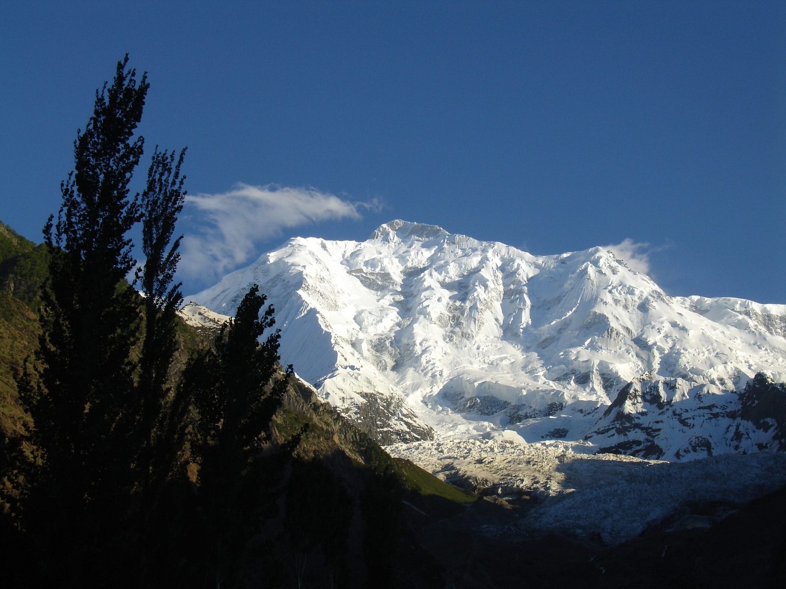
Rakaposhi is a 7,788 m Karakoram giant in the Nagar valley of Gilgit-Baltistan, about 100 km north of Gilgit, and it is the 27th-highest mountain on earth. A full Rakaposhi expedition runs roughly 40 days door to door, with base camp at the Tagafari meadow above Minapin and the summit push usually falling between late June and the end of July. The standard line is the South-West Spur, first climbed in 1958 — long, snowy, exposed, and not a beginner’s 7,000er. Expect deep trail-breaking, a real avalanche hazard, and a mountain that turns back far more teams than it lets through.
We run this Rakaposhi expedition out of Skardu and Gilgit with our own Balti team, and we will be straight with you: this is a serious peak with a thin success record. It is not Spantik with a bigger number on it. If you have stood on a 6,000er, moved well on steep snow, and can live at 6,000 m for weeks, we will take you. If you have not, we would rather put you on the base camp trek this year and the mountain next year. That is a better answer than a bad summit day.
Key takeaways
- Altitude: 7,788 m (25,551 ft) — 27th-highest peak in the world, prominence 2,818 m.
- Where: Karakoram range, between the Nagar and Bagrote valleys, roughly 100 km north of Gilgit.
- Standard route: the South-West Spur / Ridge, the 1958 first-ascent line — long, not extremely technical, but with awkward rock gendarmes high up.
- Season: June to August, with most summit attempts falling late June to late July.
- Duration: plan on roughly 40 days (approximate) including approach, rotations and weather waiting.
- Local name: Dumani in Burushaski — “Mother of Mist”.
Where Rakaposhi is, and why it stops people in the road
Drive the Karakoram Highway north from Gilgit and you do not have to look for Rakaposhi. It fills the windscreen. The massif runs almost 20 km east to west, and on its northern side it climbs about 5,900 m in only 11.2 km of horizontal distance from the Hunza river — one of the most uninterrupted rises from valley floor to summit found anywhere on earth. At Ghulmet there is a roadside viewpoint locals call Zero Point, and it is the closest you can get to a 7,788 m mountain without walking.
The mountain sits between Nagar and Bagrote. Climbing teams work from the Nagar side, walking in from the village of Minapin — the same trailhead used for the Rakaposhi base camp trek and for Diran. Base camp is the meadow at Tagafari, above the Minapin glacier.
The Rakaposhi expedition route, step by step
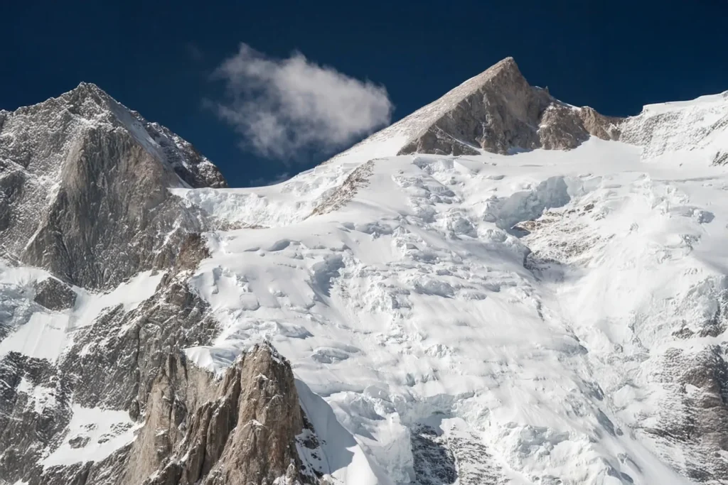
The South-West Spur is the line almost every commercial team uses. It is a long snow-and-ice ridge with some tricky rock gendarmes near the top — not desperate climbing, but sustained, high, and unforgiving of slow parties. Camps shift year to year with conditions; the shape below is what we plan around.
- Days 1–3 — Islamabad to Gilgit and Minapin. Fly or drive up the KKH, then the short road transfer into Nagar.
- Days 4–5 — Minapin to Hapakun to Tagafari base camp (approx. 3,500 m). Two easy walking days through birch and pasture with porters.
- Days 6–12 — Load-carrying and Camp 1. Route-finding onto the spur, fixing the first steep sections, sleeping high and coming down.
- Days 13–22 — Rotations to Camp 2 and Camp 3. The long acclimatisation grind. Most of the expedition’s real work happens here.
- Days 23–32 — The weather wait. Rest low, watch forecasts, keep the route stocked. Patience is a skill on this mountain.
- Days 33–37 — Summit push. Base camp to high camp over three or four days, a long summit day on the upper ridge, then straight back down.
- Days 38–40 — Clear the mountain and travel home. Strip the camps, walk out to Minapin, return via Gilgit.

A short, hard climbing history
Martin Conway looked at the south side in 1892. Secord and Vyvyan made the first proper reconnaissance in 1938. In 1947 Secord came back with H. W. Tilman and the Swiss climbers Hans Gyr and Robert Kappeler and reached about 5,800 m on the south-west spur. A Cambridge team led by Alfred Tissières got to 6,340 m in 1954; George Band, later of Kangchenjunga, was in that party. Mike Banks pushed a British-American team to 7,163 m in 1956.
The summit finally fell on 25 June 1958, when Mike Banks and Tom Patey topped out via the South-West Spur, without supplemental oxygen and in poor weather. Both came home with minor frostbite. Then the mountain shut its door: it took until 1979 for the next ascents — a Polish-Pakistani team on the North-West Ridge from the Biro glacier, and a Japanese Waseda University expedition under Eiho Ohtani on the North Spur, six weeks of work and 5,000 m of fixed rope. In 1984 the Canadians Barry Blanchard, David Cheesmond and Kevin Doyle took the North Spur in semi-alpine style with a fraction of that rope. More recently Kazuya Hiraide and Kenro Nakajima summited in 2019, and in 2021 Gilgit-Baltistan’s own Wajidullah Nagari climbed it with the Czechs Jakub Vlček and Petr Macek — a result that mattered a great deal to the guiding community up here.
Read that list again and notice what is missing: crowds. Twenty-one years passed between the first and second ascents. Rakaposhi is not a trade-route mountain.
When to go
| Months | Conditions | Verdict |
|---|---|---|
| April – May | Heavy snow on the spur, high avalanche risk, cold camps | Approach and acclimatisation only — too early to climb high |
| Early June | Snowpack settling, route work begins, weather still unsettled | Good for arrival, load-carrying and rotations |
| Late June – July | Most stable spell of the year, longest days, best consolidated snow | The summit window — plan your push here |
| August | Warmer, wetter, more rockfall and softer snow on the upper spur | Workable but declining; late attempts get harder |
| September onward | Cold returns fast, short days, storms | Season over for the summit; fine for trekking below |
If you want the wider regional picture before you book flights, our guide to the best time to visit Gilgit-Baltistan covers the whole calendar.
How hard is it, honestly
Technically the South-West Spur is moderate: steep snow, some ice, a few rock steps and gendarmes near the top that eat time. What makes Rakaposhi hard is everything else. The ridge is long. The mountain makes its own weather — Mother of Mist is not a poetic name, it is a forecast. Snow loads on the spur and avalanches are the main objective hazard. And the summit day is a big one at nearly 7,800 m, with no fixed-rope highway and no queue of other teams to break trail for you.
What we ask of climbers
What we ask of climbers: previous experience above 6,000 m, comfort on 45–55° snow, competent crampon and ice-axe work, self-rescue and crevasse skills, and the fitness to carry loads for weeks rather than sprint for a week. If you are building toward this, Spantik is the honest stepping stone, and Malubiting or Haramosh sit in the same neighbourhood. Read our acclimatisation guide before you plan your rotations — on a peak with this much waiting, how you acclimatise decides your summit chances more than how fast you climb. Pack for cold, wet weeks, not for a week: our Karakoram gear list is the starting point.
Getting there, and what it costs
Fly Islamabad to Gilgit, or drive the Karakoram Highway if the weather grounds flights — always build buffer days either way. From Gilgit it is a short run north to Minapin, and the walk to Tagafari starts there. Skardu works too if you are combining Rakaposhi with a Baltistan trip.
On money: we keep pricing personal rather than posting a number that goes stale the moment permit fees, porter rates or helicopter deposits move. Tell us your team size, your dates and whether you want full-board or base-camp-only service, and we will send a real breakdown. What we will promise is the thing behind the number — fair price, no corners cut on guides, food, or the rescue plan. Local hands, real safety, fair price.
Not going for the summit? The walk to Rakaposhi Base Camp is an honest short trek on its own. Season, route and cost are in our Rakaposhi Base Camp trek guide.
Frequently asked questions
How high is Rakaposhi?
Rakaposhi is 7,788 m (25,551 ft), making it the 27th-highest mountain in the world, with a prominence of 2,818 m. It stands in the Karakoram between the Nagar and Bagrote valleys, roughly 100 km north of Gilgit.
Who first climbed Rakaposhi, and when?
Mike Banks and Tom Patey of a British expedition reached the summit on 25 June 1958 via the South-West Spur, climbing without supplemental oxygen. Both suffered minor frostbite. The second ascent did not come until 1979.
How long does a Rakaposhi expedition take?
Plan on roughly 40 days (approximate), covering travel, the walk in to Tagafari base camp, several acclimatisation rotations, a weather wait, the summit push and the return. Shorter schedules exist on paper but leave almost no margin for the weather this mountain generates.
What is the best season to climb Rakaposhi?
June to August, with most summit attempts made between late June and late July when the snowpack has consolidated and the weather is at its most settled. August is workable but warmer and less reliable.
Do I need a permit to climb Rakaposhi?
Yes. Rakaposhi requires a mountaineering permit and liaison officer arrangement, which is different from an open-zone trekking permit, plus a Trekking and Mountaineering visa for Pakistan. We handle the permit and liaison paperwork for our teams — start the process well ahead of your dates.
Talk to the team that lives here
We are a local Balti team in Skardu, not a broker who sells your booking on to someone else. You will talk to the people who will actually be in camp with you.
WhatsApp: +92 312 9921574
Email: info@karakoramventure.com
Message us “Rakaposhi” with your dates and team size and we will come back with a route plan, a permit timeline and a real costing.
Sources & attribution: elevation, history and route data from Wikipedia (Rakaposhi), the American Alpine Journal and the Himalayan Journal. Images: “Face of Rakaposhi” by Sheba rizvi (CC BY-SA 4.0); “A view of Rakaposhi from tagahaphari” by FarazRafaqat (CC BY-SA 4.0); “Morning Rise on Rakaposhi” by mhtoori (CC BY-SA 4.0) — all via Wikimedia Commons. Camp altitudes and day counts are approximate and vary by season.

