



Crystal Peak is a 6,252 m (20,512 ft) summit in the Baltoro Muztagh, standing about five kilometres north-west of Concordia and twelve kilometres south of K2, inside Central Karakoram National Park. It was first climbed on 10 August 1892 by Martin Conway’s expedition, and it still sees very few ascents. Reaching its foot means the full Baltoro walk in from Askole, roughly six to seven days each way, so a realistic trip runs about two weeks out of Skardu. June to August gives the workable weather. And despite sitting below the 6,500 m permit line, this is a glaciated mountaineering objective, not a trekking-peak stroll.
We run this out of Skardu with our own Balti team, and we will be straight with you: most people who walk past Crystal Peak never learn its name. It stands over the north bank of the Baltoro between Concordia and K2 base camp while everyone photographs the giants behind it. If you want to climb it rather than walk under it, you need glacier skills, a proper acclimatisation plan, and a crew who knows this crevasse ground in August. If you only want to see it, the Baltoro trek takes you right beneath it.
Key takeaways
- Height: 6,252 m (20,512 ft), Baltoro Muztagh subrange of the Karakoram.
- Where: Shigar District, Gilgit-Baltistan, inside Central Karakoram National Park, about 5 km north-west of the Baltoro / Godwin-Austen confluence at Concordia.
- First ascent: 10 August 1892 by Martin Conway, Charles Granville Bruce, Matthias Zurbriggen, Parbir Thapa, Harkbir Thapa and Amar Singh, who named it for the crystals they found on top.
- Approach: Skardu to Askole by 4×4 (about 7 to 9 hours), then roughly 6 to 7 days of Baltoro trekking each way.
- Season: June, July and August are the workable months; July and August are the most settled.
- Difficulty: serious. Glacier travel, crevasse ground, altitude above 6,000 m and total remoteness. Not a beginner objective.
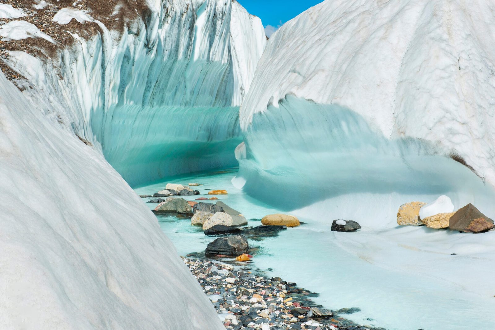
Where Crystal Peak stands, and why most trekkers walk straight past it
Crystal Peak sits five kilometres north-west of the point where the Baltoro Glacier meets the Godwin-Austen Glacier, the junction trekkers know as Concordia at 4,691 m. K2 is twelve kilometres to the north. Marble Peak, at 6,256 m, is its neighbour two kilometres to the east. The rock is gneiss and limestone, and meltwater off its slopes drains into the Braldu River, the same river you follow on the jeep road to Askole.
The number that tells you what it actually looks like is the relief: the summit rises about 1,850 m above the Baltoro Glacier in roughly three horizontal kilometres. That is a wall, not a slope. It is also why nobody notices it. Standing at Concordia with K2 at 8,611 m and Broad Peak at 8,051 m in front of you, a 6,252 m peak on the near bank reads as foreground. Walk the K2 base camp leg and you pass directly under it, usually without looking up.
If you are building a first Karakoram trip around this ground, the standard route is the K2 Base Camp trek, and the peaks you will actually name along the way are Paiju Peak, Mitre Peak and Broad Peak.
The route from Skardu, step by step
There is no shortcut. Everything on the upper Baltoro starts with the jeep road to Askole and continues on foot. This is the shape we work to, not a fixed departure, and weather moves it every year.
- Skardu (about 2,230 m). Arrive, sort permits and load, sleep low. See how to get to Skardu for flights versus the road.
- Skardu to Askole (about 3,000 m). Roughly 7 to 9 hours by 4×4 along the Shigar and Braldu valleys. Last village, last phone signal.
- Askole to Jhola (about 3,200 m). Long, hot, dusty valley walking above the Braldu.
- Jhola to Paiju (about 3,450 m). Trees, water, and the first proper view of Paiju Peak and the Baltoro snout.
- Paiju rest day. Load day for the crew, acclimatisation day for you. Do not skip it.
- Paiju to Urdukas (about 4,050 m). Onto the glacier, moraine underfoot, Trango Towers on your left.
- Urdukas to Goro II (about 4,300 m). Ice, medial moraine, and the first sight of Gasherbrum IV closing the valley.
- Goro II to Concordia (4,691 m). The confluence. K2 fills the north, Crystal Peak stands over the near bank.
- Concordia, acclimatisation and reconnaissance. Move up towards the foot of the peak, sleep, come back down.
- Summit window (allow two to three days). Glacier approach, high camp, an alpine start on snow and mixed ground.
- Return: Concordia to Urdukas to Paiju. Faster going down, harder on the knees.
- Paiju to Askole, then Askole to Skardu. Two more days, one of them in the jeep.
Add spare days. On the Baltoro they get used, either by weather or by the Skardu flight. If you would rather finish over a high pass than walk the same glacier back, the Gondogoro La crossing is the alternative exit to Hushe.
10 August 1892: Conway, Zurbriggen and the crystals
Crystal Peak was climbed early, by Karakoram standards. On 10 August 1892 Martin Conway’s expedition put Conway himself, Charles Granville Bruce, the Swiss guide Matthias Zurbriggen, Parbir Thapa, Harkbir Thapa and Amar Singh on the summit. They found fine crystals at the top and named the mountain for them. That was sixty-two years before K2 was climbed, and ten years before anyone seriously tried it.
Context matters here. Robert Lerco was the first to report reaching Concordia, in 1890; Conway followed in 1892. The name Concordia itself came later, from Aleister Crowley during the 1902 attempt on K2. So when Conway’s party stood on Crystal Peak, they were looking at a glacier junction that did not yet have its European name, and at a mountain wall nobody had measured properly. Balti hunters and shepherds had been moving through the lower valleys long before any of them arrived, and it was Balti and Nepali hands carrying the loads that made those first ascents possible. That has not changed much. Ours still do.
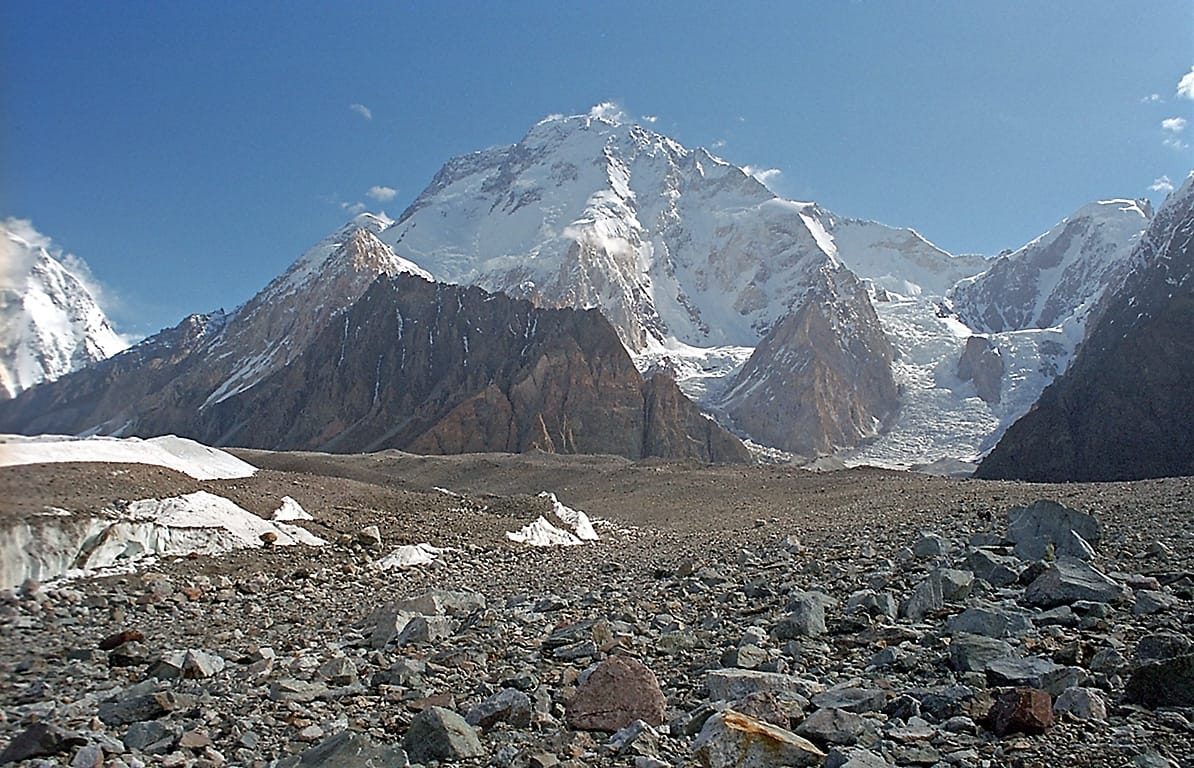
When to go
The Baltoro has a short working season, and the peak has a shorter one than the trek.
| Months | Conditions | Verdict |
|---|---|---|
| April to May | Deep snow high on the glacier, cold camps, unsettled weather | Too early for the summit; early trekkers only |
| June | Glacier opening up, cold nights, good snow cover on the upper mountain | Workable for climbing, hard conditions |
| July to August | Warmest and most settled; busiest period on the Baltoro; more meltwater and loose moraine | Best overall window |
| Early September | Colder, quieter, clean light, shorter days | Good but narrow |
| Mid-September to October | Storm risk rising, cold, jeep road less reliable | Trekking only, and with buffer days |
| November to March | Winter. Road closed or unreliable, extreme cold | No |
How hard is it, honestly
Two separate questions here, and people mix them up.
Walking under it is the Baltoro trek: about 90 km of moraine, ice and river valley each way, six to eight hours a day, sleeping between 3,000 m and 4,700 m, in tents, for two weeks. No technical climbing. It is hard because of the surface, the dust, the cold nights and the length, not because of difficulty.
Climbing it is another thing entirely. Above the glacier you are on crevassed ground, then snow and mixed terrain, at altitudes where a rescue is a helicopter question rather than a stretcher question. You want rope work, crampon technique, and honest recent experience above 5,500 m. Published route information is thin, because so few parties go, which means judgement on the day counts more than a guidebook. Read our acclimatisation guide before you commit to any schedule, and use the Karakoram packing list for the kit, then add the technical gear on top.
If you are unsure whether you are ready, say so and we will tell you straight. Sometimes the right answer is to do the base camp trek this year and come back for the peak.
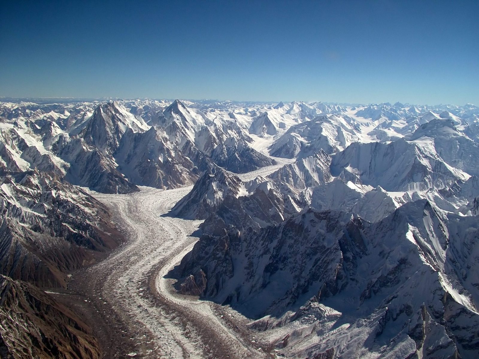
The real risk, and what we do about it
The danger on this ground is not the summit ridge. It is crevasses under fresh snow on the Baltoro and Godwin-Austen, rockfall on the moraine in hot afternoons, and altitude illness in a place where the nearest hospital is days away. We carry a satellite phone in camp on every expedition, we work with established helicopter rescue contacts for the Baltoro region, and we require proof of insurance that actually covers helicopter evacuation above 6,000 m. Budget operators cut exactly these things because you cannot see them in a brochure. Ask any operator you talk to, including us, what their evacuation plan is, in detail. If the answer is vague, walk away.
Permits and access
Crystal Peak sits below the 6,500 m line, and peaks under that height in open zones are generally treated as trekking peaks in Pakistan, without royalty or a separate climbing permit. Rules change, so we confirm the current position with the Gilgit-Baltistan authorities before every departure rather than promising you a fee that may be out of date. You will still need Central Karakoram National Park entry, trekking registration and a guide, and you need the right visa: expeditions and treks run on the Trekking and Mountaineering visa, not the standard tourist visa. Our Pakistan visa guide for trekkers walks through it.
Getting there, and what it costs
Islamabad to Skardu is a short flight when the weather allows and a long, spectacular road when it does not. Build in buffer days either way; the flight cancels often enough that pretending otherwise would be dishonest. From Skardu it is the 4×4 to Askole and then your own two feet.
On price, we keep it personal rather than posting a number that goes stale the moment porter rates or park fees move. Tell us your dates, your group size and whether you want the peak or just the walk beneath it, and we will build a real quote: fair price, no corners cut on guides, food or safety. What we will not do is quote you low and then thin the crew, shorten the acclimatisation or drop the sat phone to make the number work.
Frequently asked questions
How high is Crystal Peak?
6,252 m, or 20,512 ft. It is in the Baltoro Muztagh subrange of the Karakoram, in Shigar District, Gilgit-Baltistan, inside Central Karakoram National Park.
Do you walk past Crystal Peak on the K2 Base Camp trek?
Yes. It stands about five kilometres north-west of the Baltoro and Godwin-Austen confluence, on the near side of the glacier as you head from Concordia towards K2 base camp. Most trekkers pass beneath it without knowing its name.
Do I need a climbing permit for Crystal Peak?
Peaks below 6,500 m in Pakistan’s open zones are generally treated as trekking peaks, with no royalty or climbing permit required, but you still need national park entry, trekking formalities, a licensed guide and the correct visa. We confirm the current rules before each departure rather than quoting figures that may have changed.
When is the best time to climb it?
June to August. July and August are the most settled, June is colder with better snow cover higher up. Early September can work with a narrow window. Winter is not an option for a normal expedition.
Is it harder than the K2 Base Camp trek?
Considerably. The trek in is the same two weeks of glacier walking, then the climb adds crevassed glacier travel, snow and mixed ground above 6,000 m in a very remote place. You need real crampon and rope skills and recent high-altitude experience. If you do not have those yet, do the base camp trek first.
Talk to the team that lives here
We are a local Balti outfit based in Skardu, not a broker passing you to someone else. Our guides grew up in these valleys, our porters are from the villages you walk through, and we plan the safety side properly because we are the ones who go up with you.
WhatsApp: +92 312 9921574 | Email: info@karakoramventure.com
Send us your dates and we will come back with a straight answer on what is possible.
Sources and attribution: elevation, location, geology and first-ascent details from Wikipedia entries for Crystal Peak (Pakistan), Marble Peak (Pakistan) and Concordia (Karakoram); permit and royalty position from published Pakistani operator and tourism guidance, confirmed with the Gilgit-Baltistan authorities before each departure. Camp altitudes are approximate. Images: Usamatricks (mtzendo), CC BY-SA 4.0; Kogo, CC BY-SA 2.5; Guilhem Vellut, CC BY-SA 2.0, all via Wikimedia Commons.

