



The Mustagh Pass is a glaciated pass of about 5,422 m across the Baltoro Muztagh, the Karakoram crest that also carries K2 (8,611 m) — and that crest is now the border between Pakistan and China. It was once the shortest caravan road from Yarkand to Skardu. Moving ice closed it to caravans by the middle of the 19th century, and since Francis Younghusband forced a crossing in 1887 only two further crossings have been recorded, in 1929 and 1986. You cannot walk over it as a traveller today. What you can do is walk the Baltoro beneath it, out of Askole, on an exploratory trip of roughly two to three weeks between June and September.
We run our treks and expeditions out of Skardu with our own Balti team, and we will be straight with you about this one. The Mustagh Pass is not a trek you book off a page. It is history, and it is a piece of ground above the Baltoro Glacier that almost nobody goes to look at. The great-grandfathers of the porters who walk with us carried loads on the caravan road that crossed it. So this guide does two things: it tells you the real story of the pass, and it tells you honestly what you can and cannot do there in 2027.
Key takeaways
- Altitude: the eastern or Old Mustagh Pass is about 5,422 m. A second, so-called New Mustagh Pass lies about 16 km to the west, its height given variously as 5,700 m and 5,800 m.
- Where: across the Baltoro Muztagh subrange, north-east of the Trango Towers, linking the Baltoro side to the Sarpo Laggo Glacier and the Shaksgam on the Chinese side.
- Why it mattered: it was the shortest route from Yarkand to Skardu, and on to Srinagar — sitting midway between the Karakoram Pass (5,540 m) to the east and the Kilik and Mintaka passes to the west.
- Closed by ice: impassable to caravans since at least the mid-19th century as the glaciers on it moved. Frederic Drew recorded no crossings between Yarkand and Baltistan from 1863 to 1870.
- The famous crossing: Francis Younghusband in 1887, with five companions, no ice axes, no crampons, no proper footwear and no tent — down to the Baltoro and on to the village of Askole.
- Since then: only two recorded crossings — an Italian exploration expedition in 1929 and a French ski expedition in 1986.
Where the Mustagh Pass is, and why a caravan road ever went over it
Look at a map of the Karakoram and you will see the Baltoro Muztagh. The wall of the range that holds K2, Broad Peak, the Gasherbrums, the Muztagh Tower and Skil Brum. The Mustagh Pass is a gap in that wall. South of it the ice drains into the Baltoro and eventually the Indus. North of it the water runs towards the Tarim Basin. The pass sits on that watershed, and the crest it crosses is today the Pakistan–China boundary.
For traders it was simple arithmetic. From Yarkand, in what is now Xinjiang, the Mustagh Pass was the shortest way through to Skardu on the upper Indus, and from Skardu the road went on to Srinagar in Kashmir. To the east, the Karakoram Pass (5,540 m) carried the better-known caravan route to Leh in Ladakh. To the west, the Kilik and Mintaka passes led down into Hunza and Gilgit. The Mustagh sat between them — shorter, and far more dangerous.
Younghusband recorded that there are really two passes here: the eastern or Old Mustagh Pass at about 5,422 m, and a New Mustagh Pass roughly 16 km west, whose altitude is given in different sources as 5,700 m or 5,800 m. Nearby, the Sarpo Laggo Pass reaches 6,013 m. None of these are walk-ups. All of them are glacier ground.
How the ice closed the road, and how Younghusband crossed it anyway
The Mustagh was never an easy pass, and by the middle of the 19th century the glaciers on it had shifted enough to shut it to loaded animals. When Henry Haversham Godwin-Austen surveyed the region in 1861 the old eastern pass had been out of use for decades because of the ice built up on it, and a new pass had been sought further west. Godwin-Austen got close to the summit of that newer pass from the southern side in 1862, and weather turned him back. By then the only people still crossing were a handful of Baltis living in Yarkand, going over to visit their families. Frederic Drew recorded no crossings at all between Yarkand and Baltistan from 1863 to 1870.
The Younghusband crossing of 1887
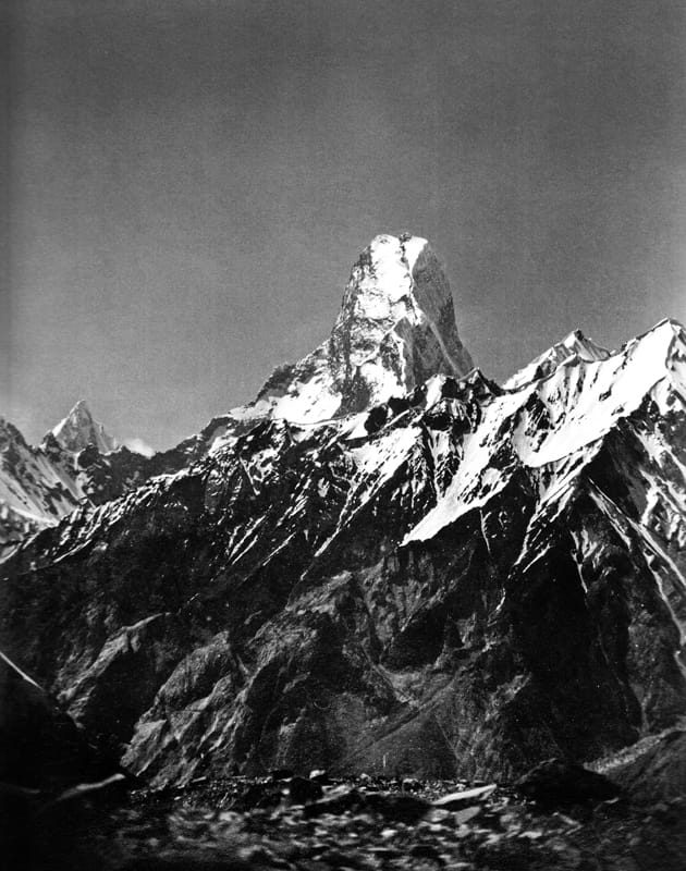
Then, in 1887, Francis Younghusband came the other way. He was travelling from Peking with a caravan at the request of Colonel Mark Sever Bell, entered the Shaksgam valley, and came out of it over the eastern Mustagh Pass. He had five companions, no ice axes, no crampons, no footwear made for the job and no tent. They got down the southern side on cut steps and improvised rope work and reached the Baltoro, and Younghusband walked on to Askole — the last village before the glacier, and still the roadhead for every K2 Base Camp trek we run today.
That is the crossing everyone remembers, and it is worth being clear about why. Not because it was elegant, but because it should not have worked. In the almost 140 years since, records show only two crossings — an Italian exploration expedition in 1929, and a French ski expedition in 1986.
What you can actually do today, step by step
Here is the honest position. The crest of the Baltoro Muztagh is an international border. There is no crossing point on it, no formalities on the far side, and the Sarpo Laggo Glacier beyond is approached from China, not from Pakistan. So nobody is selling you a Mustagh Pass crossing, and we are not either. If anyone offers you one, ask them how you leave the country at 5,422 m.
What is possible is an exploratory, expedition-style trip on the Baltoro side: the standard Askole approach, then off the trekking route and onto the side glaciers below the crest. This is not a catalogue product with fixed departures — it is a trip we would plan around your team, your skills and the conditions that year. The shape of it looks like this.
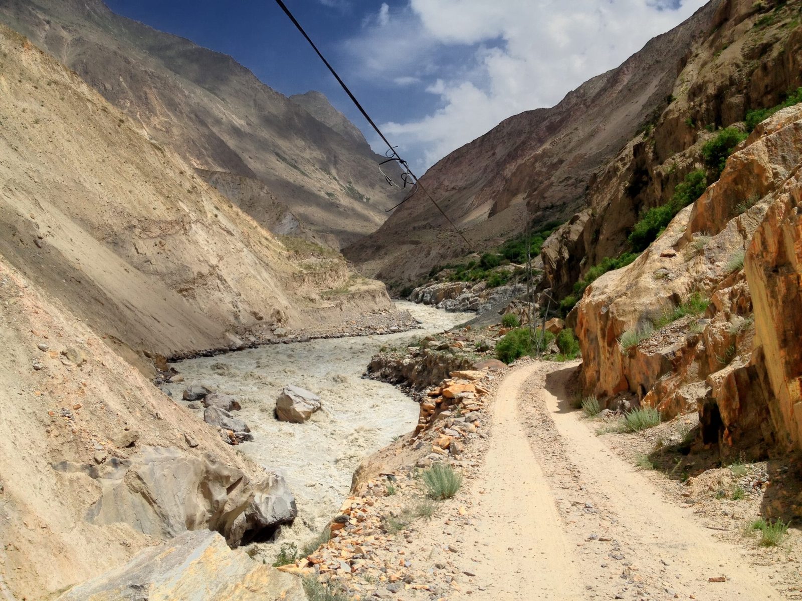
- Skardu to Askole by 4×4 jeep, roughly 7–9 hours up the Shigar and Braldu valleys. Last shops, last phone signal.
- Askole to Jhola, following the Braldu on the standard Baltoro trail.
- Jhola to Paiju, camping below the snout of the Baltoro Glacier.
- Rest and load day at Paiju — porters sort loads, the team checks glacier gear. This day earns its place.
- Paiju to Khoburtse, the first day on the ice, with the Trango group coming into view.
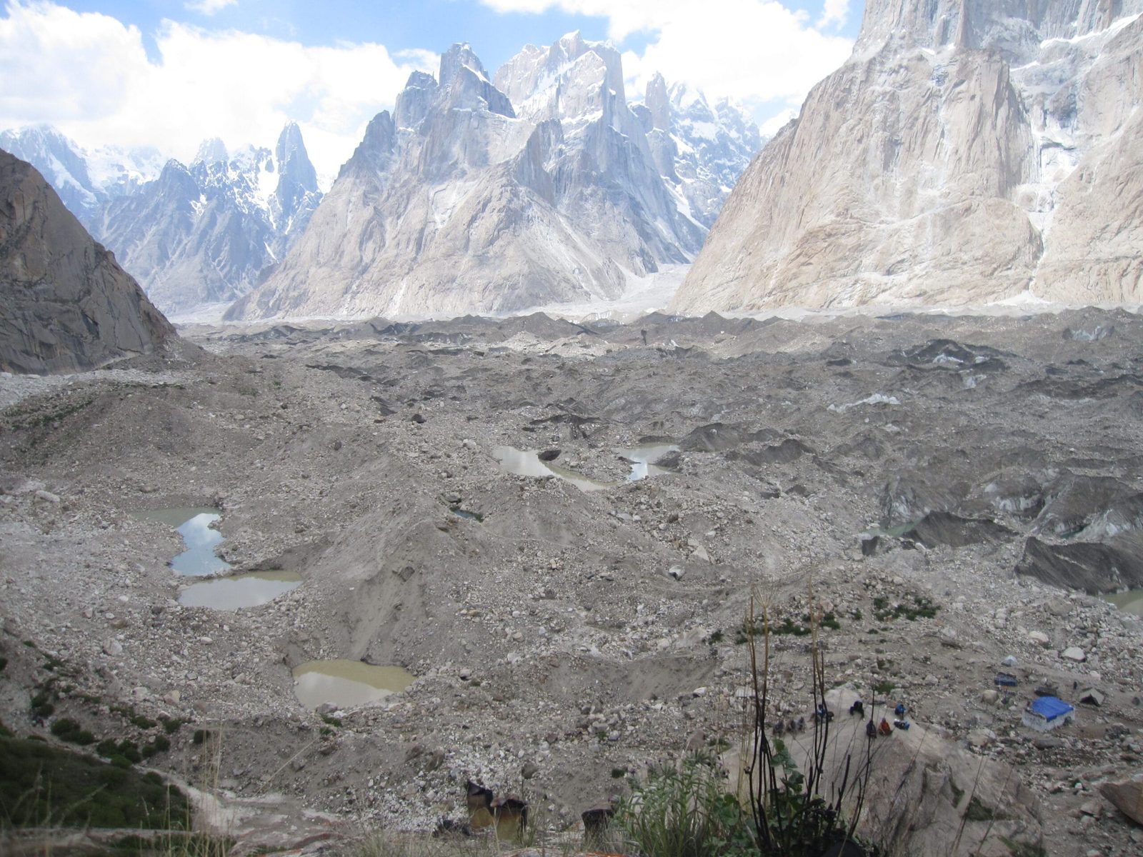
- Khoburtse to Urdukas (about 4,050 m), the balcony camp on the true left of the glacier, looking across at Trango, the Cathedrals and Lobsang Spire.
Off the trekking route, towards the crest
- Turn north off the trekking route onto the side glaciers below the Baltoro Muztagh crest. From here there is no trail, no porter route and no traffic — roped glacier travel, crevasse ground, loads carried by the team.
- High camp below the crest, placed on the day by conditions rather than by an itinerary.
- Viewpoint day towards the pass. The turnaround is the crest. You look over into the Sarpo Laggo basin and you come back down.
- Return down the Baltoro to Askole and out by jeep to Skardu, with spare days built in for weather.
Anyone who has done the Baltoro will recognise steps 1 to 6 — that is the same approach as Concordia. Steps 7 to 9 are a different kind of day out entirely.
The neighbours, the far side, and the road that keeps being proposed
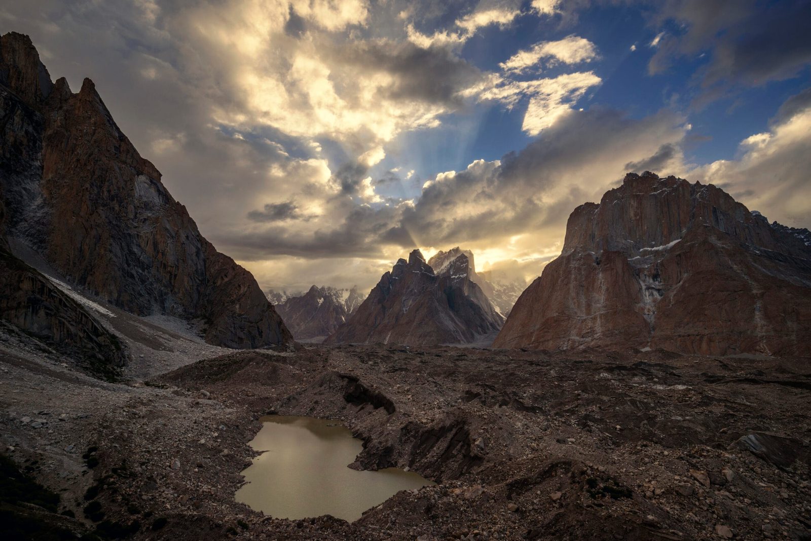
The company the pass keeps is the reason to go and look at it. Immediately west stand the Trango Towers. On the crest itself sits the Muztagh Tower (7,273 m), which gives its name to the whole subrange, and beyond it Skil Brum (7,410 m). East along the same wall is K2.
North of the crest is the Sarpo Laggo Glacier — named, as it happens, after Younghusband, because his crossing took him into that basin. A second glacier flowing from the Muztagh Tower down towards the Baltoro also carries his name. The Sarpo Laggo is reachable from the Baltoro side only over the Old Mustagh Pass. In practice it is approached from China, from Kashgar on the Karakoram Highway, past K2 north base camp.
One more thing worth knowing, because people ask. Plans have been floated under the China–Pakistan Economic Corridor to upgrade the Mustagh Pass as a road, which would cut the distance from Shigar to Yarkant by around 350 km compared with the Khunjerab Pass. Nothing is built. For now it remains what it has been for a century and a half. A glaciated gap in a wall, crossed on foot, and almost never.
When to go
The Baltoro season runs roughly April to October, and the useful window for exploratory ground above Urdukas is narrower than for a straightforward trek.
| Months | Conditions | Verdict |
|---|---|---|
| December–March | Deep snow, the Askole jeep road frequently blocked, glaciers unworkable, no porters moving. | Closed |
| April–May | Road opening, cold nights, heavy old snow high on the glacier, crevasses hidden. | Early — strong expedition parties only |
| June | Glacier surface firming up, porters moving, still properly cold at the high camps. | Good for an exploratory team |
| July–August | Warmest and busiest on the Baltoro. More meltwater, more rockfall, crevasses more open but also more visible. | Best weather odds |
| September | Cooler, clearer, much quieter, shorter days. Firmer ground underfoot. | Our pick for this kind of trip |
| October | Cold arriving, porters heading home, weather windows shortening. | Late — short trips only |
| November | Winter on the glacier. | Closed |
How hard it is — honestly
Do not read this as a harder version of the K2 Base Camp trek. It is a different activity. Steps 1 to 6 above are a demanding but well-trodden trek. Long days, rough moraine, altitude to about 4,050 m at Urdukas. If that already sounds like a lot, start with K2 Base Camp and come back to this.
Beyond Urdukas the requirements change. You need to be competent on a rope on a glacier, able to take part in a crevasse rescue rather than be the subject of one, and comfortable carrying a load above 4,500 m. Expect two to three weeks door to door, with spare days, and expect to turn around short of the objective if the ice or the weather says so. Altitude is the quiet problem: the gain from Askole to a high camp is substantial and the acclimatisation has to be built into the schedule, not hoped for — our acclimatisation guide sets out how we pace it. Gear matters more than on a trekking peak, and our Karakoram packing list is the starting point, with crampons, harness and axe added.
One honest note on the team. Exploratory glacier ground off the porter route means smaller loads, more carries and properly equipped staff. We do not send porters onto ground they are not kitted out for. That is part of why a trip like this costs more per day than a standard Baltoro trek, and we would rather explain that than quietly cut it.
The real risk, stated plainly
The hazard here is crevasses on lightly travelled glacier, rockfall on the moraine slopes below the crest, and weather that can close the rescue window for days. Askole is the last roadhead and it is a long way behind you. Every expedition we run carries a satellite phone in camp, we work with established helicopter-rescue contacts for the Baltoro region, and we will not leave Skardu without your insurance covering helicopter evacuation and trekking or mountaineering above 5,000 m. We will also turn a trip around. That is not us being cautious for the sake of it — on this ground it is the whole plan.
Permits and visa
The Baltoro trekking route out of Askole follows trekking rules, with the usual registration and a licensed guide. Ground that runs up to the Pakistan–China watershed is a different category and needs clearance from the relevant authorities, and where a named peak is involved it becomes a mountaineering permit with a royalty and a liaison officer. Permit categories and fees change, so we confirm the exact requirement for your route with the authorities before you commit — we would rather do that than guess in public.
On the visa: trekking and mountaineering in Pakistan needs the Trekking and Mountaineering visa, not a plain tourist visa, and it has to name your operator. Our Pakistan visa guide for trekkers walks through it, and we send the invitation and supporting documents you will need.
Getting there, and what it costs
Islamabad to Skardu is either a short flight over Nanga Parbat — spectacular, and weather-dependent, so build in a buffer day — or roughly two days by road on the Karakoram Highway. Our getting to Skardu guide covers both honestly, including what happens when the flight is cancelled. From Skardu it is jeeps up the Shigar and Braldu to Askole, and after that everything moves on foot.
On price: we keep pricing personal rather than posting a number that goes stale, because a trip like this is costed on team size, days, porter loads, permit category and the gear your group already owns. Tell us those and we will give you a real figure, itemised, with nothing hidden in it. Fair price, no corners cut — and if the honest answer is that your dates or your experience do not fit this objective, we will tell you that instead of selling you a trip.
Frequently asked questions
Where exactly is the Mustagh Pass?
It crosses the Baltoro Muztagh subrange of the Karakoram, north-east of the Trango Towers, and links the Baltoro glacier system on the Pakistani side with the Sarpo Laggo Glacier and the Shaksgam on the Chinese side. The crest it crosses is the present border between Pakistan and China. There are two passes: the eastern or Old Mustagh Pass at about 5,422 m, and a New Mustagh Pass about 16 km west, given as 5,700 m or 5,800 m depending on the source.
Can you cross the Mustagh Pass today?
Not as a traveller. The route has been impassable to caravans since at least the middle of the 19th century because the glaciers on it moved, and the crest is now an international border with no crossing point and no formalities on the far side. Since 1887 only two parties have crossed it, an Italian exploration expedition in 1929 and a French ski expedition in 1986. We do not offer a crossing, and you should be wary of anyone who does.
Who was the first European to cross it?
Francis Younghusband, in 1887, at the request of Colonel Mark Sever Bell. He came from the north with five companions, without ice axes, crampons, suitable footwear or a tent, descended the southern side to the Baltoro and walked on to Askole in Baltistan.
How high is the Mustagh Pass?
The Old or eastern pass is about 5,422 m. Sources give the New Mustagh Pass to the west variously as 5,700 m and 5,800 m. The nearby Sarpo Laggo Pass is 6,013 m. Treat all of these as the commonly cited approximate figures rather than surveyed certainties.
Is a road being built over the Mustagh Pass?
Plans have been floated under the China–Pakistan Economic Corridor to upgrade the pass, which would shorten the distance from Shigar to Yarkant by around 350 km compared with the Khunjerab Pass. Nothing has been built. It remains a glaciated pass crossed on foot, and very rarely at that.
Talk to the team in Skardu
Interested in the Baltoro, the Mustagh crest, or an exploratory trip off the porter routes? Tell us your dates, your group size and what your team has done before, and we will give you a straight answer — including when the answer is no.
WhatsApp: +92 312 9921574 · Email: info@karakoramventure.com
You will be talking to a local Balti team based in Skardu, not a broker — our own guides, our own logistics, a satellite phone on every expedition and a real evacuation plan. Local hands, real safety, fair price.
Sources & attribution: pass altitudes, the two-pass distinction, the Yarkand–Skardu caravan context, the Godwin-Austen and Frederic Drew records, the Younghusband crossing of 1887, the 1929 Italian and 1986 French crossings and the proposed CPEC road come from the Wikipedia entries for Mustagh Pass, Sarpo Laggo Glacier, Baltoro Muztagh, Karakoram Pass and Khunjerab Pass, which cite Younghusband (1888, 1897), Ferber (1907), Rizvi (1999) and French (1994). Images: Trango Towers — Maqsood aktar, CC BY-SA 4.0; Muztagh Tower 1909 — Vittorio Sella, public domain; Baltoro from Urdukas — Shikari7, CC BY-SA 3.0; Braldu river — Zacharie Grossen, CC BY-SA 4.0 — all via Wikimedia Commons. Altitudes are the commonly cited approximate figures; permit rules, fees and flight schedules change, so confirm current details with us before booking.

