



Uli Biaho Tower is a granite spire of roughly 6,109 m standing just west of the Trango group above the Baltoro Glacier in Gilgit-Baltistan, Pakistan. It was first climbed in 1979 by an American team — John Roskelley, Kim Schmitz, Ron Kauk and Bill Forrest — over 34 pitches of alpine-style big-wall climbing on the East Face, with ten nights spent in hammocks. Reaching its foot means a walk of roughly five to six days from Askole; a full trek to see it and return takes about 12–14 days from Skardu. The season is June to August. Trekking to the base is hard but achievable for fit walkers; climbing the tower is expert-only terrain.
We run this out of Skardu with our own Balti team, and we will be straight with you: almost nobody comes here for Uli Biaho. They come for K2 or for the Nameless Tower, and they walk past this wall without knowing its name. That is exactly why it is worth the paragraph. If you want the tower itself, you need a serious big-wall rack and a season. If you want to stand under it, you need good legs, warm kit and about two weeks.
Key Takeaways
- Height: Uli Biaho Tower is usually given as 6,109 m (20,043 ft). Roskelley’s 1979 account records 19,957 ft — sources differ slightly; treat the figure as approximate.
- Uli Biaho Peak, the higher summit of the massif at about 6,417 m, was still recorded as unclimbed as of 2006.
- First ascent: 3 July 1979, East Face, alpine style, graded VII F8 A4 — the first Grade VII completed by Americans.
- Where: Trango group, Baltoro Muztagh, reached from Skardu via Askole and the Braldu gorge.
- Trek time: roughly 5–6 walking days from Askole to the Trango area; about 12–14 days round trip from Skardu.
- Season: June to August for the walls; the wider Baltoro season runs roughly April to October.
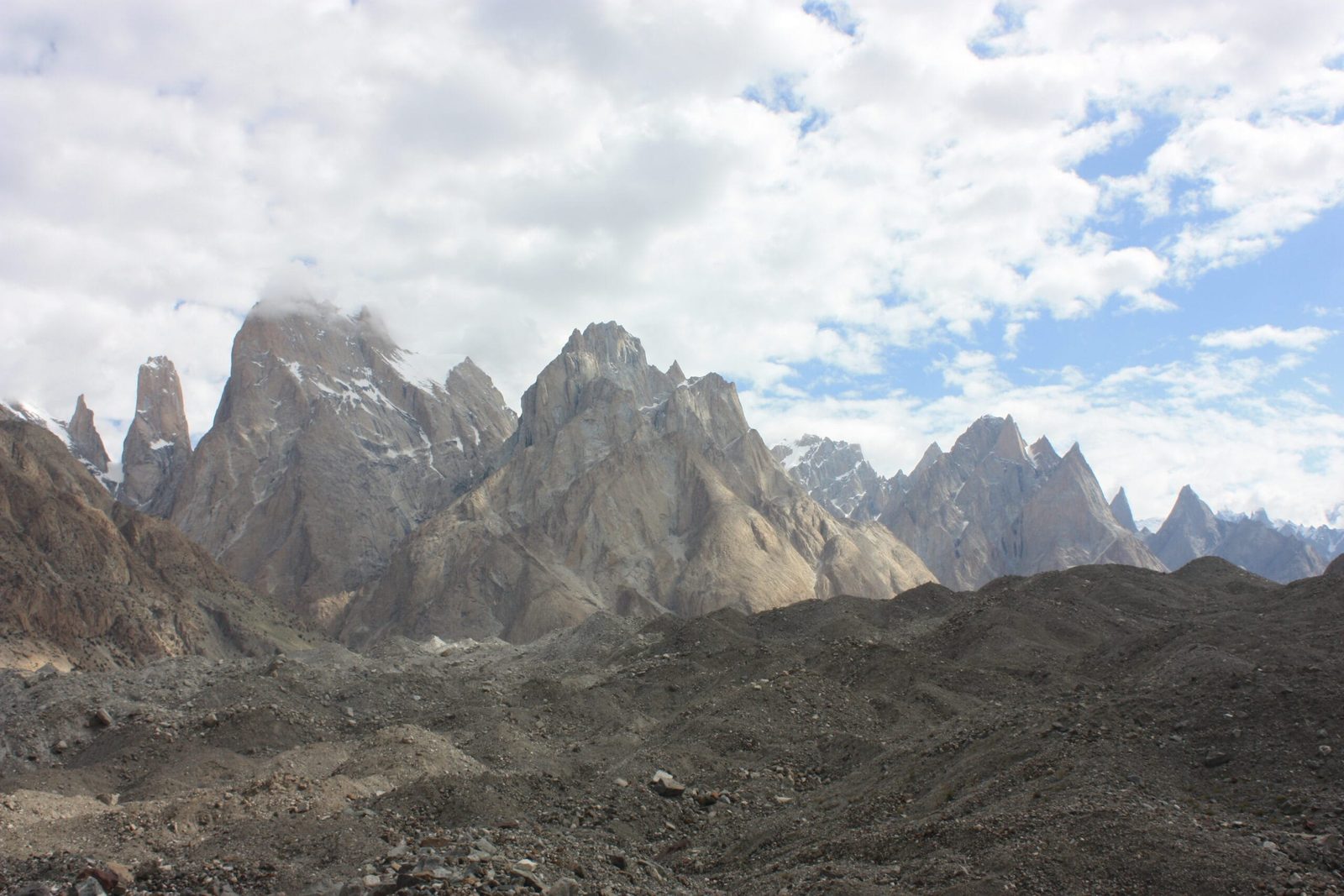
Where Uli Biaho is, and why it matters
Walk east from Askole and the Braldu gorge opens into the Baltoro Glacier, the frozen highway that carries every expedition toward Concordia and K2. About a third of the way up, the north bank explodes into granite. Most people look right at the Trango Towers. Uli Biaho is the slimmer, sharper tower set west of them, above the Uli Biaho Glacier.
It matters because of what happened on it. When Roskelley’s team arrived at Trango Base Camp in June 1979, they walked out one morning in shorts and tennis shoes to look for a line, and found what they called “the Obvious Line”: a continuous crack system leaning right, breaking the summit ice mushrooms some 3,500 feet above. They climbed it in one push, hauling roughly 300 pounds of gear, sleeping in hammocks strung on bolts. It set a standard for what alpine-style big-wall climbing in the Karakoram could be.
The route in: Skardu to the foot of the tower
The approach is the same one every Baltoro party uses, so the logistics are well worn. Getting to Skardu is by air from Islamabad or overland; from there it is jeep to Askole and then feet.
- Day 1–2 — Skardu. Permits, porters, load-packing, and a day to let the altitude settle.
- Day 3 — Skardu to Askole. Roughly 7–9 hours by 4×4 up the Shigar and Braldu valleys.
- Day 4 — Askole to Jhola. Dusty river-terrace walking above the Braldu.
- Day 5 — Jhola to Paiju. The first long day; Paiju Peak stands over the camp.
- Day 6 — Rest and load day at Paiju. Standard on this route; do not skip it.
- Day 7–8 — Onto the glacier toward Khoburtse and the Trango meadows. Moraine, meltwater channels, and the towers coming into full view.
- Day 9 — Trango / Uli Biaho base area. Grass, boulders, and a wall of granite above.
- Day 10–13 — Return by the same line to Askole, then jeep to Skardu.
Climbing parties add weeks, not days: the 1979 team spent nine nights on the wall alone, plus load carries through a dangerous 2,500-foot approach gully that spits rock once the sun hits it.
How Uli Biaho sits among its neighbours
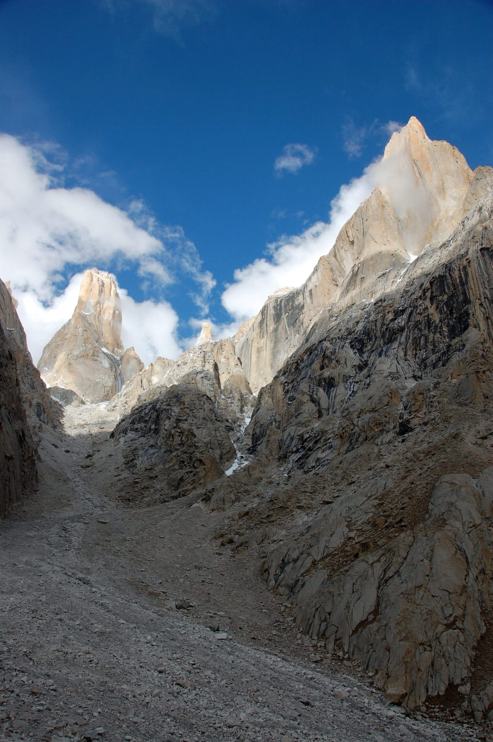
The 1979 climb, honestly told
Roskelley’s account is not a triumphant one. It is a record of hauling as the crux, of blood vessels broken pulling 100-pound bags, of ledges the size of a boot, of a lightning storm that had four men lying motionless in soaked bags all night. Bill Forrest lost electrolytes and nearly did not continue. Ron Kauk took a thirty-pound block of ice on the shoulder near the summit and said he was going no further, then went. They topped out at four in the afternoon on 3 July, took photographs, and turned straight back down into fifteen rappels.
Later ascents opened other lines — an Italian route on the south pillar in 1988, a Slovak ice line on the North-West Face in 2006, a fast West Face in 2013, and a Russian East Face route the same year. It remains a wall for experienced big-wall teams, not a guided objective.
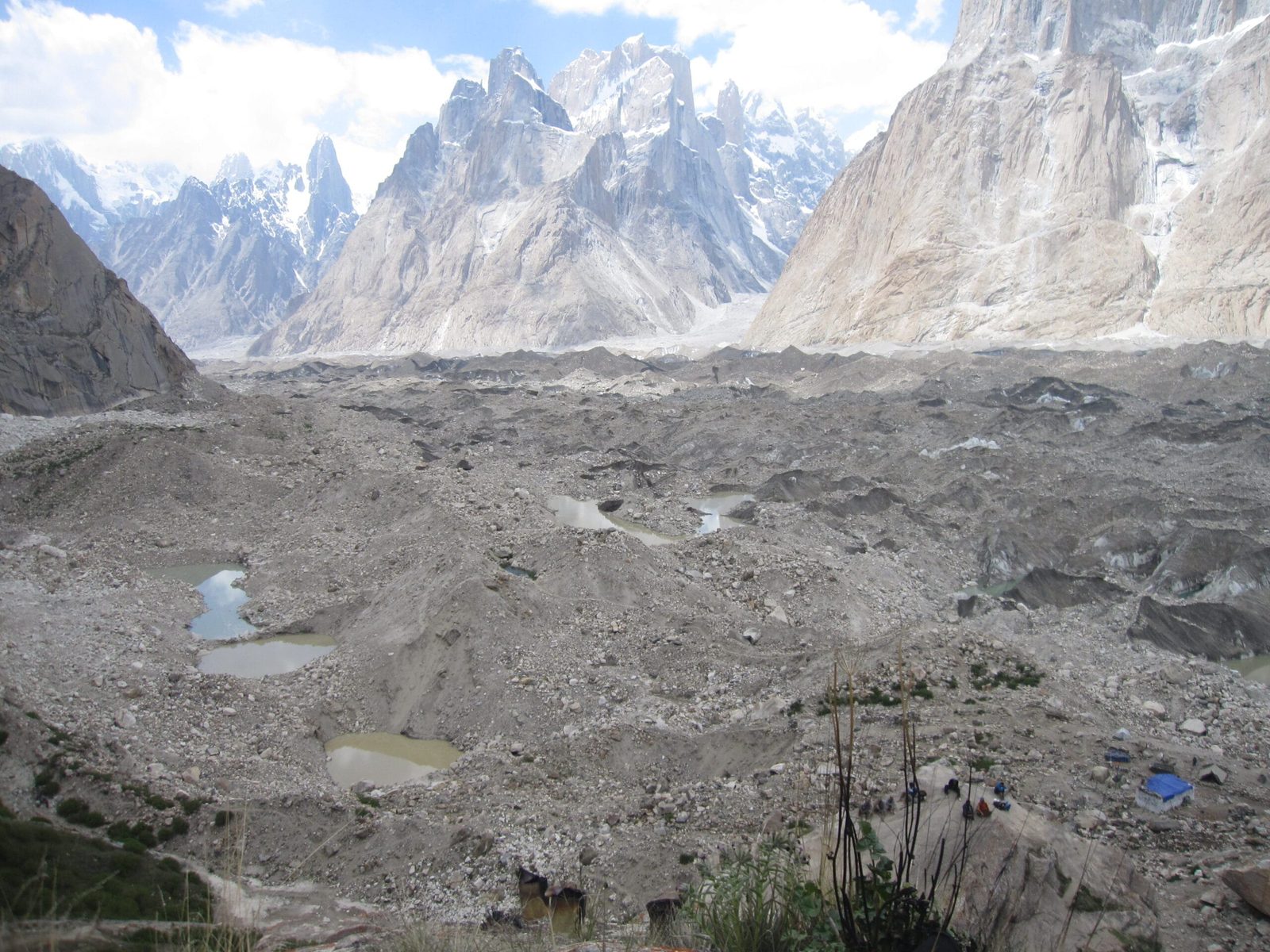
The profile: what the walk to the base actually costs you
When to go
| Months | Conditions | Verdict |
|---|---|---|
| April–May | Braldu jeep road unreliable, deep snow high, cold camps | Too early for the walls |
| June | Trail opens, glacier still firm, long daylight | Good — the 1979 team started 24 June |
| July | Warmest, busiest, most rockfall in sun-hit gullies | Best overall, with early starts |
| August | Stable spells, glacier melt at its messiest underfoot | Good |
| September–October | Colder, clearer, shorter days, camps get hard | Fine for trekking, late for big walls |
How hard is it, really
Walking to the Trango and Uli Biaho base area is a genuine Karakoram trek: six or more consecutive days on foot, moraine and loose glacier underfoot, river crossings, camps around 3,000–4,000 m, no road and no shop after Askole. If you can walk seven hours a day with a daypack, back to back, you can do it. It is not technical, and it is not a stroll. Read our acclimatisation guide before you book, and take the gear list seriously — people underdress for these camps every season.
The tower itself is a different sport. Grade VII aid and hard free climbing, objectively dangerous approach gullies, hanging bivouacs. We support such expeditions with logistics, porters and base camp; we do not pretend to guide anyone up that wall.
Getting there and what it costs
Islamabad to Skardu is a short flight when the weather behaves, and a long, spectacular road when it does not — build in buffer days either way. From Skardu it is jeep to Askole and then porters. If you are already planning the K2 Base Camp trek, Uli Biaho and the towers are on your route; you do not need a separate trip to see them.
On price, we keep it personal rather than posting a number that goes stale. What a trip costs depends on group size, porter loads, days, and whether you are trekking or climbing. Tell us your dates and we will send a real figure with everything itemised — fair price, no corners cut on guides, food or safety. We are the local Balti team on the ground, not a broker taking a margin and handing you to someone else.
Frequently asked questions
How high is Uli Biaho Tower?
It is normally given as 6,109 m (20,043 ft). John Roskelley’s 1979 first-ascent report records 19,957 ft, and some databases list lower figures, so treat the height as approximate — sources genuinely disagree.
Has Uli Biaho Peak been climbed?
Uli Biaho Peak, the higher summit of the massif at around 6,417 m, was still recorded as unclimbed as of 2006. The Tower, at 6,109 m, has been climbed several times since 1979.
Can I trek to Uli Biaho without climbing?
Yes. The walk from Askole through Jhola and Paiju to the Trango and Uli Biaho base area takes about five to six days and needs fitness, not technical skill. It is the same trail used by K2 Base Camp parties.
Do I need a permit for Uli Biaho?
Trekking in the area is open-zone and does not need a mountaineering permit. Climbing the Tower does require a peak permit with a liaison officer. All visitors need the correct Pakistan visa — a Trekking & Mountaineering visa for expeditions and treks.
When is the best time to go?
June to August. The 1979 first ascent ran from 24 June to 5 July. September is still fine for trekking but cold and late for the walls.
Plan it with the people who live here
We are a Skardu-based team of Balti guides and porters — not a broker. Same hands from the jeep at Askole to the last camp on the Baltoro, a sat phone in camp, and an evacuation plan that exists on paper before you fly.
WhatsApp: +92 312 9921574 | Email: info@karakoramventure.com
Message us “ULI BIAHO” with your dates and group size and we will come back with an itinerary and a real price.
Sources & attribution: John Roskelley, “The Obvious Line: Uli Biaho”, American Alpine Journal 1980; Wikipedia, “Uli Biaho”; Dodo Kopold, Alpinist climbing notes (2006). Images: Black Zero — CC BY 2.0; Shikari7 — CC BY-SA 3.0; Maria Ly — CC BY 2.0; all via Wikimedia Commons. Heights and timings are approximate.

