



Praqpa Ri, also written Praqpa Kangri, is a 7,134 m mountain in the Baltoro Muztagh of Gilgit-Baltistan. It stands just over two kilometres south of Skil Brum, a short glacier walk west of K2. Its main summit has never been climbed. Teams get there from Skardu by jeep to Askole , then six to eight days on foot up the Baltoro Glacier. The only realistic window is mid-June to early September. Two documented attempts on the main top have both turned back, the higher of them at about 6,300 m. Meanwhile a Chilean pair reached the lower south summit in 2017.
We run the Baltoro out of Skardu with our own Balti team, and we will be straight with you. Praqpa Ri is not a trip we sell off a shelf. It is an unclimbed 7,000er for a small, self-sufficient team. You need to move on deep snow and steep ice a long way from any help. The two parties who went at the main summit were about as experienced as they come. What we do is put a team at the foot of it properly. That means permits, porters, base camp, food, a satellite phone and an evacuation plan written down before anyone leaves Skardu. Are you here to read about one of the last blank summits above the Baltoro rather than to climb it? That is fine too. It is a mountain worth knowing.
Key takeaways
- Height: 7,134 m in Wikipedia and Peakbagger. Climbers who have been on it refer to the central summit as 7,156 m. Treat it as roughly 7,134–7,156 m — the surveys disagree.
- Status: main summit unclimbed, and listed among the world’s unclimbed 7,000 m peaks.
- Where: Baltoro Muztagh, Gilgit-Baltistan — about 2.3 km south of Skil Brum (7,410 m). The Savoia Glacier drains its east flank into the Godwin-Austen Glacier below K2.
- The other tops: a north summit of 7,096 m, still unclimbed, and a south summit first climbed on 16 July 2017 — quoted as 7,046 m by the climbers, 7,089 m by Peakbagger.
- Access: Islamabad to Skardu, 4×4 to Askole, then the Baltoro on foot. The 2017 team walked six days to Broad Peak base camp and used it as their springboard into the Khal Khal valley.
- Season and paperwork: mid-June to early September, on a mountaineering permit with liaison officer and royalty — not an open-zone trekking permit.
Where Praqpa Ri is, and why you have never heard of it
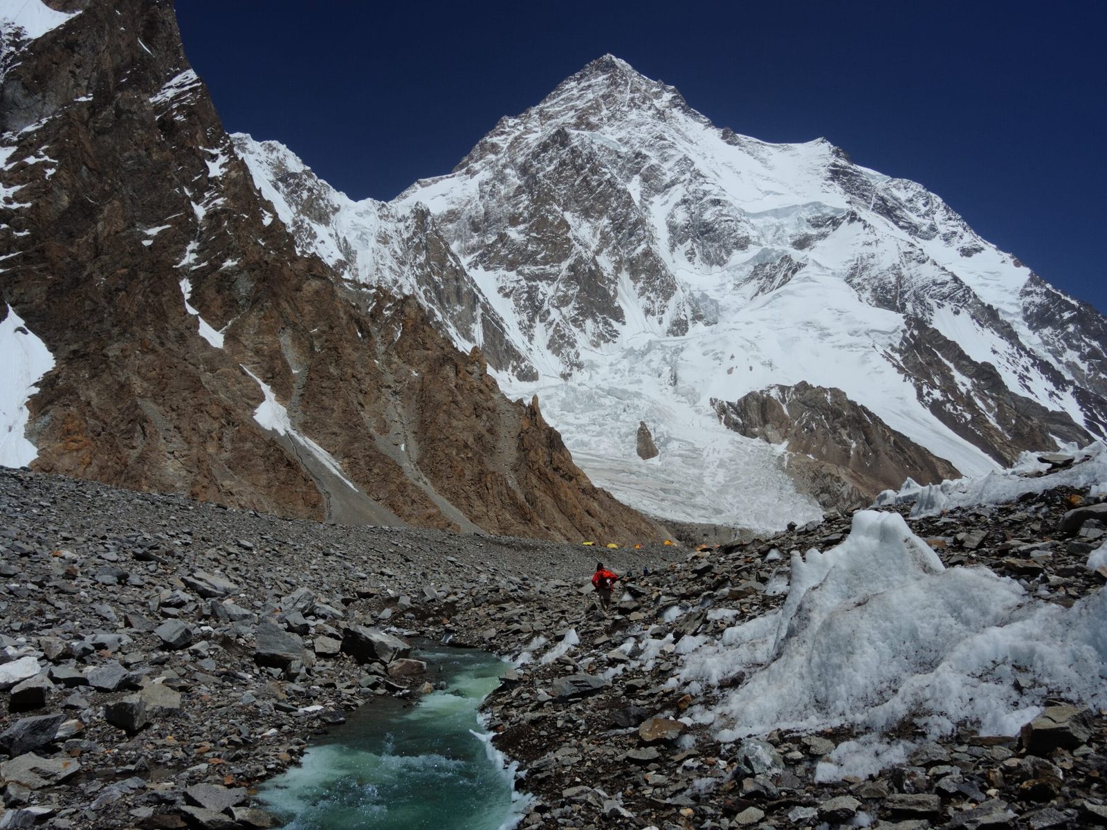
Stand at Concordia and turn north. The Godwin-Austen Glacier runs away from you towards K2, with Broad Peak on your right. Praqpa Ri is on the other side of that corridor, back and west, behind the shoulder of K2. It is a broad snow mountain. The Savoia Glacier pours off its eastern flank, and the small Khal Khal glacier is tucked in below it to the south. It sits about 2.3 km south of Skil Brum, in the same tangle of ridges as Skyang Kangri.
That location explains the anonymity. Praqpa Ri is a 7,000 m mountain standing in the shadow of the second-highest mountain on earth. It has modest prominence. Consequently the record books treat it as a satellite rather than a peak in its own right. For a century every climbing party that walked past it was on its way somewhere more famous. Nobody was looking sideways.
How it measures up against its neighbours

The two ways in: Savoia from the north, Khal Khal from the south
Everything starts the same way — the long walk that trekkers know from the K2 Base Camp trek. Where the two approaches part company is at Concordia. Ralf Dujmovits and Nancy Hansen went at the mountain from the Savoia Glacier to the north in 2016. Afterwards they suggested the Khal Khal glacier to the south was the easier line. The Chilean team took that advice the following year. Here is how a southern attempt is shaped in practice, based on what the 2017 party actually did:
- Skardu to Askole — roughly seven to nine hours by 4×4 up the Braldu gorge.
- Askole to Paiju — two days along the river to the snout of the Baltoro.
- Paiju to Urdukas — onto the glacier, past the Trango group; the first proper glacier days.
- Urdukas to Goro II to Concordia — two days of moraine and ice to the junction at about 4,600 m.
- Concordia to Broad Peak base camp — roughly half a day up the Godwin-Austen. Six days from Askole in total for the Chilean team.
- Into the Khal Khal valley — two days up the glacier with an advance camp mid-way, to the col at about 5,600 m at the foot of the south ridge.
- Acclimatisation — the 2017 team used Norit Peak (6,270 m) next to the col for this before turning to Praqpa Ri.
- The south ridge — snowfields and ice to a high camp at roughly 6,300 m, then a long plod on deep snow to the south summit.
Three expeditions, one summit — and it was not the main one
The first recorded attempt came in 2016. The Canadian climber Nancy Hansen and the German Ralf Dujmovits spent two months in the range. They went at Praqpa Ri by its east-southeast ridge from the Savoia Glacier, and reached about 6,300 m before poor snow sent them down. Hansen’s climb was supported by a Shipton-Tilman grant under the fitting title Hiding in Plain Sight: Unclimbed Summits in the Karakorum.
In 2017 three Chileans — Andrés Bosch, Alejandro Mora and Armando Montero — came in from the south. After acclimatising with a new route on Norit Peak, Bosch and Mora climbed the south ridge over three days from the 5,600 m col. First a short mixed pitch. Then 300 m of snowfields at 50–70 degrees, split by three vertical bergschrunds. Finally 300 m of good ice onto a sharp, exposed ridge. Deep snow stopped them at 8pm under a serac after sixteen hours of climbing. They summited the south top at 10am on 16 July, in weather already going bad. They were back at base camp on 19 July after nine days out. Their route is graded TD+, 1,500 m, M3, 50–90 degrees.
In 2021 Simon Messner and Martin Sieberer tried the central summit and were stopped twice at around 6,000 m by snow conditions. Messner came home talking less about the summit than about the state of the mountain: steep slopes primed to avalanche, and weather windows that a warming range is making harder to read. That is a working climber’s assessment of the Karakoram now, and it is worth taking seriously.

When to go
| Months | Conditions | Verdict |
|---|---|---|
| April – mid-May | Winter snowpack still on the Baltoro; the upper glacier is hard work for porters and rivers are unpredictable. | Too early for the mountain. |
| Late May – mid-June | The glacier opens up. Cold nights, good freeze, but heavy snow high on the peak. | Good for the approach; usually early for climbing. |
| Mid-June – July | The main Karakoram window. Longest settled spells, most workable snow. | The realistic window for an attempt. |
| August | Still climbable, but freeze levels are high; wet snow, rockfall and slopes softening within hours of sunrise. | Workable — watch the thaw. |
| September | Colder, shorter days, first autumn snowfalls. Baltoro treks still run into the month. | Closing down for expeditions. |
| October – March | Winter on the Baltoro. | Closed. |
The pattern is the same one we describe in our guide to the climbing season on the Baltoro. Praqpa Ri has one extra wrinkle: both failed attempts were beaten by snow quality rather than storms, so a settled forecast alone is not enough. You want cold nights as well as clear ones.
How hard it is, honestly
Hard enough that two strong parties have gone home without it. Nobody has been above roughly 6,300 m on the main summit.
The mountain is not a technical showpiece in the way Gasherbrum VI or the Trango walls are. The difficulty is different and in some ways worse: long snow slopes at 50 to 70 degrees, bergschrunds that go vertical, corniced ridges, and an upper mountain that holds deep, unconsolidated snow late into the season. The 2017 route reached TD+ with M3 mixed ground and sections to 90 degrees on the south ridge, and that was the easier top. Add altitude, a fortnight of glacier travel just to arrive, and a base camp days from a road.
What that means in practice: this is for a team already comfortable leading steep alpine ice and mixed at altitude, self-rescuing on a glacier, and making the call to turn round. Sound acclimatisation is not optional — read our acclimatisation guide before you plan the schedule. If you are not there yet, the honest recommendation is to walk the Baltoro first and look at the mountain from Concordia.

The real risk, and what we do about it
Avalanche is the named danger here. Simon Messner said it plainly after 2021: the slopes are steep, they hold unstable snow, and they need genuinely good weather to be safe. Add crevassed glacier travel on the Khal Khal and Savoia, a base camp that is several days’ walk from the nearest road, and altitude illness that gets serious fast above 6,000 m.
On every expedition we run there is a satellite phone in base camp, established helicopter-rescue contacts for the Baltoro region, and an evacuation plan agreed before departure — who calls whom, from where, and who pays. We will also tell you what a helicopter cannot do: it needs weather and daylight, and it does not fly to 6,000 m on the south ridge. Proper insurance for high-altitude rescue is a condition of joining us, not a suggestion. Read our insurance guide for high-altitude trekking in Pakistan.
Permits and access
Walking the Baltoro to Concordia and K2 base camp is an open-zone trek. Climbing Praqpa Ri is not: any attempt needs a mountaineering permit with a liaison officer and royalty paid through the Pakistani authorities, and that paperwork runs in months rather than weeks. The whole area sits inside Central Karakoram National Park, so park fees and rules apply as well. You also need the right visa — trekking and mountaineering visas are a separate category from the ordinary tourist visa. Start with our Pakistan visa guide for trekkers, then talk to us early. Permit timelines are the most common reason a Karakoram plan collapses.
Getting there, and what it costs
Everything begins in Skardu. Fly Islamabad to Skardu when the weather allows, or drive the Karakoram Highway and build in buffer days — our guide on how to get to Skardu covers both. From Skardu it is jeep to Askole, and after that your own legs.
On price: we keep pricing personal rather than posting a number that goes stale. An expedition on this side of the Baltoro is priced on team size, days on the mountain, porter loads, permit and royalty, and how much base camp support you want — all of which move. Tell us the shape of your trip and we will quote it honestly: a fair price, with no corners cut on guides, food or safety. Local hands, real safety, fair price.
Frequently asked questions
Has anyone climbed Praqpa Ri?
Not the main summit. It is listed among the world’s unclimbed 7,000 m peaks. The south summit was first climbed on 16 July 2017 by Andrés Bosch and Alejandro Mora of Chile via the south ridge, and the north summit at 7,096 m is also unclimbed.
How high is Praqpa Ri?
Wikipedia and Peakbagger give 7,134 m for the main summit; climbers on the mountain have referred to the central top as 7,156 m. The honest answer is that it is a shade over 7,100 m and the surveys do not fully agree.
Can I see Praqpa Ri without climbing it?
Yes. Walk the Baltoro to Concordia and on up the Godwin-Austen towards K2 base camp and you are in its valley. That is an open-zone trek of roughly two weeks, and a serious one, but it needs no mountaineering permit.
What permit do I need for Praqpa Ri?
A mountaineering permit with a liaison officer and royalty, arranged through the Pakistani authorities, plus a trekking and mountaineering visa rather than a tourist visa. Central Karakoram National Park rules and fees also apply. Allow months of lead time.
When is the best time to attempt it?
Mid-June to early September is the only realistic window, and mid-June to July is the strongest part of it. Because both attempts on the main summit were stopped by snow quality rather than storms, cold nights matter as much as clear days.
Talk to the team who lives here
Planning an attempt, or a Baltoro trek that puts you under K2 and its neighbours? Message us and you are talking to a Balti team in Skardu — not a broker in another city reselling your trip to somebody else. We will tell you honestly whether what you have in mind is realistic, and what it takes to do it safely.
WhatsApp: +92 312 9921574 · Email: info@karakoramventure.com
Sources & attribution: elevation, coordinates and unclimbed status from Wikipedia (Praqpa Kangri; Highest unclimbed mountain) and Peakbagger; the 2016 attempt from Nancy Hansen, American Alpine Journal 2017, and Deutsche Welle; the 2017 Chilean ascent of the south summit and the Norit Peak route from PlanetMountain, 16 August 2017; the 2021 attempt from Simon Messner, American Alpine Journal 2022, and Explorersweb. Images: Zacharie Grossen (CC BY-SA 4.0); Earth Science and Remote Sensing Unit, NASA Johnson Space Center (public domain); Vittorio Sella (public domain); Shikari7 (CC BY-SA 3.0) — all via Wikimedia Commons.

