



Saraghrar is a 7,340 m mountain in the Hindu Kush of Chitral, in Pakistan’s Khyber Pakhtunkhwa province. It is the fourth-highest independent peak in the range, and one of the least-visited big mountains in the country. It is not a trekking peak. For most people the realistic trip is the demanding five-day walk up the Ziwor Gol. It runs from Turikho to the 1959 Italian base camp at around 4,200 m. July to early September is the season. Climbing any of its summits is a full, self-reliant expedition on a massif that still has unclimbed lines.
We are a Skardu company and we will not pretend otherwise: Saraghrar is not our back garden the way the Baltoro is. It sits at the far western end of the Pakistani mountains, a long way from Baltistan. We run it with our own expedition staff out of Skardu, plus Chitrali crew and porters hired in the Turikho valley. Because that is how it should be done: local people, paid properly, on their own ground. And we will be straight with you about the rest: there is no lodge, no rescue post and almost no traffic up there. That is the appeal and it is also the risk.
Key takeaways
- Height: 7,340 m at the north-east summit (some sources give 7,349 m); prominence about 1,979 m; listed around 77th highest in the world.
- Where: Chitral District, Khyber Pakhtunkhwa — the Hindu Kush, not the Karakoram and not Gilgit-Baltistan.
- Base camp trek: roughly five days return from Zang Lasht in Turikho to the 1959 base camp at about 4,200 m, via the Ziwor, Ushko and Nirogh glaciers.
- Season: July to early September for trekking; June to September for climbing.
- History: north-east summit first climbed on 24 August 1959 by an Italian team; the north-west face fell to a Georgian trio in 2021 and won the 2022 Piolet d’Or.
- Access: Chitral town by road from Islamabad through Dir and the Lowari tunnel; flights to Chitral are intermittent, so never build an itinerary that depends on one.
Where Saraghrar is, and why you have never heard of it
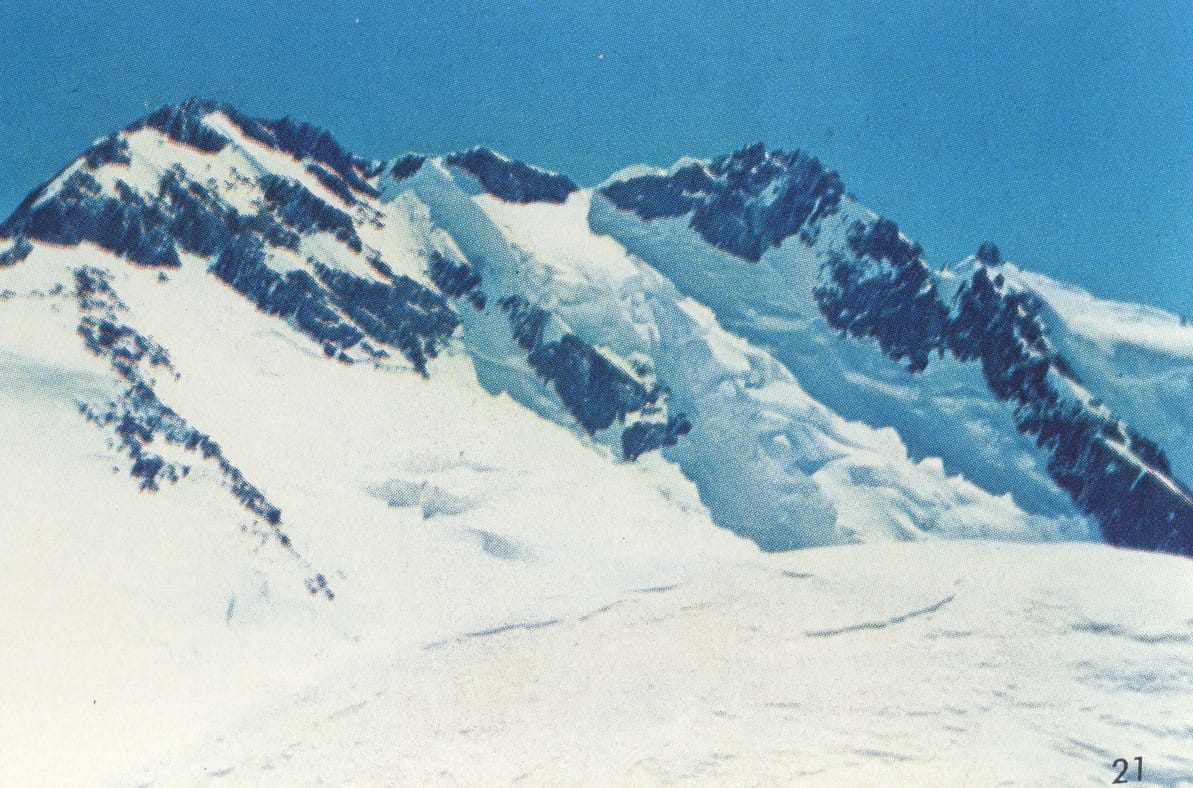
Draw a line west from the Baltoro, past Nanga Parbat, past Chitral town, and you arrive in the high Hindu Kush. This is the range that ends the Himalaya-Karakoram system, and it carries the border with Afghanistan’s Wakhan. Tirich Mir (7,708 m) owns the skyline here. Behind it sit Noshaq, Istor-o-Nal, Udren Zom and Saraghrar, and behind those, valleys that see a handful of foreigners in a good year.
Saraghrar itself is not a spire. It is a huge, irregular plateau at roughly 7,000 m, defended on every side by granite and ice walls. Five named summits are scattered across it: north-east (7,340 m), south (7,307 m), north-west (7,300 m), south-east (7,208 m) and south-west (7,148 m). Expedition reports have contradicted each other about which top is which for sixty years. That confusion is part of why the mountain stayed obscure while smaller, prettier peaks got famous.

The neighbours: how Saraghrar measures up
The four highest peaks of the Hindu Kush all stand within about 40 km of each other. Saraghrar is the fourth of them, and the one almost nobody queues for.
The walk in: Turikho, the Ziwor Gol and the 1959 base camp
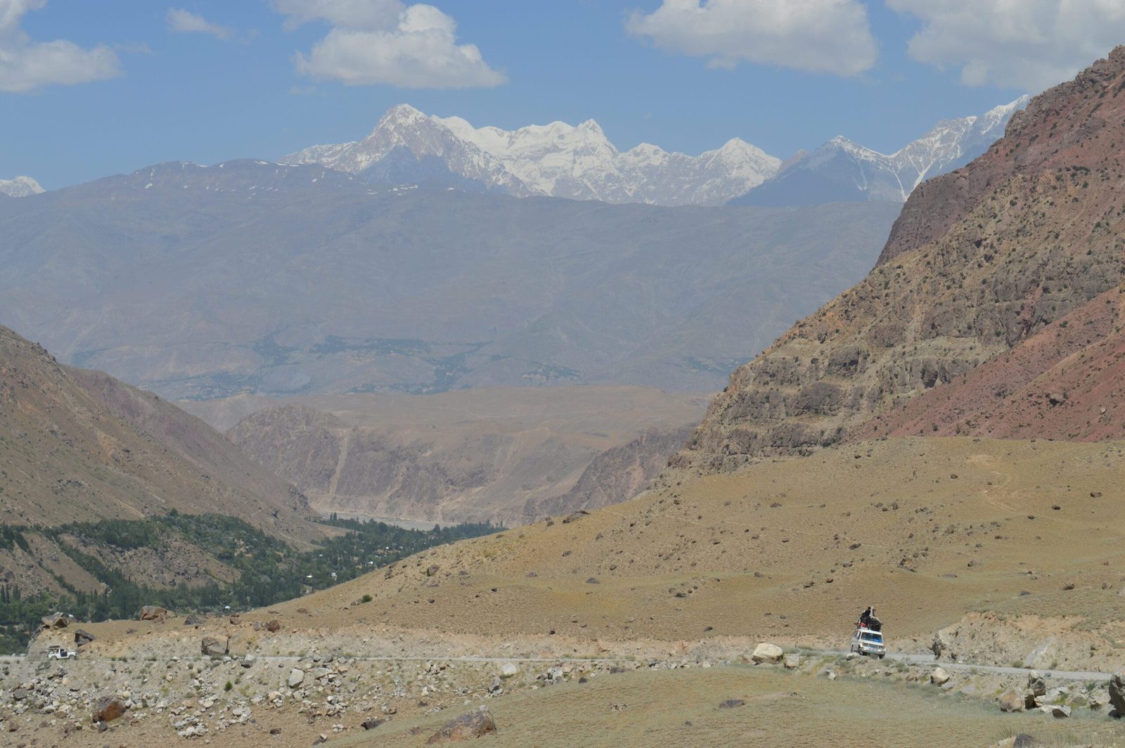
There is no tourist route to Saraghrar. The established approach is the one the Italians used, and the one we use. It goes up the Ziwor Gol from the Turikho valley. That side valley is uninhabited now; it was farmed until the glacier at its head advanced and pushed people out. It has never been resettled. The standard reference describes it as a demanding five-day trek; in practice we build in an extra day for acclimatisation and weather.
The five-day walk up the Ziwor Gol
- Drive in. Chitral town to Zang Lasht in Turikho by 4×4, roughly half a day on rough jeep road. Cross the bridge over the Turikho River to Burzum village (about 2,400 m) at the narrow mouth of the Ziwor Gol.
- Day 1 — Burzum to Golung Shal (about 2,800 m). North and west up the true left bank, past the hot springs at Uts; roughly 11.5 km.
- Day 2 — Golung Shal to Gram Shal (about 3,400 m). Around 12 km up the valley, crossing the river shortly before camp. Old terraces here show where people once lived.
- Day 3 — Gram Shal to Saraghrar Base Camp (about 4,200 m). Up the true right bank about 3.5 km to the snout of the Ushko Glacier, then cross it just above the snout. From there the route runs south along the west margin of the Nirogh Glacier and across the Sorlawi Glacier. Base camp is the one used by the 1959 expedition, on the spur between the Roma and Sorlawi glaciers.
- Day 4 — rest and view day. This is where the mountain finally shows itself properly, ringed by 6,000 m and 7,000 m peaks.
- Days 5–6 — return. Back down the Ziwor Gol to Zang Lasht in two days, then the jeep road to Chitral.
A short history of a stubborn massif
Saraghrar has never been a fashionable mountain, but its record is heavier than its reputation.
- 1958 — a British team led by Ted Norrish attempts the north-east summit. The expedition ends after the death of team member P. S. Nelson.
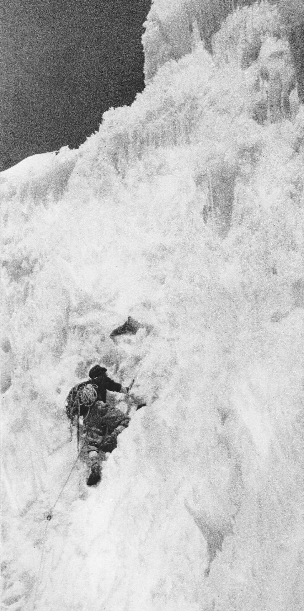
- 24 August 1959 — the north-east summit is climbed by an Italian expedition from the Rome section of the Italian Alpine Club, led by Fosco Maraini. Franco Alletto, Giancarlo Castelli, Paolo Consiglio and Carlo Alberto Pinelli reach the top, approaching by the Niroghi glacier on the north-east of the massif.
- 24 August 1967 — Japanese climbers Satoh Yukitoshi and Hara Hirosada make the first ascent of the south summit from the Rosh Gol glacier.
- 29 July 1971 — a Japanese team makes the first ascent of the south-west peak.
- 9 August 1982 — after three Catalan attempts, Juan Lopez Diaz, Enrique Lucas Llop and Nil Bohigas reach the north-west II summit (about 7,200 m).
- 2005 — a Swiss expedition led by Jean-Michel Zweiacker makes the first ascent of the south-east summit.
- 10 September 2021 — Georgians Archil Badriashvili, Giorgi Tepnadze and Bakar Gelashvili climb the unclimbed north-west face from the Rosh Gol in alpine style over eight days. The ascent wins the 2022 Piolet d’Or.
When to go
| Months | Conditions | Verdict |
|---|---|---|
| June | Deep snow still on the glaciers, cold nights, rivers rising with the melt | Climbing teams start now; early for the base camp trek |
| July | Valleys warm, glaciers opening, river crossings highest around midday | Strong for both climbing and trekking |
| August | The most settled spell — most first ascents here happened in August | Best overall window |
| Early to mid September | Cold, clear and stable; herders start leaving the high pastures | Excellent for trekking; support thins out |
| Late September to October | Hard freeze, snow returning, empty valleys | Too late for a comfortable base camp trip |
| November to May | Winter in the high Hindu Kush | Closed for practical purposes |
If you want the wider seasonal picture across northern Pakistan, our season-by-season guide covers the Karakoram side, which runs on a similar but slightly later rhythm.
How hard it is, honestly
The base camp trek is demanding rather than technical. You gain about 1,800 m over three walking days, and you sleep at 4,200 m. The last day involves crossing a glacier snout and walking moraine. That is loose, ankle-turning ground, and a twisted knee is a genuine problem because there is no road behind you. Expect six to eight hours of walking on the long days with a light pack. You do not need rope skills, but you need to be fit enough to walk day after day on rough ground and comfortable camping in the cold. Read our acclimatisation guide before you commit; 4,200 m is enough to make an unprepared person genuinely ill.
Climbing Saraghrar is a different conversation. The massif is guarded by long glacier approaches and steep ice and granite walls. Ascents are counted in single figures per summit. In fact the north-west face needed a Piolet d’Or-winning team to unlock. This is an objective for experienced alpinists running their own plan, not a guided summit you can buy. If you want a 7,000 m peak with a realistic success rate, we would point you at Spantik in the Karakoram instead, and say so plainly.
The real risk, named
The danger on this trip is not the summit. It is remoteness. From base camp you are three walking days from the nearest jeep road and a further half-day of driving from a hospital in Chitral town. There is no rescue post, no reliable phone signal and no passing traffic to help you. We carry a satellite phone on every trip, and we plan evacuation before we leave. That means who we call, which helicopter operator, which insurer guarantees payment, and which valley they can actually land in. We also brief you on it at the trailhead. Helicopter rescue in Pakistan is not free and is not automatic: it requires a financial guarantee, and weather can ground it for days. Check that your policy covers helicopter evacuation above 4,000 m; our insurance guide explains what to look for.
Permits and access
Two separate things, and people mix them up. Trekking in the Turikho valleys is treated differently from the open zones of Gilgit-Baltistan. The standard trekking reference lists these valleys as a restricted zone, where no formal trekking permit is issued. However, visits are authorised by the Deputy Commissioner in Chitral. Climbing is separate again — peaks above 6,500 m require a mountaineering permit and royalty arranged through the Alpine Club of Pakistan and the tourism ministry. Fees and rules have changed repeatedly in recent seasons, so we confirm the current position for your dates rather than publishing a number that goes stale.
Everyone on a trekking or climbing trip also needs the correct visa — the Trekking and Mountaineering category, not a plain tourist visa. Our Pakistan visa guide for trekkers walks through it.
Getting there, and what it costs
Chitral is reached by road from Islamabad. It is a long day of roughly 10 to 14 hours through Dir and the Lowari tunnel, which keeps the valley connected year-round. Still, check current tunnel timings before you set off, because daily closure windows change. Flights from Islamabad to Chitral run when they run; if one is operating on your dates, take it, but never build an itinerary that collapses without it. From Chitral town it is a rough half-day drive up the Turikho valley to the roadhead at Zang Lasht. Carry buffer days at both ends. From Skardu, our home ground, the sensible link is through Islamabad rather than overland across the country.
On price: we keep pricing personal rather than posting a number that goes stale. Group size, number of days and porter stages all move the figure. So does whether you want the base camp trek or a climbing permit, and the permit position in the year you travel. Quoting an average helps nobody. Send us your dates and team size and we will come back with a real, itemised cost — fair price, no corners cut on guides, food or safety. That is the whole deal: local hands, real safety, fair price.
Still deciding between ranges? Our roundup of the best treks in Pakistan sets Saraghrar’s neighbours against the Karakoram classics, and the Koyo Zom guide covers the Hindu Raj next door. For kit, our Karakoram packing list transfers almost unchanged to a Hindu Kush base camp trek.
Frequently asked questions
How high is Saraghrar, and where exactly is it?
Saraghrar’s north-east summit is 7,340 m (some sources give 7,349 m), making it the fourth-highest independent peak in the Hindu Kush. It stands in Chitral District, Khyber Pakhtunkhwa, in north-west Pakistan, close to the Afghan border and about 40 km from Tirich Mir.
Can I trek to Saraghrar without climbing it?
Yes, and for almost everyone that is the trip. A demanding five- to six-day return trek runs up the Ziwor Gol from Turikho to the 1959 Italian base camp at about 4,200 m. A separate four-day trek up the Rosh Gol from Zundrangram in the Tirich valley reaches Kotgaz at about 4,300 m, with Saraghrar standing at the head of the valley.
How hard is the Saraghrar base camp trek?
Demanding but not technical. You climb roughly 1,800 m over three walking days, camp at 4,200 m, and cross a glacier snout and long stretches of moraine. Six to eight hours of walking on the longer days, with no rope work required. However, real hill fitness and cold-weather camping experience are essential. There is also no easy exit if something goes wrong.
When is the best time to go?
August is the most settled month, with July and early September close behind. June still holds deep snow on the glaciers and high meltwater in the rivers. From late September the freeze arrives, the herders leave the pastures and the valley empties out.
Do I need a permit to climb or trek at Saraghrar?
For climbing, yes — peaks above 6,500 m require a mountaineering permit and royalty through the Alpine Club of Pakistan and the tourism ministry. For trekking, the Turikho valleys sit in a restricted zone where visits are authorised by the Deputy Commissioner in Chitral rather than by a standard trekking permit. Everyone also needs a Trekking and Mountaineering visa rather than a tourist visa. Rules change season to season, so confirm with us for your dates.
Plan Saraghrar with a local team, not a broker
Tell us your dates and how many of you there are, and we will send back an honest itinerary and an itemised cost — base camp trek or expedition. You will be dealing with the people who run the trip, not an agency that sells you on and disappears.
WhatsApp: +92 312 9921574 · Email: info@karakoramventure.com
Sources & attribution: elevations, summit list and ascent history from Wikipedia and American Alpine Journal expedition reports; approach and itinerary detail from published trekking references for Chitral (Mock & O’Neil); access and permit context from Pakistani tourism and Alpine Club of Pakistan sources. Figures are approximate and sources sometimes disagree; we verify current permit rules before every departure. Images: Franco Alletto (public domain) for the two Saraghrar photographs; Earth Science and Remote Sensing Unit, NASA Johnson Space Center (public domain) for the ISS view; Afaq Ali Muluk (CC BY-SA 4.0) for Tirich Mir from Parwak — all via Wikimedia Commons.

