



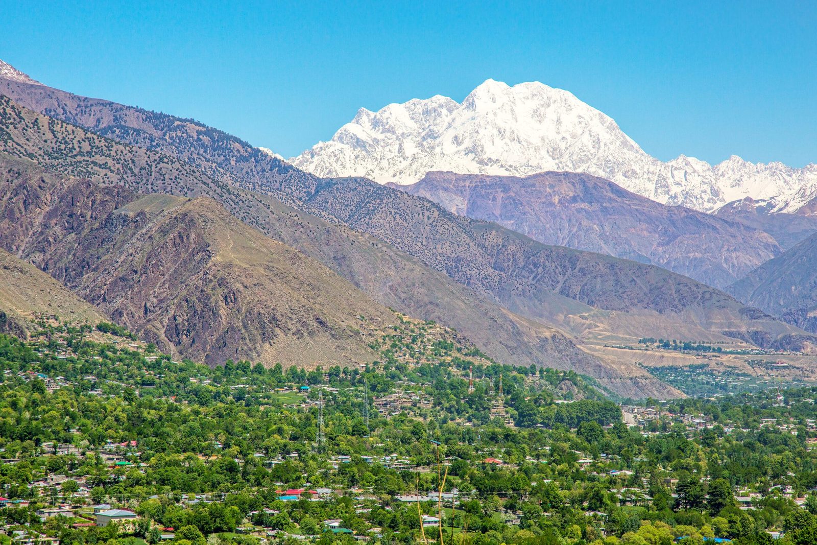
Tirich Mir is 7,708 m — the highest peak of the Hindu Kush, the 33rd highest mountain in the world, and the highest summit anywhere outside the Himalaya and the Karakoram. It stands in Chitral District, Khyber Pakhtunkhwa, in the far northwest of Pakistan, close enough to town that you can see it from the Chitral bazaar. The route most expeditions use today climbs the Upper Tirich Glacier and the north-west ridge from Babu Camp, a base camp at about 4,724 m, four trekking stages above the road head at Shagrom (about 2,760 m). The season is short: broadly June to August for a summit attempt, mid-June to mid-September for the base camp trek. Reckon a month or more door to door to climb it, and around a fortnight from Islamabad for the trek to base camp.
We should be straight with you about one thing before anything else: this is not our home valley. Karakoram Venture is based in Skardu, and our high-altitude staff are Balti men who grew up under the Baltoro. Tirich Mir sits a long way west of us, in Khowar-speaking Chitral, and we run it the only honest way — our own expedition team for the mountain work, with Chitrali crews from the Tirich valley who know that glacier and those stages far better than any outsider does. Everything below is what we say on the phone before anyone books.
Key takeaways
- Altitude: 7,708 m — highest peak of the Hindu Kush, 33rd highest in the world.
- Where: Chitral District, Khyber Pakhtunkhwa — the Hindu Kush, not the Karakoram and not Gilgit-Baltistan.
- Normal route: the Upper Tirich Glacier and north-west ridge, opened by a Czechoslovak expedition in 1967.
- First ascent: 21 July 1950, a Norwegian-British team — Arne Næss, Per Kvernberg, Henry Berg and Tony Streather — by the South Barum Glacier and the south ridge.
- Base camp: Babu Camp, about 4,724 m, roughly four trekking stages above Shagrom (about 2,760 m), the last village on the jeep road.
- Season: June to August for climbing; mid-June to mid-September for the base camp trek.
- Permits: issued by the Khyber Pakhtunkhwa provincial government, plus a Pakistan trekking and mountaineering visa.
Where Tirich Mir is, and why it is a different mountain from the Karakoram
Most people who come to Pakistan for big mountains fly to Skardu and walk up the Baltoro. Tirich Mir is the other end of the country and the other range. The Hindu Kush runs west from the Karakoram along the Afghan frontier, and Tirich Mir is its high point: 7,708 m, with a chain of about eleven summits behind it, and no mountain outside the Himalaya-Karakoram system standing taller anywhere on earth.
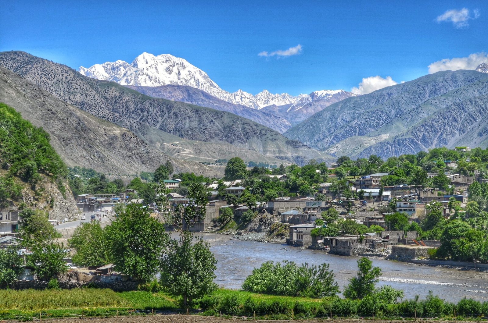
It dominates Chitral town completely. You do not have to trek to see it — walk into the main bazaar on a clear morning and it is simply there above the roofline, which is unusual for a peak this size. The approach runs up the Tirich valley to the Tirich Glacier at its head, and that glacier basin is ringed by three of the range’s 7,000ers: Tirich Mir itself, Noshaq (7,492 m) on the Afghan border, and Istor-o-Nal (7,403 m). Meltwater off these glaciers feeds the Torkhow river and then the Chitral river, which is what you drive alongside on the way in.
The approach: Chitral to Shagrom to Babu Base Camp
There is no short way in. The jeep road ends at Shagrom, about 2,760 m, the highest permanent settlement in the Tirich valley, and everything above that is walked or carried. Base camp is Babu Camp at roughly 4,724 m on the lower glacier — named for Babu, a well-known local guide from the valley. Four stages up, four stages back down.
- Islamabad to Chitral by road. A long day through Dir and the Lowari tunnel. Build in a buffer day; landslides and weather close this road without warning.
- Chitral to Shagrom by jeep up the Torkhow and Tirich valleys. Road head, permits and porters sorted here.
- Optional acclimatisation over the Zani Pass (about 3,840 m). Drive up, walk down to Shagrom. It costs a day and buys you both altitude and your first proper look at the mountain. We recommend it.
On foot from Shagrom
- Shagrom to Sherniak. First walking stage, into the valley proper.
- Sherniak to Shoghor Biasun. Rougher ground, shepherd pastures, the glacier ahead.
- Shoghor Biasun to the Istor-o-Nal camp. Moraine and glacier travel begins.
- Istor-o-Nal to Babu Camp (about 4,724 m). Base camp, under the Lower Tirich Glacier, with Tirich Concordia — where glaciers from seven side valleys meet — above.
- Return by the same stages. Trekkers turn around here. Climbers keep going, onto the Upper Tirich Glacier and the north-west ridge, with high camps above base.

The climb, and what has been done up here
The first ascent is one of the good stories in Himalayan history. On 21 July 1950 a Norwegian-British party — the philosopher Arne Næss, Per Kvernberg, Henry Berg and Tony Streather — reached the top by the South Barum Glacier and the south ridge. It was one of the highest summits anyone had climbed at that point — Annapurna had fallen only weeks earlier — and the expedition became a Norwegian documentary, Tirich Mir til topps, in 1952.
The route most teams use now
The line most teams use now came later. In 1967 a Czechoslovak expedition worked out the route via the Upper Tirich Glacier and the north-west ridge, and that is what people mean today by the normal route. The same era saw the rest of the chain fall: Tirich Mir East (7,692 m) to Norwegians in 1964, Tirich Mir West I (7,487 m) to the Czechoslovak team in 1967, and Tirich Mir West IV (7,338 m) to Kurt Diemberger and Dietmar Proske, also in 1967, by the north face.
Then it went quiet. Sitting in Pakistan’s troubled northwest near the Afghan border, the mountain was closed to foreign climbers for long stretches. It reopened in 2016 and two small teams summited that year. In July 2023 the Japanese alpinists Kazuya Hiraide and Kenro Nakajima made the first ascent of the 2,200 m north face — four nights of bivouacs, descending the 1967 normal route. It won the 2025 Piolets d’Or, awarded posthumously: both men were killed on the west face of K2 in the summer of 2024. If you climb here, you are climbing on a mountain with very few boot tracks and a lot of unfinished lines.
The name, and the fairies
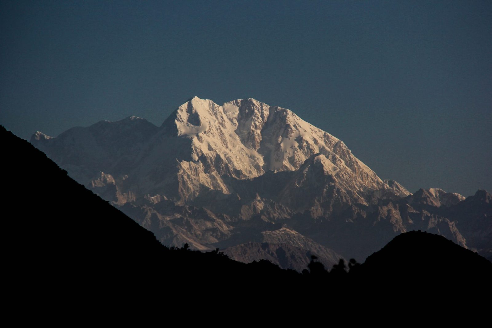
In Khowar, the language of Chitral, terich is the valley and mir means mountain — the mountain of Tirich. Scholars have linked the name back to Sanskrit roots and, more ambitiously, to the sacred Mount Meru of Hindu, Buddhist and Jain tradition.
Locally the mountain is not just rock and ice. Chitrali tradition holds that it is a fortress of fairies, the bohtan doyak or stone-throwers, and that going up there brings death to the trespasser. Among the Kalash of the nearby valleys, the peak belongs to the goddess Krumai, who appears as a wild goat. We mention this because you will hear it in the villages, and because how you treat it matters. Nobody in Shagrom needs a foreign climber explaining their own mountain to them.
When to go
| Months | Conditions | Verdict |
|---|---|---|
| November–April | Deep winter. Heavy snow on the passes and the approach; the Lowari road can be difficult; nothing operating on the mountain. | Closed season. No. |
| May – early June | Snow still low, glaciers unsettled, rivers rising with melt. Expeditions may start moving in at the tail of this window to give themselves time. | Early. Climbers only, with margin. |
| Mid-June – August | The main season. Warmest and most settled, glaciers workable, porters available. Summit attempts happen here. | Go. Best window for both climb and trek. |
| Early–mid September | Cooler, clearer air, colder nights, autumn colour coming into the valley. Thin end of the climbing season. | Very good for the base camp trek. |
| Late September–October | Cold, short days, new snow returning high. Valley travel still fine on good years. | Trek only, and only with spare days. |
For scale: the weather station at 4,245 m on the mountain averages about 6.5 °C in July and August, and about −17.5 °C in January. That is the average, not the cold nights, and not what it does at 7,000 m. Read our seasons guide if you are still deciding when to come to northern Pakistan at all.
How hard it is — honestly
The base camp trek is a serious high-altitude trek, not a walk. Four stages from 2,760 m to 4,724 m, no lodges, no teahouses, no shops, tents and porters the whole way, and glacier and moraine ground before base camp. If you are fit, used to consecutive long days with a pack, and you take the acclimatisation seriously, it is within reach without any climbing background. We will still rope up where the ice says so. Our acclimatisation guide and packing list both apply here.
The climb is another thing entirely. Tirich Mir is a 7,700 m mountain with heavily crevassed glaciers guarding the approach, a long committing ridge, real altitude, and almost no traffic to break trail or find the way for you. There are no fixed lines waiting, no queue of other teams, and no rescue infrastructure of the kind that has grown up on the Baltoro. Prior 6,000 m or 7,000 m experience is not a nice-to-have here. If you want a first big Pakistani peak, start somewhere else and come back to this one.
Safety: what actually threatens you here
Crevasses on the Tirich glaciers are the headline risk — the foot of this mountain is genuinely difficult to reach, and it has turned back strong parties. Add rockfall on the moraine, altitude, and a road in that closes without notice. The harder truth is the response time: helicopter and hospital infrastructure in Pakistan’s mountains is concentrated in Gilgit-Baltistan, and you are a long way from it in the Tirich valley.
So we resource it properly. A satellite phone in camp on every trip. A written evacuation plan with named contacts and a road-head fallback before you leave Chitral. Guides trained to turn people around early rather than late. And insurance that genuinely covers helicopter evacuation at your maximum planned altitude — we check the policy, we do not just ask if you have one. See our insurance guide.
Permits and access — different rules from the Karakoram
Tirich Mir is over 6,500 m, so climbing it needs a mountaineering permit, not just trekking paperwork. The important difference: since permits were devolved to the provinces, Hindu Kush and Hindu Raj peaks are handled by the Khyber Pakhtunkhwa government, not the Gilgit-Baltistan authorities you deal with for K2 or Broad Peak. Expect foreigner registration in Chitral and a liaison officer for expeditions.
Around the 75th anniversary of the 1950 first ascent, the KP tourism authority announced a waiver of mountain royalty and trekking fees for Hindu Kush and Hindu Raj peaks for 2025–26. That is real, and it is why interest has picked up — but announcements like this change, so confirm the current position with us before you budget rather than trusting an old blog post. We will not print a royalty figure here that goes stale.
You also need the correct visa. Trekking and mountaineering in Pakistan is not covered by a plain tourist visa — read our Pakistan visa guide for trekkers and start it early.
Getting there, and what it costs
Chitral is reached by road. From Islamabad it is a long day through Dir and the Lowari tunnel; from the north you can come over the Shandur Pass from Gilgit, which is beautiful and slow and needs its own day or two. Flights to Chitral have been intermittent for years — if one is running when you travel, take it, but do not build an itinerary that fails without it. Always carry buffer days at both ends.
On price: we keep pricing personal rather than posting a number that goes stale. Group size, days on the mountain, porter stages, permit status in the year you travel and whether you want a summit attempt or the base camp trek all move the figure, and quoting an average helps nobody. Message us with your dates and team size and we will send a real, itemised cost — fair price, no corners cut on guides, food or safety. That is the whole deal: local hands, real safety, fair price.
If Tirich Mir is more mountain than you want this year, the same team runs Koyo Zom in the Hindu Raj, and our two heaviest Pakistani objectives — K2 and Nanga Parbat — sit at the other end of the scale.
Frequently asked questions
How high is Tirich Mir?
7,708 m (25,289 ft). It is the highest peak of the Hindu Kush, the 33rd highest mountain in the world, and the highest mountain anywhere outside the Himalaya and Karakoram ranges.
Is Tirich Mir in the Karakoram or in Gilgit-Baltistan?
Neither. Tirich Mir is in the Hindu Kush range, in Chitral District, Khyber Pakhtunkhwa, in northwestern Pakistan. That matters practically: permits come from the KP provincial government rather than Gilgit-Baltistan, and the approach is from Chitral, not Skardu.
Can I trek to Tirich Mir base camp without climbing experience?
Yes, if you are genuinely fit and properly acclimatised. It is four camping stages from Shagrom (about 2,760 m) to Babu Camp (about 4,724 m), with moraine and glacier ground near the top and no lodges or shops on the route. It is a supported wilderness trek, not a teahouse walk, and we rope up where the glacier requires it.
When was Tirich Mir first climbed?
On 21 July 1950, by a Norwegian-British expedition — Arne Næss, Per Kvernberg, Henry Berg and Tony Streather — via the South Barum Glacier and the south ridge. The normal route used today, up the Upper Tirich Glacier and the north-west ridge, was established by a Czechoslovak expedition in 1967.
Do I need a permit to climb Tirich Mir?
Yes. Peaks above 6,500 m require a mountaineering permit, issued for the Hindu Kush by the Khyber Pakhtunkhwa government, along with foreigner registration in Chitral and a liaison officer for expeditions. You also need a Pakistan trekking and mountaineering visa rather than a standard tourist visa. Fee arrangements have changed recently, so confirm the current position before budgeting.
Talk to the team that would actually be with you
Tell us your dates, your group size and whether you want the base camp trek or a summit attempt, and we will come back with a real itinerary and an itemised price — not a brochure.
WhatsApp: +92 312 9921574 | Email: info@karakoramventure.com
You are booking a local Balti team, not a broker. We do not hand you over to somebody else at the airport, and on Tirich Mir we work with Chitrali crews from the valley itself — because on their mountain, they know more than we do.
Sources & attribution: altitudes, first-ascent details and route history from Wikipedia (Terich Mir), SummitPost (Tirich Mir), the Himalayan Journal, the American Alpine Journal and Piolets d’Or; permit and fee-waiver reporting from ExplorersWeb. Figures marked approximate where sources differ. Images: Shah Tahsin Anwar (CC BY-SA 4.0), Emaad Paracha (CC BY-SA 4.0), Usmanqazi1994 (CC BY-SA 4.0) and the Earth Science and Remote Sensing Unit, NASA Johnson Space Center (public domain), all via Wikimedia Commons.

