



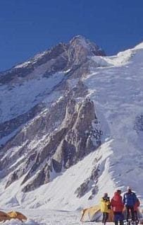
Gasherbrum III is a 7,952 m peak in the Baltoro Muztagh of the Pakistani Karakoram, standing between Gasherbrum II and Gasherbrum IV on the Gilgit-Baltistan–Xinjiang border. It sits just 48 metres short of 8,000 m, and that single fact is why almost nobody climbs it. Access is the classic Baltoro approach — Skardu to Askole by jeep, then roughly seven days of glacier trekking through Concordia to a base camp at about 5,000 m on the South Gasherbrum Glacier. A full expedition typically runs 45–55 days door to door, in the June–August window. It is a serious, technical high-altitude climb, not a trekking peak.
We run the Baltoro out of Skardu with our own Balti team, and we will be straight with you about this one: Gasherbrum III is not a mountain we recommend to most climbers. It is high, it is cold, it has been summited only a handful of times in fifty years, and it offers none of the fixed-rope infrastructure that makes its neighbours feasible. If you have already climbed an 8,000er and you want something quiet and hard, read on. If this is your first Karakoram season, look at Gasherbrum I & II or Broad Peak first.
Key takeaways
- Altitude: 7,952 m — 48 m short of eight-thousander status.
- Range: Gasherbrum massif, Baltoro Muztagh, Karakoram; on the Pakistan–China border.
- Topographic prominence: roughly 355–390 m depending on the source, so it is technically a subpeak of Gasherbrum II.
- First ascent: 11 August 1975, by a Polish team — Wanda Rutkiewicz, Alison Chadwick-Onyszkiewicz, Janusz Onyszkiewicz and Krzysztof Zdzitowiecki.
- Base camp: about 5,000 m on the South Gasherbrum Glacier, shared with Gasherbrum I and II expeditions.
- Season: late June to mid-August; the approach itself is walkable roughly May–September.
Where Gasherbrum III sits — and why it gets skipped
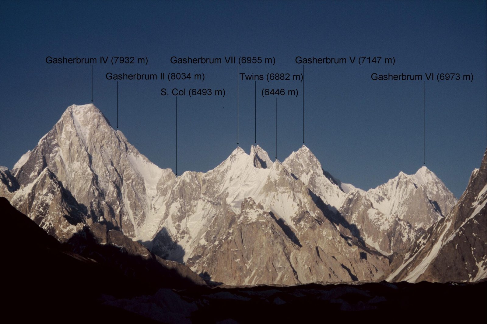
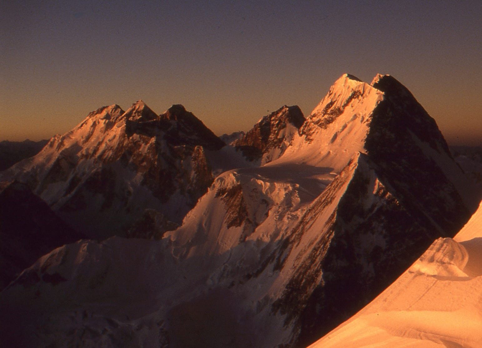
The name Gasherbrum comes from the Balti rgasha brum — beautiful mountain. There are six numbered Gasherbrums clustered at the head of the Baltoro Glacier, and three of the six carry most of the traffic: Gasherbrum I (8,080 m) and Gasherbrum II (8,035 m) because they are eight-thousanders, and Gasherbrum IV (7,925 m) because its Shining Wall is one of the great objectives in world alpinism.
Gasherbrum III falls between those two kinds of fame. It is higher than Gasherbrum IV and only 83 m below Gasherbrum II, yet it has neither the round number nor the legendary wall. Its topographic prominence — the drop to the col linking it to Gasherbrum II — is only around 355–390 m, well under the 500 m threshold most lists use for an independent mountain. So the catalogues file it as a subpeak, the commercial operators ignore it, and the mountain gets left alone.
That is exactly the appeal for the right climber. There is no queue on Gasherbrum III. There never has been.
The approach, step by step
The walk in is the same corridor used by every K2 and Gasherbrum expedition, and it is the finest approach in the Karakoram. Days are approximate; weather and load-carrying change everything.
- Islamabad to Skardu. Flight when the weather allows, otherwise two days on the Karakoram Highway. Build in buffer days either way.
- Skardu. Briefing, permit formalities, final gear check, load-packing with the team.
- Skardu to Askole by 4×4 jeep, roughly 7–9 hours on rough road. Last village, last phone signal.
- Askole to Jhola — long, hot, dusty valley walking along the Braldu.
- Jhola to Paiju — first proper view of the Trango group and the glacier snout.
- Paiju — rest and acclimatisation day; porters prepare bridges and loads for the ice.
- Paiju to Khoburtse or Urdukas — onto the Baltoro proper, moraine and ice underfoot.
- Urdukas to Goro II — the middle glacier, with Gasherbrum IV growing ahead.
- Goro II to Concordia (~4,600 m) — the junction where the Godwin-Austen and Upper Baltoro meet, under K2.
- Concordia to Gasherbrum Base Camp (~5,000 m) on the South Gasherbrum Glacier, below the Abruzzi.
- Acclimatisation rotations on the Gasherbrum II side — camps at roughly 5,900–6,000 m, 6,400–6,500 m and 7,000–7,100 m. All figures approximate and route-dependent.
- Summit push. The 1975 line follows the Gasherbrum II normal route to around 7,400 m, traverses below the Gasherbrum II summit pyramid into the high cwm between the two peaks, then climbs a steep couloir splitting the south-east face of Gasherbrum III.
- Walk out back down the Baltoro, or over Gondogoro La to Hushe if the pass and your team are in condition for it.
The giants around it
Standing at Gasherbrum Base Camp you are surrounded by more high ground than almost anywhere on earth. Here is the massif by height — note how tightly the top four are packed.
A short and unusual climbing history
Gasherbrum III was, until 1975, the highest unclimbed mountain in the world. It fell on 11 August 1975 to a Polish team — Wanda Rutkiewicz, Alison Chadwick-Onyszkiewicz, Janusz Onyszkiewicz and Krzysztof Zdzitowiecki — who climbed the Gasherbrum II normal route to about 7,400 m, traversed into the cwm between the two peaks, and took the south-east face couloir to the top. It remains the highest summit in the world on which women were part of the first-ascent party.
In 1985 the Scottish climbers Geoffrey Cohen and Desmond Rubens attempted the huge West Ridge and turned around at about 7,700 m. The ridge then sat unclimbed for nearly forty years. In summer 2024 Slovenia’s Aleš Česen and Britain’s Tom Livingstone climbed it alpine style over seven days — no supplementary oxygen, no high-altitude porters, no fixed rope — summiting on 4 August after a sitting bivouac at around 7,800 m, then descending by traversing to the Gasherbrum II normal route. They named the line Edge of Entropy.
That is the honest picture of this mountain: two ascents worth talking about in half a century, both of them by teams operating at the top of the sport.
When to go
The Baltoro is a summer range. Outside the window the glacier crossings, the porter logistics and the weather all stop cooperating.
| Months | Conditions | Verdict |
|---|---|---|
| March–April | Deep snow low down, Askole road unreliable, bridges not in place | No |
| May | Approach becoming walkable, cold on the glacier, high camps unsettled | Approach only |
| Late June–July | Main climbing window; warmest, longest days, most teams at Gasherbrum BC | Best |
| August | Still climbable — both known ascents summited in August; weather turns faster | Good |
| September | Cold sets in, teams clearing out, superb light for trekking | Trekking only |
| October–February | Winter Karakoram — specialist expeditions only | No |
For the wider picture of how the Baltoro season runs, see our guide to climbing season on the Baltoro.
The altitude you actually gain
People underestimate the approach because it is “only trekking”. It is a week of glacier travel gaining nearly 3,000 m before the climbing starts.
How hard it is, honestly
Hard. Harder than the numbers suggest, and harder than Gasherbrum II, which shares most of the route.
Altitude. 7,952 m is eight-thousander territory in everything but the label. The summit day is long, cold and usually done without supplementary oxygen because nobody stocks it for a peak with this little traffic. You need a previous 7,000 m summit at minimum, and realistically an 8,000 m one.
Terrain. The 1975 line means climbing the Gasherbrum II route to 7,400 m and then leaving it — a traverse and a steep face couloir at extreme altitude with no fixed rope beyond that point and nobody else on the ground. The West Ridge is a full alpine-style objective for elite teams.
Fitness. Multi-week glacier living, repeated rotations, heavy days. If you cannot carry a real load for eight hours day after day at 6,000 m, this is not the season for it.
Acclimatisation. Non-negotiable, and it is the single biggest determinant of whether you summit. Read our acclimatisation guide before you plan your rotation schedule.
The real risk — and what we do about it
Above 7,400 m on Gasherbrum III you are off the trade route, above the fixed rope, on a face where a slip is not survivable and where nobody is coming past to help. Add crevasse risk on the South Gasherbrum Glacier, serac danger in the icefall between Gasherbrum III and IV, and high-altitude cerebral and pulmonary oedema.
We carry a satellite phone in camp on every expedition, we hold established helicopter-rescue contacts for the Baltoro region, and we build a written evacuation plan with you before you leave Skardu. We will also tell you to turn around, and we will not sell you a summit day the mountain is not offering. Budget operators cut this. We do not.
Permits and visas
Gasherbrum III is a mountaineering objective, not an open-zone trek. Climbing peaks of this height in Pakistan requires a mountaineering permit and a licensed liaison arrangement handled through a registered operator — that is us. The trekking permit that covers a Concordia walk-in does not cover the climb. Because the peak sits on the border, expect additional scrutiny; timelines are not instant, so plan months ahead.
You will also need the correct visa — a Trekking & Mountaineering visa, not a plain tourist visa. Our Pakistan visa guide for trekkers walks through it.
Getting there, and what it costs
Everything starts in Skardu. Islamabad to Skardu is a short flight when the weather plays, or a long overland drive when it does not — our guide to getting to Skardu covers both, and we always build buffer days around the flight. From Skardu it is 4×4 jeeps to Askole, then porters and the glacier.
On price: we keep pricing personal rather than posting a number that goes stale. A Gasherbrum III expedition is costed from the permit, the team size, the number of porter stages, the rotation plan and how long you want to sit at base camp waiting for weather. Tell us your dates and your climbing history and we will build the real number. Fair price, no corners cut — and we will tell you honestly if we think a different peak is the better use of your season.
Frequently asked questions
How high is Gasherbrum III?
7,952 m (26,089 ft). It falls 48 m short of the 8,000 m mark, which is the main reason it attracts so little attention despite standing higher than Gasherbrum IV.
Why is Gasherbrum III not counted as an eight-thousander?
Two reasons. It is 48 m below 8,000 m, and its topographic prominence is only about 355–390 m — under the 500 m threshold most lists require, so it is generally classified as a subpeak of Gasherbrum II rather than an independent mountain.
Who made the first ascent of Gasherbrum III?
A Polish team on 11 August 1975: Wanda Rutkiewicz, Alison Chadwick-Onyszkiewicz, Janusz Onyszkiewicz and Krzysztof Zdzitowiecki. It remains the highest peak in the world on which women were part of the first-ascent party.
Has Gasherbrum III been climbed recently?
Yes. In summer 2024 Aleš Česen and Tom Livingstone made the first ascent of the West Ridge, alpine style over seven days without supplementary oxygen or high-altitude porters, summiting on 4 August 2024.
Do I need experience above 8,000 m to attempt it?
Not formally, but we would want to see a successful 7,000 m summit at minimum and strong glacier and mixed-ground competence. Realistically most people who succeed here have already climbed an eight-thousander. If you are building towards that, Spantik then Broad Peak is the honest progression.
Talk to the team who lives here
We are a local Balti team based in Skardu, not a broker. The guides, the cooks, the high-altitude staff and the jeeps are ours, and the person who answers your message is the person who will be at base camp with you.
WhatsApp: +92 312 9921574
Email: info@karakoramventure.com
Send us your dates and your climbing CV and we will come back with a straight answer — including whether Gasherbrum III is the right mountain for you. Local hands, real safety, fair price.
Sources & attribution: altitude, prominence and first-ascent details cross-checked against Wikipedia, PeakVisor, American Alpine Club publications and PlanetMountain reporting on the 2024 West Ridge ascent. Where sources differ on prominence we give the range and label it approximate. Images: Gasherbrum III by Olaf Rieck (derivative by Bulwersator, public domain); Gasherbrum group west faces by Florian Ederer (public domain); Broad Peak and the Gasherbrums from K2 by Adha65 (derivative by Rupert Pupkin, CC BY-SA 3.0) — all via Wikimedia Commons.

