



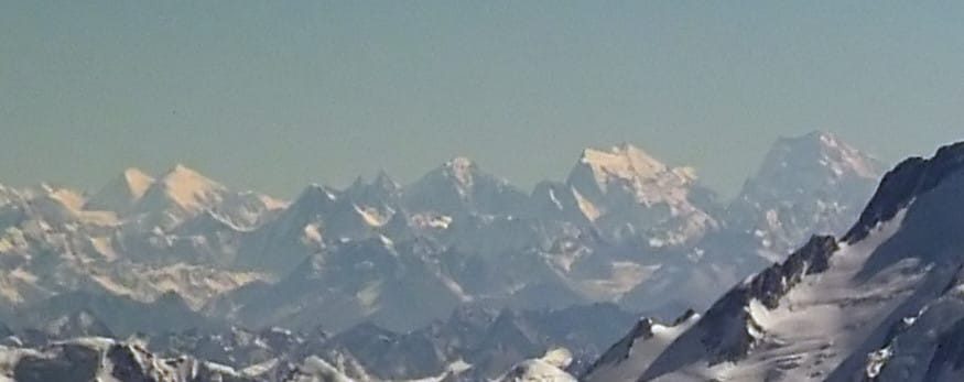
Link Sar is a 7,041 m peak in the Masherbrum range of the Pakistani Karakoram. It stands on the horseshoe of rock and ice that links K6 and K7, around the head of the Charakusa Glacier. The mountain sits in Ghanche District, above the Hushe valley. In fact it was one of the highest unclimbed mountains on earth until 6 August 2019. On that day Mark Richey, Steve Swenson, Chris Wright and Graham Zimmerman topped out. Their six-day push up the 3,400 m south-east face won the 2020 Piolet d’Or. Ordinary trekkers do not climb Link Sar. What they can do is walk to the Charakusa, roughly 7 to 10 days out of Skardu, and stand under it. Season is late June to early September; the trek is demanding, the mountain is expert-only.
We run this valley out of Skardu with our own Balti team, and we will be straight with you from the first line: Link Sar is not a summit you book. Eight expeditions tried and failed before the 2019 team got up it. What we do run — well, and often — is the trek into the Charakusa. We also handle base-camp logistics for serious alpine teams. Those teams arrive with their own permit, their own rack, and an honest assessment of that face. Everything below is written for both.
Link Sar: key takeaways
- Link Sar is 7,041 m, in the Masherbrum sub-range of the Karakoram, between the head of the Charakusa Glacier and the Kaberi Glacier.
- It sits on the horseshoe joining K6 (7,282 m) and K7 (6,934 m), above the Hushe valley in Ghanche District.
- First ascent: 6 August 2019, by Richey, Swenson, Wright and Zimmerman, via the south-east face. Awarded a Piolet d’Or in 2020.
- A subsidiary summit, Link Sar West (6,938 m), was reached in 2015 by Jon Griffith and Andy Houseman via the north-west face.
- For trekkers, the realistic objective is Charakusa base camp (roughly 4,100 m) — about 7–10 days from Skardu, return.
- Season: late June to early September. Access is by jeep from Skardu via Khaplu to Hushe, then on foot.
Where Link Sar is, and why almost nobody has been on it
Walk to the head of the Charakusa Glacier and you are standing inside a ring of granite and ice. K7 on one side, K6 on the other, and between them a broad, ice-armoured mountain that most visitors cannot name. That is Link Sar. Its far side drains into the Kaberi Glacier, and that is the whole problem. The eastern approaches sit close to the contested Pakistan–India line. As a result, permits simply were not issued for decades.
The climbing history of Link Sar
The history is short because the access was closed. Japanese teams attempted it in the mid-1970s. Steve Swenson got a permit for the eastern side in 2001 and made limited progress; for the following decade every application to return was refused. Jon Griffith began working the western side from 2011. Then in 2015 he and Andy Houseman climbed the north-west face to Link Sar West at 6,938 m. They stopped there, a kilometre short of the main summit, with illness and a closing weather window. In 2017 Swenson returned with Zimmerman and Wright. They reached about 5,900 m on the south-west face in foul weather. Even so, they came away with the thing that mattered: a line they believed would go.
It went in 2019. Richey, Swenson, Wright and Zimmerman climbed the 3,400 m south-east face between 31 July and 8 August. That was six days up from advanced base. They sat out a storm of more than 36 hours, and survived a 35 m leader fall on summit day. They topped out on 6 August. The Piolets d’Or jury honoured the ascent the following year. If you want the primary account, read the team’s own report in the American Alpine Journal — it is more honest than anything a tour company will write for you.
The route in: Skardu to the Charakusa, step by step
This is the trek we actually run. It is a walk-in on moraine and glacier, not a climb, but it is remote and the last road ends a long way below base camp.
- Day 1 — Skardu (about 2,230 m). Arrive by air or road, kit check, permits and food purchased in the bazaar. See our guide to getting to Skardu.
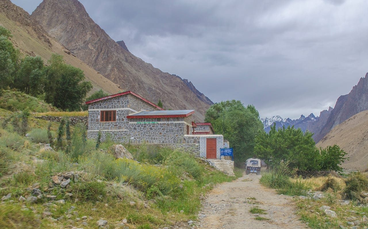
- Day 2 — Skardu to Hushe by jeep. Down the Shyok through Khaplu, then up the Hushe valley past Kanday to Hushe village (roughly 3,050 m). A long day on rough road.
- Day 3 — Hushe to Saicho. A short, deliberate first walking day up the valley floor to camp in the willows. Good for the legs and for acclimatising.
- Day 4 — Saicho to Charakusa base camp (about 4,100 m). Onto the moraine, up beside the glacier, and into the amphitheatre under K7, Link Sar and K6.
- Day 5 — Acclimatisation and viewpoints. Day walks onto the ablation valley and up towards the Naisar side for the full sweep of the horseshoe.
- Days 6–7 — Upper glacier exploration. Optional higher camps or a push towards the Kaberi side, weather and team fitness permitting.
- Days 8–10 — Return. Back down to Hushe, jeep to Khaplu or Skardu, buffer day for weather and flights.
How long the Charakusa trek takes
Fit, well-acclimatised groups do it in seven days. We usually plan ten. Because in the Karakoram, the buffer day is the difference between a good trip and a scramble to make a flight.
What you actually see up there
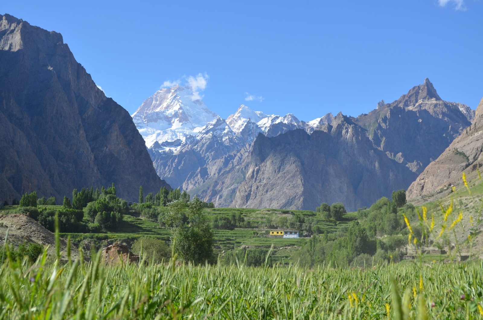
The Charakusa is the finest granite amphitheatre in Baltistan and it is not close. K7 rises as a clean pyramid; K6 carries the snow; Link Sar sits between them, broader and icier than either, and reads less like a spire than a fortress. Down-valley, Masherbrum closes the view. If you have walked the Baltoro, this is the opposite experience: no queue of expeditions, no fixed lines, and often nobody in camp but your own team and the shepherds.
Climbers who come here come for the rock. The valley has fed decades of hard alpinism, and it neighbours the Nangma valley at Kanday — Pakistan’s Yosemite — and the Laila Peak side of Hushe. Trekkers who want the same granite without the glacier commitment usually take our Charakusa valley trek or the Masherbrum base camp walk instead.
When to go
| Months | Conditions | Verdict |
|---|---|---|
| April – May | Deep snow on the moraine, glacier unstable, Hushe road still patchy after winter. | Too early for the Charakusa. |
| Late June | Snow line lifting, rivers rising with melt, camps opening up. | Workable, expect wet feet. |
| July – August | Warmest and driest window; the Karakoram climbing season. Also the busiest and the hottest on the walk-in. | Best overall — and the alpine window. |
| Early September | Cooler, clearer air, thin crowds, first cold nights. | Excellent for photography and trekking. |
| Late Sept – October | Hard frosts, short days, storms close the high ground quickly. | Only for experienced, self-sufficient teams. |
More on the wider region in our season-by-season guide to Gilgit-Baltistan.
How hard is it — honestly
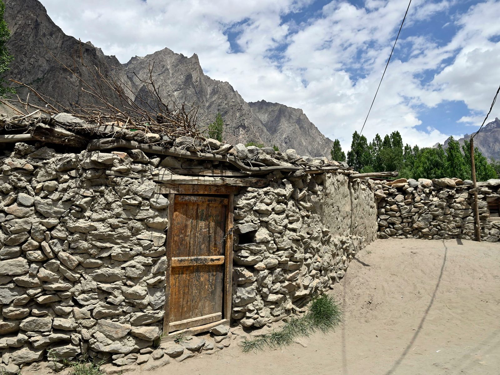
For trekkers: the walk to Charakusa base camp is strenuous but non-technical. You need 5–7 hours of hill walking a day with a daypack, sure footing on loose moraine, and a tolerance for cold nights at around 4,100 m. There is no teahouse, no phone signal and no shop past Hushe. Read our acclimatisation guide before you book anything.
For climbers: Link Sar itself is expert-only, and we will not pretend otherwise. The 2019 line is a 3,400 m mixed face climbed capsule-style by four of the most experienced Karakoram alpinists alive, after two prior reconnaissance expeditions by the same people. Anyone approaching it needs a full mountaineering permit, a serious CV, and a rescue plan they have actually costed. If you ask us for a guided ascent of Link Sar, we will tell you no, and explain why.
Safety — the real risk here
This valley is remote. The nearest hospital of any size is in Skardu, a long jeep day beyond the roadhead. Helicopter evacuation depends on weather, clearance and daylight, so it is never a guarantee. The genuine dangers are altitude sickness on a fast walk-in, rockfall and crevasses on the glacier, and river crossings in high summer melt. Every Karakoram Venture trip into the Charakusa carries a satellite phone and a first-aid kit with the right altitude drugs. In addition, each trip has a named evacuation plan, with our Skardu contacts and established helicopter-rescue channels for the region. We also require you to hold insurance that covers high-altitude trekking and evacuation — see our insurance guide. Budget operators quietly cut these things. We name them because they are what you are paying for.
Permits and access
Trekking to Charakusa base camp falls in the open zone, so it does not require a mountaineering permit. However, local registration applies. Rules for the Hushe side can also tighten at short notice, because the eastern approaches sit close to the disputed line. Climbing Link Sar or any peak on the horseshoe is different. It requires a full mountaineering permit from the relevant Pakistani authority, arranged well in advance, with a liaison officer. Permits on the Kaberi side have historically been difficult or impossible to obtain. Every foreign visitor also needs the correct Pakistani visa: trekkers and climbers should apply on the trekking and mountaineering category, not the ordinary tourist one. Our Pakistan visa guide for trekkers walks through it. We handle permits, registration and the liaison officer for our own groups.
Getting there, and what it costs
Fly Islamabad to Skardu when the weather allows — it is the fast option and it is weather-dependent — or come overland on the Karakoram Highway with buffer days built in. From Skardu it is a jeep day down the Shyok through Khaplu and up to Hushe, where the road stops and the walking starts.
On price, we keep it personal rather than posting a number that goes stale the moment porter rates or permit fees change. Tell us your dates, group size and whether you want a trek or full base-camp support for a climbing team, and we will send you a costed itinerary with nothing hidden in it. Fair price, no corners cut — the guides, the food and the safety kit are the last places we would save money.
Frequently asked questions
How high is Link Sar?
Link Sar is 7,041 m. It stands in the Masherbrum sub-range of the Karakoram, on the ridge horseshoe that links K6 (7,282 m) and K7 (6,934 m) around the head of the Charakusa Glacier.
Who made the first ascent of Link Sar, and when?
Mark Richey, Steve Swenson, Chris Wright and Graham Zimmerman reached the summit on 6 August 2019, climbing the 3,400 m south-east face between 31 July and 8 August. The ascent received a Piolet d’Or in 2020. Link Sar West (6,938 m) had been reached separately in 2015 by Jon Griffith and Andy Houseman.
Can I trek to Link Sar base camp?
You can trek to the Charakusa Glacier base camp at roughly 4,100 m, beneath K7, Link Sar and K6. That is the standard trekking objective and takes about 7–10 days return from Skardu. Going higher on the mountain is technical alpine ground, not trekking.
Do I need a permit for the Charakusa?
Trekking in the Charakusa falls in the open zone, so no mountaineering permit is needed, but local registration applies and access rules can change. Climbing any peak here, including Link Sar, requires a full mountaineering permit and a liaison officer. All foreign visitors need a Pakistani visa on the trekking and mountaineering category.
When is the best time to trek in the Hushe valley?
Late June to early September. July and August are warmest and driest and coincide with the Karakoram climbing season; early September brings cooler, clearer air and fewer people. Outside that window snow, melt-swollen rivers and storms make the walk-in unreliable.
Tell us your dates and group size and we will come back with a real itinerary — trek or expedition base-camp support. WhatsApp +92 312 9921574 or email info@karakoramventure.com.
We are based in Skardu. Our guides, cooks and high-altitude staff are Balti, from these valleys — you deal with the team that walks with you, not a broker. Local hands, real safety, fair price.
Sources & attribution: elevations, climbing history and first-ascent details from Wikipedia (Link Sar), the American Alpine Journal (Swenson & Zimmerman, “Synergy”, AAJ 2020; Houseman, AAJ 2016) and the Piolets d’Or 2020 honoured-ascents list. Where sources differ slightly on elevation we have used the commonly quoted figure. Images: Guilhem Vellut (CC BY 2.0), Zafaryaab (CC BY-SA 4.0), Moskenes (CC BY 4.0) and Flicks by Rizwan (CC BY-SA 3.0), all via Wikimedia Commons.

