



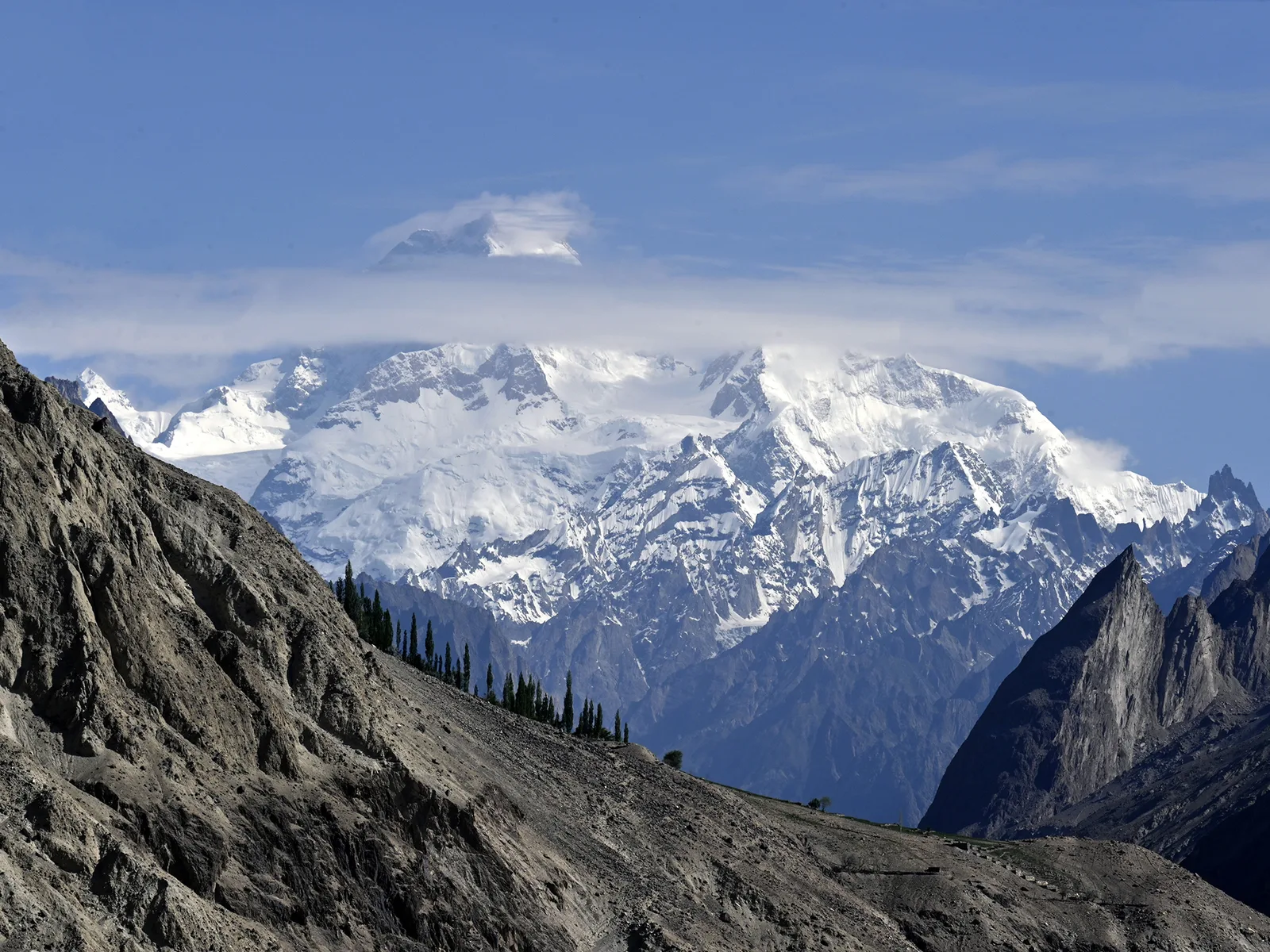
Masherbrum (7,821 m / 25,659 ft) is the great pyramid of ice and granite that towers over the head of the Hushe Valley in Gilgit-Baltistan, Pakistan — and it carries the oldest survey name in the whole range: K1. It was the first Karakoram peak the British surveyors measured, in 1856, which is exactly why the peak behind it ended up labelled K2. Today most travellers meet Masherbrum not as climbers but as trekkers, on the moderate week-long walk up the Hushe Valley to its base camp — a route our Balti team guides every summer.
Key Takeaways
- Height: 7,821 m (25,659 ft) — the 22nd-highest mountain on Earth and 9th-highest in Pakistan.
- The original K1: the first Karakoram peak mapped (1856); K2 was named as the peak “behind K1”.
- Where: Ghanche District, at the head of the Hushe Valley, south of the Baltoro Glacier.
- Trekkers: Masherbrum Base Camp (~4,200–4,500 m) is a moderate, mostly non-technical 6–8 day round trek from Hushe village.
- Climbers: a serious, rarely-climbed 7,800 m peak — only a handful of successful ascents since 1960.
- Season: roughly late June to September; Skardu is the staging town.
The peak that named K2
In 1856 a British Royal Engineers officer, Thomas Montgomerie, sat on the slopes of Harmukh in Kashmir and sketched the distant ice giants of the Karakoram. The first one he labelled was this mountain: K1. The next peak, glimpsed behind it, he labelled K2 — a survey code that, unlike the others, stuck and became world-famous. K1 already had a local Balti name, Masherbrum, so the K-number quietly faded. But the order of discovery is fixed in those labels: Masherbrum came first. The whole numbering scheme traces back to the Great Trigonometrical Survey of British India.
The name itself is debated. In Balti, brum means mountain; masher is less certain. One reading links it to a word for a muzzle-loader or matchlock, after the curved, hammer-like shape of the summit seen from the Baltoro; another reads masha as “lady”, making Masherbrum the “queen of peaks”. We won’t pretend to settle a debate that linguists haven’t — the American Alpine Journal’s study of Balti place names lays out the options.
Where Masherbrum stands
Masherbrum is the high point of the Masherbrum Mountains, a sub-range that sits south of the Baltoro Glacier. The Karakoram’s four local eight-thousanders — K2, Broad Peak, Gasherbrum I and II — line up on the north side of the Baltoro, which is why Masherbrum, for all its size, is often the peak people photograph rather than the one they aim for. You see it clearly from Concordia, the great glacier junction under K2.
The mountain straddles the head of two valleys. To the north it drops toward the Yermanendu and Baltoro glaciers; to the south it feeds the Hushe Valley, which runs down through Ghanche District toward Khaplu. The Hushe side is the “normal” approach — both for the few who climb the peak and for the many more who trek to its base camp. Hushe village, around 3,050 m, is the last settlement and the true climbers’ village of this corner of Baltistan; the same families guide and porter on Laila Peak, K6, K7 and Masherbrum alike.
A short, hard history of climbing it
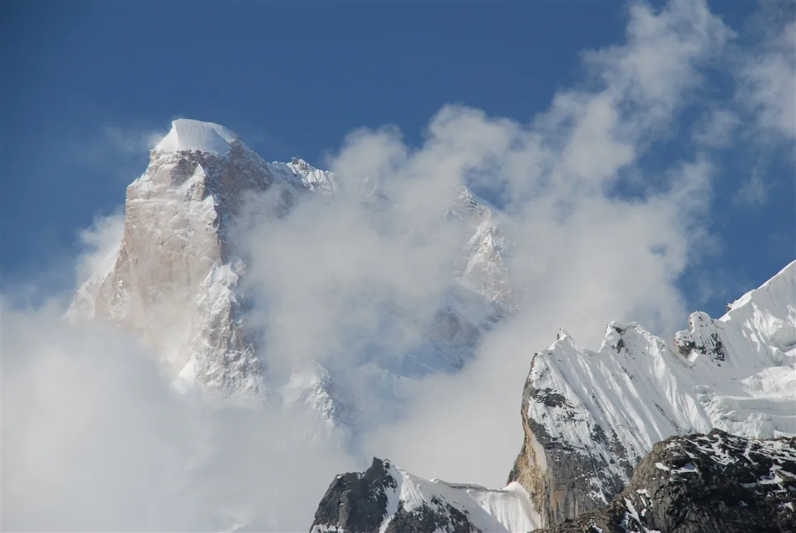
Masherbrum has a reputation among mountaineers that its modest profile hides: it is genuinely difficult, and it has rebuffed far more parties than it has let through. The peak was reconnoitred as early as 1911 by the American explorers Fanny Bullock Workman and her husband.
The first serious attempt came in 1938, a British party led by James Waller that included the future Gurkha trekking pioneer J.O.M. Roberts. They pushed to around 7,600 m on the south-east side before blizzards and waist-deep snow turned them back; two climbers came down badly frostbitten. Roberts’ own account survives in the Himalayan Journal. A New Zealand team reached roughly 7,000 m in 1955. In 1957 a British expedition that included Don Whillans got to within about 200 m of the top, but the climb cost the life of Bob Downes to altitude sickness.
Safety reality: Masherbrum is rated one of the hardest peaks above 7,500 m in the world, with only a handful of successful ascents in its history. Climbing the summit is an objective for experienced, fully-supported expedition teams, not a trekking goal. The base-camp trek below is a different, far more accessible undertaking — but it still crosses moraine and reaches over 4,000 m, where altitude and weather must be respected.
The summit finally fell on 6 July 1960 (some sources say 7 July) to George Bell and Willi Unsoeld on an American-Pakistani expedition led by Nick Clinch, by the south-east face that had stopped everyone before. Two days later Clinch and the Pakistani climber Jawed Akhter also reached the top — making Masherbrum the highest peak in Pakistan to have a Pakistani on its summit on the first-ascent expedition. Successful repeats have been rare ever since.
The Masherbrum Base Camp trek, via Hushe
For trekkers, this is the real prize: a short, scenic walk that puts you under a 7,800 m wall without the technical demands of a glacier crossing like the Gondogoro La. From Hushe village the trail follows the Masherbrum (Aling) Glacier valley up through grazing settlements to base camp, set on ablation slopes at roughly 4,200–4,500 m depending on which camp you use (sources vary; we’ll mark it approximate).
A typical schedule, run as a round trip from Skardu, looks like this. Treat the days as a guide, not a promise — weather, flights and fitness all move the schedule.
| Day | Stage | Approx. altitude |
|---|---|---|
| 1 | Skardu → Hushe by jeep (~6–7 hrs) | ~3,050 m |
| 2 | Hushe → Parbisan | ~3,475 m |
| 3 | Parbisan → Brumbrama | ~4,050 m |
| 4 | Brumbrama → Masherbrum Base Camp | ~4,200–4,500 m |
| 5 | Rest / explore the glacier viewpoints | base camp |
| 6–7 | Return to Hushe, drive to Skardu | descending |
How hard is it, and when to go
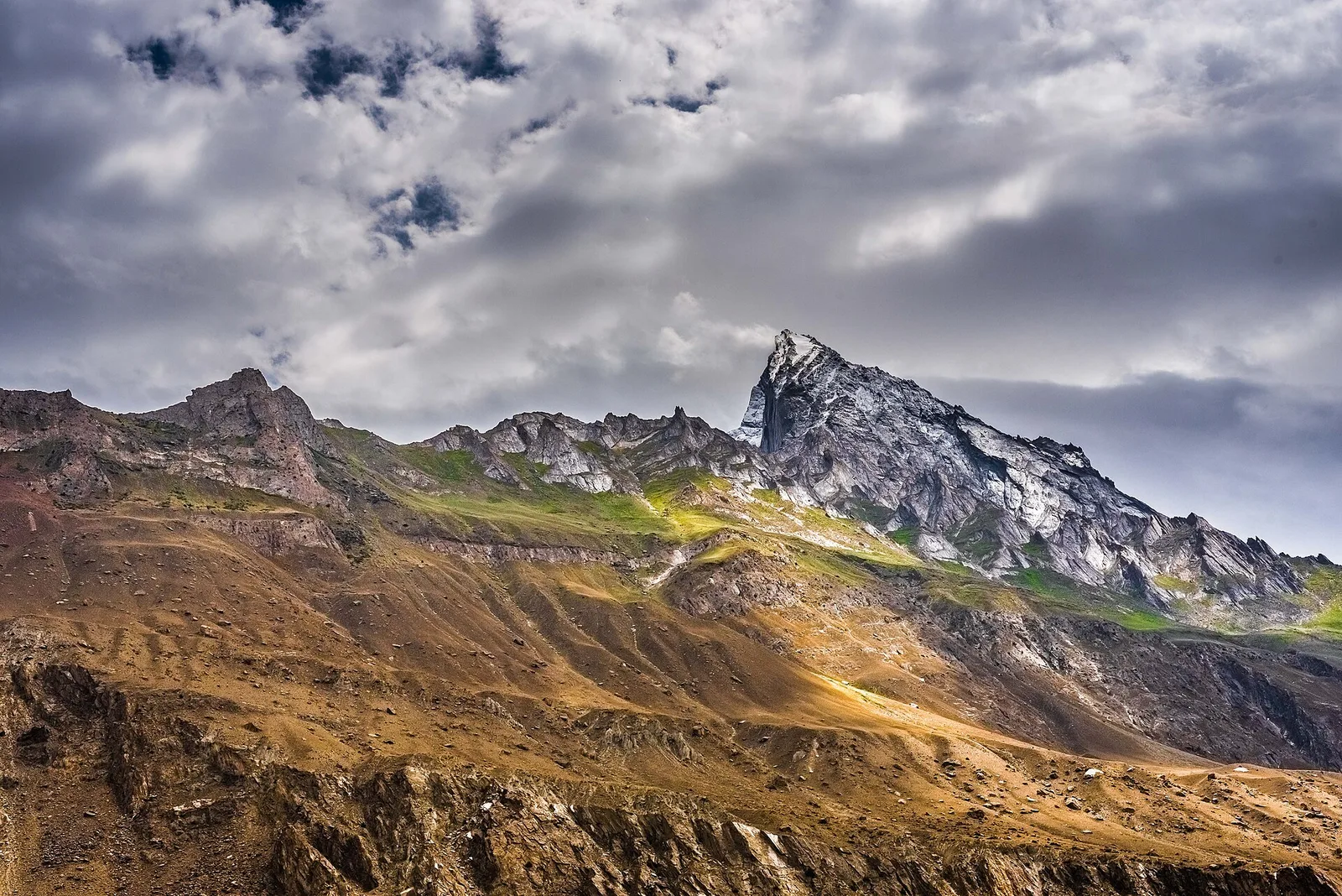
The trek to base camp is graded moderate. There’s no rope-work or pass-crossing on the standard route — it’s steady walking on glacial moraine, side-streams and grassy broq (summer pastures), with the main challenge being altitude and a few rough, rocky sections. If you can walk six to seven hours a day for several days and you acclimatise sensibly, you can do this. It is a good first taste of the Karakoram before committing to a bigger objective like K2 Base Camp or Snow Lake.
Season runs roughly late June through September, the same window as the bigger Baltoro climbing season. July and August are the most reliable for clear high-camp weather; September brings cooler nights and the first autumn colour lower down. Outside that window the high pastures are under snow and the jeep road up the Hushe Valley can be cut.
Permits & visa note: the Masherbrum trek sits in an open trekking zone and does not need a mountaineering permit, but you should still travel with a registered local operator and carry passport copies for valley check-posts. Climbing the peak is a different matter — that requires a formal mountaineering permit, royalty and a liaison officer, and a Trekking & Mountaineering visa rather than a plain tourist visa. Rules change; we confirm the current position for your exact route before you book.
Getting there
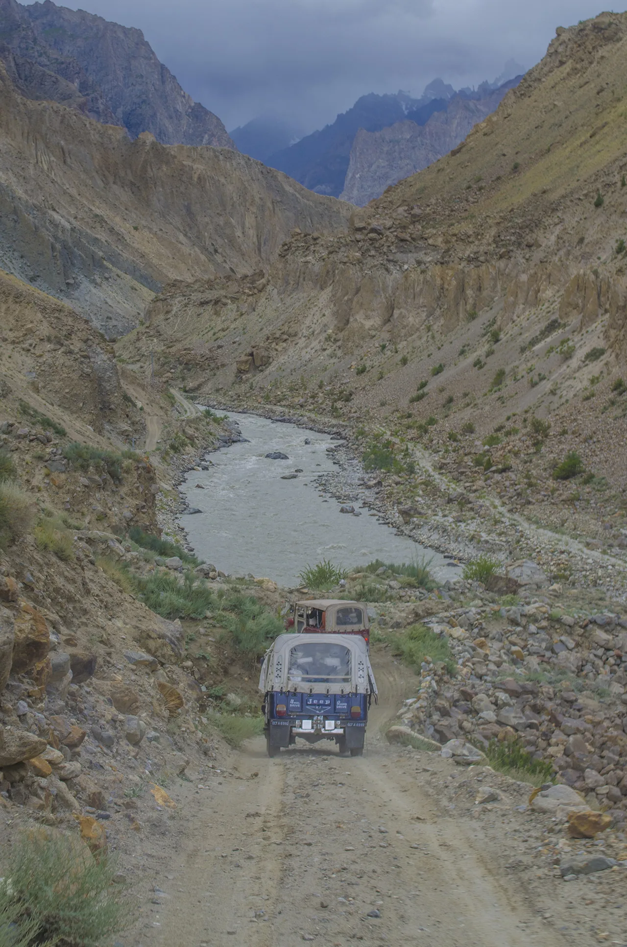
Everything starts in Skardu. Most travellers fly Islamabad–Skardu (around an hour, but genuinely weather-dependent) or drive the long, scenic road in; we plan buffer days for the flight either way. From Skardu it’s a half-day 4×4 jeep run east toward Khaplu and up into the Hushe Valley to the trailhead. Our full breakdown of both options is in how to get to Skardu.
Masherbrum trek vs. climb — at a glance
| Base Camp Trek | Summit Expedition | |
|---|---|---|
| High point | ~4,200–4,500 m | 7,821 m |
| Difficulty | Moderate, non-technical | Extreme; among the hardest 7,000ers |
| Typical duration | ~6–8 days from Skardu | 5–7 weeks |
| Permit | Open trekking zone | Mountaineering permit + royalty + LO |
| Who it’s for | Fit trekkers | Experienced expedition climbers |
You can stand under it. Our 9-day Masherbrum Base Camp Trek walks two days up from Hushe to the moraine at about 4,400 m — moderate, no glacier travel, from $1,190 per person with flights, porters and a Hushe guide, permits handled. Travelling with non-trekkers? The 3-day Khaplu & Hushe Valley Tour from $420 reaches the same village by road.
Frequently asked questions
How high is Masherbrum, and why is it called K1?
Masherbrum is 7,821 m (25,659 ft), the 22nd-highest mountain in the world. It was the first Karakoram peak mapped during the Great Trigonometrical Survey in 1856, so it was labelled “K1”; the peak seen behind it became “K2”.
How long is the Masherbrum Base Camp trek?
Plan on about 6–8 days return from Skardu: a jeep day to Hushe, three days up to base camp via Parbisan and Brumbrama, a rest day, then the descent. We add buffer days for the Skardu flight.
Is the trek difficult?
It’s moderate and non-technical — steady walking on moraine and pasture, no roped climbing on the standard route. The main demands are altitude (over 4,000 m) and several days of consecutive walking.
When is the best time to go?
Roughly late June to September. July and August give the most reliable high weather; September is cooler with early autumn colour.
Do I need a permit?
The base-camp trek is in an open zone and doesn’t need a mountaineering permit, though you should travel with a registered operator. Climbing the peak does require a formal mountaineering permit, royalty and liaison officer. Rules change, so we confirm the current requirements before you book.
Walk up the Hushe Valley with a Hushe team
We can fold Masherbrum Base Camp into a wider Hushe-region itinerary — see our Thaley La & Masherbrum region trek for one way to pair the valley’s high passes and base camps.
Planning your 2027 trek? WhatsApp us on +92 312 9921574 or email info@karakoramventure.com — you’ll be talking to a local Balti team from these valleys, not a broker. Local hands, real safety, fair price.
Sources: Wikipedia (Masherbrum, Hushe Valley, Great Trigonometrical Survey, Ghanche District); Himalayan Journal (J.O.M. Roberts, “The Attempt on Masherbrum, 1938”); American Alpine Journal (H. Adams Carter, “Balti Place Names in the Karakoram”); SummitPost. Altitudes are approximate and cross-checked against multiple sources; figures vary between references and are marked accordingly. Photos via Wikimedia Commons under the licences credited in each caption.

