



The Karambar Lake trek climbs to a lake at roughly 4,272 m, on the watershed between Chitral’s Yarkhun valley and the Karambar valley of Ishkoman, in Ghizer District, Gilgit-Baltistan. It is about 3.9 km long and up to 2 km wide, and it holds the highest water-clarity reading ever recorded in the published literature on Pakistani lakes. From the Gilgit side you walk it in five to six days and about 62 km up the Karambar valley from the road head at Bort (2,728 m), crossing the Chattiboi Glacier on the way. The season is July to September. The whole area is a restricted zone, so a permit and a licensed guide are compulsory, and the glacier work makes this a demanding trek rather than a scenic day out.
We should be straight with you about where the Karambar Lake trek sits. Karakoram Venture is based in Skardu, and our high-altitude staff are Balti men who grew up under the Baltoro. Karambar is a long way west of home, in Ghizer, and we run it the only honest way — our own team leading from Gilgit, with Ishkoman and Wakhi herders hired in the valley itself, because the Chattiboi Glacier changes shape every year and the men from Sokhter Rabot are the ones who actually know this season’s line across it. Everything below is what we say on the phone before anybody books.
Key takeaways
- Altitude: about 4,272 m at the lake; the Karambar An (pass) just above it is quoted between 4,320 m and 4,343 m depending on the source.
- Where: head of the Karambar valley, Ishkoman, Ghizer District, Gilgit-Baltistan — on the divide between the Hindu Raj and the Karakoram, a short walk from the Afghan Wakhan.
- Days: five to six walking days and roughly 62 km each way from the road head at Bort; about 11–12 days from Gilgit for the out-and-back.
- Season: July to September. Earlier and the fords are dangerous; later and the herders and the weather have both gone.
- Difficulty: demanding. Glacier crossings, river fords, no shops, no lodges and no phone signal for the best part of a week.
- Permits: restricted zone — a trekking permit and a licensed guide are compulsory, and you will be checked.
Where Karambar Lake is, and why it is worth six days
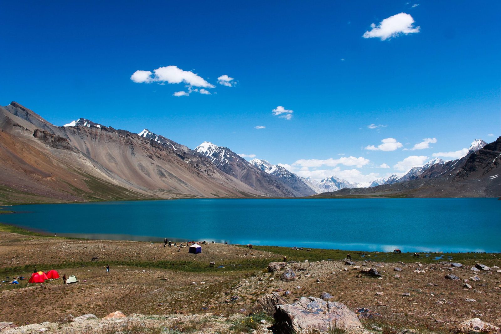
Look at a map of the far north of Pakistan and find the thin finger of Afghan territory reaching east — the Wakhan Corridor. Karambar Lake lies just south of it, on the grassy watershed where the Hindu Raj range hands over to the Karakoram. Water leaving the lake’s east end becomes the Karambar River, which turns into the Ishkoman River below Imit, joins the Ghizer River at Gahkuch, and arrives in Gilgit as the Gilgit River. Water leaving the west end drops into Chitral’s Yarkhun valley. You can stand on one shore and watch two river systems begin.
The numbers are unusual for Pakistan. The lake covers 2.632 km², which makes it the second largest lake in northern Pakistan by surface area after Attabad. Maximum depth is about 55 m, though published figures for the average depth vary wildly — anywhere from 17 m to 52 m — so treat any single number with suspicion. What is not in dispute is the clarity: a Secchi disc reading of 13.75, the highest ever recorded in the literature on Pakistani lakes. Since 2011 the surrounding country has been protected as Qurumbar National Park. It is commonly listed as the 33rd highest lake in the world, though rankings differ from source to source.
The other reason to come is the ground you cross to get there. The upper Karambar is, after the Deosai plains, the largest alpine meadow in Pakistan — kilometre after kilometre of rolling grass, clear streams, wild onions, marmots on every south-facing slope, and Wakhi and Gujar herders with their animals. If you have walked our Shimshal Pass trek, this is the same kind of high pastoral country, only longer and emptier.
The Karambar Lake trek route from Gilgit, day by day
The standard approach is from the Gilgit side, up the Karambar valley from Bort. The stages below follow the established trekking route; the daily distances are approximate and depend on where the herders’ huts are usable that year.
- Gilgit to Imit and on to Bort (2,728 m), by jeep. About five hours to Imit. The road continues to Bort, but in high summer meltwater regularly cuts it at Bilhanz — when that happens it is a four-hour walk to Bort and you lose most of a day. Build the buffer in.
- Bort to Maturamdan (2,895 m) — 13 km, 4–5 hours. Along the true left bank to Yazben, then across the snout of the Karambar Glacier, which pushes into the valley from the east and can be a genuine obstacle. Maturamdan is the highest year-round village in the valley.
- Maturamdan to Waraghut (3,300 m) — 12 km, 5–6 hours. Cross the footbridge at Piyakhin to the west bank and climb steadily.
- Waraghut to Sokhter Rabot (3,420 m) — 10 km, 4–5 hours. Past the cable crossing at Chilinj, where the route over the Chilinji An from Chapursan joins, and onto a broad alluvial plain settled in the 1930s by Uzbeks fleeing north of the border. Rabot means a dwelling place.
The upper valley to Karambar Lake
- Sokhter Rabot to Shuyinj (3,930 m) — 14.6 km, 5–6 hours. The crux. The Chattiboi Glacier fills the entire valley and the river runs underneath it for about 4 km; the glacier is the route. You follow the medial moraine, work out onto white ice, then across to the granite cliffs on the north side. The line changes every year.
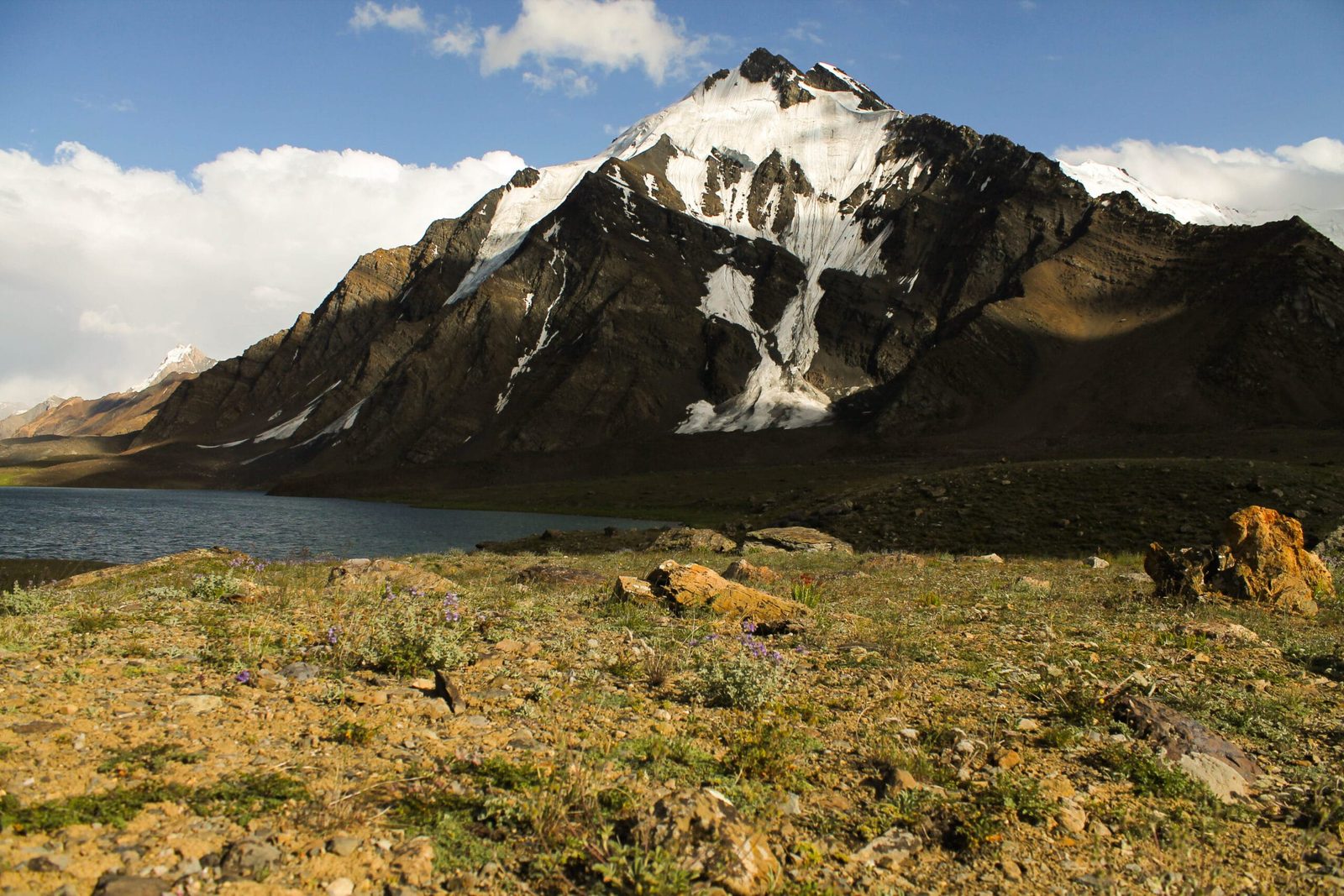
- Shuyinj to Karambar Lake (about 4,272 m) — 12.4 km, 4 hours. Out of the moraine and onto the great grasslands. The lake appears without much warning, opaque turquoise, with Zhui Sar above the south shore dropping a glacier straight into the water. Camp at the west end by the big cairn, where there are stone porter shelters.
- Rest day at the lake. Take it. It is an hour and a quarter just to walk the north shore, the Karambar An is 1.2 km west of camp, and this is the whole point of the trip.
- Return to Bort in three to four days, then jeep out to Gilgit.
Schematic and approximate — camp altitudes and distances from the established trekking stages, not a survey.
What the valley remembers
This is an old road, not a new one. More than a thousand years ago Chinese pilgrims travelling south for Buddhist teaching wrote about crossing a “wild onion” pass; the Karambar An, where wild onions grow thickly along every stream, is the likeliest candidate. The valley was a pilgrimage and trade route from the Wakhan to Gilgit long before anyone drew a border across it.
The glaciers here have humbled better-known men than us. In 1876 the British officer John Biddulph was stopped by the Karambar Glacier and described it as an impassable wall of ice protruding from a side valley. In 1916 Tom Longstaff found the same glacier jammed against the far rock wall with the river running beneath it. By 1948 the explorer H.W. Tilman found it had pulled back well short of the river. Three visits, three different mountains. That is exactly why we hire a herder from Sokhter Rabot rather than trusting a map or a track log.
The people are layered too. Gujars graze the Karambar, Wakhi the Broghil side. Sokhter Rabot was settled by Uzbeks who fled south in the 1930s. In the early 1980s Kyrgyz families crossed the Khodarg Werth pass into this valley to escape the Soviet invasion of the Wakhan. Nobody up here is a tourist attraction; they are working herders having a hard summer, and we treat their camps accordingly.
The other way in: Broghil
There is a second approach, from Chitral. You start at Lasht in the upper Yarkhun valley and walk east through Broghil — Wakhi yak country, hot springs, small lakes, and a clear view across the valley to Koyo Zom (6,872 m), the highest peak of the Hindu Raj. That side is graded moderate rather than demanding, because you gain the lake over gentle grassland instead of fighting the Chattiboi Glacier, and the season opens a few weeks earlier, from June.
Walked end to end, Lasht to Bort is around 125 km and about ten days — a full traverse from the Hindu Raj into the Karakoram, finishing in Gilgit-Baltistan. It is the better trip if you have the time and the visa days, and the harder one to organise, because you are crossing from Khyber Pakhtunkhwa into Gilgit-Baltistan with permits and check posts on both sides. Ask us about it early rather than late.
How Karambar compares
Schematic and approximate — commonly quoted altitudes; sources vary by a few metres.
The chart makes an honest point. Karambar is not the highest thing you can walk to in Gilgit-Baltistan — Rush Lake is over 400 m higher, and Gondogoro La is another kilometre above that. What Karambar has is distance. You are six days from the road head in a restricted border zone, which is a different kind of commitment from a hard day on a high pass.
When to go
| Months | Conditions | Verdict |
|---|---|---|
| June | Snow lingering on the pass and upper meadows; rivers rising fast; the Chattiboi crossing unsettled. | Workable from the Broghil side only. Too early from Bort. |
| July | Meadows green, lake ice-free, herders in place. Fords are at their highest and the jeep road is often cut at Bilhanz. | The classic month. Expect wet feet and a lost day on the road. |
| August | Warmest and most settled. Grassland at its best, water levels dropping through the month. | Best all-round window. |
| Early–mid September | Cold nights, hard clear light, fords low, herders starting to move down. | Excellent, especially for photography. Go early in the month. |
| Late September to May | Snow on the pass, camps abandoned, no support in the valley. | Closed. Do not attempt it. |
If you are still choosing between regions and months, our season-by-season guide to Gilgit-Baltistan lays the whole calendar out.
How hard it is, honestly
Fitness. Six consecutive days of four to six hours carrying a daypack, on rough ground, at altitude, with a heavy return. If you cannot do back-to-back hill days at home without wrecking yourself, this is not the one to start with.
Altitude. You sleep at 2,728 m and finish at about 4,272 m over five to six nights, which is a reasonable gradient — but 4,272 m is high enough for real altitude sickness, and you are days from a road. Read our acclimatisation guide before you come, and take the rest day at the lake seriously.
Terrain. This is the part people underestimate. The Chattiboi Glacier crossing is 4 km of moraine, bare ice and crevasses with no fixed line, and the route moves from one summer to the next. Rope, harness and basic glacier-travel competence are needed; crampons are often useful. There are also river fords that can be genuinely dangerous in July. Our Karakoram gear list covers what you actually need to bring.
Remoteness. No shops, no lodges, no medical post and no mobile signal beyond the last village. Everything you eat for a fortnight walks in with you.
The real risk here is not the altitude
It is the combination of an unroped glacier, high water at the fords, and being five days from a vehicle. People get into trouble on the Chattiboi and at the Bad Swat crossing, not on the pass. We carry a satellite phone on every departure, we brief and rope the glacier sections rather than walking them casually, and we plan the evacuation before we leave Gilgit — including which stage a casualty gets carried to, and where a helicopter can realistically land, because on this route it is not everywhere. We also require proof of insurance that covers helicopter evacuation above 4,000 m; see our insurance guide. Operators who quote this trek without a sat phone and a named rescue plan are gambling with somebody else’s legs.
Permits and access — this is a restricted zone
Karambar is not an open-zone trek. It sits against the Afghan border, and a restricted-zone trekking permit plus a licensed guide are compulsory. You will be checked: police at Imit and Lasht, and the Chitral Scouts at Ishkarwaz on the Broghil side. Published permit rates have sat around $50 per person, but fees and procedures change — we confirm the current position when you book rather than quoting you a number that goes stale.
You do not need a mountaineering permit, because you are not climbing a peak — but you do need the right visa. Pakistan issues a trekking and mountaineering visa that is distinct from a plain tourist visa, and the paperwork wants your operator named. Start with our Pakistan visa guide for trekkers, then send us your dates and we will handle the permit side.
Getting there, and what it costs
Unusually for us, this trip does not start in Skardu. Fly or drive to Gilgit, then it is roughly five hours by jeep to Imit via the Khanchey bridge over the Gilgit River, and on to Bort if the road is open. Most people reach Gilgit either by air from Islamabad or overland up the Karakoram Highway — our KKH road-trip guide covers the drive, and if you want an easy acclimatisation day near Gilgit before you start, Naltar and Phander are both close.
On price, we keep it personal rather than posting a number that goes stale. Costs on this route move with the permit, the jeep situation, how many stages the porters claim in a given season, and whether the road is cut at Bilhanz. Tell us your dates and group size and we will price it properly — a fair price, with no corners cut on the guide, the food, or the sat phone. What we will not do is quote you a cheap figure and then thin the crew to make it work.
Frequently asked questions
How high is Karambar Lake?
About 4,272 m (14,016 ft). Trekking references quote 4,260 m and geographic sources 4,272 m, so treat it as approximate. The Karambar An, the pass 1.2 km west of the lake, is quoted between 4,320 m and 4,343 m.
How many days does the Karambar Lake trek take?
From the road head at Bort it is five to six walking days and roughly 62 km each way, plus a rest day at the lake. Allow about 11 to 12 days from Gilgit for the out-and-back, and add a buffer day in case the jeep road is cut at Bilhanz. The full Broghil-to-Bort traverse from Chitral is around 125 km and about ten days.
Do I need a permit for Karambar Lake?
Yes. The whole area is a restricted zone, so a trekking permit and a licensed guide are compulsory, and you will be checked by police at Imit and Lasht and by the Chitral Scouts at Ishkarwaz. You also need Pakistan’s trekking and mountaineering visa rather than a standard tourist visa. You do not need a mountaineering permit unless you intend to climb a peak.
Is Karambar Lake harder than a normal trek in Pakistan?
Harder than most, yes. The altitude is moderate by Karakoram standards, but the Chattiboi Glacier fills the valley for about 4 km with no fixed route, the river fords run high in July, and you are five days from the nearest vehicle. It is graded demanding and technical from the Bort side, and moderate from the Broghil side, where you reach the lake over grassland instead.
When is the best time to trek to Karambar Lake?
August, with early September a close second for clear light and lower rivers. July works but brings the highest water and the greatest chance of the jeep road being cut. June is only realistic from the Broghil side. From late September the herders leave and the route effectively closes.
Talk to us about Karambar
Send us your dates and group size and we will tell you honestly whether the window works, what the permit position is this season, and what it costs. If we think you are not ready for the Chattiboi, we will say so and put you on something better suited.
WhatsApp: +92 312 9921574 | Email: info@karakoramventure.com
You are booking a local team, not a broker. Nobody hands you over to a stranger at the airport. On Karambar our own staff lead the trip and we hire Ishkoman and Wakhi herders in the valley, because on their glacier they know more than we do.
Sources & attribution: lake dimensions, clarity, depth, national-park status and pass altitudes from Wikipedia (Karambar Lake; Karambar Pass) and the sources cited there, including ICIMOD on Qurumbar National Park; route stages, camp altitudes, distances, grading, season, permit position and the Biddulph, Longstaff and Tilman glacier accounts from Trekking in Pakistan (Karambar An and Darkot An; Broghil and Karambar An). Figures marked approximate where sources differ. Images: Hasanzubair89 (CC BY-SA 3.0) and Aqibdar23 (CC BY-SA 4.0), both via Wikimedia Commons.

