



Burji La is the high pass on the wall directly south of Skardu, linking the Skardu valley to the Deosai plateau in Gilgit-Baltistan, Pakistan. It sits at roughly 4,880 m (about 16,010 ft); Wikipedia rounds it to 5,000 m and some references give 4,816 m, so treat the number as approximate. The pass is only about 16 km from Skardu in a straight line but some 2,600 m above it, and most trekkers take four to seven walking days to cross from town to the Deosai side. The season runs roughly late June to mid-September. It is a non-technical but seriously steep walk, and on a clear morning the summit ridge of K2 shows on the horizon along with Nanga Parbat, Masherbrum and the Gasherbrums.
We run this trek out of Skardu with our own Balti team, and we will be straight with you about what Burji La is and is not. It is not a soft warm-up walk. You climb the height of a decent alpine peak out of the back of our own town, on loose ground, in four short days. What it is, is the cheapest and fastest way in the whole Karakoram to stand above 4,800 m, look at K2 and Nanga Parbat in the same turn of the head, and find out how your body handles altitude before you commit twelve days and real money to the K2 Base Camp trek or an 8,000er. Half our expedition clients would be better off doing this first.
Key takeaways
- Height of the pass: approximately 4,880 m (16,010 ft). Published figures range from about 4,816 m to 5,000 m — approximate.
- Where: on the ridge between Skardu and the Deosai plateau, Skardu District, Gilgit-Baltistan, Pakistan.
- Vertical gain from Skardu: roughly 2,600 m, from a town at about 2,230 m (the wider valley averages nearer 2,500 m).
- Duration: four to seven days on foot depending on the version; we build seven to nine days Skardu to Skardu with weather and acclimatisation buffer.
- Distance: around 80 km for the full Skardu–Burji La–Deosai crossing (approximate, varies by route and pick-up point).
- Season: roughly late June to mid-September. Deosai is snow-bound November to May.
- Difficulty: moderate to hard. No ropes or technical climbing, but relentless ascent, loose ground and a fast altitude profile.
Where Burji La is, and why anyone bothers
Stand in Skardu bazaar and look south. That brown wall above the Indus is what you climb. Burji La is the notch in it. On the far side the ground stops going up and simply opens — the Deosai plateau, averaging about 4,114 m, one of the highest plateaux on earth, wildflowers to the horizon in July and brown bears somewhere in the folds of it.
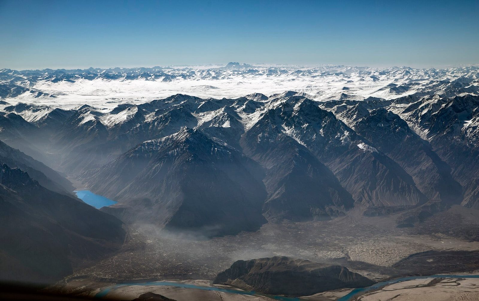
Most people meet Deosai from a jeep seat on the Deosai jeep safari, which is a fine day out and takes three or four hours from town. Burji La is the other way in. You walk up to the plateau instead of driving onto it, and you arrive at 4,800 m having earned every metre. That difference is the whole point.
The second reason is the view, and it is the reason experienced trekkers come back. There is no other easily reached point in Baltistan where the Karakoram giants and Nanga Parbat are visible from the same spot.
What you actually see from the top
From the pass, on a clear morning, the list is genuinely absurd: K2, Nanga Parbat, Masherbrum, Chogolisa, Laila Peak, Spantik (Golden Peak), Gasherbrum I, Gasherbrum II, Gasherbrum IV and a shoulder of Broad Peak.
Now the honest part. These are long sight lines. K2 does not fill the sky the way it does from Concordia; from Burji La it is a small serrated triangle far off to the north-east, and it needs a genuinely clear sky to show at all. Cloud, haze or afternoon build-up will take it from you. Camp high, get on the pass at first light, and give yourself a spare day. Trekkers who arrive at midday in August haze and see nothing are not unlucky — they are early to bed and late out of the tent.
The route, day by day
This is how we run it. Other operators shorten it to four days; we do not, because the altitude profile is the whole risk on this trek and cutting a day makes it worse. Camps and stage times are approximate and we adjust them to the group.
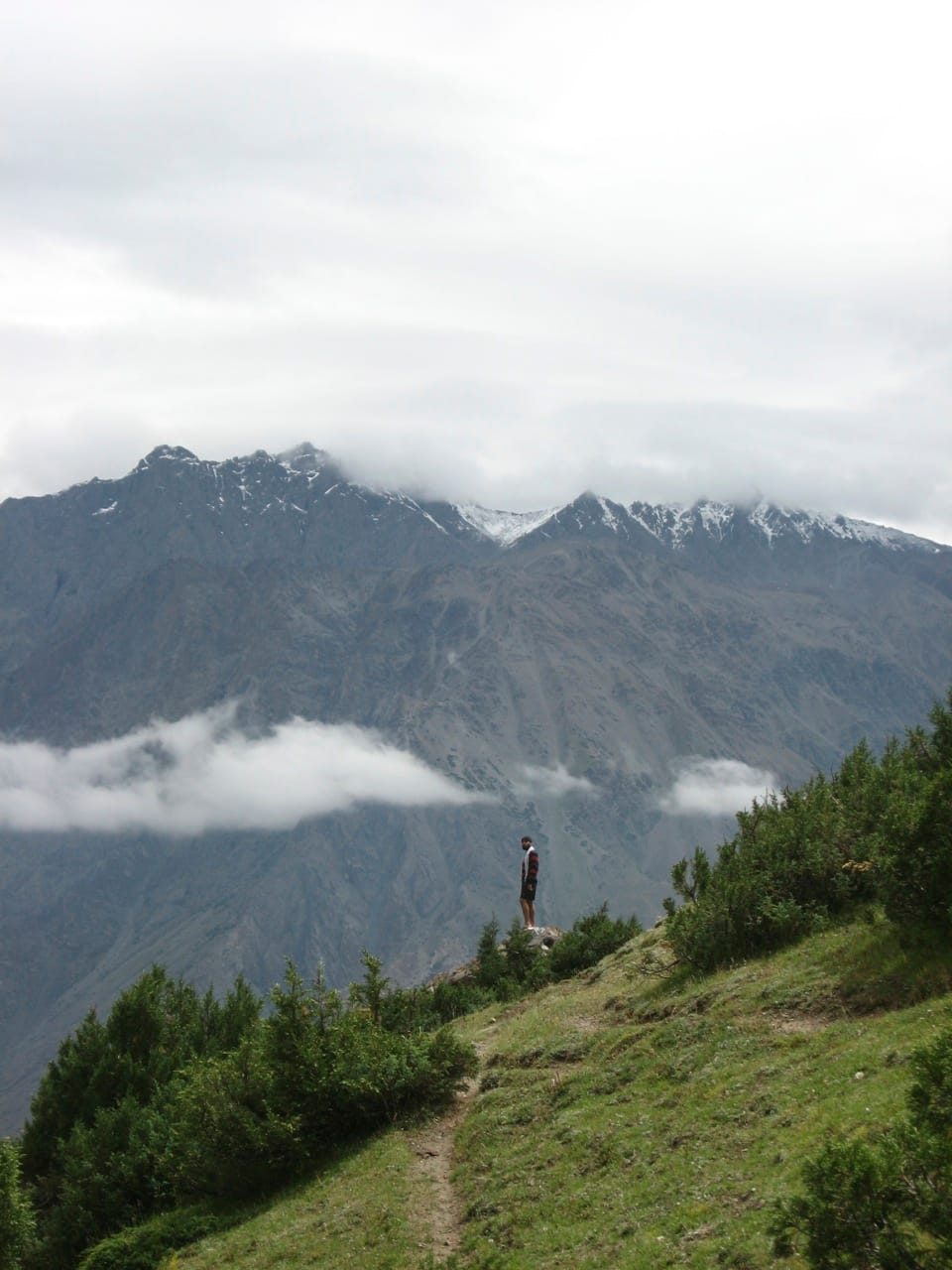
- Day 1 — Skardu, rest and check. Arrive, sleep at about 2,230 m, sort gear, and walk the Kharpocho Fort and Manthal Buddha Rock circuit. It is a real acclimatisation walk disguised as sightseeing.
- Day 2 — Skardu to the first camp (about 3,200 m). Short jeep transfer to the trailhead above the Satpara side, then three to five hours on foot up terraced fields and then open slope. Hot, dry, no shade. Water goes in early.
- Day 3 — first camp to Burji base camp (about 4,100 m). Four to six hours on rougher ground with the valley dropping away behind you. This is the day the altitude starts to speak. We keep it deliberately short and get people into camp by mid-afternoon.
- Day 4 — acclimatisation day at base camp. A climb-high, sleep-low excursion towards the pass, then back down to camp. Skip this and you will pay for it on the pass.
Over the pass and onto Deosai
- Day 5 — Burji La (about 4,880 m) and down to Deosai. Pre-dawn start, two to three hours to the top for the light, an hour on the pass, then a long descent onto the plateau to camp near the lakes on the Deosai side.
- Day 6 — across Deosai. Plateau walking at around 4,000 m to 4,200 m, marmots, wildflowers in July, and the long empty feeling that Deosai does better than anywhere else in Pakistan.
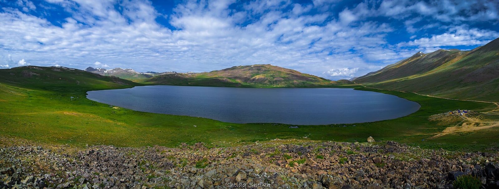
- Day 7 — Sheosar Lake and out. Reach Sheosar Lake at roughly 4,250 m, then jeep pick-up and back to Skardu (or on towards Astore, if you want to keep going).
Some groups reverse it, driving onto Deosai and walking out over Burji La down to Skardu. That is easier on the legs and much worse for acclimatisation, because you gain height in a vehicle rather than on foot. We do it only for clients who have already been high that season.
When to go
Deosai is under snow from roughly November to May, and that governs everything. The trekking window is short. For the wider picture see our guide to the best time to visit Gilgit-Baltistan.
| Months | Conditions | Verdict |
|---|---|---|
| November–May | Plateau snow-bound, pass blocked, camps not viable | Closed. Do not attempt. |
| Early–mid June | Snow still lying high, wet ground, streams high with melt | Possible for strong parties, expect snow on the pass |
| Late June–July | Deosai wildflowers at their peak, warm days, cold nights, some cloud build-up | Best for colour and green plateau |
| August | Warmest, most reliable ground, but the haziest skies of the season | Good walking, weaker long-range views |
| September to mid-month | Cold nights, thin crowds, the clearest air of the year | Best for the K2 and Nanga Parbat view |
| Late September–October | Hard frost, first snows, plateau emptying out | Marginal. Weather-dependent, needs buffer days |
If you are coming for the panorama, come in early September. If you are coming for Deosai in flower, come in July. You will not get both at their best in the same trip.
How hard it is, honestly
Technically, this trek asks nothing of you. No rope, no crampons in normal season conditions, no glacier travel, no exposure that would frighten a hillwalker. Physically and physiologically it asks quite a lot.
The altitude is the real problem
You go from about 2,230 m to about 4,880 m in three walking days. That is a fast profile by any standard, and it is faster than the first week of the K2 Base Camp trek. Headache, poor sleep and loss of appetite at Burji base camp are normal; confusion, breathlessness at rest or a wet cough are not, and mean we go down. Read our acclimatisation guide before you book anything in this region.
The ground
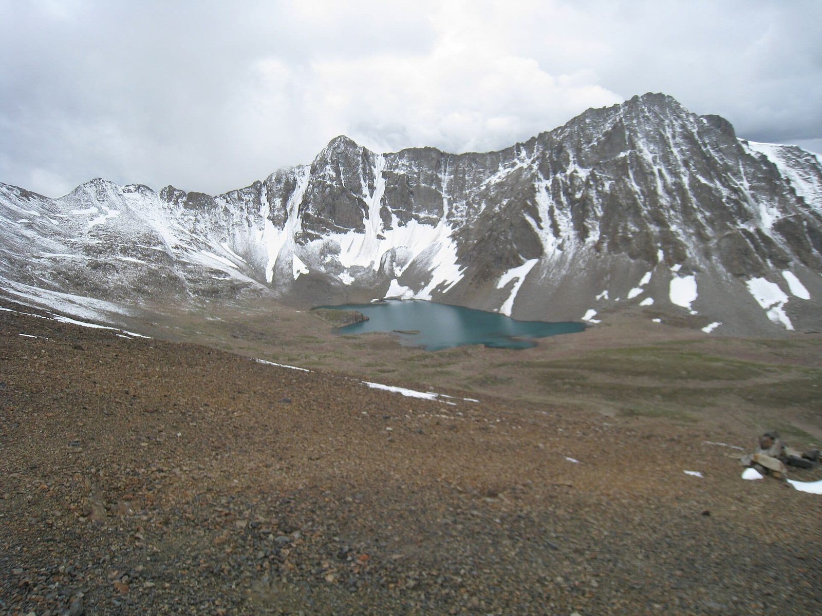
Dry, loose, stony slope for most of the ascent, with scree on the upper section that is tiring on the way up and unpleasant on the way down with a heavy pack. Poles help more here than on most Karakoram treks. Snow can linger on the pass into July.
Fitness
You should be able to walk five to six hours on rough ground on consecutive days carrying a daypack, having trained with hills rather than only a gym. Porters carry the main loads. If you are using Burji La as a test piece for Spantik or an 8,000er, that is exactly the right use for it — and how you feel on day five is real information. Take it seriously either way.
Safety: short trek, real altitude, thin margins
The danger here is not the terrain. It is that a fast ascent to nearly 4,900 m can produce HACE or HAPE in a fit person who felt fine at breakfast, and that from Burji base camp you are a full day of descent from a vehicle. Weather on the plateau turns quickly and hypothermia in wet, wind-driven conditions at 4,000 m is a genuine risk even in July. Being close to Skardu on a map does not mean close in hours.
Every Karakoram Venture trek and expedition carries a satellite phone, and we hold established helicopter-rescue contacts for the Skardu and Deosai region with a written evacuation plan for each departure. We also require you to hold cover that actually pays out above 4,500 m — see our note on travel insurance for high-altitude trekking in Pakistan. Budget operators cut exactly these things because you cannot see them in a brochure. We do not.
Permits and visa
Burji La is a trekking pass in an open zone, not a climbing objective, so no mountaineering permit is required. What does apply is Deosai National Park entry and registration, and a licensed guide. Rules and fees are set locally and change; we confirm the current position for your dates rather than quoting a figure that goes stale here.
For the visa, foreign trekkers should hold a Pakistani Trekking & Mountaineering visa rather than a plain tourist visa. Our Pakistan visa guide for trekkers walks through it.
Getting there, and what it costs
Everything starts in Skardu. Fly Islamabad to Skardu in about an hour when the weather cooperates, or drive the Karakoram Highway and the Skardu road over roughly two days. Both are covered in how to get to Skardu, and if you are new to the town our Skardu travel guide covers where to stay and eat. Build a buffer day for flight cancellations; they are common and they are weather, not incompetence.
On kit, this is a cold-nights, hot-days trek with no resupply. Our Karakoram packing list applies almost unchanged; the only Burji-specific notes are a genuinely warm sleeping bag for camps above 4,000 m and better sun protection than you think you need, because the plateau reflects hard.
On price, we keep pricing personal rather than posting a number that goes stale. What it depends on is group size, number of days, whether you want the reverse crossing, and your transport in and out. Message us with your dates and party size and we will send a real itinerary and an honest quote. Fair price, no corners cut — not the cheapest bid in the bazaar, and not the number a foreign agency quotes you for the same Balti crew.
Book the seven-day version. Our Burji La Trek runs exactly the route above, Skardu to Sheosar Lake with the acclimatisation day kept in, from $1,150 per person with a Balti crew, camping gear and a sat phone. Fixed July and August 2027 departures, or private on your dates.
Frequently asked questions
How high is Burji La?
Approximately 4,880 m (16,010 ft). Sources vary: Wikipedia rounds it to 5,000 m, some trekking references give 4,816 m. The pass is roughly 2,600 m above Skardu, which sits at about 2,230 m.
Can you really see K2 from Burji La?
Yes, in clear conditions — along with Nanga Parbat, Masherbrum, Chogolisa, Laila Peak, Spantik, Gasherbrum I, II and IV and part of Broad Peak. But it is a long-range view: K2 appears as a small, distant triangle, not the wall you see at Concordia. You need a clear sky and an early start, and haze in August often hides it.
How many days is the Burji La trek?
Four to seven days on foot depending on the version. We build a seven to nine day Skardu-to-Skardu programme including an acclimatisation day at Burji base camp and a weather buffer, because the altitude profile is the main risk on this route.
When is the best time to trek Burji La?
Roughly late June to mid-September. July gives you Deosai in full flower; early September gives the clearest air and the best chance of the K2 and Nanga Parbat panorama. Deosai is snow-bound from about November to May and the route is closed.
Do I need a permit for the Burji La trek?
No mountaineering permit — it is an open-zone trekking pass. You will need Deosai National Park entry and registration and a licensed guide, and foreign trekkers should hold a Pakistani Trekking & Mountaineering visa rather than a tourist visa. We confirm current park fees for your dates.
Cross Burji La with a local Balti team
We are based in Skardu, at the bottom of this climb. Our guides, cooks and porters are from the Balti valleys here — not a broker handing you to a third party. Tell us your dates and group size and we will come back with a real itinerary and an honest quote.
WhatsApp: +92 312 9921574 | Email: info@karakoramventure.com
Local hands, real safety, fair price.
Sources & attribution: pass elevation, location and the list of visible peaks from Wikipedia (Burji La); Deosai plateau average elevation (about 4,114 m) and Sheosar Lake elevation (about 4,250 m) from Wikipedia; Satpara Lake and Skardu elevations from Wikipedia; distance and stage timings compiled from published Pakistani trekking itineraries and our own operations — treat all altitudes and timings as approximate. Images: Khankayani512 (CC BY-SA 4.0), Ijaz024 (CC BY-SA 4.0, two images) and Ishtiaq93 (CC BY-SA 4.0), all via Wikimedia Commons.

