



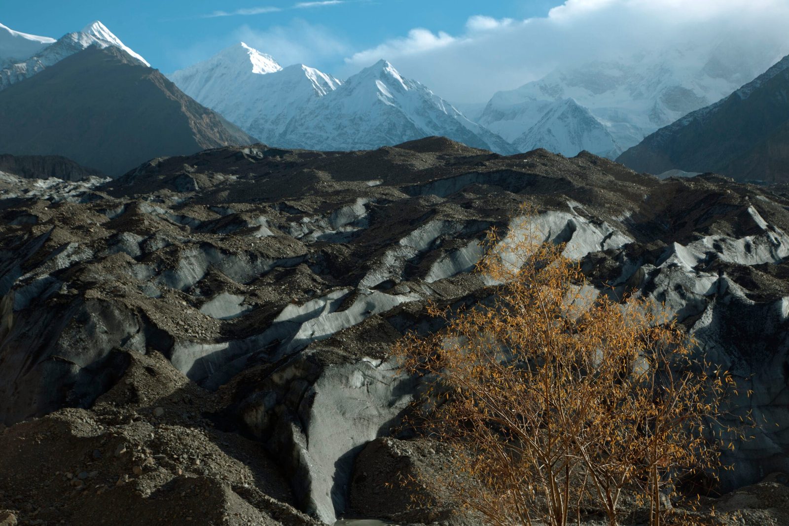
Malangutti Sar is a 7,207 m peak in the Hispar Muztagh, rising above the Shimshal valley in Hunza District, Gilgit-Baltistan. It was first climbed on 12 August 1985 by a Japanese team, and it has stayed almost untouched ever since — there is no trade route, no fixed-rope highway, no queue. A full expedition runs roughly 28–35 days door to door, with the climbing window between late June and August. It is a serious, committing 7,000er for experienced alpinists, not a first big mountain.
We run this out of Skardu and Shimshal with our own Balti and Wakhi team, and we will be straight with you: this is not a peak we sell to people who have just come off a base-camp trek. Malangutti Sar sits between the Malangutti Glacier on its east flank and the Momhil Glacier on its west, in a corner of the Karakoram that sees a handful of parties a decade. If you want crowds and certainty, go to the Baltoro. If you want a mountain where the route is still an open question, read on.
Key takeaways
- Height: 7,207 m (23,645 ft) — the figure in the standard 8000ers.com list. The American Alpine Journal recorded the first ascent at c. 7,025 m, so treat the exact height as approximate.
- Where: Hispar Muztagh, Shimshal valley, Hunza District, Gilgit-Baltistan — the 103rd highest mountain on earth.
- First ascent: 12 August 1985, by Tadao Sugimoto (leader), Kengo Nakahara, Yasushi Muranaka and Ang Nima Sherpa.
- Glaciers: Malangutti Glacier on the east flank, Momhil Glacier on the west.
- Season: late June to August. July is the most reliable stretch.
- Trip length: roughly 28–35 days including travel, acclimatisation and weather days.
- Difficulty: expedition-grade. Glacier travel, crevasse rescue and previous 6,000 m or 7,000 m experience are prerequisites, not nice-to-haves.
Where Malangutti Sar is, and why it matters
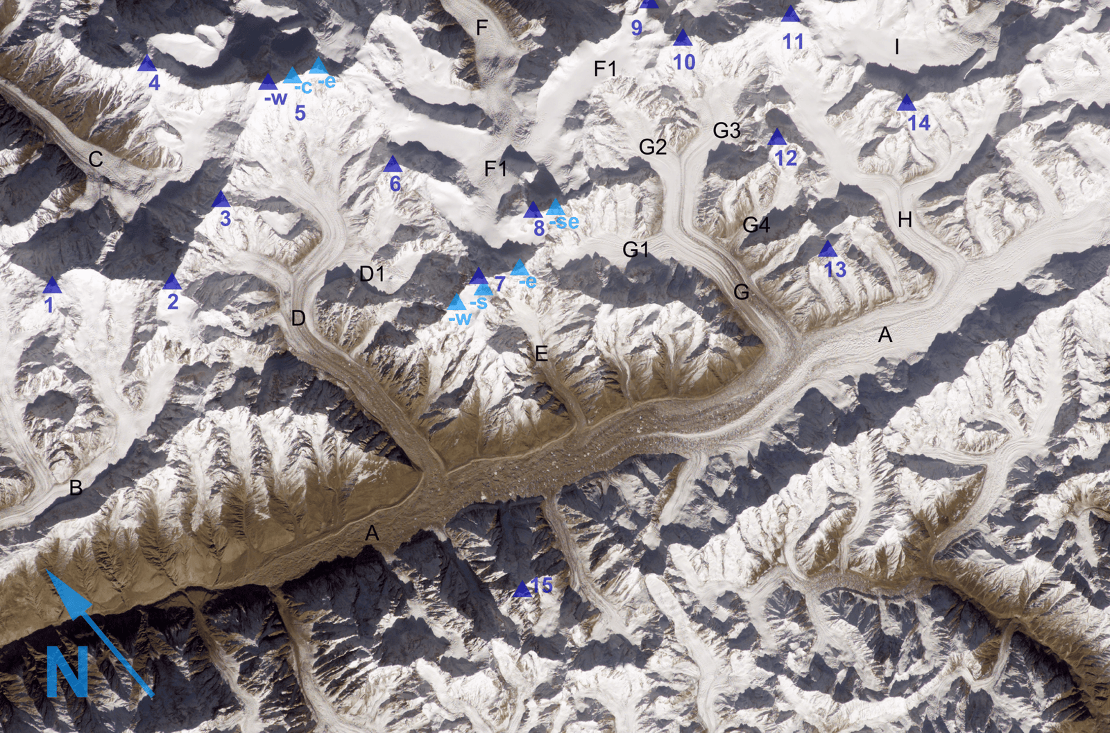
The Hispar Muztagh is the sub-range that holds Distaghil Sar, Kanjut Sar, Trivor and a row of other 7,000ers that most trekkers have never heard of. Malangutti Sar sits in the Shimshal arm of that range. Its 7,207 m puts it 103rd on the list of the world’s highest mountains — higher than plenty of famous Himalayan peaks, and far, far less visited.
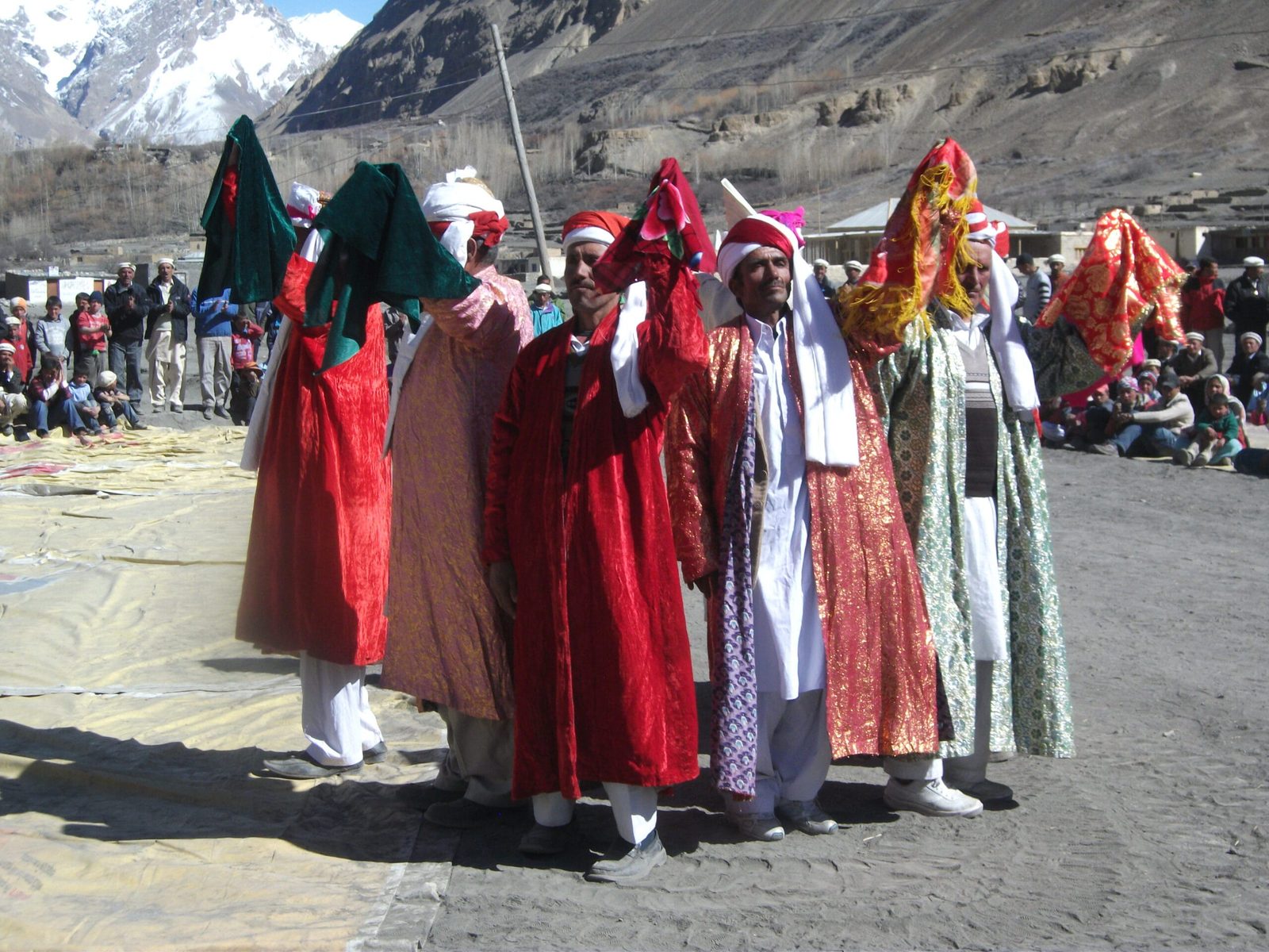
Everything here starts in Shimshal. The village sits at 3,113 m and is the highest settlement in Hunza District. Until October 2003 there was no road at all: you walked in, two or three days from the Karakoram Highway. The 56 km jeep track from Passu took eighteen years to build, and the people of Shimshal built much of it themselves through nomus, their own system of community self-help. That matters when you get there. Shimshal is Wakhi-speaking, and it has produced some of Pakistan’s best-known mountaineers — Rajab Shah, Samina Baig, Abdul Joshi. The porters you hire are not casual labour. They are from a village that calls itself the valley of mountaineers, and they have every right to.
How Malangutti Sar compares to its neighbours
Schematic chart — heights are approximate and differ between published lists.
The route, step by step
There is no standard commercial itinerary for Malangutti Sar the way there is for K2 Base Camp. What follows is the shape of an expedition as we build it, and the camp altitudes above base camp are indicative rather than fixed — on a peak this rarely climbed, you place camps where the mountain lets you.
- Days 1–2 — Islamabad to Gilgit or Hunza. Fly or drive up the Karakoram Highway. We build in a buffer day here; mountain flights are weather-dependent and the road is long.
- Day 3 — Passu to Shimshal. The 56 km jeep track up the Shimshal gorge. It is narrow, exposed and slow. Most people remember it.
- Days 4–5 — Shimshal (3,113 m). Rest, hire porters, sort loads, drink a lot of tea. Two nights here is not wasted time — it is the first real step of acclimatisation.
- Days 6–8 — walk in to base camp. Up the Malangutti Glacier to a base camp in the region of 4,300 m. Moraine, meltwater, and load-carrying.
- Days 9–24 — the mountain. Rotations up an advanced base and three high camps, roughly 4,800 m, 5,300 m, 5,900 m and 6,500 m, with rest days back at base. Expect fixed rope on the steeper snow and ice sections and a long summit day from the top camp.
- Days 25–28 — clear the mountain and walk out. Strip camps, carry everything down, back to Shimshal.
- Days 29–32 — Shimshal to Islamabad. Plus contingency. On a Karakoram expedition, the buffer days are the ones that get used.
Schematic elevation profile
Schematic profile — approximate. Camp placement on a rarely climbed peak is decided on the mountain, not on a webpage.
The 1985 first ascent, and the silence since
On 12 August 1985 a Japanese expedition led by Tadao Sugimoto put Sugimoto himself, Kengo Nakahara, Yasushi Muranaka and Ang Nima Sherpa on the summit. The American Alpine Journal logged the peak at c. 7,025 m in its report of that season; the later 8000ers.com survey list puts it at 7,207 m. Both numbers are in print. We quote 7,207 m because it is the figure the modern lists and Wikipedia carry, but we are not going to pretend the discrepancy does not exist.
What is striking is how little has happened since. Compare that with the traffic on the Baltoro, where Broad Peak and the Gasherbrums see teams every summer. Malangutti Sar is in the same country, a few valleys west, and it is functionally an exploratory objective. The same is true of its neighbours — Momhil Sar, Yukshin Gardan Sar and Lupghar Sar. If your ambition is a summit that has been climbed a handful of times, this corner of the Karakoram is where you look.
When to go
| Period | Conditions | Verdict |
|---|---|---|
| April – May | Deep snow low down, cold, the Shimshal road can still be blocked by snow or slides. | Too early for the peak. Fine for valley travel later in May. |
| Early June | Approach clearing, glacier still well covered, high camps very cold. | Possible for a strong team happy to work in cold conditions. |
| Late June – July | The main Karakoram window. Longest days, most settled weather, snow bridges still holding. | Best. This is when we schedule. |
| August | Still climbable; crevasses opening, glacier travel more awkward, more meltwater on the walk-in. | Good, with a competent team and an early start each day. |
| September | Colder, shorter days, weather turning. Beautiful, but the margin narrows. | Late. Better for trekking than for a 7,000 m summit push. |
| October – March | Winter. Shimshal itself becomes hard to reach. | No. |
How hard is it, honestly
Hard. Not fashionable-hard — actually hard, in a way that has more to do with remoteness than with technical grade.
Altitude. 7,207 m is high enough that you will be moving slowly and sleeping badly above 6,000 m. You need a proper acclimatisation plan, and you need to have used one before. Read our acclimatisation guide before you commit.
Terrain. Long glacier approaches, crevasse fields, snow and ice slopes steep enough to want fixed rope. You should be fluent in rope work, crevasse rescue and self-arrest before you arrive, not learning them at base camp.
Fitness. You will carry loads. On a peak with no established infrastructure, every rope and every gas cylinder that goes up goes up on somebody’s back.
Prerequisites we will ask about. Previous 6,000 m summits at minimum, ideally a 7,000er. Multi-week expedition experience. If Spantik is still ahead of you rather than behind you, do that first — and we will tell you so rather than take the booking.
Safety: this is a long way from help
The real risk on Malangutti Sar is not the summit slope. It is the combination of crevassed glacier, objective hazard from serac and avalanche, and the fact that you are days from a road and hours of flying time from a hospital. There is no rescue team waiting at base camp.
So we resource it properly: a satellite phone in camp with the team, established helicopter-rescue contacts for Gilgit-Baltistan, a written evacuation plan agreed before we leave Shimshal, and a requirement that every climber carries insurance that actually covers helicopter evacuation and high-altitude mountaineering. Check what your policy really says — our insurance guide covers the traps. We will turn a team around for weather or condition, and we would rather lose a summit than a client.
Permits and visa
Trekking in the open zones of Gilgit-Baltistan and climbing a 7,000 m peak are two different things administratively. Any ascent of Malangutti Sar needs a mountaineering permit and a licensed liaison arrangement, applied for well in advance through the relevant Pakistani authorities — that is our job, not yours, but it is why we ask for your passport details months ahead.
You will also need the correct visa. A standard tourist visa is not the right document for a mountaineering expedition; Pakistan issues a separate trekking and mountaineering category. Start early — see our Pakistan visa guide for trekkers. Shimshal is also a sensitive border area, so the paperwork genuinely matters here.
Getting there, and what it costs
Most teams fly Islamabad to Gilgit and drive up the Karakoram Highway to Passu, then take the jeep road into Shimshal. Flights are quick and weather-dependent; the road is long and reliable. We normally plan the road as the default and treat the flight as the bonus, which is the opposite of how it is usually sold, but it means the expedition does not start with three days of waiting at an airport. If you are coming through Skardu instead, our how to get to Skardu guide covers both options.
On cost: we keep pricing personal rather than posting a number that goes stale the moment porter rates, permit fees or fuel move. An expedition like this is priced on team size, length, how much high-altitude support you want and how many buffer days you build in. What we will promise is a fair price with no corners cut — the sat phone, the food, the porter wages and the insurance cover stay where they should be. Message us with your dates and your climbing history and we will send you a real number, not a teaser.
Frequently asked questions
How high is Malangutti Sar?
7,207 m (23,645 ft) according to the standard 8000ers.com list, which makes it the 103rd highest mountain in the world. The American Alpine Journal recorded it as c. 7,025 m at the time of the 1985 first ascent, so the exact height should be treated as approximate.
Who made the first ascent of Malangutti Sar?
A Japanese expedition, on 12 August 1985. The summit party was Tadao Sugimoto (the leader), Kengo Nakahara, Yasushi Muranaka and Ang Nima Sherpa. The peak has seen very little traffic since.
How long does a Malangutti Sar expedition take?
Plan on roughly 28–35 days door to door. That covers travel to Shimshal, the walk in up the Malangutti Glacier, acclimatisation rotations, the summit attempt, the walk out, and the weather days you will almost certainly need.
What experience do I need?
Previous high-altitude summits — 6,000 m as a minimum and ideally a 7,000er — plus solid glacier travel, crevasse rescue and fixed-rope skills, and experience of multi-week expedition life. If this would be your first big mountain, we will point you at Spantik or a Baltoro base-camp trek first.
When is the best time to climb Malangutti Sar?
Late June to August, with July the most reliable window. Earlier is very cold with unsettled approach conditions; September brings shorter days and a narrowing weather margin.
Talk to the team that actually runs it
We are a local Balti team working with Shimshal’s own Wakhi mountaineers and porters — not a broker who sells you a trip and hands you to somebody else. Tell us your dates, your team size and what you have climbed, and we will tell you honestly whether Malangutti Sar is the right objective for you this season.
WhatsApp: +92 312 9921574 | Email: info@karakoramventure.com
Local hands, real safety, fair price.
Sources & attribution: heights and location from the 8000ers.com list and Wikipedia (Malangutti Sar, Shimshal, Hispar Muztagh); first-ascent details and the c. 7,025 m figure from the American Alpine Journal 1986, Climbs and Expeditions, Pakistan; Shimshal village altitude, the 56 km Passu road completed October 2003, and the Shimshal Pass figure from Wikipedia (Shimshal). Images: Fayeem Avzl — CC BY-SA 4.0; NASA / ISS, derivative work by Rupert Pupkin — public domain; Omernasimhere — CC BY-SA 4.0; Spiture — CC BY-SA 4.0; all via Wikimedia Commons.

