



Bagrot Valley is a 25-kilometre Karakoram side valley that runs east off the Karakoram Highway about 38 km from Gilgit, roughly two hours by jeep. It climbs from around 2,500 m at the villages to about 4,500 m at the glacier heads, under Rakaposhi (7,788 m), Diran (7,266 m) and Bilchar Dobani (about 6,143 m). Most people come for two to four days; the walk from the road head up to Diran Base Camp at roughly 4,300 m takes two to three days each way. Season is June to September. It is a moderate trek — no technical climbing — but the altitude is real and the ground is rough.
We run Bagrot out of Skardu and Gilgit with our own team, and we will be straight with you: this is not the Baltoro. There is no Concordia moment here, no line of eight-thousanders. What Bagrot has instead is trees — juniper, willow, poplar, wild apricot — running right up to glacier ice, and almost nobody on the path. If you have three spare days at the start or end of a Karakoram trip and you want a green valley with two seven-thousanders standing over it, this is the one we send people to.
Key takeaways
- Where: Bagrot (Bagrote) Valley, Karakoram range, Gilgit-Baltistan — about 38 km east of Gilgit, roughly two hours by jeep.
- Altitude: valley floor around 2,500 m, rising to about 4,500 m at the glacier heads. Diran Base Camp sits at roughly 4,300 m.
- The giants: Rakaposhi 7,788 m, Diran 7,266 m, Bilchar Dobani about 6,143 m.
- Glaciers: Hinarche and Bursil in the upper valley, plus the Gargo and Yune drainages.
- Trek length: 2–3 days each way to Diran Base Camp; 1–2 days for a village and meadow circuit.
- Season: June to September for the high camps. The lower valley is reachable most of the year.
Where Bagrot Valley is, and why it matters
Leave Gilgit heading east and the Bagrot road turns off near Oshikhandass, where the Bagrot river comes down to meet the Gilgit river. From there the track climbs east into the mountains, and the change is quick. Within an hour you are among terraced fields, apricot and walnut trees, irrigation channels cut into the hillside, and villages that see a fraction of the traffic that goes to Hunza on the other side of the same massif.
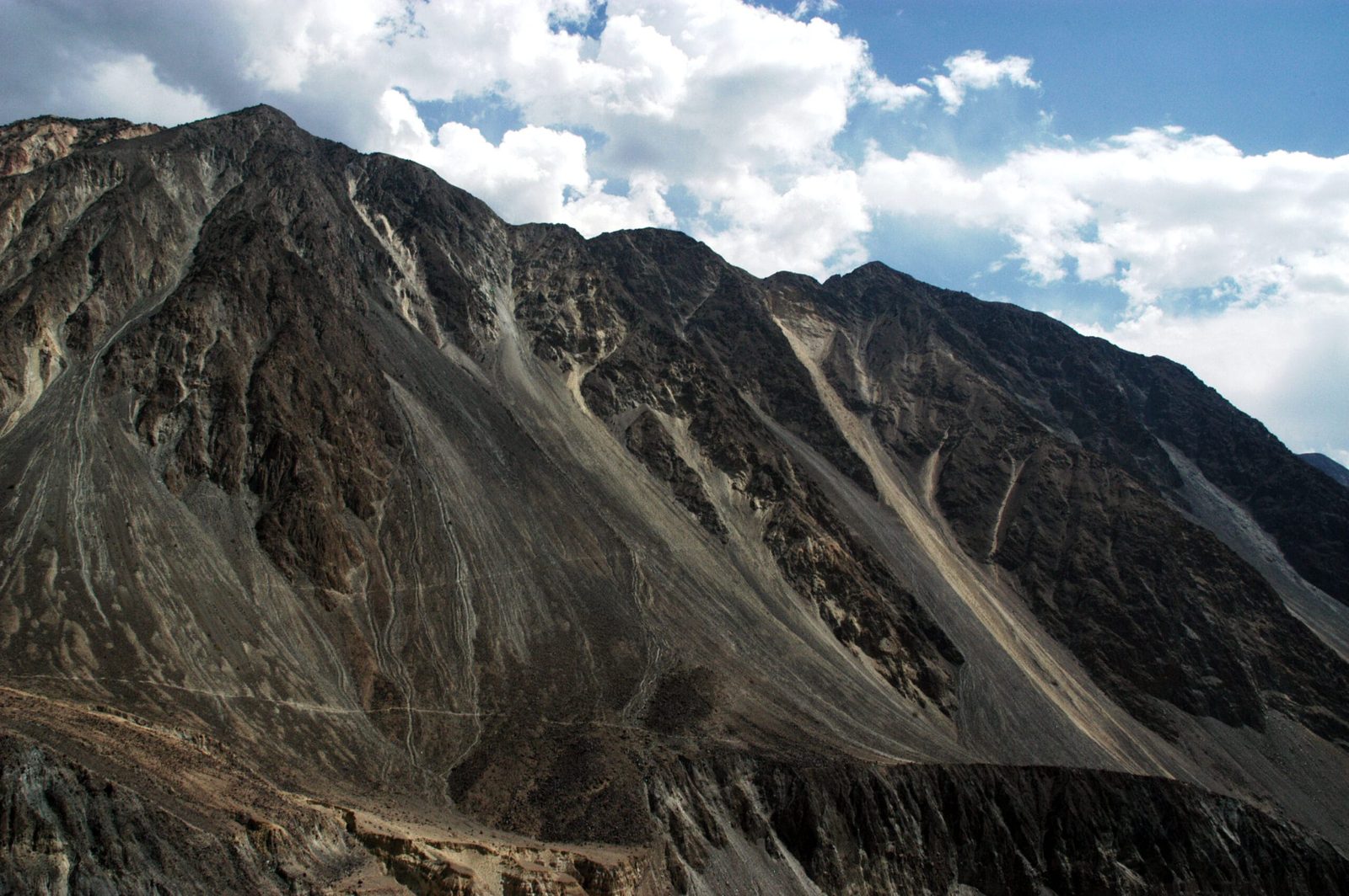
That is the geography that makes Bagrot worth a detour. Rakaposhi is the mountain everyone photographs from the Karakoram Highway at Hunza. Bagrot sits on the other side of it. Diran, the peak that shares the same massif, throws its glaciers down into this valley. So do half a dozen smaller drainages — Hinarche, Bursil, Gargo, Yune, Hurangi. The Bagrot river is fed by all of them, which is why the valley is greener and wetter than most of the Karakoram, and why the villages here have been farming it for centuries.
Shina is the language of the valley, spoken in every village from the road head to the last houses at Sath Gasunar. We staff Bagrot the way we staff everything: a local guide and porters hired in the valley itself, from the villages you will be walking through — not a crew bussed in from somewhere else.
The route, village by village
There is no single Bagrot trek. There is a road that runs up the valley through the villages, and a set of walks that leave it. Here is how we normally build the trip.
- Gilgit to Sinaker (about 2 hours, jeep). Roughly 38 km. The lower half is metalled, the upper half is rough but passable. This is the road head for the Diran side.
- Sinaker → Datuchi → Bulchi (walking day 1). Easy walking through fields and irrigation channels, gaining a couple of hundred metres. Cliffs above Datuchi are markhor ground; you may see nothing, and that is normal.
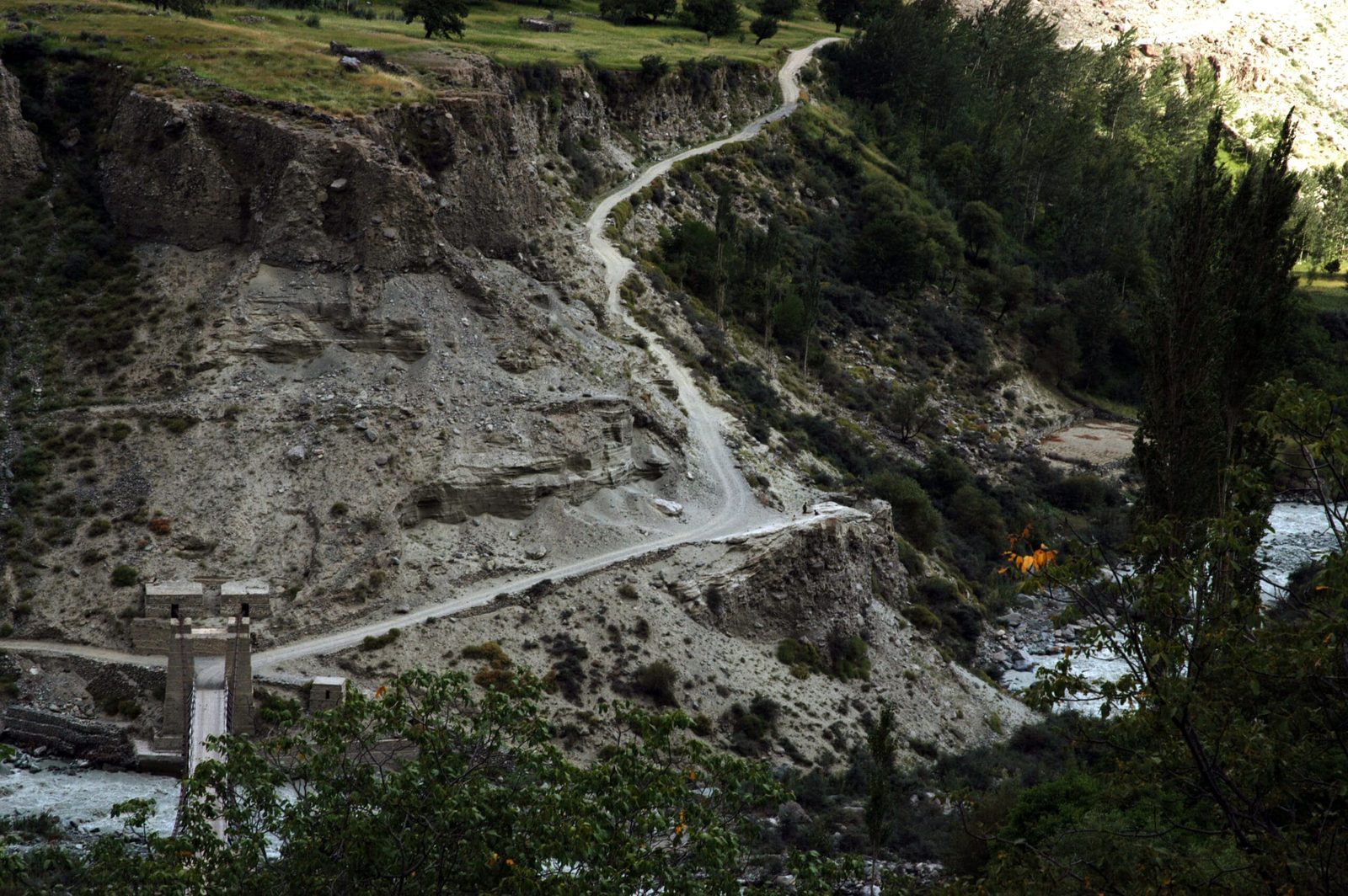
- Bulchi → Hopay → Chirah (walking day 2). Hopay is the last main village. Past Chirah the farmland stops and the moraine begins. First proper sight of the Hinarche Glacier tongue.
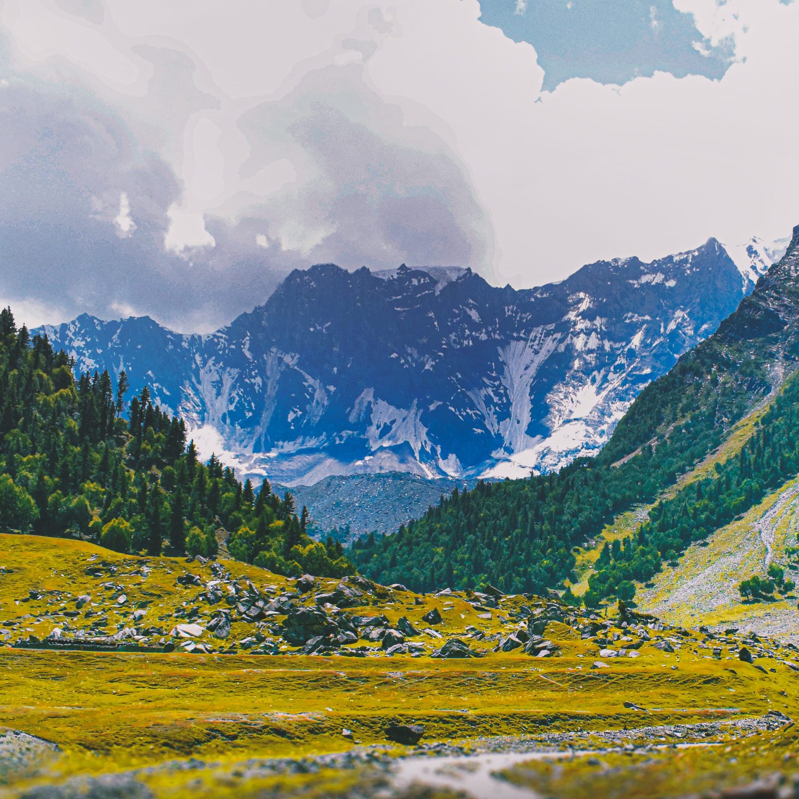
- Chirah → Gargo meadow camp (walking day 2 or 3). Summer pasture at around 3,300–3,400 m, used by herders through the warm months. Most people spend a night here to let the altitude settle.
- Gargo → Diran Base Camp (about 4,300 m). A long day up moraine and pasture to the meadow under Diran’s southern flank. The last hour is loose ground and slow.
- Rest day at base camp. Day walks onto the Hinarche moraine, no technical kit needed. This is the day the trip is actually for.
- Descend to the road head (1–2 days) and jeep back to Gilgit.
A shorter version exists and it is a good one: two nights in Hopay or Datuchi, a day walk up towards Gargo, and a day on the lower Hinarche moraine. That gets you the valley without the altitude gain, and it works for people who are only passing through Gilgit.
The giants above the valley
Three mountains define Bagrot, and it is worth knowing which is which before you get there.
Rakaposhi (7,788 m) is the famous one, and Bagrot gives you its southern and eastern aspect rather than the vertical north face that everyone shoots from the highway. From the upper valley near Sath Gasunar it stands clear.
Diran (7,266 m) is the peak that dominates the head of the valley. It is a snow pyramid, it looks straightforward from below, and it has a long record of proving otherwise — the mountain has killed climbers who underestimated its avalanche-prone slopes. We say that plainly because the walk to its base camp is easy enough that people forget what they are standing under.
Bilchar Dobani (about 6,143 m) is the rock and ice peak on the Gilgit side of the valley, visible from the city itself. It was first climbed on 9 June 1979 by Isao Ikeuchi and Masaru Hashimoto on a Japanese expedition. Sources give its height as anything from 6,134 m to 6,143 m; treat the figure as approximate.
When to go
| Months | Conditions | Verdict |
|---|---|---|
| April–May | Blossom in the villages, snow still low on the pastures, upper camps not yet open. Jeep road usually fine to the villages. | Good for a village and lower-valley visit only |
| June | Snow clearing off the meadows, rivers rising with melt, herders moving up. Wildflowers start. | First reliable month for the high camps |
| July–August | Warmest, greenest, meadows in full flower. Afternoon cloud is common; occasional monsoon spillover brings rain and rockfall on the moraine. | Peak season — best conditions overall |
| September | Clear, cold, stable. Colours turning in the villages, herders coming down. | Our favourite month for photography |
| October–March | High camps closed by snow. Lower villages reachable in most winters but cold, short days, limited services. | Lower valley day trips only |
How hard is it, honestly
Fitness. If you can walk five to seven hours on rough ground for several days in a row, you can do Bagrot. There is no technical climbing on the base camp route and no rope work. The daily gains are modest by Karakoram standards.
Altitude. This is where people get caught out. Going from Gilgit at about 1,500 m to a base camp at about 4,300 m in two or three days is a fast profile. Altitude sickness is a real possibility, and the standard fix is boring: an extra night at Gargo, plenty of water, and a willingness to turn round. If you are coming straight off a flight to Gilgit, build in a day. Our acclimatisation guide covers the arithmetic.
Terrain. Village paths and irrigation channels lower down, then loose lateral moraine higher up. Moraine is tiring, unstable, and unglamorous. River crossings on snow-melt streams are easiest early in the morning when the flow is lowest.
Comfort. Homestays and basic guesthouses in the villages; tents above Chirah. Mobile signal fades out past Datuchi and is gone entirely above it.
The real risk here
Bagrot is a moderate trek, but it is a remote one. There is no road above the villages, no clinic above Datuchi, and no phone signal above it either. The specific hazards are altitude sickness on a fast profile, rockfall and unstable footing on the Hinarche moraine, and snow-melt streams that swell through the afternoon. We carry a satellite phone on every trip above the villages, we brief the group on turn-round times before we start, and we go in with an evacuation plan agreed before departure and the rescue contacts needed to trigger it. Confirm that your travel insurance covers helicopter evacuation and trekking to at least 4,500 m — many standard policies do not. We are happy to look at your policy wording before you book.
Permits and access
Bagrot is trekking country, not a mountaineering objective, so you do not need the climbing permit and royalty that a peak like Diran itself requires. The upper valley does sit in the Central Karakoram National Park zone, where park entry and trekking fees normally apply, and requirements do change — we confirm the current position with the Gilgit office before every departure rather than quoting you a rule that may have moved. What does not change is the visa: you need one before you fly, and if you intend to climb rather than walk, that is a different visa category. Our Pakistan visa guide for trekkers walks through it.
Getting there, and what it costs
Fly Islamabad to Gilgit or Skardu when the weather allows — it is an hour in the air and one of the great short flights anywhere. When it does not allow, it is the Karakoram Highway: long, spectacular, and worth building buffer days around. We cover both options in our Karakoram Highway road trip guide, and if you are weighing up which side of Gilgit-Baltistan to base yourself on, our comparison of Hunza or Skardu is the honest version.
From Gilgit it is a jeep and about two hours to Sinaker. We handle the jeep, the guide, the porters hired in the valley itself, the permits, food and camp kit.
On price: we keep pricing personal rather than posting a number that goes stale the moment porter rates or park fees change. Tell us your dates, your group size and how many nights you want above the villages, and we will send you a real figure with the line items visible. Fair price, no corners cut — and no cutting the sat phone or the guide ratio to hit a number.
Bagrot also pairs well. It sits close enough to Gilgit to bolt onto a bigger trip — the Rakaposhi Base Camp trek from the Minapin side, the Diran Base Camp trek from Minapin which approaches the same mountain from the north, Naltar Valley for its lakes, or the harder Kutwal Lake trek under Haramosh. For timing across the whole region, see our season-by-season guide to Gilgit-Baltistan.
Frequently asked questions
Where is Bagrot Valley and how do you get there?
Bagrot Valley is in the Karakoram range in Gilgit-Baltistan, Pakistan, roughly 38 km east of Gilgit city. The turning is near Oshikhandass, where the Bagrot river joins the Gilgit river. It is about two hours by jeep from Gilgit to the road head at Sinaker; the lower part of the road is metalled and the upper part is rough.
How long does the trek to Diran Base Camp from Bagrot take?
Two to three days of walking each way from the road head at Sinaker, with a rest or acclimatisation night at the Gargo meadows on the way up. Base camp sits at roughly 4,300 m. Most people take five to seven days for the round trip including a full day at base camp.
Is Bagrot Valley suitable for beginners?
The lower valley is — village walks and day hikes need no more than ordinary fitness. The base camp trek is moderate rather than hard, with no technical climbing, but the altitude gain from Gilgit at about 1,500 m to about 4,300 m in two or three days is fast. First-time trekkers should add an extra acclimatisation night rather than push it.
What is the best time to visit Bagrot Valley?
June to September for the high camps, with July and August the warmest and greenest and September the clearest and coldest. The lower villages are reachable for much of the year, but the meadows and base camps are under snow from roughly October to May.
Do I need a permit to trek in Bagrot Valley?
You do not need a mountaineering permit to trek here — that is only for climbing peaks such as Diran. The upper valley falls within the Central Karakoram National Park zone, where park entry and trekking fees normally apply, and the exact requirements change from season to season. We confirm the current position with the Gilgit office before each departure. You do need a Pakistan visa arranged before you travel.
Walk Bagrot with a local team
Tell us your dates and group size and we will put together a real itinerary and a real price — not a brochure. We are a local team based in Skardu and Gilgit, not a broker: our own guides, our own porters hired in the valley, sat phone in camp and an evacuation plan that exists on paper before you leave.
WhatsApp: +92 312 9921574 · Email: info@karakoramventure.com
Sources & attribution: elevations and valley geography from Wikipedia (Bagrot Valley, Rakaposhi, Diran, Bilchar Dobani) and Central Karakoram National Park material; Bilchar Dobani first-ascent detail (Isao Ikeuchi and Masaru Hashimoto, 9 June 1979). Camp elevations are approximate and vary between sources. Images: Gargo Meadows by Adnan Temur Barcha (CC BY-SA 4.0); Bagrot Valley mountains by Zensky (CC BY-SA 3.0); Hopay suspension bridge by Zensky (public domain) — all via Wikimedia Commons.

