
 EN
 العربية
 Deutsch
 Español
 Français
 Italiano
 Polski
 Русский
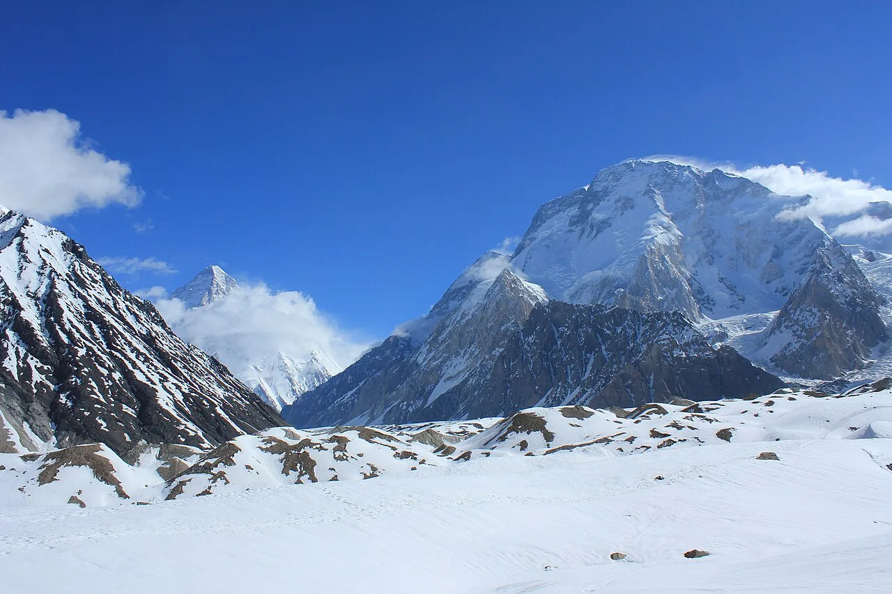
Pakistan's main mountain ranges are the Karakoram, the western end of the Himalaya and the Hindu Kush, with the smaller Hindu Raj between them and the Pamir along the northern border. Further south are the much lower Salt Range and Sulaiman Mountains. Pakistan has five of the world's 14 peaks above 8,000 m and more than 100 above 7,000 m. Here is how the ranges fit together, from a Skardu team that works in all three big ones.
Key Takeaways
- Karakoram: home to K2 (8,611 m) and four of the 14 eight-thousanders; mostly in Gilgit-Baltistan.
- Himalaya: its western anchor is Nanga Parbat (8,126 m), Pakistan's fifth eight-thousander.
- Hindu Kush: runs from Afghanistan into Chitral; highest peak Tirich Mir (7,708 m).
- Hindu Raj: between the Hindu Kush and the Karakoram; highest peak Koyo Zom (6,872 m).
- Glaciers: Pakistan has more than 7,000, more than any country outside the polar regions.
What are the main mountain ranges of Pakistan?
The three great ranges are the Karakoram, the Himalaya and the Hindu Kush. They meet in the north of the country, in Gilgit-Baltistan and Chitral. Smaller ranges include the Hindu Raj, the edge of the Pamir, the Salt Range in Punjab and the Sulaiman Mountains in the west.
| Range | Where in Pakistan | Highest peak in Pakistan | Known for |
|---|---|---|---|
| Karakoram | Gilgit-Baltistan (Baltistan, Hunza, Nagar) | K2, 8,611 m | Four eight-thousanders, the Baltoro and Biafo glaciers |
| Himalaya | Diamer and Astore, south of the Indus | Nanga Parbat, 8,126 m | Fairy Meadows and the Rupal Face |
| Hindu Kush | Chitral, Khyber Pakhtunkhwa | Tirich Mir, 7,708 m | The Kalash valleys, Chitral, Swat Kohistan |
| Hindu Raj | Between Chitral and Gilgit | Koyo Zom, 6,872 m | Remote valleys, peaks averaging 5,000–6,000 m |
| Pamir (edge) | Northern border along the Wakhan Corridor | Border ridges | The meeting point of Pakistan, Afghanistan and China |
| Salt Range | Northern Punjab | Sakesar | The Khewra salt mines |
| Sulaiman Mountains | Western Pakistan, Khyber Pakhtunkhwa and Balochistan | Takht-e-Sulaiman, 3,487 m (main range) | The eastern edge of the Iranian plateau |
Is K2 in the Himalayas?
No. K2 is in the Karakoram, which is a separate range from the Himalaya. The Gilgit, Indus and Shyok rivers form the Karakoram's southern boundary and separate it from the north-western end of the Himalaya. Nanga Parbat, south of the Indus, is the Himalayan peak.
The two ranges are often lumped together, and the wider region is sometimes called the Hindu Kush Himalaya. For climbers and trekkers the difference matters: the Karakoram is drier, more glaciated and more remote. Our guide to the Karakoram range goes into detail.
The Karakoram: K2 and the great glaciers
The Karakoram spans Pakistan, China and India, with its north-western end reaching into Afghanistan and Tajikistan. Most of it lies in Gilgit-Baltistan. It contains four of the 14 eight-thousanders: K2, Gasherbrum I, Broad Peak and Gasherbrum II, all at the head of the Baltoro Glacier.
It is also a range of ice. The Biafo Glacier (63 km) is among the longest glaciers outside the polar regions. The Baltoro leads to Concordia, where four of those 8,000 m peaks stand within a few days' walk. Treks here include the K2 Base Camp Trek, the Gondogoro La and the Biafo–Hispar traverse. See the K2 and Baltoro hub for all of them.
The Himalaya in Pakistan: Nanga Parbat
Pakistan holds the western end of the Himalaya. Its great peak is Nanga Parbat (8,126 m), the ninth-highest mountain on Earth and the westernmost major Himalayan peak. It rises just south-east of the Indus's northernmost bend.
Nanga Parbat stands far above the land around it, with the second-highest prominence among the world's 100 tallest mountains, after Everest. Visitors see it from Fairy Meadows on the Raikot side or from the Rupal valley in Astore. Our Nanga Parbat hub covers the treks and the climb.
The Hindu Kush and Hindu Raj
The Hindu Kush is an 800 km range running from central and eastern Afghanistan into north-western Pakistan. Its highest point, Tirich Mir (7,708 m), is in Chitral. Its eastern end merges with the Karakoram. Swat Kohistan and the Kalash valleys sit in its southern folds.
The Hindu Raj lies between the Hindu Kush and the Karakoram, west of Gilgit. Its peaks average 5,000 to 6,000 m, and its highest is Koyo Zom (6,872 m). Read more in our guides to Tirich Mir and Koyo Zom, or our Swat Valley guide for an easy Hindu Kush trip.
The Pamir, Salt Range and Sulaiman Mountains
The Pamir lies mostly in Tajikistan. To the south it borders the Hindu Kush along Afghanistan's Wakhan Corridor and touches Chitral and Gilgit-Baltistan. In Pakistan you meet it only along the far northern border, beyond Hunza.
Two lower ranges complete the picture. The Salt Range in northern Punjab is named for its rock salt; it holds the Khewra mines, and its highest point is Sakesar. The Sulaiman Mountains run north to south in western Pakistan. Their best-known summit is Takht-e-Sulaiman (3,487 m). Neither is trekking country in the Karakoram sense.
How many mountains in Pakistan are over 7,000 m?
Pakistan has 108 peaks above 7,000 m and five above 8,000 m. Most of the highest are in the Karakoram, with others in the Himalaya and the Hindu Kush. There is no full count of the peaks above 5,000 m.
Many of these peaks are rarely climbed and some are still unclimbed. For the five eight-thousanders, see our guide to Pakistan's 8,000 m peaks. For permits and royalties, see the mountaineering in Pakistan hub.
When is the season in Pakistan's mountains?
The trekking season runs from April to September. July and August are best for the high Karakoram glaciers such as the Baltoro. Expeditions to the 8,000 m peaks climb mostly in June, July and August.
Lower valleys such as Hunza and Swat open earlier and stay open later, into October and beyond. High passes stay snowbound well into summer. Our trekking in Pakistan hub covers grades, gear and season for each region.
See the Karakoram at its highest
Our K2 Base Camp Trek Classic walks the Baltoro Glacier to Concordia and K2 Base Camp in 21 days, from US$2,300 per person. Insurance is mandatory for this high-altitude trek.
Frequently asked questions
What are the three main mountain ranges of Pakistan?
The Karakoram, the Himalaya and the Hindu Kush. They meet in the north of the country, in Gilgit-Baltistan and Chitral. The Hindu Raj lies between them and the Pamir touches the northern border.
Which is the highest mountain range in Pakistan?
The Karakoram. It holds K2 (8,611 m), the second-highest mountain on Earth, and three more eight-thousanders: Gasherbrum I, Broad Peak and Gasherbrum II.
Is K2 part of the Himalayas?
No. K2 is in the Karakoram, a separate range. The Gilgit, Indus and Shyok rivers divide the Karakoram from the Himalaya. Pakistan's Himalayan giant is Nanga Parbat.
What is the highest peak of the Hindu Kush?
Tirich Mir, at 7,708 m, in the Chitral District of Khyber Pakhtunkhwa, Pakistan.
How many 8,000 m peaks are in Pakistan?
Five: K2, Nanga Parbat, Gasherbrum I, Broad Peak and Gasherbrum II. Four are in the Karakoram and one, Nanga Parbat, is in the Himalaya.
How many glaciers does Pakistan have?
More than 7,000, which is more than any other country outside the polar regions. The Biafo and Baltoro in the Karakoram are among the best known.
Written by Zulfiqar Ali, founder of Karakoram Venture, who has led the K2 Base Camp and Gondogoro La treks at least 26 times and the Biafo Glacier trek at least 9 times. Heights and facts checked against public sources in November 2026.