
 EN
 العربية
 Deutsch
 Español
 Français
 Italiano
 Polski
 Русский
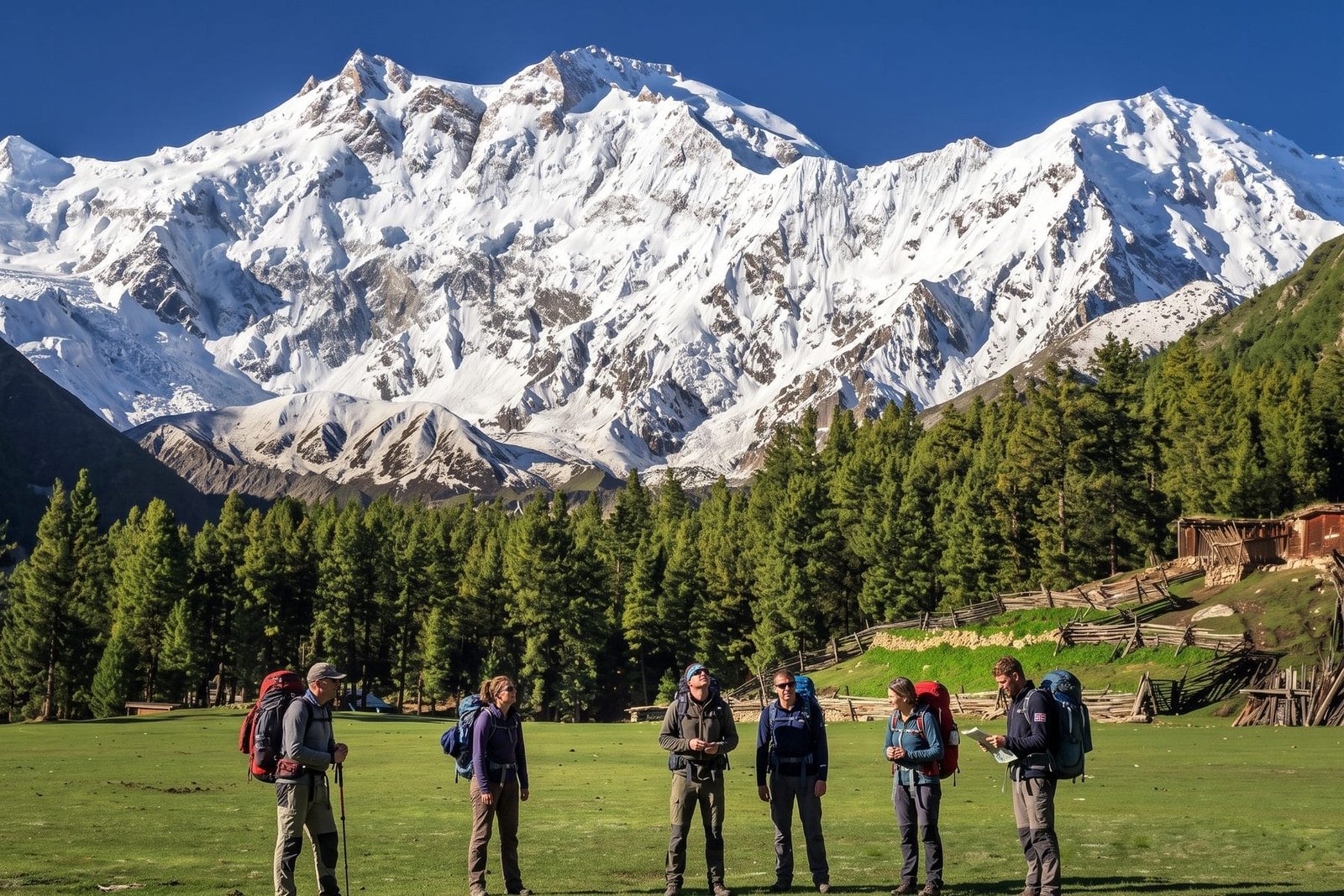
The Rupal Face is the south side of Nanga Parbat, and Wikipedia gives it as rising 4,600 m (15,090 ft) above its base, which is why it is "often referred to as the highest mountain face in the world". It is a single wall of rock and ice that climbers spent decades staring at before anyone climbed it. This is the story of how big it is, who first climbed it in 1970 and what that cost, what two Americans did on it in 2005, and, because we run trips here, which of our itineraries actually put you in front of it. The answer is not the one you might assume, and we will be exact about it.
How big is the Rupal Face, really?
The figure you will see everywhere is 4,600 m, and it comes with a qualifier worth keeping. Wikipedia says the Rupal Face rises 4,600 m above its base and is "often referred to" as the highest mountain face in the world. That is a claim about measurement convention, not a verdict, and we will phrase it the same way.
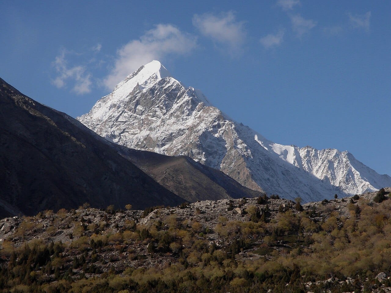
A little context makes the number real. Nanga Parbat's summit is 8,126 m, the ninth-highest mountain on Earth. Subtract 4,600 m and the wall's foot is at roughly 3,500 m, which fits the way our own guide describes it, a continuous wall rising from the valley at about 3,500 m to the summit. Near the base is a glacial lake called Latbo, above a seasonal shepherds' village of the same name.
Nanga Parbat has more than one monster wall. Wikipedia says the north side, the Raikot (also spelled Rakhiot) Flank, rises 7,000 m from the Indus valley to the summit in just 25 km, which it calls one of the ten greatest elevation gains in such a short distance on Earth. So the Rupal Face is the tallest single wall, and the Raikot side is the biggest total drop. Both are true, and which one looks bigger depends on where you stand.
The mountain also rises "far above its surrounding terrain" and has the second-highest prominence among the 100 tallest mountains, behind only Mount Everest. The name comes from the Sanskrit for "naked mountain", and Wikipedia ties it to the south face, which is usually snowless. The local Shina name is Diamer.
Which side of Nanga Parbat is which?
This is the point most travel writing blurs, so here it is plainly. Nanga Parbat has three primary faces, and each has its own approach.
| Face | Side of the mountain | Reached from | What we run |
|---|---|---|---|
| Rupal | South / southeast | Astore Valley, then the Rupal Valley and Tarashing | The Astore Valley and Rama Lake Tour (day 3 at Tarashing) |
| Raikot (Wikipedia: "Rakhiot") | North | Raikot Bridge on the Karakoram Highway, jeep to Tato, walk to Fairy Meadows | Fairy Meadows treks and the Nanga Parbat & Rakaposhi trek |
| Diamir | West / northwest | The Diamir Valley from Chilas | The Nanga Parbat Expedition (Kinshofer Route) |
Two spelling notes. Our trek pages and guides spell it Raikot, while Wikipedia uses Rakhiot; this post follows our pages. And the "Rupal Face" and "the south face" are the same thing.
Who first climbed the Rupal Face, and when?
Two brothers from South Tyrol, in June 1970, in an expedition led by Karl Herrligkoffer. The aim of the expedition was to climb the then unclimbed Rupal Face. Wikipedia's Nanga Parbat article records that in 1970 the brothers Günther and Reinhold Messner made the third ascent of the mountain and the first ascent of the Rupal Face.
The mountain had been climbed before. The first ascent was by the Austrian Hermann Buhl on 3 July 1953, via the Raikot Flank, solo for the final 1,300 m. The second ascent was via the Diamir Face in 1962 by Toni Kinshofer, Siegfried Löw and A. Mannhardt, and that route became the standard one. The Messners' 1970 ascent was the third overall and the first up the south wall.
The key fact about the climb is how it ended. Reinhold's account is that after the summit, with Günther exhausted and suffering from altitude sickness, descending the Rupal Face seemed too dangerous, and the brothers instead went down the gentler Diamir Face on the other side of the mountain. That made the 1970 climb the first traverse of Nanga Parbat. In other words, nobody who made the first ascent of the Rupal Face went back down it.
What happened to Günther Messner?
He died on the descent. This is the part of the story that has been argued over for more than fifty years, and we will tell it with the care it deserves.
Wikipedia's account is that the brothers spent a bivouac high on the mountain, then a second at the Mummery Rib, and that by the third day without shelter or water Günther could barely walk. He disappeared at the bottom of the Diamir Face, most likely killed by an ice avalanche, while Reinhold, walking ahead and with severe frostbite, continued down the Diamir valley until he found local shepherds. Reinhold lost seven toes to frostbite. The dates differ slightly across Wikipedia pages: one gives Günther's death as 29 June 1970, another says the summit day was 27 June and that he died two days later.
The controversy is real. Expedition members Max von Kienlin and Hans Saler claimed that Reinhold had planned the Diamir descent in advance and had not been forced into it, while Reinhold's version is that Günther was too weak to go back down the Rupal Face and that waiting would have been fatal. The question of where on the Diamir Face Günther died was partly settled in 2005, when three local guides found human remains at about 4,300 m on the Diamir Face and a DNA analysis at the University of Innsbruck confirmed on 21 October 2005 that they were Günther's. Wikipedia says that evidence supported Reinhold's account that Günther died on the west side and not on the Rupal Face, but that argument persists about exactly where.
We take no side in a dispute between two sets of people who were there. What we can say is that the first ascent of the world's biggest wall came with the loss of a young man.
Why had it taken so long?
Because of what the south wall is. Wikipedia describes the south and southeast side of the mountain as dominated by the Rupal Face, and describes the Raikot and Diamir sides as more complex. Climbers had spent years on the north side: the first German expedition went there in 1932, the disasters of 1934 and 1937 followed, and the 1953 first ascent used the Raikot Flank. The German interest in the mountain in the 1930s, and the 1934 tragedy in which three German mountaineers and six Sherpas died, is the background to our existing piece Nanga Parbat, Schicksalsberg der Deutschen. Karl Herrligkoffer, the leader of the 1970 expedition, was the half-brother of Willy Merkl, who died on the mountain in 1934, and Wikipedia says Herrligkoffer had organised six expeditions before 1970 and was said to be obsessed with the peak.
The wall remained a prize for decades. Wikipedia lists a 1976 ascent by a team of four on a new route on the Rupal Face, the second ascent of that face, called the Schell route after the Austrian team leader, on a line plotted by Karl Herrligkoffer. In 1985 Jerzy Kukuczka, Zygmunt Heinrich, Slawomir Lobodzinski and Carlos Carsolio climbed the Southeast Pillar, or Polish Spur, on the right-hand side of the face, reaching the summit on 13 July.
What did Steve House and Vince Anderson do in 2005?
They changed the way people thought about the wall. In September 2005, Wikipedia says, Vince Anderson and Steve House made an "extremely lightweight, fast ascent of a new, direct route on the face, earning high praise from the climbing community". The same article describes the late 1980s and 2005 as the arrival and then the resurgence of lightweight, alpine-style attempts on the Rupal Face, after the earlier large expeditions.
The recognition came the following year. Wikipedia's list of Piolets d'Or winners gives 2006 to Steve House and Vince Anderson "for the rapid light ascent of the Rupal Face of Nanga Parbat". So: the climb was 2005, the award 2006. Many sources shorten that to "the 2005 Piolet d'Or", and it is worth knowing why they are both right and wrong.
We do not know the climbers' times or details from our sources, and we will not guess at them. The point for this story is the contrast: in 1970, the first ascent of the wall was a large, supported expedition that ended in tragedy. In 2005, two climbers made a fast, light ascent of a new line on the same face.
Other attempts on the Rupal side have since gone on in winter. Wikipedia lists several winter attempts on the Schell route, including Polish, French, Italian-German and Russian parties, with some reaching 7,000 m or higher; that list records no completed winter ascent of the Rupal Face. The first successful winter ascent of the mountain, in February 2016, was by Ali Sadpara, Alex Txikon and Simone Moro. Our guide to the standard route is on the Nanga Parbat expedition page.
Where do you actually see the Rupal Face?
From the Rupal Valley, on the southern side, which is reached via the Astore Valley. The Rupal Valley lies in Astore District, on the southern side of Nanga Parbat. The Astore Valley leaves the Karakoram Highway at Jaglot, about 60 km south of Gilgit. Tarashing, Wikipedia says, is considered the gateway to Nanga Parbat, a village at about 2,900 m with a large glacier beside the Rupal River.
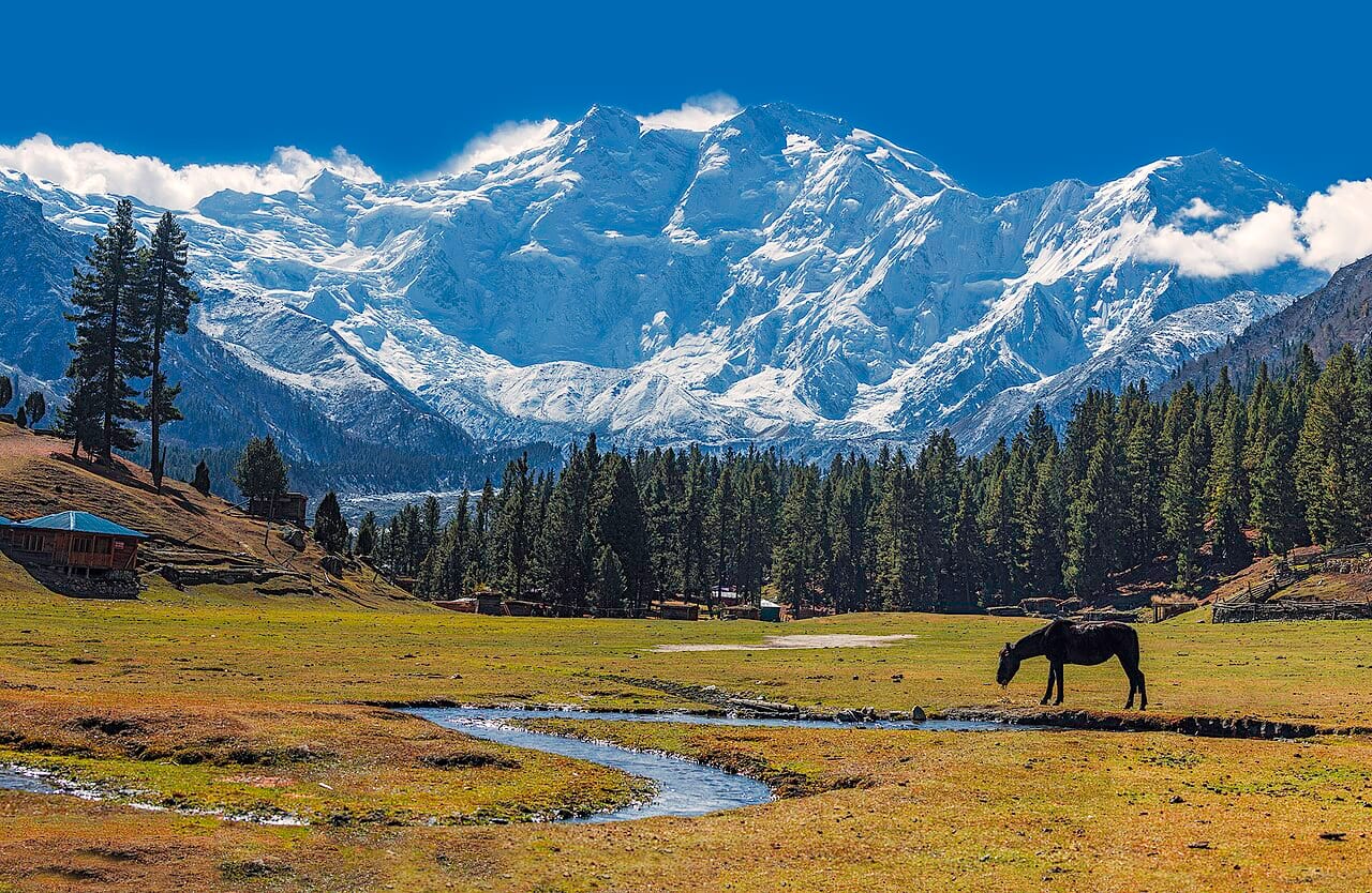
Our Astore Valley and Rama Lake Tour is the trip that goes there. It is a 4-day, 3-night summer trip by 4x4. Day 1 crosses the Deosai plateau from Skardu to Astore, day 2 goes to Rama Meadows and Rama Lake, and day 3 goes into the Rupal Valley to Tarashing village, where our itinerary describes standing "directly beneath" the wall. Day 4 recrosses Deosai to Skardu. The season on the page is mid-June to September, and the prices are $560 per person in a group of four to six, $700 for two or three and $1,250 solo. That is a view, not a climb or a trek: the tour page describes real walking as short and optional. Read our Astore Valley and Rama Lake guide for the valley.
The tour page claims the wall is "the biggest mountain wall on earth" and "more than 4,000 m of Nanga Parbat in one view". We would rather use the Wikipedia wording ("often referred to as the highest mountain face in the world", 4,600 m above its base).
What about the Fairy Meadows treks?
They do not visit the Rupal side. This is the point we most want you to leave with, because the two are easy to confuse.
Our Fairy Meadows treks and our 12-day Nanga Parbat and Rakaposhi Base Camp Trek all go to the northern side. They run from Raikot Bridge on the Karakoram Highway, by jeep to Tato and then on foot to Fairy Meadows at about 3,300 m, with the Nanga Parbat base camp viewpoint beyond. What you see from there is the Raikot or Raikot side of the mountain. The Nanga Parbat & Rakaposhi page itself says you are "face to face with the 8,126 m Raikot face". A view of the Rupal Face is not part of these itineraries.
The Wikipedia entry for Fairy Meadows puts it near a base camp site of Nanga Parbat on the Raikot side, and what you see is the North Peak, 7,816 m, rather than the main summit. (The North Peak is a subsidiary summit about three kilometres north of the main summit.)
Our existing guide, Nanga Parbat Base Camp Trek: Fairy Meadows and Rupal, compares the two approaches in detail, and its "Raikot side vs Rupal side" section is the one to read next. Our Mazeno Pass trek guide connects the Rupal and Diamir sides, but it is a guide, not a package we publish.
And the Diamir side?
Our Nanga Parbat Expedition climbs the Kinshofer Route on the Diamir Face, the standard line of almost every contemporary ascent. It is a 42-day expedition priced at $7,900 base-camp service or $16,900 full-board guided, with an 8,000 m peak permit, royalty and a liaison officer. That is the side where Günther Messner's remains were found.
When is the best time to see the Rupal Face?
Our Rupal-side tour lists mid-June to September, and our Nanga Parbat guide gives June to September as prime, with a broader season of roughly April to October. The 2027 summer is the window to plan around. We do not have a source for the exact opening dates of the road into the Rupal Valley, and we will not promise any.
Is the Rupal Face worth the journey if you will not climb it?
Our honest answer is yes, if you are interested in what a mountain looks like at scale. Standing in the Rupal Valley, you are looking at a wall that took the mountaineering world from 1932, the first German expedition, to 1970 to get up, and that has been the setting for the most lightweight ascent on Nanga Parbat since. Few places show the difference between a viewpoint and a route as clearly.
If you want a base camp on foot with less of the logistics, our comparison of four base camps puts the Fairy Meadows trek next to K2, Broad Peak and Gasherbrum, and the Nanga Parbat page has the whole mountain. If your interest is the peak as an 8,000 m summit, see our list of Pakistan's five eight-thousanders.
Ready to see the Rupal Face?
For the Rupal Valley, ask us about the Astore Valley and Rama Lake Tour. For the north side at Fairy Meadows, see the Fairy Meadows trek or the Nanga Parbat and Rakaposhi Base Camp Trek. For the summit itself, see the Nanga Parbat Expedition. A 10% deposit (minimum $50) confirms a place on our tours. Message us on WhatsApp with your dates and tell us which side of the mountain you want to see.
Frequently asked questions
How tall is the Rupal Face of Nanga Parbat?
About 4,600 m (15,090 ft) from its base to the summit of Nanga Parbat, according to Wikipedia, which says it is often called the highest mountain face in the world.
Who first climbed the Rupal Face?
The brothers Günther and Reinhold Messner, in June 1970 on an expedition led by Karl Herrligkoffer. They descended by the Diamir Face on the other side.
Did Steve House and Vince Anderson win the Piolet d'Or for the Rupal Face?
Yes: they made a light, fast ascent of a new direct route on the face in September 2005, and Wikipedia lists them as the 2006 Piolet d'Or winners.
Can you see the Rupal Face from Fairy Meadows?
No. Fairy Meadows is on the northern, Raikot or Raikot side. The Rupal Face is on the south side of the mountain, reached via Astore and the Rupal Valley.
Can you trek to the Rupal Face?
Yes, there are treks on the Rupal side, and our Nanga Parbat guide describes the one to the Herrligkoffer base camp area as longer, quieter and more committing than Fairy Meadows. We run a 4-day vehicle trip to Tarashing rather than a trek there.
Is Nanga Parbat the same as the "Killer Mountain"?
Yes, Wikipedia says the mountain has earned the nickname Killer Mountain for its high number of climber fatalities. Our trek pages note that the Fairy Meadows walk asks for no technical climbing.
Written by Zulfiqar Ali, founder of Karakoram Venture. Mountain history read from Wikipedia on 11 November 2026; tour details are our published 2027 pages.