



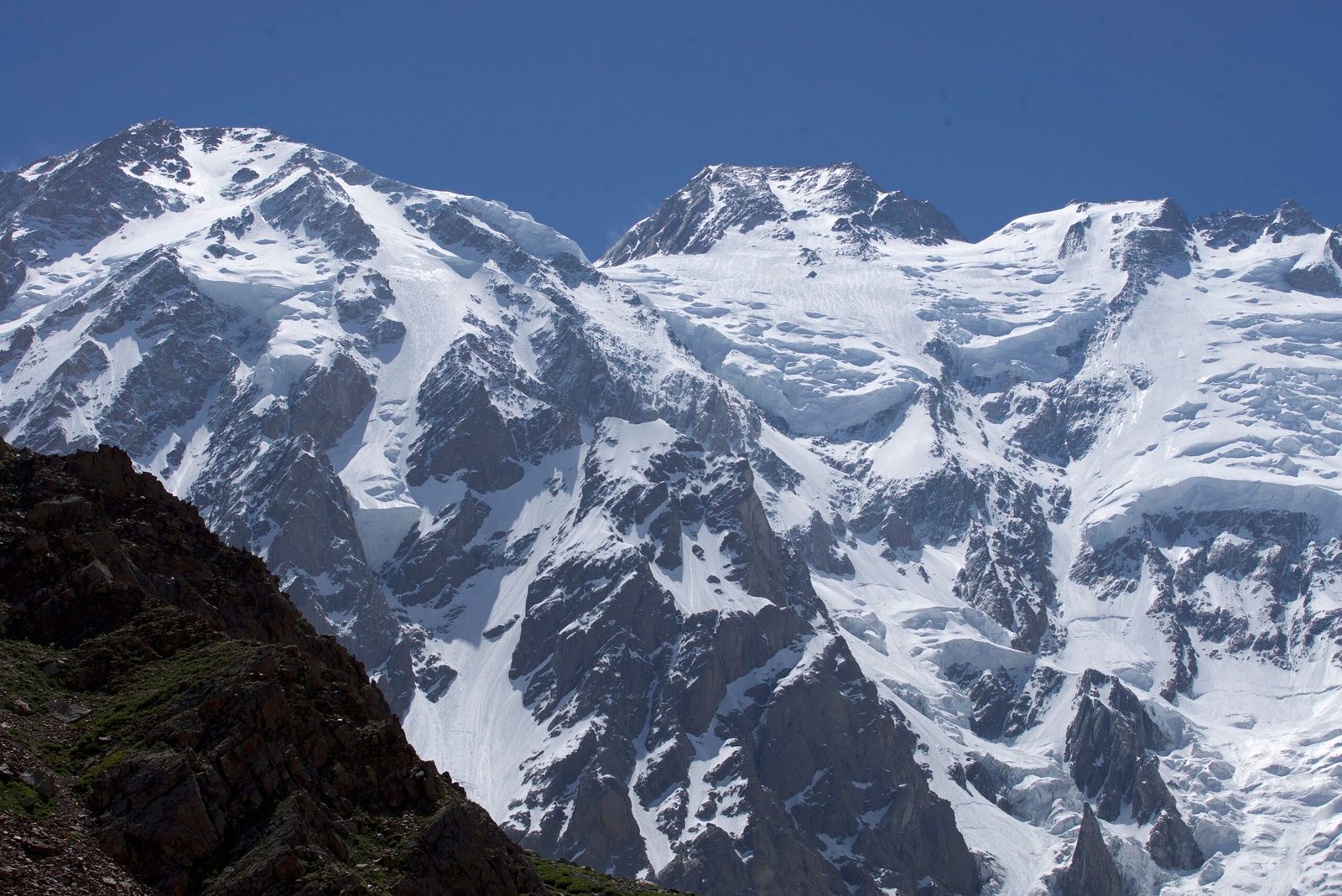
Nanga Parbat is 8,126 m and the ninth-highest mountain on earth, standing alone at the western end of the Himalaya in Diamer District, Gilgit-Baltistan. Almost every commercial expedition today climbs the Kinshofer route on the Diamir (west) face, moving through four high camps between a base camp at roughly 4,200 m and the summit. The climbing season is short — broadly June and July, with most summit windows falling in the second half of that stretch. Plan on about six to seven weeks door to door from Islamabad. It is a technical, avalanche-prone 8,000er with one of the hardest reputations in the range, and it is not a first high-altitude climb.
We run Nanga Parbat out of Gilgit-Baltistan with our own Balti team, and we will be straight with you: this mountain has killed a lot of good climbers, and the ones who get up it and back down are usually the ones who arrived already fit, already acclimatised on something smaller, and willing to walk away from a bad forecast. Everything below is what we tell people on the phone before they book.
Key takeaways
- Altitude: 8,126 m — ninth-highest mountain in the world, and the western anchor of the Himalaya.
- Where: Diamer District, Gilgit-Baltistan, west of the Indus and separate from the Karakoram giants.
- Normal route: the Kinshofer route on the Diamir face, first climbed in 1962.
- Camps: base camp about 4,200 m, then roughly 5,000 m, 6,200 m, 6,900 m and around 7,400 m (approximate — teams vary).
- Season: June and July. Winter ascents exist, but the first one only came in 2016.
- Difficulty: serious. Steep mixed ground low on the route, real avalanche and rockfall exposure, and a long summit day.
Where Nanga Parbat is, and why it stands alone
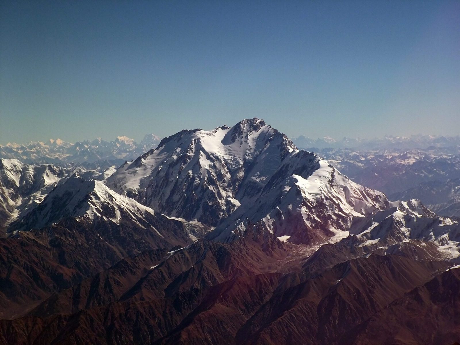
First, Nanga Parbat is not a Karakoram peak. It sits west of the Indus, the last great block of the Himalaya before the river cuts through and the Karakoram takes over on the far bank. That isolation is the whole character of the mountain: no neighbouring giants to shelter it, nothing to break the weather, and a summit that rises more than 4,000 m above the valleys on every side. The name comes from the Sanskrit for "naked mountain"; locally in Diamer it is Diamir, the king of mountains.
Accordingly, you approach from the Karakoram Highway. From Islamabad the road runs up the Indus to Chilas — see our Karakoram Highway guide for what that drive is actually like — then a jeep track turns off into the Bunar and Diamir valleys, and you walk the last stretch to base camp. On the far side of the mountain, the Rupal valley in Astore is reached from Skardu or Gilgit; that side is where our Nanga Parbat base camp trek and the walk in to Fairy Meadows get their views.
How it compares to Pakistan’s other 8,000ers
Schematic comparison. Heights are the standard published figures; the axis is truncated at 7,900 m.
The Kinshofer route, step by step
Specifically, the Kinshofer line goes up the Diamir face and was opened on the second ascent in 1962. It is steeper and more technical low down than most people expect from a "normal route" — the Kinshofer wall itself is a fixed-rope rock and ice barrier that you will climb and descend many times during rotations. Above it the mountain lays back into long snow slopes and a summit day that goes on and on.
- Islamabad to Chilas. A long day on the Karakoram Highway along the Indus gorge. Weather and road conditions decide the timing, so we build in buffer.
- Chilas to the Diamir valley. Jeep as far as the track allows, then porters and a walk in to base camp at roughly 4,200 m.
- Base camp, and time. Puja, load sorting, and acclimatisation walks. Nobody rushes this — see our acclimatisation guide for how we stage it.
- Rotation one: Camp 1 (about 5,000 m). Moraine and glacier travel to the foot of the wall.
- Rotation two: Camp 2 (about 6,200 m). The Kinshofer wall — steep mixed climbing on fixed rope. This is the technical crux of the route.
- Rotation three: Camp 3 (about 6,900 m). Snow slopes and traverses, with real avalanche exposure after storms.
- Camp 4 (around 7,100–7,400 m). Placement varies by team and conditions.
- Summit push. A long, cold day up the Bazhin basin and the summit slopes to 8,126 m — then the whole descent, which is where this mountain does most of its damage.
Schematic and approximate. Camp altitudes and placements vary between teams and seasons.
The Rupal Face, and the history you are walking into
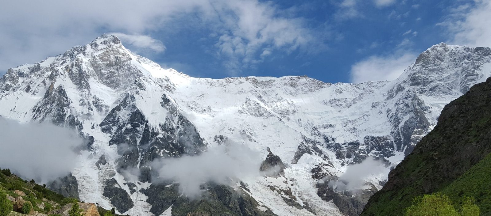
Meanwhile, on the south side, Nanga Parbat throws up the Rupal Face — roughly 4,600 m of continuous mountain from the valley to the summit, widely described as the highest mountain face in the world. Standing under it is one of the great sights in Pakistan, and you do not need to be a climber to see it.
The climbing history is heavy, and worth knowing before you commit:
- 1895. A. F. Mummery made the first serious attempt and disappeared on the mountain — the first of many.
- 1934. Willy Merkl’s expedition was caught high on the Rakhiot side in a long storm. Merkl, Uli Wieland, Willo Welzenbach and six Sherpa porters died; Alfred Drexel had already died of altitude illness earlier in the trip.
- 1937. An avalanche overran Camp IV below Rakhiot Peak and killed all sixteen men there — seven Germans and nine Sherpas. It remains one of the worst single disasters in mountaineering.
- 3 July 1953. Hermann Buhl made the first ascent, finishing alone and without supplementary oxygen on Karl Herrligkoffer’s expedition, and bivouacking standing up above 8,000 m on the way down.
- 23 June 1962. Toni Kinshofer, Anderl Mannhardt and Sigi Löw made the second ascent by the Diamir face — the line that carries Kinshofer’s name and is now the normal route.
- 27 June 1970. Reinhold and Günther Messner climbed the Rupal Face and descended the Diamir side, the first traverse of the mountain. Günther died on the descent.
- 1978. Reinhold Messner returned and soloed the Diamir face — the first solo ascent of an 8,000 m peak.
- 26 February 2016. The first winter ascent, by Simone Moro, Alex Txikon and Muhammad Ali "Sadpara" — a Balti climber from Sadpara village outside Skardu. That one is personal for us.

The named dangers, and what we do about them
Above all, the named danger on Nanga Parbat is avalanche and serac release, especially on the traverses above Camp 2 after fresh snow, and the descent after a long summit day when people are empty. The mountain’s fatality rate is among the highest of any 8,000er. We carry a satellite phone in base camp and on the climb, we run established helicopter-rescue contacts for Gilgit-Baltistan, and we require proof of insurance that covers helicopter evacuation and high-altitude rescue before you fly — our insurance guide explains what to look for. We will also turn a team around. If the snow is loaded or the window closes, we go down, and we would rather lose the summit than a climber.
When to go
In short, the window is narrow. Nanga Parbat is climbed in summer, and the useful weather is a short list of days rather than a season you can stroll through.
| Months | Conditions | Verdict |
|---|---|---|
| March – May | Deep winter snow still on the route, cold, high avalanche danger, valleys only just opening. | Too early for the normal route. |
| June | Teams arrive, base camp goes in, rotations begin. Snow still heavy up high early in the month. | Arrival and acclimatisation. |
| Late June – July | The main summit window. Warmer, more settled spells between storms; the route is fixed and other teams are on it. | Best — this is when it happens. |
| August | Monsoon influence reaches further west some years; wetter, less reliable, teams thinning out. | Late and marginal. |
| September – October | Clear, cold, beautiful in the valleys, but short days and no fixed infrastructure on the mountain. | Trekking yes, climbing no. |
| Winter | Extreme cold and wind. First winter ascent only came in 2016. | Specialist expeditions only. |
If you are choosing between Pakistani 8,000ers for the same summer, read this next to our Broad Peak, Gasherbrum I and II and K2 pages. They share a season but not a character.
How hard is it, honestly
Harder than its height suggests. Indeed, Nanga Parbat is not a walk-up 8,000er with a technical crux you clip past — the Kinshofer wall is genuine steep ground you will move on repeatedly, the upper mountain is long and exposed, and the weather arrives without much warning because there is nothing upwind to slow it.
What we ask of you
- Previous 8,000 m or high 7,000 m experience. This is not a first big mountain. If you are building towards it, Spantik is the sensible step before.
- Fixed-rope competence. Jumar, abseil, changeovers on steep mixed ground, in the dark, in gloves, without thinking about it.
- Real endurance base. Long days back to back, carrying, at altitude, for weeks.
- The temperament to turn around. The climbers who last are the ones who can walk down from 7,800 m and mean it.
Importantly, Nanga Parbat is a mountaineering objective, not an open-zone trek. Climbing it requires a peak permit arranged through the relevant Pakistani authorities, with a liaison officer assigned to the expedition — we handle that paperwork, and it needs months of lead time, not weeks. You will also need the right visa: expeditions and treks use a mountaineering and trekking category, not a plain tourist visa. Our Pakistan visa guide walks through it. The base camp treks on the Rupal and Fairy Meadows side are a different matter and sit in open zone — no peak permit needed.
Getting there, and what it costs
In any case, most teams fly into Islamabad and drive the Karakoram Highway to Chilas, then jeep into the Diamir valley and walk to base camp. Some itineraries route via Gilgit; if you are coming off another trip in Baltistan, Skardu connects by road as well — our getting to Skardu guide covers the flight-versus-road question, and best time to visit Gilgit-Baltistan is useful if you are adding days either side.
On price: we keep pricing personal rather than posting a number that goes stale. An expedition cost depends on team size, permit and liaison-officer fees in the year you climb, how much high-altitude support and oxygen you want, and how many rest days you build in. Tell us your dates and what you want the support to look like and we will put a real figure in front of you — a fair price, with no corners cut on guides, food, or safety kit. That is the whole basis we operate on: local hands, real safety, fair price.
Of course, you can climb it with us. Our 42-day Nanga Parbat Expedition takes the Kinshofer Route on the Diamir Face with our own high-altitude team, four camps and daily forecasting, full-board from $16,900 per person. Previous 7,000 m experience is required; our 21-day Spantik Expedition from $6,400 is the qualifier we recommend. Local Balti staff, sat phone at base camp, and no summit promises — the mountain decides.
Frequently asked questions
How high is Nanga Parbat and where does it rank?
Nanga Parbat is 8,126 m. Therefore it is the ninth-highest mountain in the world, and the second-highest in Pakistan after K2. It sits in Diamer District, Gilgit-Baltistan, at the western end of the Himalaya.
What is the normal route on Nanga Parbat?
The Kinshofer route on the Diamir (west) face. Indeed, it was opened on the second ascent in June 1962 by Toni Kinshofer, Anderl Mannhardt and Sigi Löw, and it is the line used by almost all commercial expeditions today. Its crux is the steep Kinshofer wall below Camp 2.
When is the climbing season on Nanga Parbat?
June and July. Specifically, teams arrive in June to establish base camp and acclimatise, with summit windows most often falling from late June through July. Winter ascents are possible but exceptional — the first was on 26 February 2016.
Why is Nanga Parbat called the Killer Mountain?
Because of its early history and its continuing fatality rate. Sixteen men died in a single avalanche at Camp IV in 1937, and the 1934 expedition lost Willy Merkl and eight others. It was not climbed until Hermann Buhl reached the summit on 3 July 1953, and it still has one of the highest death rates of any 8,000 m peak.
Do I need a permit to climb Nanga Parbat?
Yes. Moreover, climbing the peak requires a mountaineering permit and an assigned liaison officer, arranged well in advance, plus a mountaineering and trekking visa rather than a tourist visa. The base camp treks on the Rupal and Fairy Meadows sides do not need a peak permit.
Talk to the team that lives here
If you are looking at Nanga Parbat for 2027 or 2028, send us your dates, your climbing history and what level of support you want. You will be talking to a local Balti team in Gilgit-Baltistan — not a broker who will hand you to someone else once you have paid.
WhatsApp: +92 312 9921574 · Email: info@karakoramventure.com
Sources & attribution: elevations, first-ascent dates and expedition history cross-checked against Wikipedia, American Alpine Club publications and published expedition reports; camp altitudes are approximate and vary by team. Photographs: Marek Matlovič (CC BY-SA 4.0), Ahmad Omer (CC BY-SA 4.0), Maariz Ansari (CC BY-SA 4.0) and Guilhem Vellut (CC BY-SA 2.0), all via Wikimedia Commons.

