



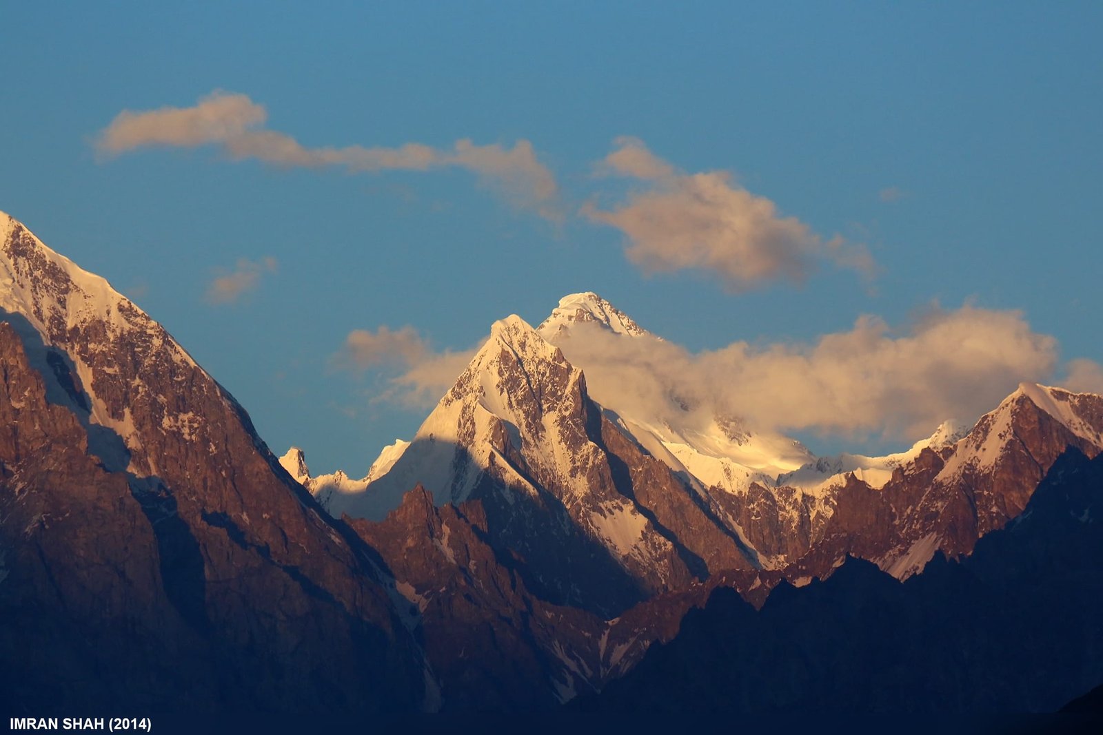
Trivor (7,577 m) is a Karakoram giant in the Hispar Muztagh, north of the Hispar Glacier in Gilgit-Baltistan, Pakistan. It has been climbed exactly twice: by Wilfrid Noyce and Jack Sadler on 17 August 1960, and by Atsushi Endo and Toshifumi Onuki in 1991. Both parties reached the summit by the northwest ridge. Access is from the Hunza side through Nagar and Hispar village, the climbing window is roughly June to August, and this is a serious, committing expedition — not a trekking peak.
We run Hispar Muztagh logistics out of Skardu and Hunza with our own Balti team, and we will be straight with you: Trivor is not a mountain you book because you saw a photograph. Two successful ascents in sixty-six years is not marketing copy, it is the record. What we can do well is get you and your gear to the foot of it, feed you, keep a satellite phone in camp and a real evacuation plan on paper. What the mountain does after that is between you and the northwest ridge.
Key takeaways
- Height: 7,577 m (24,859 ft). An older figure of 7,728 m is still quoted but is not consistent with the photographic evidence.
- Range: Hispar Muztagh, the second-highest sub-range of the Karakoram after the Baltoro Muztagh.
- Ascents: two. First on 17 August 1960 (Noyce, UK and Sadler, USA); second in 1991 by a Japanese pair.
- Standard line: the northwest ridge, gained from a high col.
- Access: Karakoram Highway to Nagar, then the rough Hispar valley jeep road to Hispar village, then on foot.
- Season: broadly June to August; expedition length is measured in weeks, not days.
Where Trivor is, and why almost nobody goes
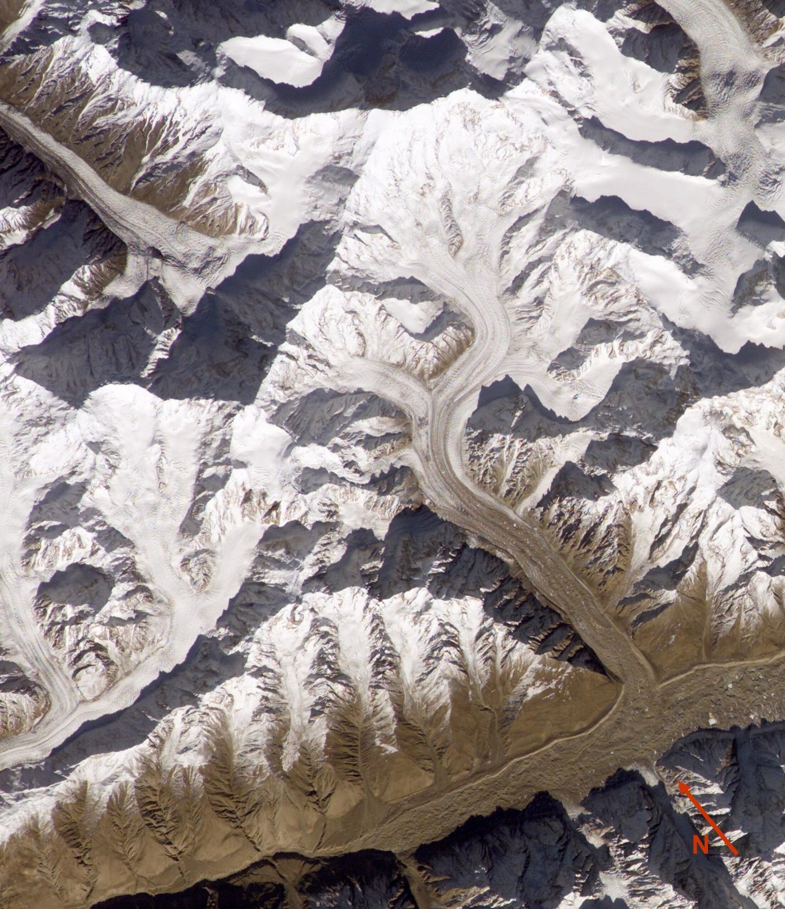
The Hispar Muztagh sits north of the Hispar Glacier, south of the Shimshal Valley and east of Hunza. It is the second-highest sub-range in the Karakoram, and it carries a wall of seven-thousanders that most travellers have never heard of: Distaghil Sar (7,885 m), Khunyang Chhish (7,852 m), Kanjut Sar (7,760 m), Trivor, and Momhil Sar (7,343 m) next door.
Trivor is not obscure because it is small. It is obscure because it is awkward. It sits back from the road behind glaciers that take days to walk, its ridges are long and corniced, and there is no tidy normal route that a commercial team can rig and repeat. Compare that with the Baltoro, where the trail to Concordia is walked by hundreds every summer. Here you may not see another party for the entire trip.
The route, step by step
There is no fixed commercial itinerary for Trivor, because there have been two ascents. What follows is the shape of an approach, based on the published accounts and on how the Hispar valley actually works.
- Islamabad to Gilgit or Hunza. By air to Gilgit when the weather allows, or overland on the Karakoram Highway. Build in buffer days either way.
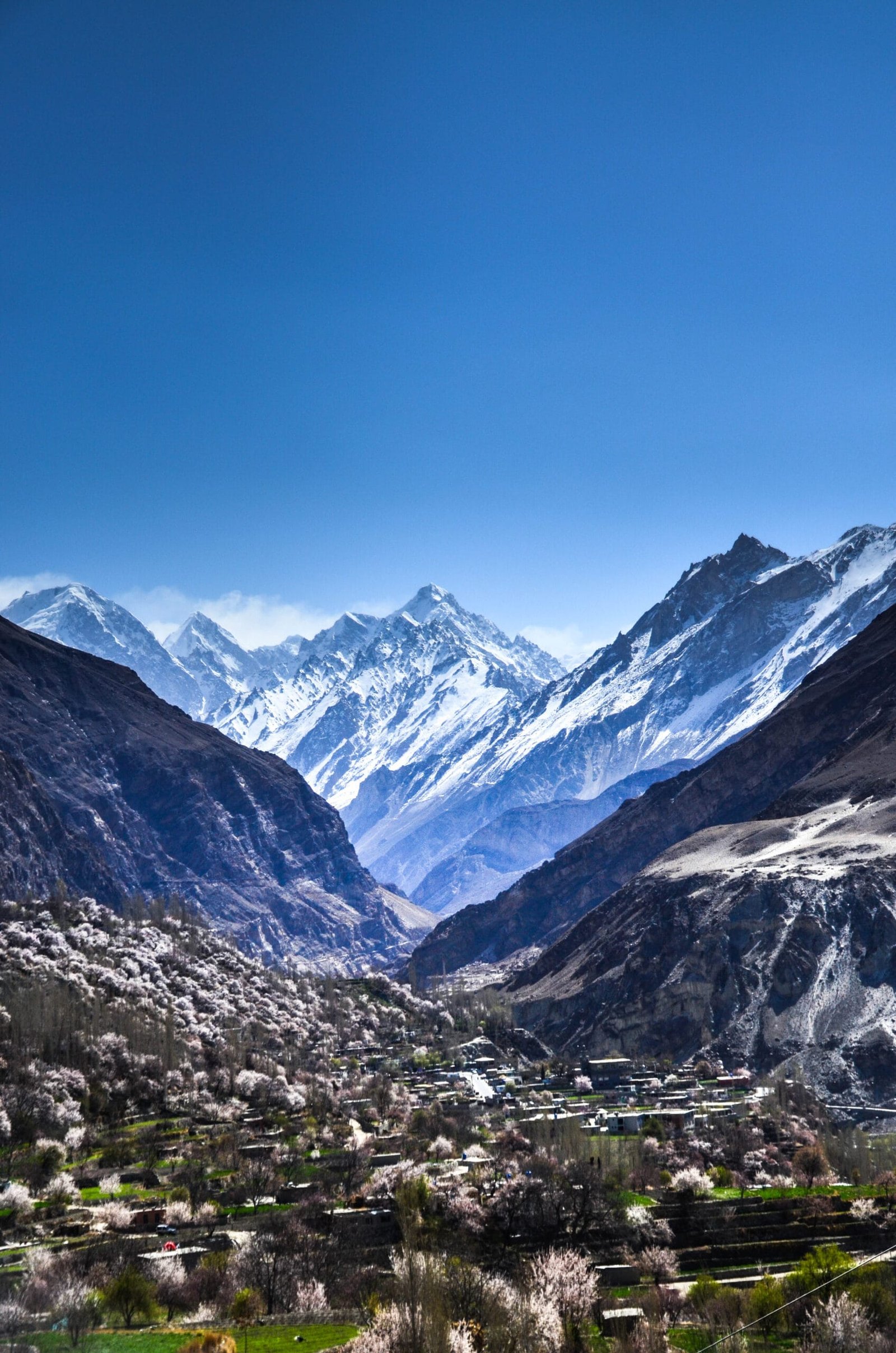
- Hunza to Nagar and into the Hispar valley. A rough jeep road runs up the valley from the Karakoram Highway. It is landslide-prone and closes without notice.
- Hispar village. The last settlement. Porters, final loads and the last chance to fix anything.
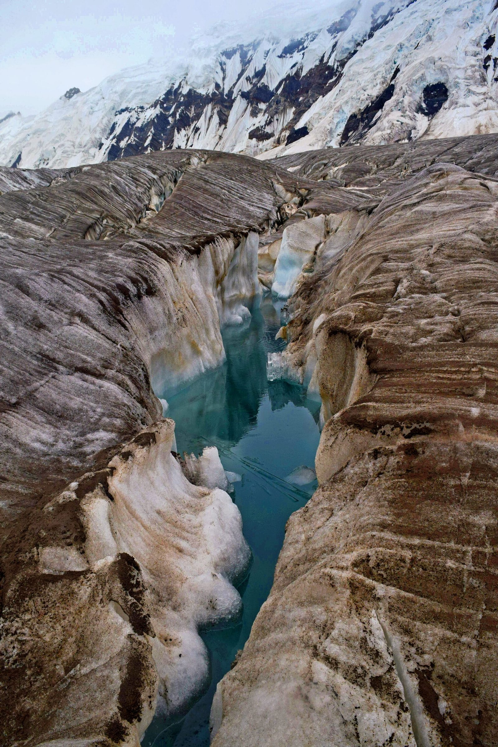
- On to the glacier. The Hispar Glacier runs roughly 49 km east, an ice highway that has carried travellers between Nagar and Baltistan for a very long time. The Trivor approach turns north off the main system.
- Base camp and the approach glacier. Noyce and Sadler in 1960 came from the Trivor Glacier, running towards the peak from the south-west, and worked up to the high col at the foot of the northwest ridge.
- The northwest ridge. Both successful parties finished this way. It is the line, and it is long.
The 1991 pair took a different way in: from the north, off the Momhil Glacier, up a northeast-facing spur to the east ridge of Momhil Sar, then down to that same col and onto Trivor’s northwest ridge. Two ascents, two approaches, one summit ridge.
Noyce, Sadler, and a motorbike
The 1960 British–American expedition is one of the good stories of Karakoram climbing. Wilfrid Noyce, who had been high on Everest in 1953, wrote the trip up as To the Unknown Mountain and in the Alpine Journal. He and the American Jack Sadler summited on 17 August 1960.
The footnote everyone remembers concerns another team member. Don Whillans had shipped a 650cc Triumph out to Pakistan, and once the climbing was finished and his partners had flown home, he rode it the seven thousand miles back to Britain alone. That is the temperament this range attracted in 1960, and to be honest it is roughly the temperament it still asks for.
Then, for thirty-one years, nothing. In 1991 Atsushi Endo and Toshifumi Onuki made the second ascent. Since then, attempts — including on the north face, reported in the American Alpine Journal — but no third summit.
When to go
The Karakoram climbing season is short and the Hispar Muztagh is no kinder than the Baltoro. Read this next to our season-by-season guide to Gilgit-Baltistan.
| Months | Conditions | Verdict |
|---|---|---|
| April–May | Deep snow low down, unstable weather, jeep road often shut by slides | Approach only, at best |
| June | Season opening, glaciers still well covered, cold nights | Good for approach and acclimatisation |
| July–August | The main window. Longest settled spells, warmest nights high up | Best chance of a summit |
| September | Cooling fast, shorter days, glacier travel harder as snow bridges go | Late and marginal |
| October–March | Winter. Road access unreliable, temperatures severe | Not a commercial proposition |
How hard is it, honestly
Hard enough that two teams have done it. Trivor is an expedition for climbers who already have 7,000 m experience, who are competent on long corniced snow ridges without fixed rope, and who can operate self-sufficiently for weeks. It is not a step up from a base camp trek, and it is not a first seven-thousander — if that is what you want, we would point you somewhere with a known line.
Three things make it serious: the approach is long and the glaciers are broken, the northwest ridge is committing once you are on it, and rescue is slow because you are far from the road. Altitude planning matters more here than on a mountain with a short walk-in; our acclimatisation guide is the baseline, and for gear the Karakoram kit list is the starting point, not the finish.
Getting there, and what it costs
Most parties fly Islamabad to Gilgit and drive on, or take the Karakoram Highway overland with buffer days for weather and slides. If you are combining Trivor with anything Baltistan-side, our guide on getting to Skardu covers the other half of the region.
On price: we keep pricing personal rather than posting a number that goes stale. An expedition of this kind is costed around your team size, your days, your porter and permit load and your logistics — and a published figure would be wrong for almost everyone. Tell us your plan and we will build the number in front of you. Fair price, no corners cut on guides, food or safety.
If you want the Hispar Muztagh without an unclimbed-grade objective, the Snow Lake and Biafo–Hispar traverse takes you through the same country on foot.
Frequently asked questions
How high is Trivor?
7,577 m (24,859 ft), from a Russian 1:100,000 topographic map. An older figure of 7,728 m circulates widely but is not consistent with photographic evidence, so treat it with caution.
How many times has Trivor been climbed?
Twice. Wilfrid Noyce and Jack Sadler on 17 August 1960, and Atsushi Endo and Toshifumi Onuki in 1991. Both ascents finished up the northwest ridge.
Is Trivor a trekking peak?
No. It is a full mountaineering expedition requiring a permit, prior 7,000 m experience and weeks in the field. There is no established commercial normal route.
When is the best time to attempt Trivor?
July and August offer the most settled weather. June works for approach and acclimatisation. Outside roughly June to August, access and conditions become unreliable.
How do you get to the mountain?
Karakoram Highway to Nagar, then the rough jeep road up the Hispar valley to Hispar village, then on foot onto the glacier system. The road is landslide-prone and can close without warning.
Talk to the team that lives here
If Trivor or anything else in the Hispar Muztagh is on your mind, message us and we will tell you honestly what is realistic for your team and your season. You will be talking to a local Balti team, not a broker — our own guides, our own logistics, a satellite phone in camp and a rescue plan that exists on paper before you leave.
WhatsApp: +92 312 9921574 | Email: info@karakoramventure.com
Sources & attribution: elevation, first and second ascent details from Wikipedia (Trivor; Hispar Muztagh), Wilfrid Noyce, “The Ascent of Trivor”, Alpine Journal 66 (1961), and the American Alpine Journal (1992; 2024). Images: Trivor from Aliabad — Imran Shah, CC BY-SA 2.0; western Hispar Muztagh from the ISS — NASA / ISS, derivative by Rupert Pupkin, public domain; Hispar Glacier track — Yousaf Feroz Gill, CC BY-SA 4.0; peaks north of the Hispar valley — Azeemtariq9293, CC BY-SA 4.0. All via Wikimedia Commons.

