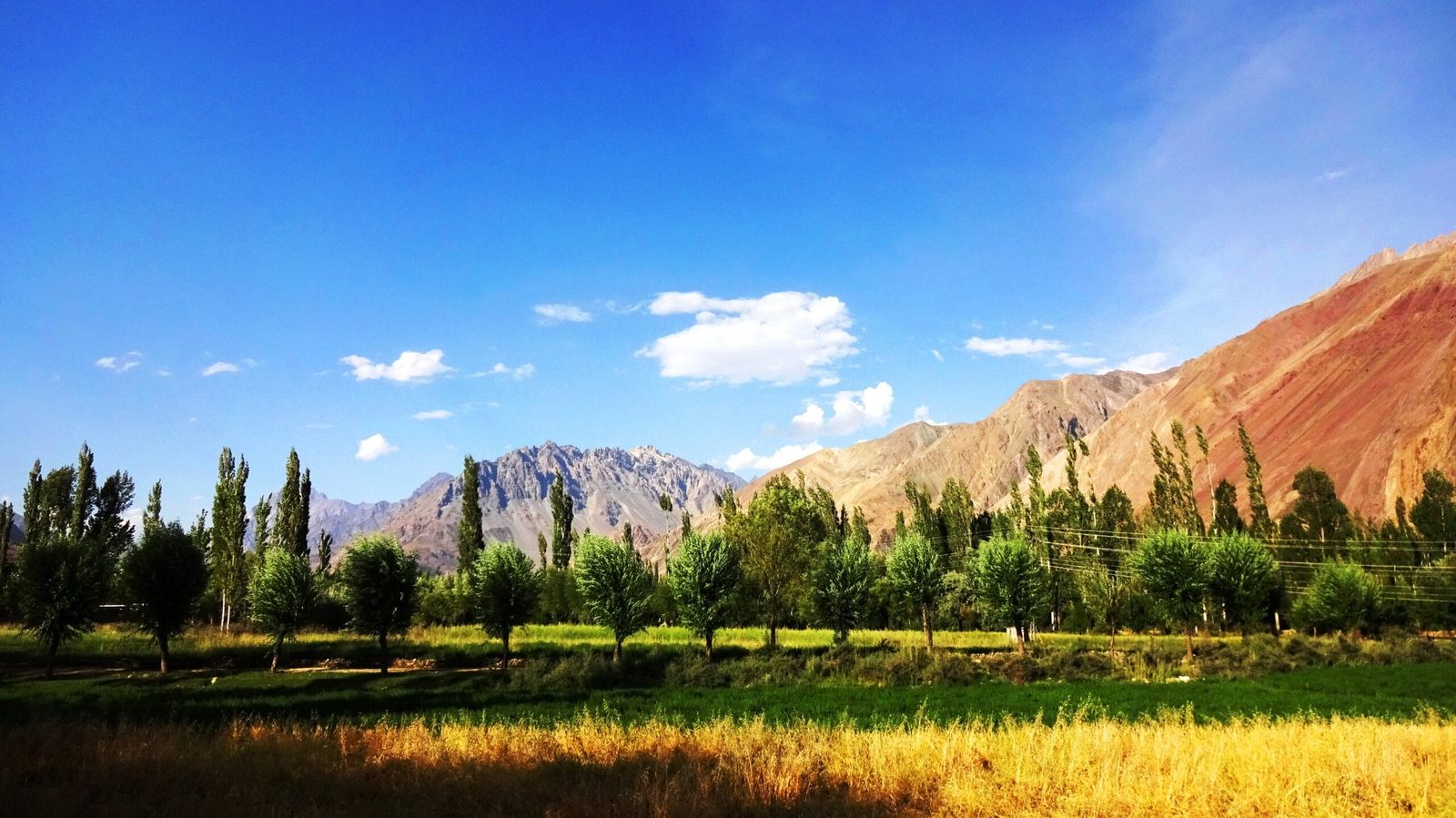
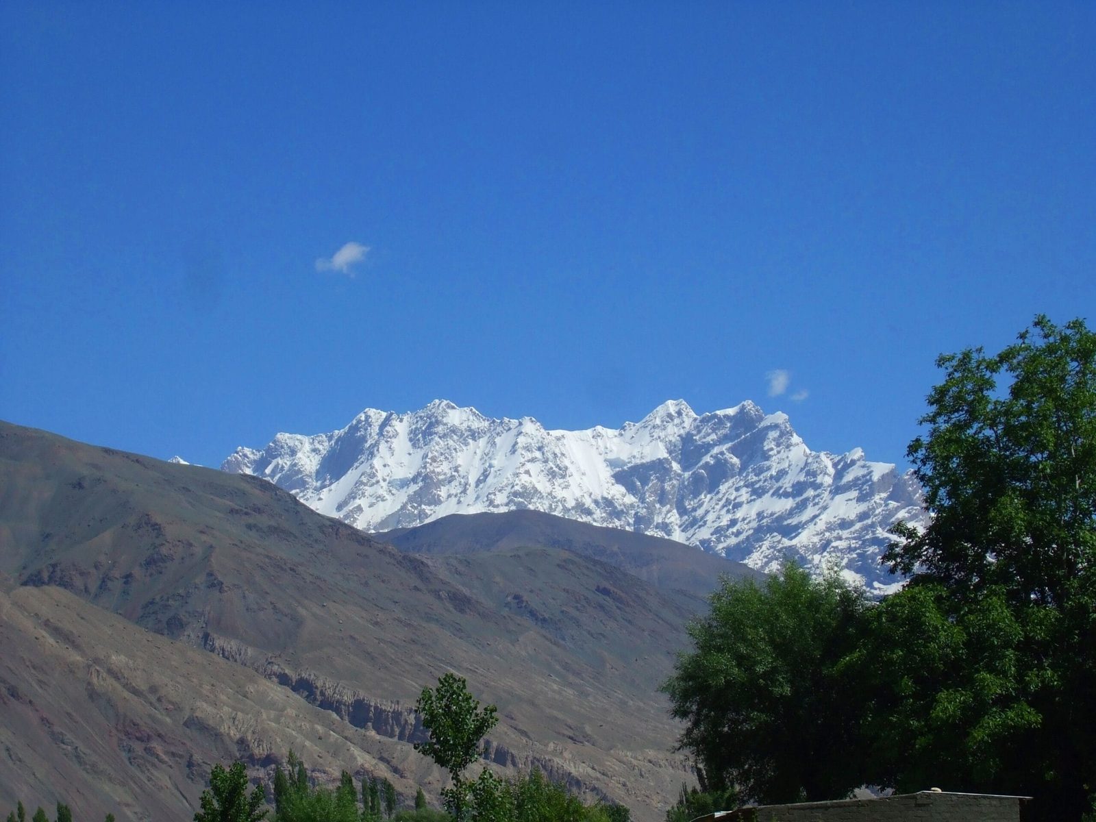
Koyo Zom is the highest mountain of the Hindu Raj, roughly 6,872 m (some sources give 6,877 m), standing on the boundary between Upper Chitral and Gilgit-Baltistan, west of the Karakoram. It has been climbed only a handful of times since the Austrian first ascent in 1968. Expeditions run 4–5 weeks door to door, with base camp at about 3,500 m and a summer-to-early-autumn window; the descent-side glaciers, not the summit, have caused the worst trouble here. This is a serious alpine objective, not a trekking peak.
We run our trips out of Skardu with our own Balti team, and we will be straight with you: Koyo Zom is at the far western edge of what we organise, five hard driving days from our home valleys. We do not pretend it is a walk-up, and we do not pretend it is busy. It is a rarely visited 6,800 m mountain in a range most climbers cannot place on a map. If that is what you are after, we can put the logistics, permits and staff behind it. If you want a first Karakoram summit, we will tell you honestly to look at Spantik instead.
Key takeaways
- Height: about 6,872 m (6,877 m in some climbing records) — the highest peak in the Hindu Raj range.
- Where: on the Upper Chitral (Khyber Pakhtunkhwa) – Gilgit-Baltistan boundary, between the Hindu Kush and the Karakoram.
- First ascent: 1968, an Austrian expedition led by Albert Stamm, by the east face; repeated by a British party in 1974.
- Third ascent: September 2019, Tom Livingstone and Ally Swinton, new route The Great Game (1,500 m, ED+) on the north-west face.
- Approach: the 2019 team drove six days from Islamabad via Chitral into the Yarkhun Valley, then walked about 90 minutes from a footbridge to base camp at 3,500 m.
- Prominence: around 2,562 m, which makes it an “ultra” — it stands clear of everything around it.
Where Koyo Zom is, and why almost nobody has climbed it
Between the Hindu Kush in the west and the Karakoram in the east sits a third range that gets almost no attention: the Hindu Raj. Koyo Zom is its high point. From the north it looks out toward Afghanistan’s Wakhan Corridor; from the south-east, its glaciers drain toward the head of the Yasin Valley in Ghizer.
The reason the mountain is nearly untouched is not difficulty alone. For decades the region was effectively closed to foreign expeditions because of instability further south, and permits were not being issued. That silence lasted long enough that a 6,872 m ultra had only two recorded ascents in fifty years. When the British team of Will Sim, Tom Livingstone, Ally Swinton, John Crook and Uisdean Hawthorn secured a permit for autumn 2019, they were arriving at a mountain that had been left alone since 1974.
The route, step by step
There is no fixed commercial itinerary for this mountain. What follows mirrors the 2019 expedition’s logistics, and it is the realistic shape of a trip. Days are approximate and depend on roads, weather and permits.
- Islamabad. Arrival, permit and briefing formalities, final food and fuel buying.
- Drive north to Chitral. Long road days; the 2019 team took six days of driving in total from Islamabad to base camp.
- Chitral to the Yarkhun Valley. Roughly two more days by jeep beyond Chitral, up an increasingly narrow valley running parallel to the Wakhan Corridor. Villages thin out into hamlets.
- Footbridge over the Yarkhun River. Porters take the loads; it is only about a 90-minute walk up a side valley from here.
- Base camp, 3,500 m. Grass, running water, and the first full view of the mountain more than 3,300 m above you.
- Acclimatisation, 7–14 days. Repeated carries and nights higher. The 2019 pair slept at 5,880 m on the icefield before their summit push.
- Advance base, about 4,500 m. Roughly 1,000 m above base camp.
- Summit push, 4–6 days. The east face is the original 1968 line and the normal descent; the north-west face is a hard modern alpine route.
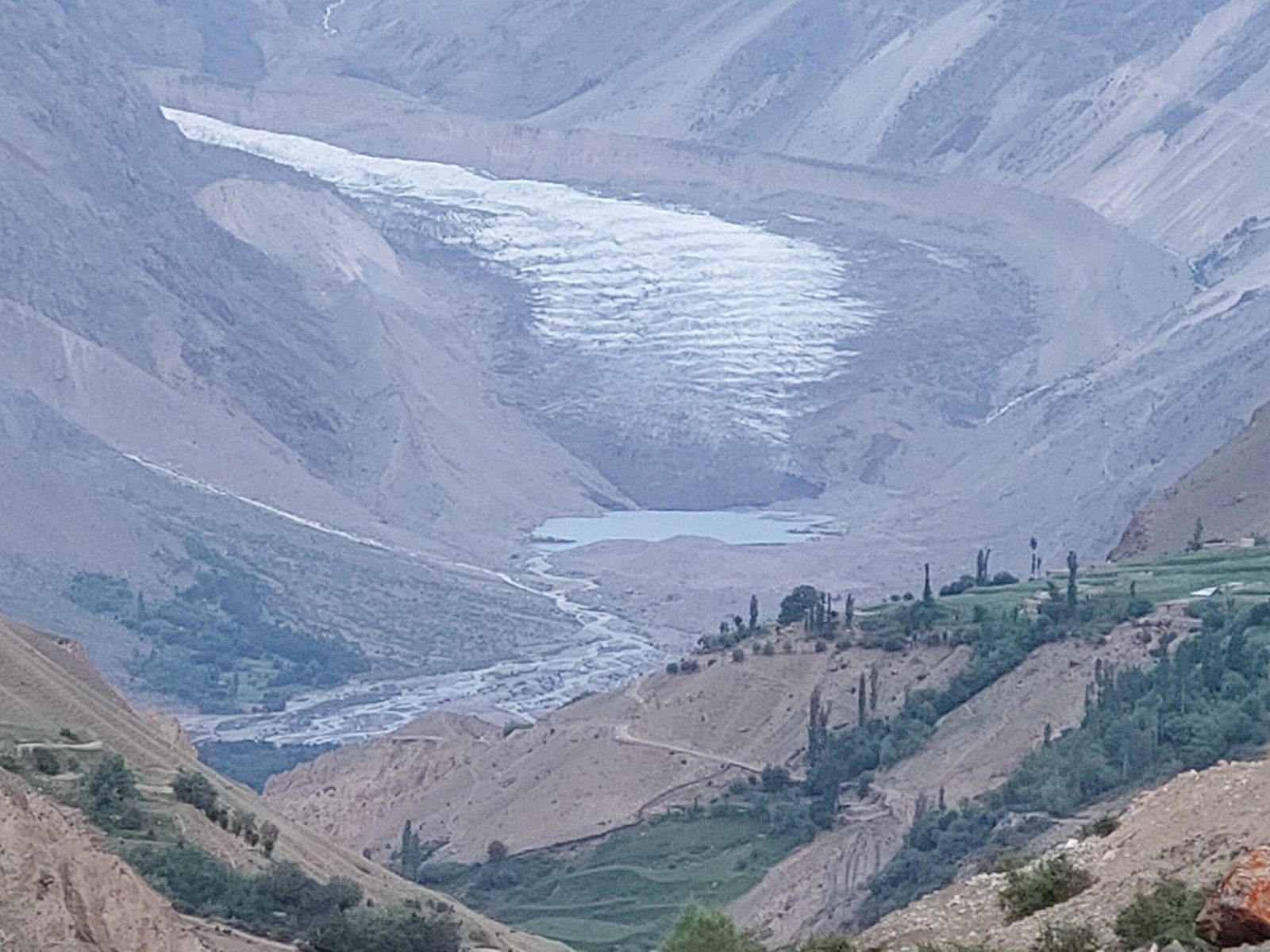
- Descent and exit. Off the east side onto the Pechus Glacier, then back around to base camp, and the long drive out.

1968, 1974, 2019: the whole climbing history in three lines
An Austrian expedition led by Albert Stamm made the first ascent in 1968 by the east face. British climbers repeated that line in 1974. Then nothing for forty-five years.
In September 2019, Livingstone and Swinton climbed the north-west face over five days — steep mixed chimneys, a snow ridge bivouac, and an overhanging headwall they nicknamed the Cathedral, with rock pitches led in rock shoes at around 6,200 m. They summited at about 1 p.m. on 28 September and downclimbed and abseiled the east face to the Pechus Glacier. They named the route The Great Game: 1,500 m, ED+. It was only the third ascent of the mountain.
The story does not end at the summit, and that is the part worth reading twice. On the descent glacier, at roughly 5,900 m, Swinton broke through a snow bridge and fell around 20 m into a crevasse, taking a serious head injury. Livingstone hauled him out alone, triggered an SOS on a satellite communicator, and spent a night keeping him warm and awake. Helicopters could not land at first in high winds; the army set up a makeshift fuel depot and helipad at the mouth of the Yasin Valley so lighter machines could reach them. Both men got out.
When to go
| Months | Conditions | Verdict |
|---|---|---|
| April–May | Deep snow low down, unsettled weather, passes and jeep roads still opening | Too early |
| June–July | Warmest, longest days; softer snow and more active glaciers in the afternoons | Workable, move early |
| August–mid September | Generally settled spells, colder nights, firmer snow bridges | Best window |
| Late September | Cold, short days, autumn snowfall approaching — the 2019 ascent was 28 September | Good but committing |
| October onwards | Winter conditions, road and helicopter access unreliable | Not recommended |
For the wider regional picture, see our season-by-season guide to Gilgit-Baltistan.
How hard is it, honestly
Hard, and not in a way that fitness alone solves. The original east face line is the least difficult way up and is the standard descent, but it is still a long glaciated alpine route at nearly 6,900 m with no fixed ropes, no camps built by anyone else, and no other teams on the mountain to help you. The 2019 north-west face route is ED+ and squarely expert terrain.
What we look for before we take a booking here: previous 6,000 m summits, confident crevasse rescue and rope work as a small team, competent mixed climbing, and a partner you have climbed with before. Base camp sits more than 3,300 m below the summit, so acclimatisation is slow — read our acclimatisation guide and budget the days for it. Gear-wise, start from our Karakoram gear list and add a full alpine rack.
If this reads as too much, it may be. Plenty of people who ask us about Koyo Zom are better served by a hard trek rather than an expedition, by the Shimshal Pass trek, or by the quieter valleys of Ghizer such as Phander and Shandur and Naltar. We would rather tell you that now than at 5,880 m.
Getting there, and what it costs
Two realistic ways in. From the Chitral side, fly or drive to Chitral and continue by jeep up the Yarkhun Valley — the line the 2019 team used, and the shortest road approach to base camp. From our side, you can also fly Islamabad–Gilgit or Islamabad–Skardu and drive west through Ghizer and Yasin, which is longer but lets you combine the trip with the Karakoram. If you are travelling to us in Baltistan first, see how to get to Skardu.
On price: we keep pricing personal rather than posting a number that goes stale. An expedition like this depends on team size, days, porter loads, permit costs and how much rescue cover you want carried. Tell us your dates and your climbing history and we will build an honest quote — fair price, no corners cut on guides, food or safety. And get proper cover before you come; our guide to travel insurance for high-altitude trekking in Pakistan explains what a policy has to actually include for helicopter evacuation.
Frequently asked questions
How high is Koyo Zom?
About 6,872 m (22,546 ft). Some climbing records list 6,877 m. Either way it is the highest peak in Pakistan’s Hindu Raj range, with roughly 2,562 m of prominence.
Where exactly is Koyo Zom?
On the boundary between Upper Chitral District in Khyber Pakhtunkhwa and Gilgit-Baltistan, in the Hindu Raj range, between the Hindu Kush and the Karakoram. Its glaciers drain toward the Yarkhun Valley on one side and the head of the Yasin Valley on the other.
Has Koyo Zom been climbed many times?
No. An Austrian expedition led by Albert Stamm made the first ascent in 1968 by the east face, a British team repeated it in 1974, and the third recorded ascent was in September 2019 by Tom Livingstone and Ally Swinton via a new north-west face route, The Great Game (1,500 m, ED+).
Can I trek to Koyo Zom base camp without climbing?
Physically, yes — base camp is at about 3,500 m and roughly 90 minutes on foot from a footbridge over the Yarkhun River. But the journey there is several days of rough driving, and access and permit rules for this border area need checking before every departure. We will tell you honestly whether a given season is workable.
What is the biggest danger on Koyo Zom?
Crevassed glaciers and remoteness. The 2019 expedition’s serious accident was a crevasse fall on easy descent ground, and the rescue needed a satellite SOS, an army fuel depot at the mouth of the Yasin Valley, and two helicopter attempts in high wind. Plan for self-rescue first and outside help second.
Talk to the team that lives here
Send us your dates, your team size and your climbing CV, and we will tell you straight whether Koyo Zom is the right objective for you — and what it will take to do it properly.
WhatsApp: +92 312 9921574 | Email: info@karakoramventure.com
You will be answered by our own local Balti team in Skardu, not a broker. Local hands, real safety, fair price.
Sources & attribution: elevation and prominence from Wikipedia/Peakbagger; expedition history and 2019 route details from the American Alpine Journal (Tom Livingstone, “The Great Game”) and Planetmountain. Images: Shakeelgilgity (CC BY-SA 4.0), Irfan Manichic (CC BY-SA 4.0), EAhmadNawaz (CC BY-SA 4.0) and NASA Johnson Space Center Earth Science and Remote Sensing Unit (public domain), all via Wikimedia Commons.