



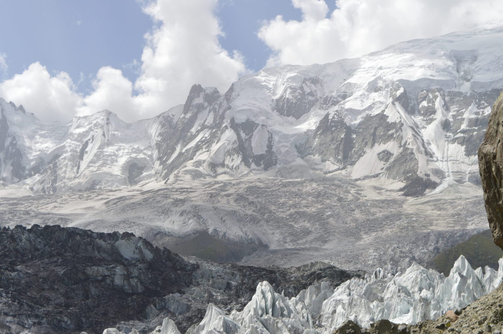
Diran is a 7,266 m (23,839 ft) snow pyramid in the Karakoram, standing east of Rakaposhi above the Minapin and Bagrot valleys of Gilgit-Baltistan. It was first climbed in 1968, alpine-style, by the Austrians Rainer Goeschl, Rudolph Pischinger and Hanns Schell, after three earlier expeditions had been beaten back. The normal route is a snow and ice climb from base camp on the Minapin side, with three high camps and no sustained technical difficulty. A full expedition runs roughly 25 to 35 days door to door, best between mid-June and late August. It is not a technical mountain. It is a dangerous one, and those are different things.
We run Diran with our own Balti and Nagar team, and we will be straight with you before you book anything: Diran has a reputation as an easy 7,000er, and that reputation has cost people their lives. The slopes are gentle enough to walk. They are also loaded with wind slab, cut by hidden crevasses, and they lie under seracs that do not care how fit you are. If you want a first seven-thousander, Diran can be it. But you climb it on snow judgement, not on ambition, and you turn around when the snow says so.
Key takeaways
- Height: 7,266 m (23,839 ft), ranked 93rd in the world, with 1,325 m of prominence. Rakaposhi-Haramosh range, Karakoram.
- Where: Rakaposhi-Haramosh range, Gilgit-Baltistan — approached from Minapin in Nagar, on the Karakoram Highway, about two hours from Gilgit.
- First ascent: 1968, alpine-style, by Rainer Goeschl, Rudolph Pischinger and Hanns Schell of Austria. British (1958), German (1959) and Austrian (1964) attempts failed on weather, deep snow and avalanches.
- Route: the normal line from the Minapin Glacier side. Snow and ice, moderate angle, three camps above base. Base camp is usually placed around 3,700–4,000 m depending on the year.
- Season: mid-June to late August. July is the usual summit window.
- Time needed: roughly 25–35 days including approach, acclimatisation, load-carrying and weather days.
- The honest bit: low technical grade, high objective danger. Avalanche and crevasse risk are the reason people do not come home from Diran.
Where Diran is, and why it keeps pulling climbers back
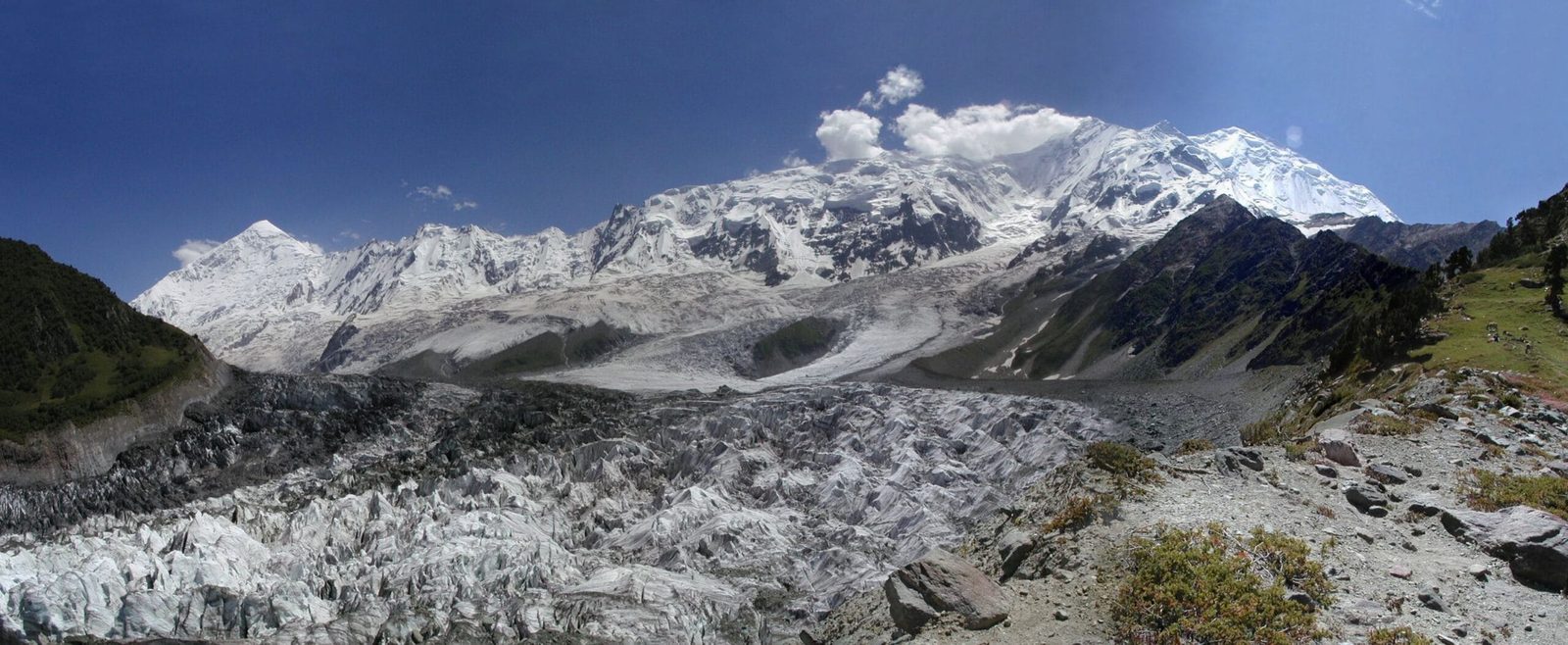
Drive north from Gilgit on the Karakoram Highway and Rakaposhi does all the shouting. Diran sits quietly to its east, a clean white cone at the head of the Minapin Glacier, with the Hinarchi and Barpu glaciers wrapping around its other flanks. You can see it from Karimabad. You can see it from the jeep. That easy visibility is part of why it gets underestimated.
Diran belongs to the Rakaposhi-Haramosh subrange, which is a compact and serious piece of the Karakoram. Within about thirty kilometres of each other stand Rakaposhi (7,788 m), Malubiting (7,458 m), Haramosh (7,409 m), Diran itself, and Spantik (7,027 m). Five seven-thousanders, one small corner of Nagar.
For climbers, Diran occupies a specific slot: it is one of the very few Karakoram seven-thousanders where a competent, fit alpinist with glacier skills can realistically reach the summit without technical rock or ice pitches. That is the appeal. Spantik is the other common answer to the same question, and the two are worth comparing honestly — Spantik is longer and colder, Diran is shorter and more avalanche-prone.
The route, step by step
The normal route follows the ground the Austrians took in 1968: in from Minapin, up onto the glacier system on the north-west side of the mountain, and then moderately angled snow and ice to the summit ridge. Below is how a standard expedition is structured. Camp heights are approximate — teams shift them year to year as the ice moves.
- Days 1–3. Islamabad to Gilgit to Minapin. Fly or drive up the Karakoram Highway. Minapin village sits at roughly 2,000 m, a couple of hours north of Gilgit.
- Days 4–5. Trek to base camp. Up through the Minapin gorge to Hapakun, then onto the meadow ground near Tagafari, the same approach as the Rakaposhi Base Camp trek. Base camp for Diran is established beyond it, usually around 3,700–4,000 m. Porters carry to here; above this it is your team and ours.
- Days 6–10. Acclimatisation and Camp 1. Route-finding through the crevassed lower glacier, fixing where needed, and carries to Camp 1 at roughly 5,000 m. Sleep low, climb high, repeat. Our acclimatisation guide covers how we pace this.
- Days 11–18. Camp 2 and Camp 3. Camp 2 at around 5,600 m, Camp 3 at around 6,300 m on the upper snowfields. This is the load-carrying phase, and it is where most of the expedition time actually goes.
- Days 19–26. Summit window. From Camp 3 the summit day is long, cold and mostly a snow plod on moderate angles — but only when the snow is stable. Expect to sit and wait. Expect to go up and come back down without summiting, at least once.
- Days 27–32. Strip the mountain and walk out. Everything comes down, including rubbish. Back to Minapin, then Gilgit and Islamabad, with buffer days for weather on the flights.
The mountain that looks easy
Diran resisted three expeditions before it fell. A British team tried in 1958. A German team tried in 1959. An Austrian team tried in 1964. All three were turned back by bad weather, deep snow and avalanches — not by steep ground. Then in 1968 Rainer Goeschl, Rudolph Pischinger and Hanns Schell climbed it alpine-style, and Diran entered the guidebooks as an accessible seven-thousander.
The record since then is a long argument with that word accessible. In 1996 two Japanese alpinists, Hiroshi Iwazaki and Masanori Suzuki, were setting up an advanced camp at 4,500 m on the southern side when an avalanche flattened their tent and buried their gear; had it come five minutes later they would have been inside it. They rebuilt, went back up, and summited on 24 July. That is Diran in one story: nothing hard to climb, everything to respect.
Climbers have died here in crevasses and under avalanches, and several strong expeditions have simply walked away from unstable snow. We think that is the correct decision and we back our clients when they make it. A guide who pushes a team onto a loaded slope on Diran because the permit was expensive is not a guide worth hiring.
When to go
Diran has a narrower usable window than the Baltoro giants because it is a snow mountain at a modest latitude, and warm, wet snow is the whole problem. Broadly:
| Months | Conditions | Verdict |
|---|---|---|
| April–May | Deep winter snowpack still settling. Cold, high avalanche hazard on the approach slopes. | Too early for most teams |
| Mid-June | Glacier opening up, snow consolidating. Base camp comfortable. Weather still unsettled. | Good for arrival and acclimatisation |
| July | The standard summit month. Longest settled spells, warmest camps. Also the busiest. | Best window |
| August | Still climbable, snow bridges weakening, crevasses opening. Monsoon edge can reach in. | Workable, judgement-dependent |
| September onward | Cold returns, days shorten, storms lengthen. | Closing down |
If you are choosing when to build a wider Gilgit-Baltistan trip around the climb, our season guide to Gilgit-Baltistan lays out the rest of the year.
How hard it is, honestly
Technically: low. Moderate snow and ice slopes, some fixed rope on the steeper sections, no sustained rock or hard ice on the normal line. If you can move confidently on a glacier in crampons, rope up properly, arrest a fall and jumar a fixed line, you have the hand skills.
Physically: serious. You will spend three to four weeks above 3,700 m, carry loads between camps, and do a long summit day at over 7,000 m. Come with a real base: multi-day hill fitness, ideally a previous trip above 5,500 m. A Rakaposhi Base Camp trek or the Bagrot valley trek makes a sensible warm-up in the same range.
Objectively: this is where Diran earns its name. Avalanche risk on the approach and mid-mountain slopes, crevasses under snow bridges, serac fall in places. None of that is fixed by being fitter. It is managed by timing, snow assessment, roped travel discipline and a willingness to stop.
Safety: the real risk on Diran is snow, not steepness
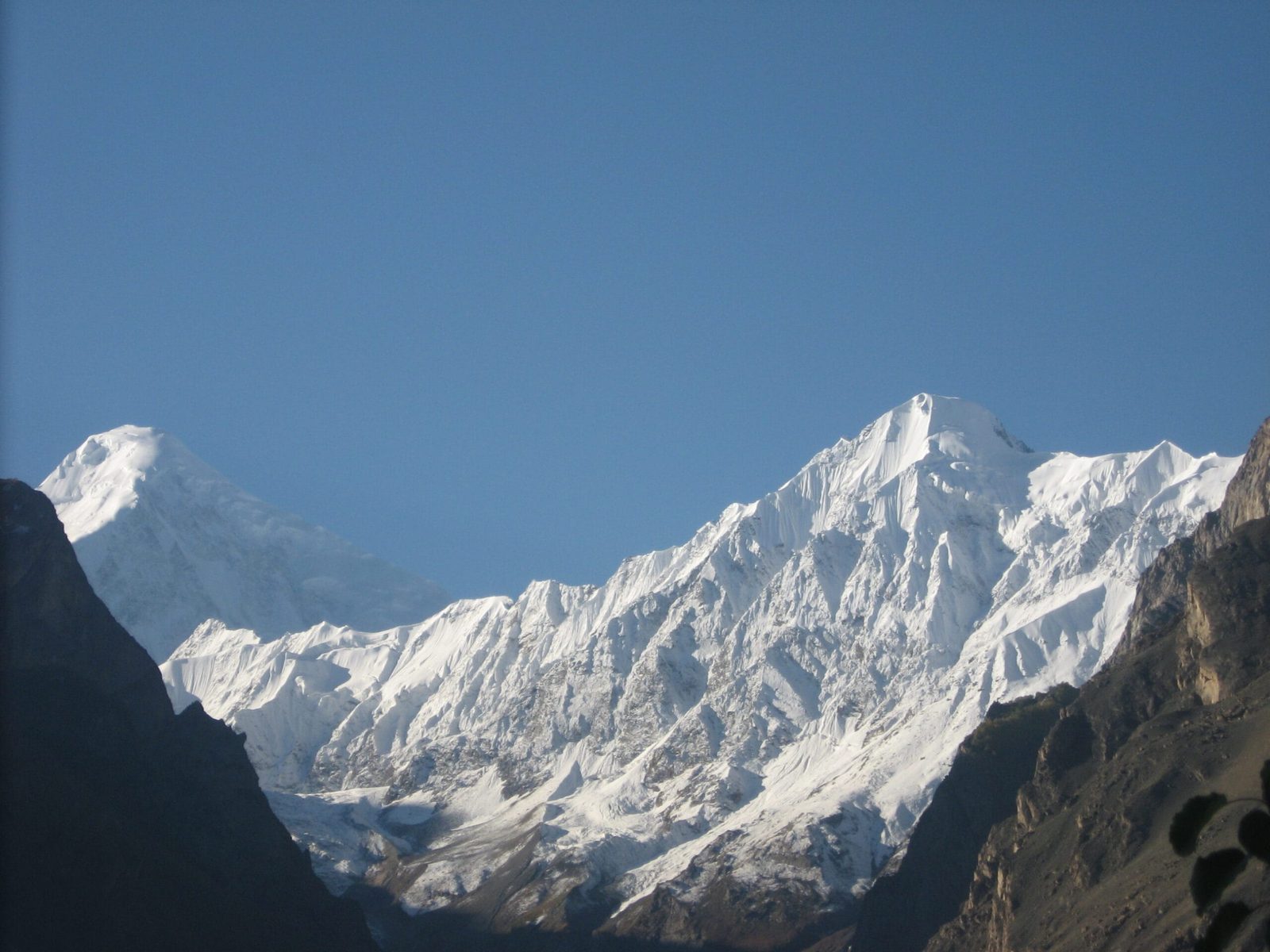
People have died on Diran in crevasses and under avalanches on ground that photographs as a gentle white slope. We do not sell this climb as a soft 7,000er. On every expedition we carry a satellite phone in base camp, run fixed radio check-ins between camps, keep an evacuation plan written down before the first load carry, and hold established helicopter-rescue contacts for Gilgit-Baltistan. Helicopter rescue in Pakistan requires a financial guarantee from your insurer, so proper cover is not optional — see our high-altitude insurance guide. If the snow is wrong, we go down. That is the deal, and we say it before you pay a deposit, not after.
Permits and visa
Diran is a mountaineering objective, not an open-zone trek. Peaks above 6,500 m in Gilgit-Baltistan need a climbing permit issued through the Gilgit-Baltistan tourism department, with a registered liaison arrangement and environmental fees. Royalty rates have been revised and disputed in recent seasons, so we confirm the current figure with the department for your specific dates rather than quoting a number that may be out of date. Allow at least four to six weeks for the paperwork. You also need a Pakistan Trekking and Mountaineering visa, which is a different category from the ordinary tourist visa — our Pakistan visa guide walks through it. We handle the permit file; you handle arriving with the right visa.
Getting there, and what it costs
Islamabad to Gilgit by air is the fast option, weather permitting, and Gilgit to Minapin is roughly two hours by road on the Karakoram Highway. The overland alternative runs the full length of the Karakoram Highway and takes a long day and a half, but it acclimatises you gently and it never gets cancelled by cloud. We build buffer days into every expedition for exactly this reason.
On cost: we keep pricing personal rather than posting a number that goes stale. Permit and royalty rates move, the number of climbers on the permit changes the per-person figure, and a four-person team and a solo client are different expeditions. Tell us your dates and your group size and we will send a full breakdown — permit, liaison officer, porters, high-altitude staff, food, group gear, sat phone, insurance requirements. Fair price, no corners cut. What we will not do is quote you low by leaving the safety line items out, which is how the cheap numbers you see elsewhere get built.
Bring the right kit. Our Karakoram gear list covers the trekking layer of it; for Diran add a proper 7,000 m boot, a warm sleeping system and personal glacier hardware, and we will send you the full expedition list when you book.
Frequently asked questions
How high is Diran Peak?
Diran is 7,266 m (23,839 ft), which ranks it 93rd in the world, with 1,325 m of prominence. It stands in the Rakaposhi-Haramosh range of the Karakoram, east of Rakaposhi, in Gilgit-Baltistan, above the Minapin and Bagrot valleys.
Is Diran a good first 7,000 m peak?
It can be, and it is one of the few realistic options in the Karakoram, but only for climbers who already have solid glacier and crampon skills and previous altitude experience. Technically the normal route is not hard. The danger is avalanche and crevasse risk, and no amount of fitness reduces that. If you have never been above 5,500 m, do a trekking peak or a base camp trek first.
How long does a Diran expedition take?
Plan on roughly 25 to 35 days door to door. That covers travel to Minapin, two days trekking to base camp, two to three weeks of acclimatisation, load-carrying and waiting for a summit window, and the walk out. Compressing it is the single most common mistake teams make.
When is the best time to climb Diran?
Mid-June to late August, with July the standard summit month. Earlier in the season the snowpack is unstable; by late August snow bridges weaken and crevasses open up. Summit success depends far more on snow conditions in your particular window than on the calendar.
What permit do I need for Diran?
A mountaineering permit issued through the Gilgit-Baltistan tourism department, since Diran is above 6,500 m, plus a Pakistan Trekking and Mountaineering visa rather than a tourist visa. Royalty and environmental fees apply and have changed in recent seasons, so we confirm current rates for your dates. Allow four to six weeks for the paperwork.
Talk to the team that climbs there
Send us your dates and group size and we will tell you honestly whether Diran is the right mountain for you this year — and if it is not, which one is. You will be talking to a local Balti team, not a broker who sells your booking on to someone else.
WhatsApp: +92 312 9921574 | Email: info@karakoramventure.com
Local hands, real safety, fair price.
Sources & attribution: height, prominence, ranking, first-ascent details and the record of the 1958, 1959 and 1964 attempts from Wikipedia and Peakbagger; the 1996 Japanese ascent and avalanche account from Shigeharu Inouye, “The Story of an Ice Axe”, Alpine Journal 2000; permit framework from Gilgit-Baltistan tourism department guidance. Camp heights are approximate and vary by expedition. Images: Zahyd Zay D (CC BY-SA 4.0), Waqas.usman (CC BY-SA 3.0) and Shaun D Metcalfe (CC BY 2.0), all via Wikimedia Commons.

