Malubiting is a 7,458 m peak in the Rakaposhi–Haramosh range of the Karakoram, roughly 50 km east of Gilgit, and it was the most-attempted unclimbed summit in the range before an Austrian team finally reached the top on 23 August 1971. The normal approach is not from Gilgit at all: expeditions travel Skardu → Shigar → the Basha valley to Arandu, then walk about 35 km up the Chogo Lungma Glacier to a base camp near 4,200 m. Allow six to seven weeks for a full expedition; the season runs roughly June to early September. This is a serious glaciated snow-and-ice climb, not a trekking peak — and it has seen only a handful of ascents in more than fifty years.
We run this out of Skardu with our own Balti team, and we will be straight with you: Malubiting is not a peak we sell to people ticking off a list. It is long, remote, and quiet in a way that the Baltoro no longer is. Most people who ask us about Malubiting end up doing one of two things — a full expedition with a small, experienced rope team, or the far more accessible Rush Lake side of the same massif, where you can stand at 4,694 m and look straight at it. Both are honest answers. Here is what each one actually involves.
Key Takeaways
- Altitude: 7,458 m (24,469 ft), with a topographic prominence of 2,193 m — an ultra-prominent peak.
- Range: Rakaposhi–Haramosh Mountains, Karakoram, Gilgit-Baltistan — it sits between Bilchar Dobani and Haramosh Peak.
- First ascent: 23 August 1971, by K. Pirker, H. Schell, H. Schindlbacher and H. Sturm (Austria), via the North-East Ridge.
- Attempts before that: six failed expeditions from 1955 onward — German, British, Japanese, Pakistani and Polish.
- Approach: Skardu → Shigar → Basha valley → Arandu (~3,000 m) → 3–4 days up the Chogo Lungma Glacier to base camp at ~4,200 m.
- Season: roughly June to early September; the 1971 team summited in late August after being pinned down six days by a monsoon storm.
Where Malubiting sits — and why so few people go
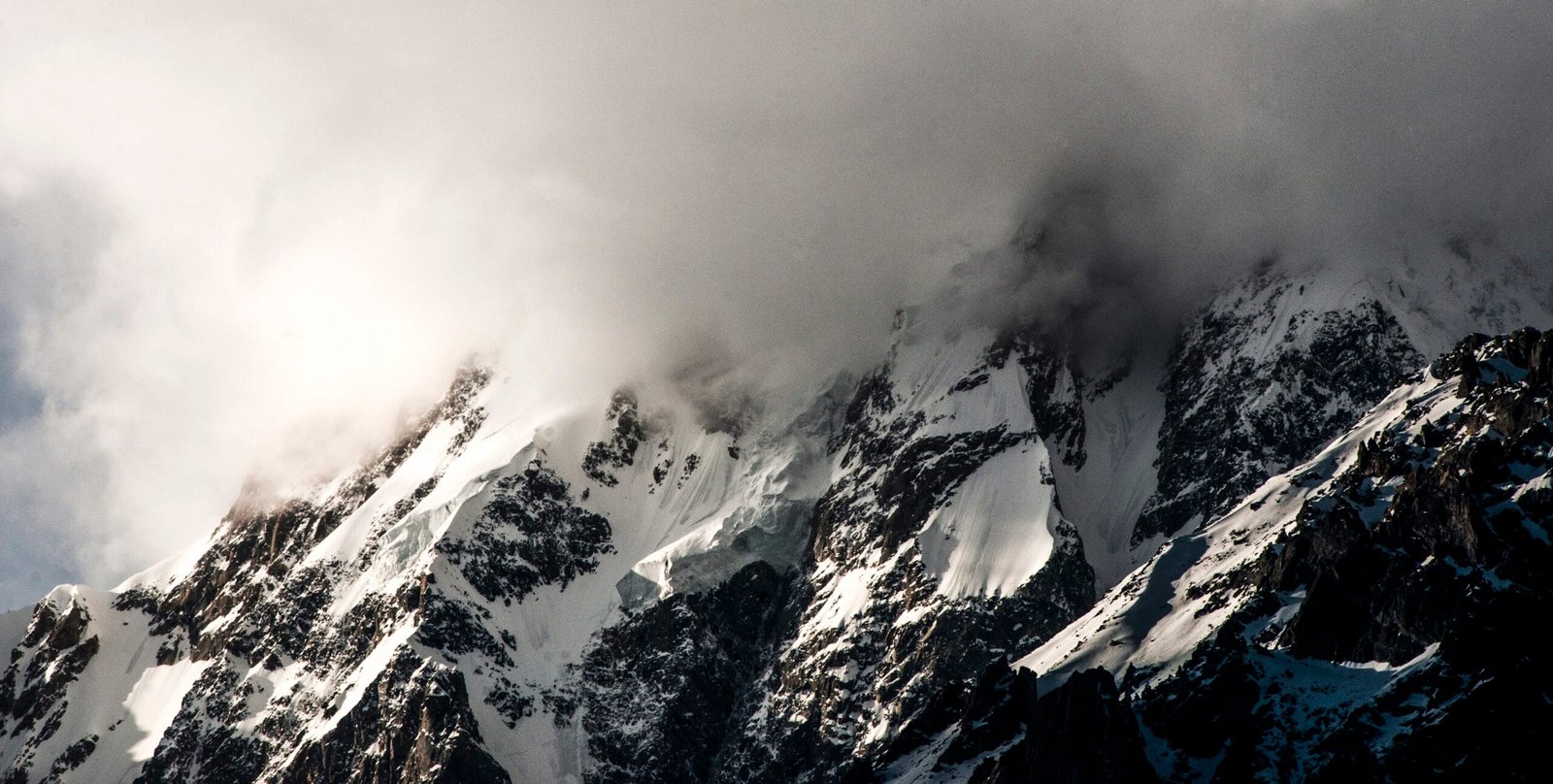
The Rakaposhi–Haramosh Mountains form the wall along the north bank of the Indus. Everyone knows the two peaks the range is named for: Rakaposhi at 7,788 m and Haramosh at 7,409 m. Malubiting sits in the middle of them, higher than Haramosh, and almost nobody has heard of it.
There is a reason. Rakaposhi rises straight out of the Karakoram Highway; you can photograph it from a roadside tea shop. Malubiting hides. From the south-west it climbs steeply above Haramosh Jutial along the Phuparash River, and from its eastern flanks the long Chogo Lungma Glacier runs down towards Arandu — the same glacier system that feeds the approach to Spantik. You do not stumble across this mountain. You commit to it.
That obscurity is exactly what some climbers are after. According to the Himalayan Index there has been only one further ascent since 1971, by a Swiss-German party in 1997 on the original route. There may be others that never made the record, but the picture is clear enough: on Malubiting you will not be queueing behind anyone.
Schematic comparison — approximate, for orientation only.
The route: Skardu to the summit, step by step
The 1971 line is still the reference route, and everything below follows the expedition leader’s own published account. Distances and camp heights are theirs; treat the day counts as a realistic frame, not a guarantee — weather on the Chogo Lungma decides the schedule, not the itinerary sheet.
- Islamabad → Skardu. Fly, or drive if the weather closes the airport. See how to get to Skardu for the honest comparison.
- Skardu → Shigar → Basha valley. By jeep through Shigar, then up the Basha — stone and sand desert with green oasis villages at the side-valley mouths.
- Arandu (~3,000 m). The last settlement, at the snout of the Chogo Lungma Glacier. Porters are engaged here.
- Arandu → Base Camp (~4,200 m). About 35 km along the moraine edge and across the glacier. The Austrians took three and a half days with 31 porters.
- Glacier reconnaissance. A 12 km route through moraine and crevasse fields to reach the ice slopes and ridges of the mountain. This phase alone took the first-ascent team two weeks.
- Camp II — Polan La. Above the ice slope of the pass, with fixed rope on the rock band above camp. This is where the 1971 team sat out a six-day monsoon storm and ran out of food.
- Camp III (6,200 m). On the ridge of the north summit.
- Camp IV. On the upper plateau, roughly 900 m below the summit, among crevasses and ice towers. Short skis were used here.
- Summit day. Depot at about 7,150 m below the saddle, then the last 300 m of snow slope to the main summit at 7,458 m — skirting the Central Peak, having come over the North Peak.
One footnote on the numbers, because we would rather flag it than quietly smooth it over: the 1971 account gives the summit as 7,549 m. Modern survey figures put Malubiting at 7,458 m, and that is the value we use throughout. Older Karakoram heights are often out by several dozen metres.
Seven attempts, one summit: the 1971 story
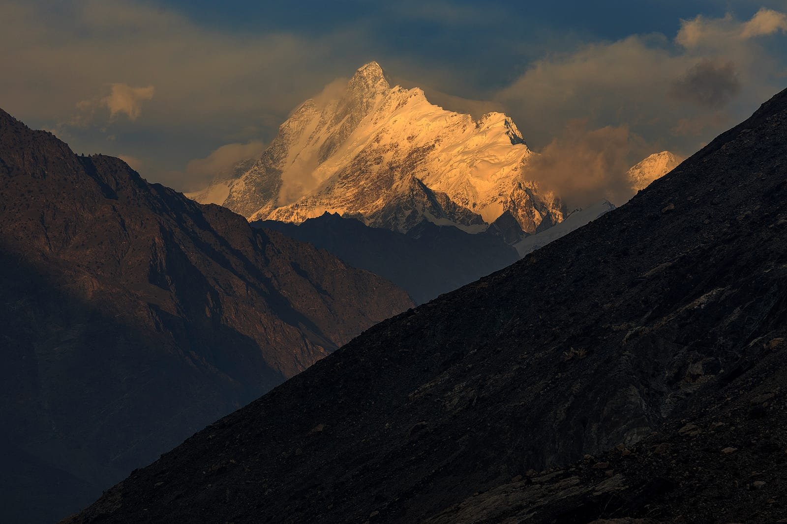
Malubiting was, by the first-ascent team’s own reckoning, the most frequently attempted summit in the Karakoram from 1955 onward. German, British, Japanese, Pakistani and Polish expeditions all turned back. The Polish party of 1969 forced the pass between Spantik and Malubiting North-East that they named Polan La, reached the North-East summit, and pushed some way across the high plateau near 7,100 m before stopping.
Two years later the Styrian High Mountain Club expedition — Hilmer Sturm, Kurt Pirker, Hanns Schell and leader Horst Schindlbacher, with Polish doctor Jerzy Hajdukiewicz — drove 7,500 km from Graz, crossed the Babusar Pass when monsoon cloud grounded their flights, and rafted the Shigar on inflated goatskins. They reached the main summit a few minutes before 3 p.m. on 23 August. In Schindlbacher’s telling there was no flag and no ceremony: they sat on a rock terrace above the south wall for two hours with the Indus glittering 6,000 m below.
That is the mountain’s whole recorded climbing history in two paragraphs. It tells you something about what you are signing up for.
Schematic profile — approximate heights, for orientation only.
The Rush Lake side: seeing Malubiting without climbing it
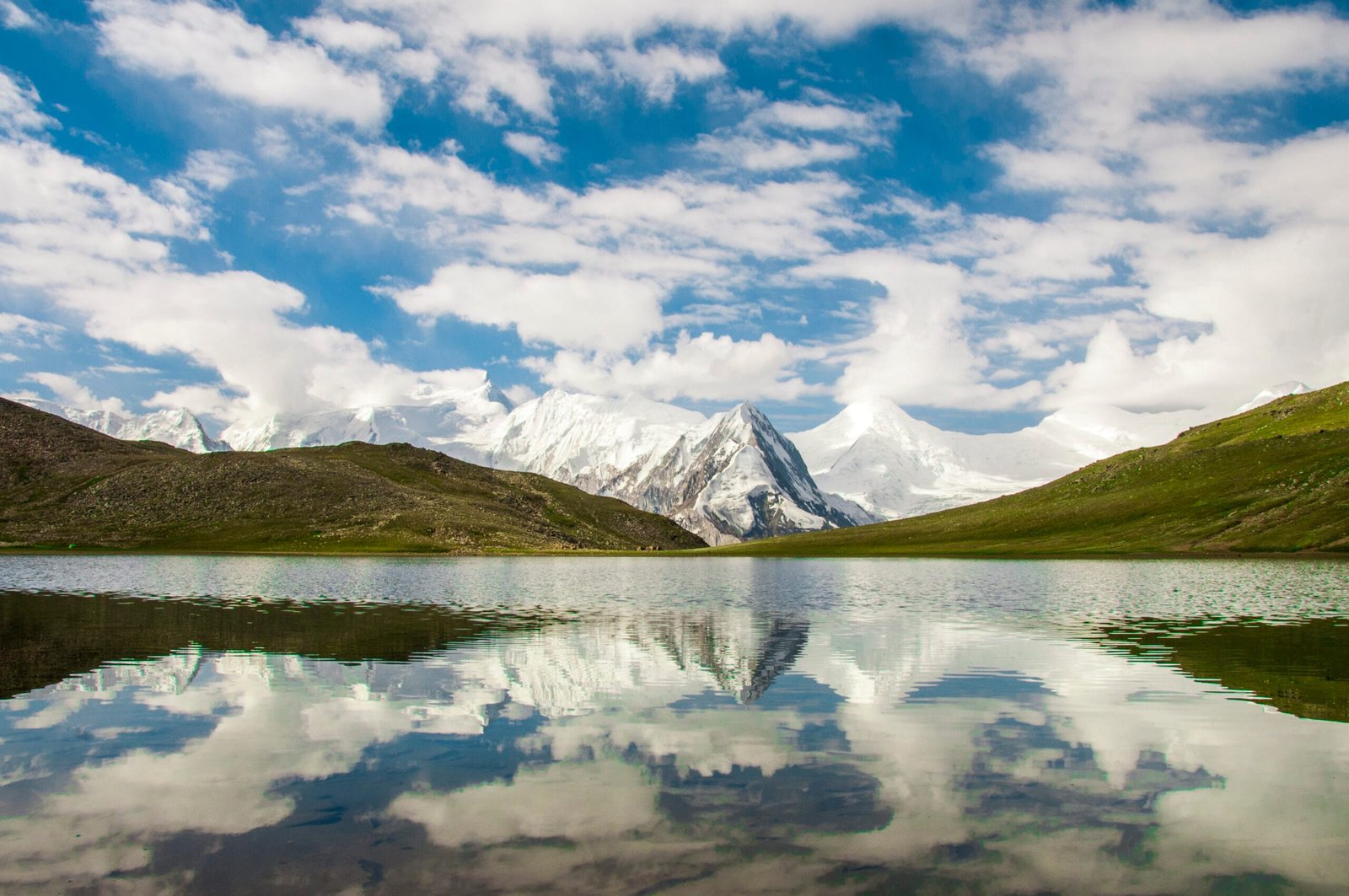
Most people who fall for this mountain are not going to climb it, and there is no shame in that. The alternative is genuinely good. From Nagar, the Rush Lake trek takes you over the Barpu Glacier to a lake at 4,694 m — one of the highest alpine lakes in the world — with Malubiting, Spantik, Miar Peak and the Rakaposhi wall around you. It is a week rather than seven weeks, it needs no mountaineering permit, and the view of Malubiting is far better than anything you get from the road.
If your interest is the range rather than the summit, look also at the Rakaposhi Base Camp trek and the Haramosh and Kutwal Lake trek. All three sit in the same massif and none of them demand a 7,000 m CV.
When to go
| Months | Conditions | Verdict |
|---|---|---|
| April–May | Deep winter snow still on the glacier; Basha valley jeep track unreliable; cold on the plateau | Too early for the summit |
| June | Approach opens up; snow still firm high on the route; porters available | Good for the walk-in and load carries |
| July–August | Warmest, but monsoon incursions reach the Karakoram — the 1971 team lost six days to a storm at Camp II | The classic summit window, with weather patience built in |
| Early September | Cooler, more stable, shorter days; glacier travel firms up again | Good, if your team is already acclimatised |
| October onwards | Cold, high winds, short daylight, porters heading down | Close the season |
For the wider regional picture, our guide to the best time to visit Gilgit-Baltistan covers roads, flights and blossom season alongside the climbing calendar.
How hard is it, honestly
Hard. Not technically extreme by modern standards on the original line — the easiest route is described as a glacier, snow and ice climb rather than a rock route — but hard in every other sense that matters.
- Remoteness. Base camp is three and a half days’ walk beyond the last village. There is no lodge, no rescue post, no other team to borrow a rope from.
- Glacier travel. Twelve kilometres of moraine and crevasse between base camp and the mountain proper. Rope skills and crevasse rescue are non-negotiable.
- Altitude. You are living above 6,000 m for the summit push and crossing a plateau near 7,100 m. Read our acclimatisation guide before you commit.
- Snow conditions. The first-ascent party sank to the hips in loose snow above 6,200 m. Trail-breaking at that height is the real work.
- Weather. Monsoon storms reach this part of the Karakoram. Build spare days into the plan or do not go.
If you have not climbed a 7,000 m peak before, Malubiting is the wrong place to start. Spantik — on the far side of the same Chogo Lungma system — is the sensible first 7,000er, and we say so even though it is the smaller sale.
The real risk, and what we do about it
The dangers here are crevasse falls on the Chogo Lungma, avalanche and serac collapse on the upper slopes, and being caught high by a monsoon storm with no way down in a hurry. Arandu is days away and a helicopter needs weather and clearance. We carry a satellite phone in camp, work with established helicopter-rescue contacts for Gilgit-Baltistan, and we require proper high-altitude evacuation cover before departure — see our notes on travel insurance for high-altitude trekking in Pakistan. We will also turn a team around. That is part of the service, not a failure of it.
Permits and visa
Climbing Malubiting is mountaineering, not trekking: it requires a mountaineering permit and a liaison officer, arranged in advance — a different process from walking an open-zone route like Rush Lake. Everyone also needs the correct Pakistani visa; expedition members should apply on the Trekking & Mountaineering category rather than a plain tourist visa. Our Pakistan visa guide for trekkers walks through it. Permit rules and fees change — we confirm the current position with the authorities for your specific dates rather than quoting last year’s.
Getting there, and what it costs
Everything starts in Skardu. From there it is jeep through Shigar and the Basha valley to Arandu, then porters and your own legs. Getting to Skardu itself means either the flight from Islamabad — fast, spectacular, and cancelled the moment the weather turns — or two long days by road with a buffer day built in. For an expedition of this length we plan the road option as the fallback from the outset.
On cost: we keep pricing personal rather than posting a number that goes stale. A Malubiting expedition is quoted on team size, duration, permit and liaison-officer costs, porter loads to a base camp three and a half days beyond the last village, and the food and fuel to sit out bad weather. Message us with your dates and team and we will build the real figure. Fair price, no corners cut — and we will tell you where a cheaper quote you have seen elsewhere is saving money, because it is usually on the sat phone, the porter wages, or the spare days.
Frequently asked questions
How high is Malubiting?
Malubiting is 7,458 m (24,469 ft), with a topographic prominence of 2,193 m, which makes it an ultra-prominent peak. It is the second highest summit between the Haramosh and Hispar valleys. Some older accounts, including the 1971 first-ascent report, give 7,549 m; the modern figure is 7,458 m.
Who made the first ascent of Malubiting?
An Austrian team from the Styrian High Mountain Club — Kurt Pirker, Hanns Schell, Horst Schindlbacher and Hilmer Sturm — reached the main summit on 23 August 1971 via the North-East Ridge, going over the North Peak and skirting the Central Peak. Six earlier expeditions from 1955 onward had failed.
How do you get to Malubiting base camp?
From Skardu by jeep through Shigar and up the Basha valley to Arandu at about 3,000 m, at the tongue of the Chogo Lungma Glacier. From Arandu it is roughly 35 km on foot along the moraine and across the glacier to a base camp near 4,200 m — three to four days with porters.
Can you trek to see Malubiting without climbing it?
Yes. The Rush Lake trek from Nagar reaches 4,694 m over the Barpu Glacier and gives an open view of Malubiting alongside Spantik and Miar Peak. It takes about a week, needs no mountaineering permit, and is the answer for most people who want to see this mountain properly.
Is Malubiting a good first 7,000 m peak?
No. It is remote, seldom climbed, involves long committing glacier travel and a summit push from a plateau near 7,100 m, with no other teams on the mountain to help. Spantik, on the same Chogo Lungma glacier system, is the sensible first 7,000er in this region.
Talk to the team that lives here
Planning a Malubiting expedition, or the Rush Lake route onto the same massif? Message us with your dates and team size and we will tell you honestly what is realistic.
WhatsApp: +92 312 9921574 | Email: info@karakoramventure.com
You will be talking to a local Balti team in Skardu, not a broker. Local hands, real safety, fair price.
Sources & attribution: elevation, prominence and first-ascent data from Wikipedia (Malubiting) and the American Alpine Journal records cited there; route, camp heights and expedition narrative from Horst Schindlbacher, “The First Ascent of Malubiting, 1971”, Himalayan Journal vol. 32. Images: Malubiting from Nagar — Anees Javaid, CC BY-SA 3.0; Malubiting at sunset from the Skardu–Gilgit road — Imrankhakwani, CC BY-SA 4.0; Rush Lake with Miar Peak — Aneesjavaid, CC BY-SA 4.0; all via Wikimedia Commons.