



The Mazeno Pass trek crosses a saddle of roughly 5,358 m at the western end of the Nanga Parbat massif. It is how a trekker gets around the ninth-highest mountain on earth. The classic line starts in the Rupal Valley above Astore. It climbs to the pass beneath the Mazeno Ridge, drops into the Diamir side, and finishes at Fairy Meadows. That is roughly 140 to 150 km, and about 14 days on the trail. The window is narrow: July to early September, and even then the pass holds snow. Nothing on it is technical climbing. However, it is high, remote and committing, with several nights above 4,000 m and no road within reach of the middle of the route.
We run our trips out of Skardu with our own Balti team, and we will be straight with you about this one. The Mazeno is a half-circuit of a mountain that has killed a great many good climbers. As a result, the trekking route deserves more respect than its lack of ropework suggests. You are walking from one side of Nanga Parbat to the other, over a high snow pass. In the middle, the only escape option is a long walk back the way you came. If you have crossed a 5,000 m pass before and you are honest about your fitness, this is one of the finest walks in Pakistan. If you have not, do Nanga Parbat Base Camp first.
Key takeaways
- Pass altitude: about 5,358 m. Published figures range from roughly 5,358 m to 5,400 m — treat it as approximate.
- Route: Tarashing (about 2,900 m) → Rupal Valley → Mazeno Pass → Diamir side → Fairy Meadows (about 3,300 m).
- Distance and time: roughly 140–150 km, about 14 days walking; we plan around 18 to 20 days from Islamabad with buffers.
- Season: July to early September. Earlier and the pass is usually snow-choked.
- Difficulty: hard trekking, not climbing. At least three nights above 4,000 m, one long snow pass day.
- The ridge above you: the Mazeno Ridge is 13 km from pass to col — the longest ridge on any 8,000 m peak on earth.
Where the Mazeno Pass is, and why it matters
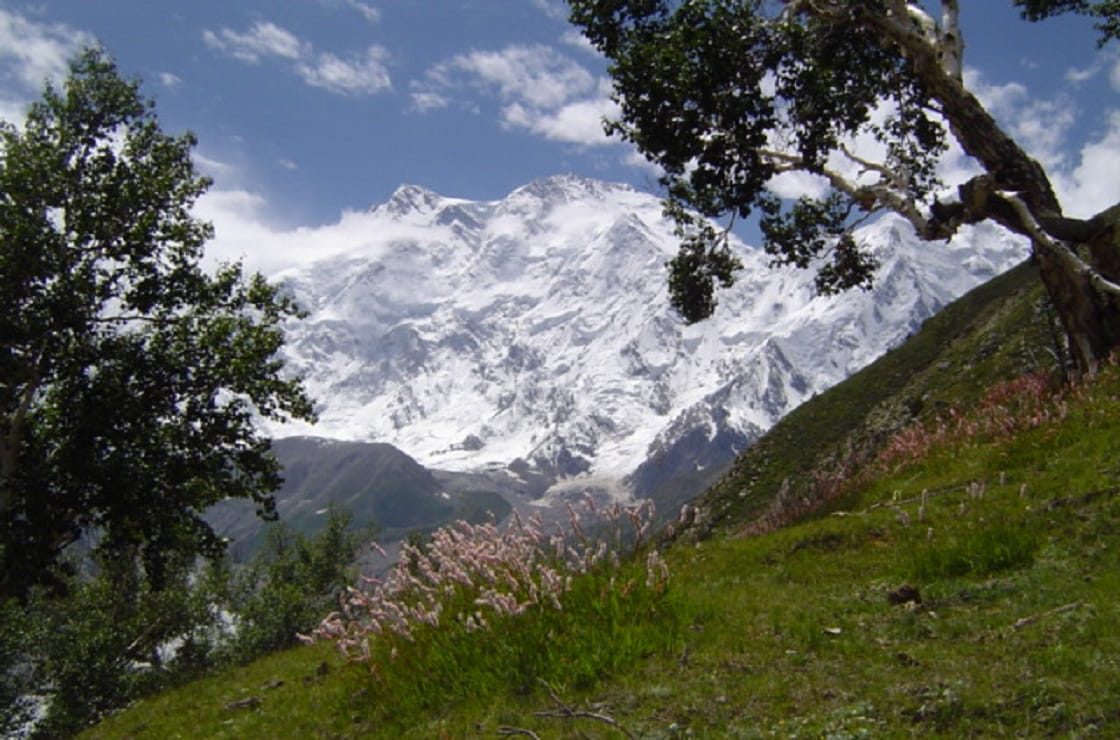
Nanga Parbat stands at 8,126 m, alone at the western end of the Himalaya, west of the Indus and north of Astore. It shows three great faces: the Rupal Face to the south, the Diamir Face to the west, and the Rakhiot Face to the north. Most visitors only ever see one of them.
The Mazeno Pass sits at the southern end of the Mazeno Ridge, the long arm the mountain throws out to the west. It is an old link between Astore and Chilas, and for a trekker it is the only walkable line around the mountain’s western shoulder. There is no road, no bridge and no shortcut — you either cross the pass or you turn round. That is exactly why the route is worth doing, and exactly why it needs planning.
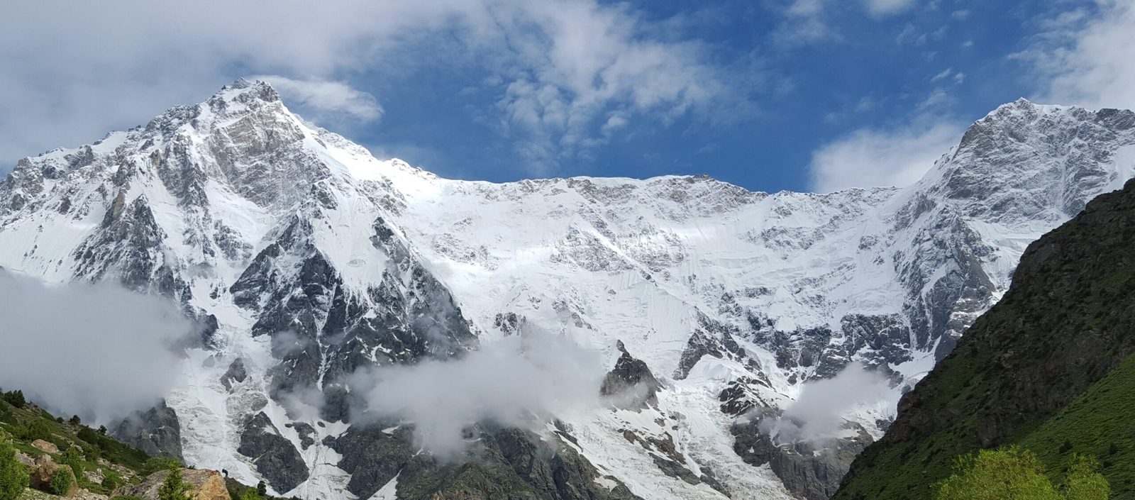
Access is from the Astore side. From Islamabad it is a long road day up the Karakoram Highway to Chilas. Then a jeep road runs east into Astore Valley and on to Tarashing at about 2,900 m, where the walking starts.
The Mazeno Pass trek route, step by step
This is the shape of the crossing, not a fixed timetable. Weather on the pass moves days around, and we build spare days in rather than pretend it will not.
Day by day across the pass
- Islamabad to Chilas by road on the KKH — a long driving day along the Indus.
- Chilas to Astore and Tarashing (about 2,900 m) by jeep, climbing off the Indus into the Astore drainage.
- Tarashing to Herrligkoffer Base Camp (about 3,550 m, figures vary) through Rupal village — the first walking day, straight under the Rupal Face.
- Acclimatisation day at the base camp meadows, with a walk up towards Shaigiri and the Bazhin Glacier.
- West up the Rupal Valley to the Mazeno base camp meadows beneath the Mazeno Wall.
- Move to a high camp below the pass. This is usually the coldest night of the trek.
- Cross the Mazeno Pass (about 5,358 m). Early start, snow underfoot, a long descent on the far side. This is the day the trek is built around.
- Down the western drainages towards the Diamir side — a big loss of height over rough moraine and grazing ground.
- Diamir Valley, under the face that carries the Kinshofer Route that climbers use on the mountain itself.
- Out to the KKH near Bunar, then the jeep track to Tato and up to Fairy Meadows (about 3,300 m) for the Rakhiot Face.
- Down to Raikot Bridge and drive out to Gilgit or Chilas.
Walk it in that direction and you see all three faces of Nanga Parbat in a fortnight, in order, on foot. Very few mountains on earth give you that.
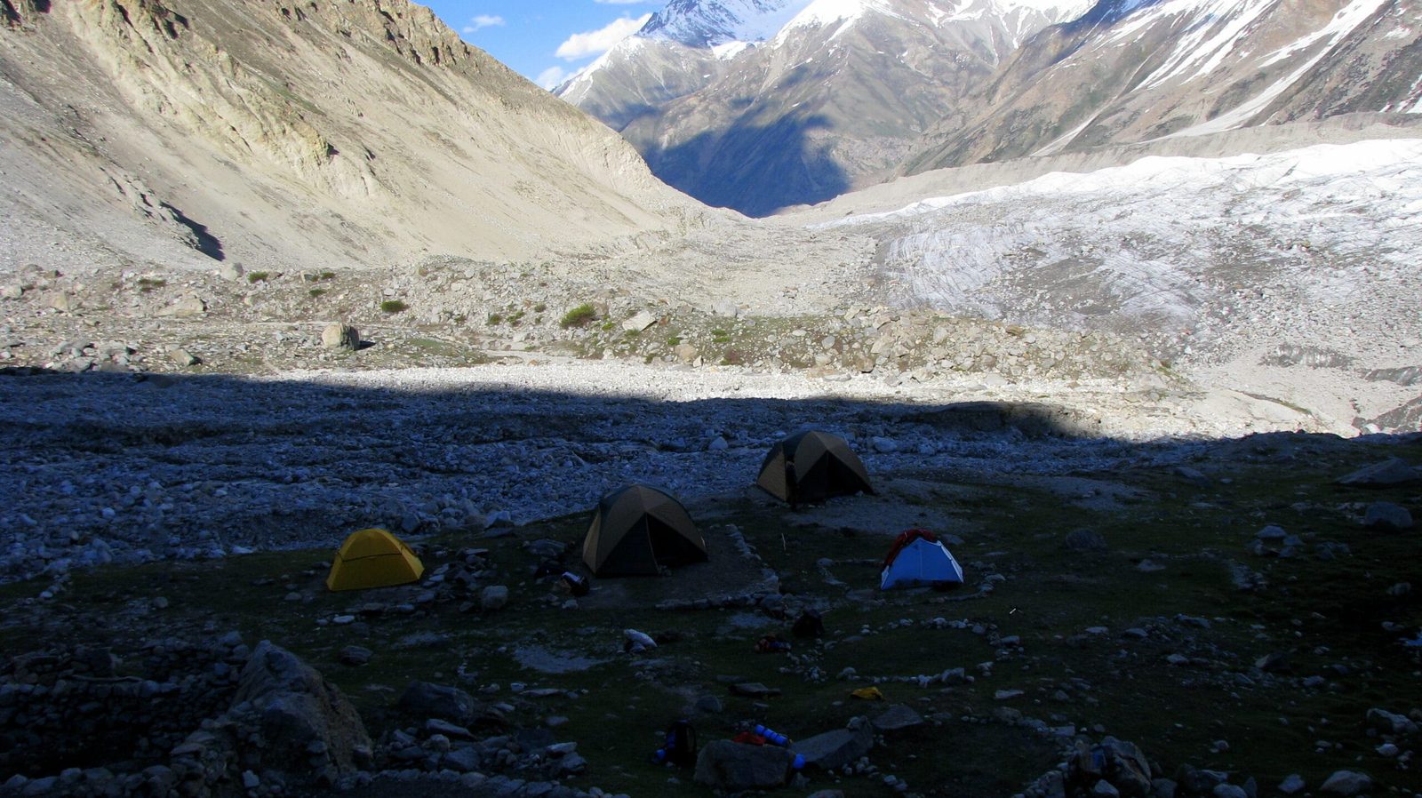
Schematic and approximate. Intermediate camp altitudes shift year to year with snow and grazing conditions.
The Mazeno Ridge: the longest ridge on any 8,000er
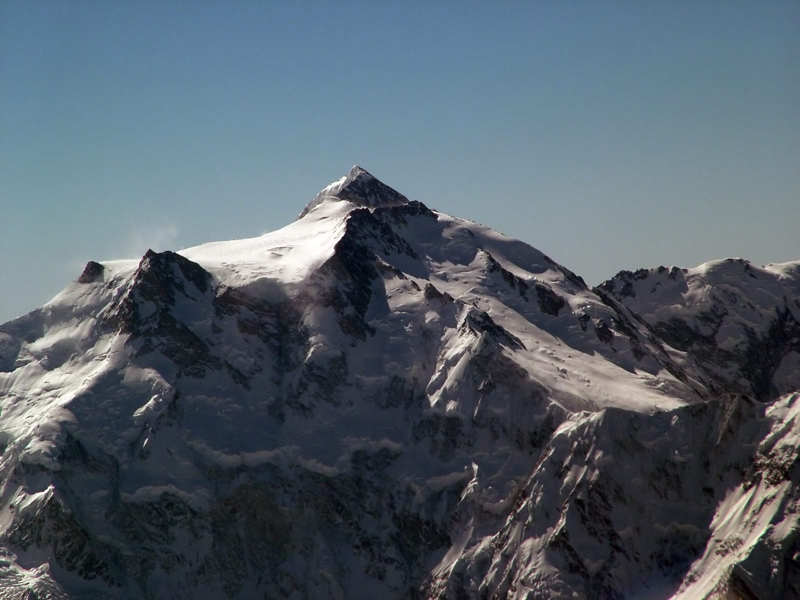
Walk to the pass and you are standing at the foot of one of the great problems of Himalayan alpinism. The Mazeno Ridge runs 13 km from the Mazeno Pass to the Mazeno Col, and it is the longest ridge on any eight-thousander on earth. Eight subsidiary summits stand along it, all of them above 6,800 m, the highest being Mazeno Peak at 7,120 m. Once a climber commits, there is no obvious escape off either flank until the col.
Attempts on the Mazeno Ridge
A French team under Louis Audoubert tried it first in 1979 and got no further than the first Mazeno peak. Doug Scott went back three times, once in 1992 with Sandy Allan. Then on the 1995 attempt Rick Allen, Wojciech Kurtyka and Andrew Lock climbed the first three peaks of the ridge. In 2004 the Americans Doug Chabot and Steve Swenson traversed roughly 10 km to the Mazeno Col but went down the Schell Route when Swenson developed a respiratory infection.
It fell in 2012. Sandy Allan, Rick Allen and Cathy O’Dowd, with Lhakpa Rangduk, Lhakpa Nuru and Lhakpa Zarok, traversed the whole ridge and camped at 7,200 m on the col. The first summit push failed; O’Dowd and the three Sherpas went down the Diamir Face. Allan and Allen stayed up, and on 15 July they reached the summit of Nanga Parbat — the first complete ascent of the Mazeno Ridge. They descended the Kinshofer Route and reached base camp on the 19th, eighteen days out. It won them a Piolet d’Or in 2013.
In 2017 the Argentine Mariano Galvan and the Spaniard Alberto Zerain disappeared attempting the second ascent, almost certainly in an avalanche. As of the last published record, nobody else has summited Nanga Parbat by the Mazeno. When you cross the pass and look up, that is the ground you are looking at.
Schematic. The trek tops out at the pass; everything above it on this chart is climbing ground.
When to go
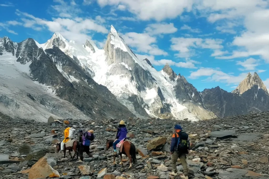
The pass is the constraint, not the valleys. Rupal and Diamir are walkable for longer than the Mazeno is crossable.
| Months | Conditions | Verdict |
|---|---|---|
| May to mid-June | Deep snow on the pass, side streams still locked up, jeep roads opening late | Not usually crossable |
| Late June | Snow softening, high camps still wintry, weather unsettled | Early — only with a strong, experienced group |
| July | Best balance of snow cover and settled weather, long daylight for the pass day | Prime window |
| August | Warm, generally stable, more meltwater in the gorges and river crossings | Prime window |
| Early September | Cold nights, clear air, the best light of the year, shorter days | Very good — pack warmer |
| Late September onward | First winter snowfalls close the pass | Closed |
If you are still choosing your dates for the wider region, our note on the best time to visit Gilgit-Baltistan sets the pass window against everything else.
How hard it is, honestly
Fitness. Fourteen days of walking with several 700 to 1,000 m ascent days, on rough moraine and grazing paths rather than built trail. You should be able to walk six to eight hours a day, day after day, carrying a light pack. Porters and pack animals carry the loads; your legs still have to turn up.
Altitude. The pass is the highest point at about 5,358 m, and you will sleep at least three nights above 4,000 m before you get there. The profile is a reasonable one for acclimatising, but only if you do not rush the front half. Therefore read our acclimatisation guide before you commit to a short itinerary.
Terrain. No technical climbing. Snow on the pass day, sometimes enough to want an ice axe and to move roped on the descent depending on the year. Loose moraine, boulder fields, and glacier-fed stream crossings on the Diamir side that are easier early in the morning than late in the afternoon.
Remoteness. This is the honest part. In the middle of the route you are days from a road on either side. The Karakoram packing list is the baseline; we send a Mazeno-specific addition on top of it, and we are strict about the sleeping bag rating.
Safety: the real risk is weather on the pass and the distance to help
A storm on the Mazeno Pass, with a party strung out on snow, is the scenario that hurts people here. The second is a twisted ankle two days from any road. We carry a satellite phone on every departure, and we work to established helicopter-rescue contacts for the region. We also set a hard turnaround time for the pass day, and we use it. Helicopter evacuation in Pakistan needs an insurance guarantee in place before a machine lifts — check our notes on high-altitude trekking insurance and make sure your policy covers 6,000 m and helicopter rescue. If an operator will not put their evacuation plan in writing, walk away from them.
Permits and access
The Mazeno crossing is a pass, not a summit, and it lies in open zone — so no mountaineering permit or peak royalty applies to trekkers. You do need the correct Pakistan visa. Trekking parties should apply on the trekking and mountaineering category, rather than a plain tourist visa, with a registered local operator named on the application. Our Pakistan visa guide for trekkers walks through it. Rules do change, and we confirm the current position for your dates before you apply.
Getting there, and what it costs
Almost everyone comes in by road: Islamabad to Chilas on the KKH, then east into Astore. Flights help less here than they do for the Baltoro, because the trailhead is on the Astore side rather than out of Skardu. However, if you are combining the Mazeno with a Baltistan trip, our guide on getting to Skardu covers the air option. Either way, build a spare day at each end for weather and road closures.
On price, we keep it personal rather than posting a number that goes stale. What a Mazeno crossing costs depends on group size, whether you want pack animals or porters, how many buffer days you carry, and where you start and finish. Tell us your dates and your group and we will send a full breakdown. What we will promise is a fair price with no corners cut on guides, food, or the safety kit.
You can stand under both faces. Our 4-day Astore Valley & Rama Lake Tour reaches Tarashing beneath the Rupal Face by 4×4 from $560 per person — no mountaineering involved. Climbers aiming higher: the 42-day Nanga Parbat Expedition takes the Kinshofer Route on the Diamir side, full-board from $16,900, previous 7,000 m experience required.
Frequently asked questions
How high is the Mazeno Pass?
About 5,358 m. Published figures vary between roughly 5,358 m and 5,400 m depending on the source, so treat it as approximate rather than surveyed.
How many days is the Mazeno Pass trek?
About 14 days on the trail for the classic half-circuit from Tarashing to Fairy Meadows, covering roughly 140 to 150 km. We plan around 18 to 20 days from Islamabad and back once drives and buffer days are added.
Do I need mountaineering experience?
No technical climbing is involved, but you need real trekking experience at altitude. Depending on the year there can be enough snow on the pass day to want an ice axe and to move roped on the descent, so this is not a first high-altitude trek.
Is a permit needed for the Mazeno Pass?
It is an open-zone trek, so no mountaineering permit or peak fee applies. You do need the correct Pakistan visa — the trekking and mountaineering category — with a registered local operator named on the application.
What is the Mazeno Ridge, and can trekkers go on it?
It is the 13 km ridge from the Mazeno Pass to the Mazeno Col, the longest ridge on any 8,000 m peak, with eight summits above 6,800 m. It is serious alpine climbing ground and has only been traversed to the summit of Nanga Parbat once, in 2012. Trekkers cross the pass at its foot and look up.
Talk to the team that actually walks it
The Mazeno works when the people planning it know the pass, the weather and the villages on both sides. We plan it from Skardu with our own Balti staff and the Astore-side crews we have worked with for years — a local team, not a broker passing you on to somebody else. Sat phone in camp, a real evacuation plan, fair price.
WhatsApp: +92 312 9921574 · Email: info@karakoramventure.com — send us your dates and group size and we will tell you honestly whether the crossing is right for you.
Sources & attribution: ridge length, pass altitude, subsidiary-peak heights and the climbing history cross-checked against Wikipedia (Mazeno Ridge, Nanga Parbat), the American Alpine Journal and British Mountaineering Council reporting on the 1979, 1995, 2004, 2012 and 2017 attempts; pass altitude and trek distance are approximate and vary by source. Images: Ahmad Omer (CC BY-SA 4.0); Nak (CC BY-SA 3.0); Guilhem Vellut (CC BY-SA 2.0); Abbas pakistani (CC BY-SA 4.0) — all via Wikimedia Commons.

