



Sia Kangri is a 7,422-metre peak at the far head of the Baltoro Glacier, in the Baltoro Muztagh of the Karakoram. Its summit sits on the Pakistan–China border, and about a kilometre to the south-east lies the tri-point where Indian-, Pakistani- and Chinese-controlled territory meet. You reach it from Skardu through Askole, up the Baltoro past Concordia, and on to the Conway Saddle. Expect roughly six weeks door to door, a working window of late June to late August, and a permit process that is more difficult than the climbing.
We run this out of Skardu with our own Balti team, and we will be straight with you: Sia Kangri is not a mountain you book like a base camp trek. It is remote, it is politically sensitive, and permission comes from Islamabad rather than from a booking form. What it gives you in return is the deepest, quietest corner of the Baltoro — a summit that almost nobody has stood on since 1934, looking down on the Gasherbrums from the far side.
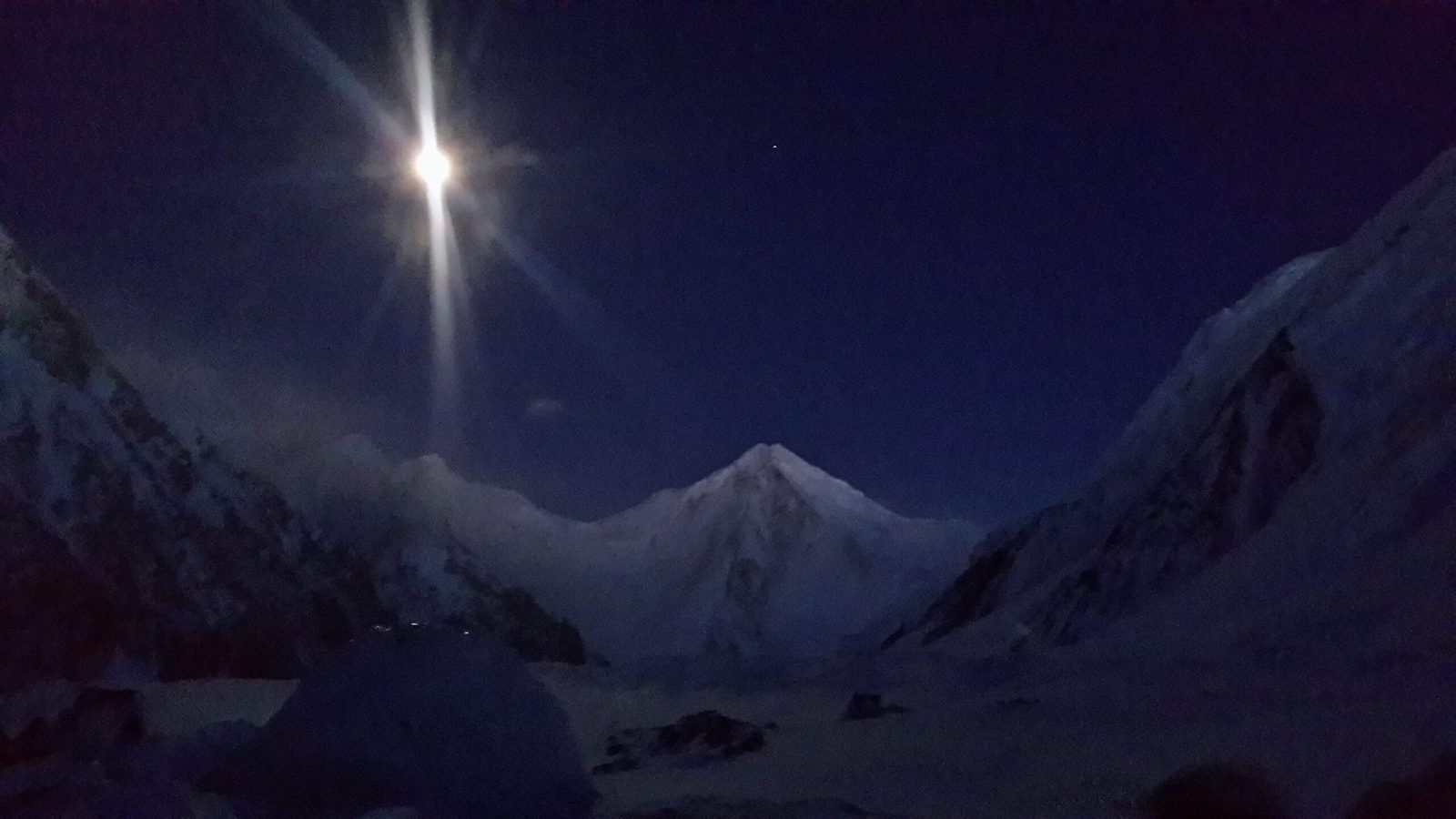
Key Takeaways
- Height: 7,422 m (24,350 ft). The 63rd highest mountain in the world and the 25th highest in Pakistan.
- Range and position: Baltoro Muztagh, Karakoram. The summit lies on the Pakistan–China border; the India–Pakistan–China tri-point is about 1 km to the south-east. Territory on all sides is disputed.
- First ascent: 1934, by the International Himalaya Expedition led by Günter Dyhrenfurth. Hans Ertl and Albert Höcht reached the central, east and main summits on 12 August.
- A record that stood 20 years: on 3 August 1934, Hettie Dyhrenfurth reached the 7,273 m western summit and set the women’s world altitude record.
- Approach: Skardu → Askole by jeep, then the Baltoro Glacier to Concordia and on up the upper Baltoro to the Conway Saddle.
- Season: late June to late August, with July the most reliable working window.
- Permits: a full mountaineering permit with royalty and liaison officer, plus specific clearance for a sensitive border zone. Not a routine approval.
Where Sia Kangri is, and why it matters
Walk the Baltoro Glacier to Concordia and most people stop there, or turn north to K2. Sia Kangri asks you to keep going — east and then south, up the Abruzzi and Upper Baltoro ice, into the amphitheatre at the very head of the glacier system. That is where the Baltoro finally runs out and the watershed turns: from Sia Kangri, water drains one way into the Indus basin and the other into the Tarim.
Why the map matters here
The peak also sits at one of the most politically complicated points on the map. The summit is on the Pakistan–China boundary. A kilometre south-east is the junction of territory controlled by three countries, all of it disputed. Indira Col, three kilometres east, is the northernmost point under Indian control. None of that changes the climbing, but it changes everything about the paperwork — and any operator who tells you otherwise has not run this trip.
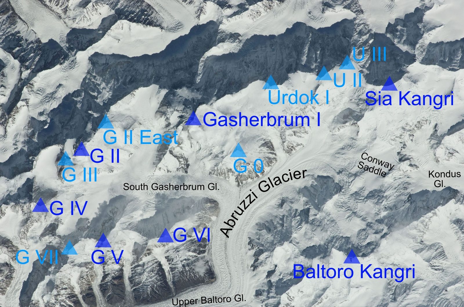
In pure height Sia Kangri is the smaller neighbour of the giants it shares a glacier with. That is the point of it. Standing on the summit you are level with nothing and below everything — Gasherbrum I and II to the north, the Shining Wall of Gasherbrum IV beyond them, Chogolisa across the ice and Baltoro Kangri, the Golden Throne, joined to you by the Conway Saddle itself.
The route, step by step
There is no trade route on Sia Kangri and no fixed rope waiting for you. What there is, is a long and well-understood approach — the same one every Baltoro expedition uses as far as Concordia — followed by a serious glacier journey into ground almost nobody visits. Camp altitudes below are typical rather than fixed; the crevasses decide where you actually sleep.
- Days 1–3 — Islamabad to Skardu. Fly if the weather allows, or take the road. Build in buffer days: mountain flights to Skardu get cancelled, and on an expedition of this length a lost day at the start costs you a summit window at the end. See our guide to getting to Skardu.
- Days 4–5 — Skardu, permits and Askole. Final briefing, liaison officer joins, load check, then the jeep road up the Shigar and Braldu valleys to Askole (roughly 3,050 m), about seven to nine hours of rough driving.
- Days 6–12 — Askole to Concordia. The classic Baltoro walk-in via Jhola, Paiju, Urdukas and Goro II to Concordia at around 4,650 m. This is the same approach as the K2 Base Camp trek, and it doubles as your acclimatisation.
- Days 13–15 — Concordia to base camp. Turn east up the Upper Baltoro and Abruzzi Glacier below the Gasherbrums, then south into the Sia Kangri cirque. Base camp typically sits around 5,000–5,200 m on the glacier.
On the mountain: rotations and the summit window
- Days 16–35 — the mountain. Load-carrying and rotations to establish two to three high camps, with the Conway Saddle — the broad col linking Sia Kangri to Baltoro Kangri — as the natural staging point at roughly 5,900–6,300 m depending on which source and which line you follow. Above the saddle it is snow and ice slopes and a long, exposed summit ridge.
- Days 36–38 — summit window. One good weather cycle, taken when it comes rather than when the schedule says.
- Days 39–45 — clear the mountain and walk out. Back down the Baltoro to Askole and out to Skardu.
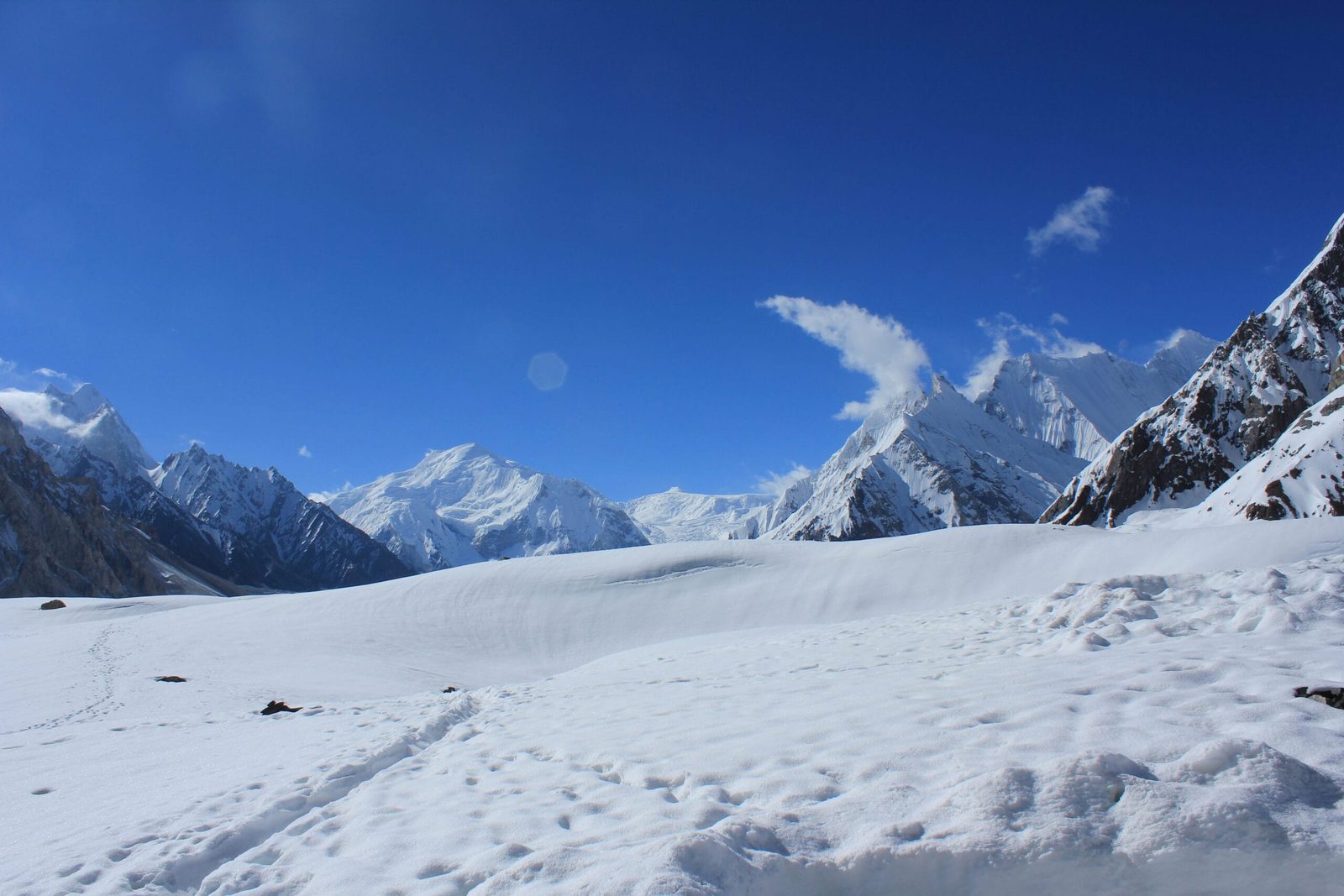
1934: the year the mountain was climbed, and then forgotten
Sia Kangri has one of the strangest histories in the Karakoram: it was climbed early, climbed thoroughly, and then very nearly left alone for the next ninety years.
Fanny Bullock Workman, exploring here in 1912, named it Queen Mary Peak — the name it carried for decades. In 1934 Günter Dyhrenfurth brought his International Himalaya Expedition to the upper Baltoro to look at the Gasherbrums. The Gasherbrums did not go. So the team turned to the peaks at the head of the glacier instead.
On 3 August, Hans Ertl and Albert Höcht, climbing with Günter and his wife Hettie Dyhrenfurth, reached the western summit at 7,273 m. Hettie’s ascent broke the women’s altitude record that Fanny Bullock Workman had set in 1906, and her record then stood for twenty years. Nine days later, on 12 August, Ertl and Höcht went back and climbed the central, east and main summits of the group.
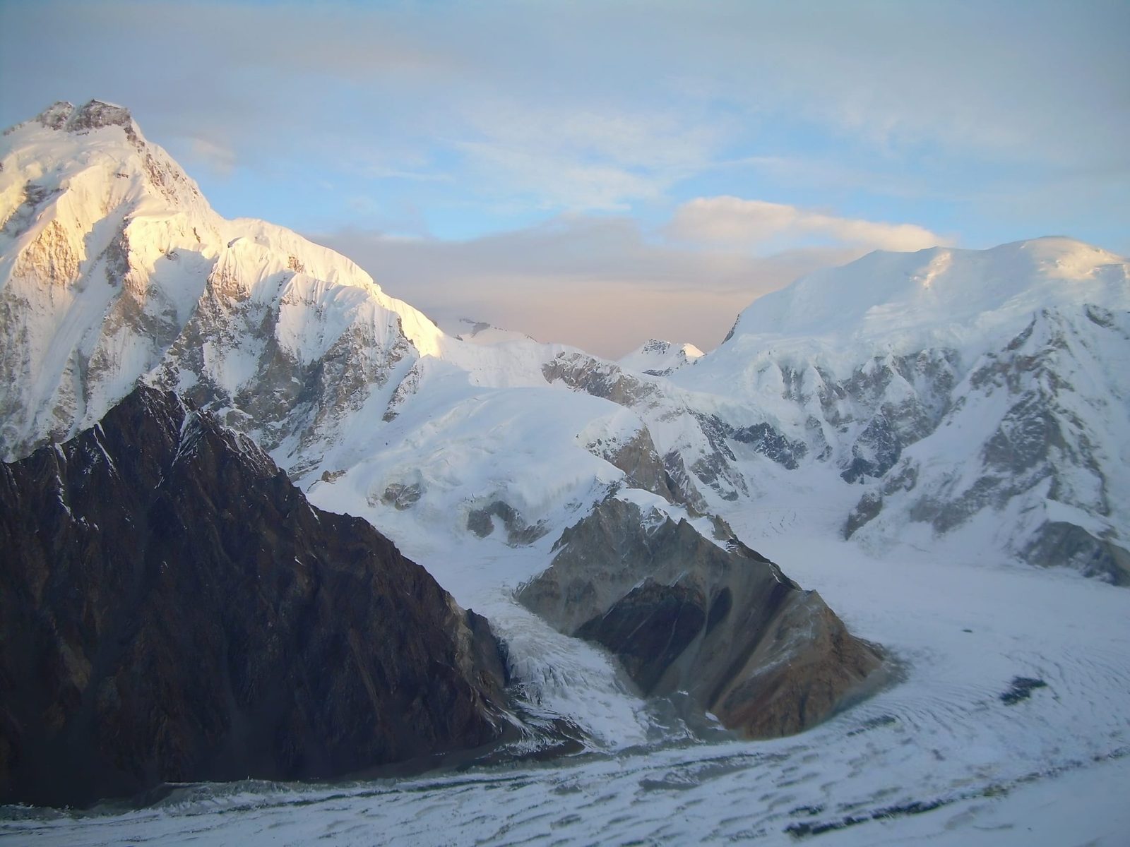
The saddle you cross to get there carries the name of Martin Conway, who came up the Baltoro in 1892 and gave Concordia its name too. So the whole approach is a walk through the naming history of the range — Conway’s saddle, Workman’s peak, Dyhrenfurth’s summit. Then the border hardened, the region became sensitive, and Sia Kangri disappeared from expedition lists for most of a century. Pakistan has since opened it to climbers who can secure permission from Islamabad, which is why it is on this page at all.
When to go
| Months | Conditions | Verdict |
|---|---|---|
| March–May | Deep snow on the Baltoro, unstable weather, the Askole jeep road often still blocked. | Too early. Not workable for this peak. |
| Late June | Approach clears, glacier still well covered, cold nights. Crevasse bridges generally sound. | Good for the walk-in and establishing camps. |
| July | The most settled spell of the year on the upper Baltoro. Warm days, workable weather cycles. | Best summit window. |
| August | Still viable, but the glacier opens up as the season warms and crossings get slower. | Workable, with a harder approach. |
| September onwards | Cold sets in fast, days shorten, storms return, high camps become punishing. | Too late for a 7,400 m objective here. |
The pattern matches the rest of the range — see our overview of the climbing season on the Baltoro. Plan for a summit push in July and keep the shoulders as your margin, not your plan.
How hard is it?
Honest answer: the climbing on Sia Kangri is not the hardest thing about Sia Kangri. Above the Conway Saddle it is largely snow and ice slopes and a long summit ridge — technically moderate by Karakoram standards, closer to Baltoro Kangri than to Gasherbrum IV. What makes it a serious undertaking is everything around the climbing.
- Altitude. You will spend weeks above 5,000 m and sleep repeatedly above 6,000 m. Read our acclimatisation guide before you commit — the walk-in helps, but it does not do the whole job.
- Glacier travel. The upper Baltoro and Abruzzi are heavily crevassed, and by August the bridges thin badly. Everyone on the team needs to be genuinely competent on a rope, with real crevasse-rescue skill rather than a course certificate from four years ago.
- Remoteness. You are at the far end of a seven-day glacier approach. Nothing about a rescue here is quick, and weather can close the option entirely.
- Time on your feet. Six weeks. Carrying loads, sitting out storms, going back up. Expedition fitness is as much patience as it is lungs.
Previous experience above 6,000 m is effectively a requirement. If Sia Kangri would be your first high-altitude climb, we will tell you so and point you at Spantik instead — that is not a sales tactic, it is how people come home.
The real risk, and what we do about it
The dangers here are crevasse falls on a long unsupported glacier approach, altitude illness during weeks of load-carrying, and storms that pin a team at a high camp with no quick way down. Sia Kangri is far enough up the Baltoro that self-rescue is the first plan and helicopter evacuation is the second, weather permitting.
Every Karakoram Venture expedition carries a satellite phone in base camp and on the mountain, and we run an established evacuation plan with helicopter-rescue contacts for the Baltoro region. We check your insurance covers high-altitude rescue before you fly, because the rescue services here will want that confirmed. We would rather turn a team around than be a statistic in next year’s journal.
Permits and access — read this before you plan anything
Sia Kangri is above 6,500 m, so it needs a full mountaineering permit with royalty payment and an assigned liaison officer — not the open-zone trekking permit that covers the K2 Base Camp walk. On top of that, it sits in a sensitive border area, and permission has to come through Islamabad. Approval is not automatic and it is not fast; treat several months of lead time as the minimum and accept that a refusal is possible.
You will also need a Trekking & Mountaineering visa for Pakistan, which is a different category from the ordinary tourist visa. Our Pakistan visa guide for trekkers walks through it. We handle the permit application, liaison officer and local clearances from our office — that is the part of this trip you cannot do from abroad.
Getting there, and what it costs
The route in is Islamabad to Skardu by air or by road, Skardu to Askole by 4×4 jeep, then everything else on foot. Porters carry from Askole; the walk-in follows the Baltoro exactly as the K2 Base Camp teams do, and splits off east of Concordia.
On price, we keep pricing personal rather than posting a number that goes stale. Permit royalties, liaison officer costs, porter rates and the size of your team all move the figure, and an expedition quote that ignores those is not a quote. Send us your dates and team and we will build you a full written cost breakdown — fair price, no corners cut on guides, food or safety equipment.
Frequently asked questions
How high is Sia Kangri?
7,422 m (24,350 ft). That makes it the 63rd highest mountain in the world and the 25th highest in Pakistan. Its western summit, which is where the 1934 women’s altitude record was set, is 7,273 m.
Has Sia Kangri been climbed?
Yes, and unusually early. The 1934 International Himalaya Expedition led by Günter Dyhrenfurth put Hans Ertl and Albert Höcht on the western summit on 3 August with Günter and Hettie Dyhrenfurth, and then on the central, east and main summits on 12 August. Traffic since then has been very light because of the peak’s position in a disputed border zone, so there is no established trade route and very little recent beta on the upper mountain.
Where does the Sia Kangri approach start?
Skardu, then jeep to Askole, then the Baltoro Glacier on foot via Paiju, Urdukas and Goro II to Concordia at around 4,650 m. From Concordia you turn east up the Upper Baltoro and Abruzzi Glacier to a base camp around 5,000–5,200 m below the Conway Saddle. Askole to base camp is roughly nine to ten days of walking.
Do I need a special permit for Sia Kangri?
Yes. Because it is above 6,500 m it requires a mountaineering permit with royalty and a liaison officer, and because it lies on a disputed border it needs specific clearance from Islamabad. It is not covered by an open-zone trekking permit. You will also need a Trekking & Mountaineering visa rather than a tourist visa. Allow several months, and plan for the possibility that permission is not granted in a given season.
When is the best time to climb Sia Kangri?
July, inside a working season that runs from late June to late August. June gives you the soundest snow bridges for the glacier approach but colder, less settled weather high up; by late August the crevasses have opened and the walk-in slows down. September is too late for a peak of this height in this position.
Talk to the people who actually run it
We are a local Balti team from Skardu, not a broker reselling someone else’s expedition. Your guides, cooks, high-altitude staff and logistics are ours, and the porters on the Baltoro are from the Braldu villages you walk through. Local hands, real safety, fair price.
WhatsApp: +92 312 9921574
Email: info@karakoramventure.com
Send us your dates, team size and climbing history. We will come back with an honest assessment, a realistic view of the permit timeline, and a full written quote — including whether we think Sia Kangri is the right objective for you this year.
Sources & attribution: elevation, position, border and ranking data from Wikipedia’s Sia Kangri entry and Peakbagger; first-ascent and 1934 expedition history from the Himalayan Journal (vol. 7, 1935), Isserman & Weaver’s Fallen Giants, and American Alpine Club publications; Conway Saddle altitudes vary between published sources and are given as a range and marked approximate; season and access details cross-checked against regional operators and our own field experience. Prices and permit fees are deliberately not published here because they change. Images: Ammar Hassan (CC BY-SA 4.0); S8isfi (CC BY-SA 3.0); NASA / Rupert Pupkin (public domain); Sallahuddin shah (CC BY-SA 4.0) — all via Wikimedia Commons.

